| Locality type: | Dam |
| Classification |
|---|
|
| Species: | 'Garnet Group' (not an IMA approved species) |
| Formula: | X3Z2(SiO4)3 |
| Confirmation |
|---|
|
| Validity: | Confirmed |
| Confirmation Methods: | Visually Identified |
| Data |
|---|
|
| Mineral Data: | Click here to view Garnet Group data |
| Locality Data: | Click here to view Mansfield Hollow Dam, Windham, Windham County, Connecticut, USA |
| Data Identifiers |
|---|
|
| Mindat Occurrence Record ID: | 1409705 |
| Long-form Identifier: | 1:3:1409705:8 |
| GUID (UUID V4): | 33977643-b5c3-4612-a95a-10155852ee22 |
| Nearest other occurrences of Garnet Group |
|---|
|
|
| 5.0km (3.1 miles) | ⓘLinen Company mill no. 2, Willimantic, Windham, Windham County, Connecticut, USA |
| 20.7km (12.8 miles) | ⓘBozrah, New London County, Connecticut, USA |
| 23.0km (14.3 miles) | ⓘBolton Notch, Bolton, Tolland County, Connecticut, USA |
| 25.2km (15.7 miles) | ⓘInterstate 84 (I-84; I-86; State Route 15; Wilbur Cross Highway), Union, Tolland County, Connecticut, USA |
| 26.3km (16.3 miles) | ⓘNorwich, New London County, Connecticut, USA |
| 27.2km (16.9 miles) | ⓘCordierite locality (Bigelow Pond), Union, Tolland County, Connecticut, USA |
| 33.2km (20.6 miles) | ⓘEast Glastonbury Quarry (Curtis Quarry), East Glastonbury, Glastonbury, Hartford County, Connecticut, USA |
| 36.4km (22.6 miles) | ⓘRoaring Brook Quarry, South Glastonbury, Glastonbury, Hartford County, Connecticut, USA |
| 36.6km (22.7 miles) | ⓘGreat Hill cobalt mines, Cobalt, East Hampton (Chatham), Middlesex County, Connecticut, USA |
| 37.7km (23.4 miles) | ⓘGotta-Walden Prospect, Portland, Middlesex County, Connecticut, USA |
| References |
|---|
|
|
| Reference Search (possible matching items) |
|---|
 | | Journal (article/letter/editorial) | | CONNECTICUT Mineral Locality Index Although many sites in Connecticut are no longer open to collectors...H. WEBER 1172 West L a k e Avenue Guilford, Connecticut 06437-1342 E A R L E C. SULLIVAN 17 R o c k y...y R i d g e D r i v e T r u m b u l l , Connecticut 06611-5326 T his locality index is meant to serve...collectors. More often than not, collecting in Connecticut is no longer per mitted. Many of the localities...effort has been made to list a l l localities in Connecticut, a small state that is big on mineralization |
|
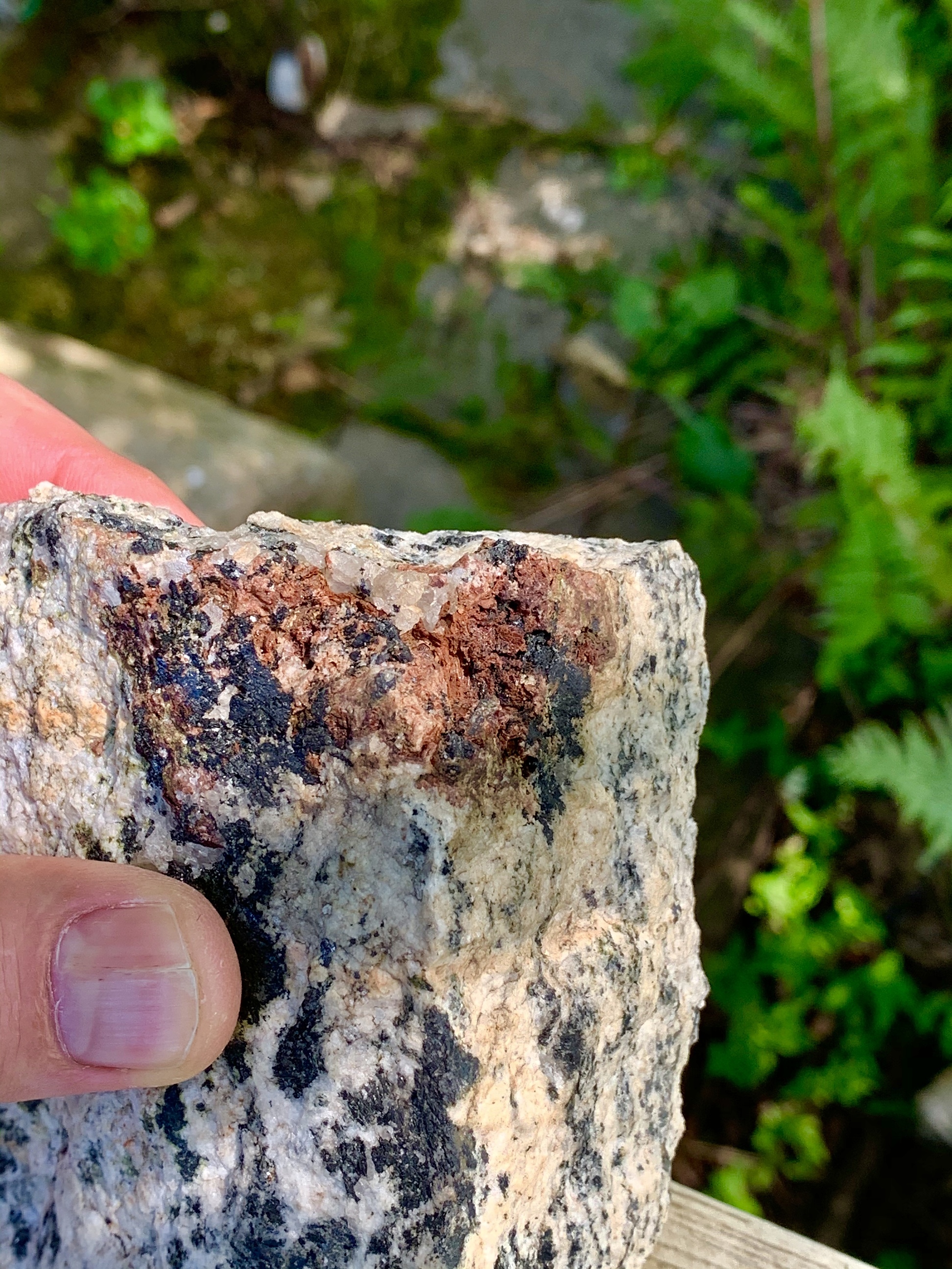


Mansfield Hollow Dam, Windham, Windham County, Connecticut, USA