Chlorite Group from
Nello Teer Crabtree Creek Quarry, Raleigh, Wake County, North Carolina, USA

| Locality type: | Quarry | |
| Classification | ||
|---|---|---|
| Species: | 'Chlorite Group' (not an IMA approved species) | |
| Confirmation | ||
| Validity: | Believed Valid | |
| Associated Minerals Based on Photo Data: | ||
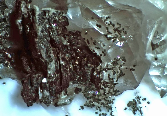
| Quartz | ⓘ3 photos of Chlorite Group associated with Quartz at this locality. | |
| Albite | ⓘ3 photos of Chlorite Group associated with Albite at this locality. | |
| Epidote | ⓘ1 photo of Chlorite Group associated with Epidote at this locality. | |
| Muscovite | ⓘ1 photo of Chlorite Group associated with Muscovite at this locality. | |
| Data | ||
| Mineral Data: | Click here to view Chlorite Group data | |
| Locality Data: | Click here to view Nello Teer Crabtree Creek Quarry, Raleigh, Wake County, North Carolina, USA | |
| Data Identifiers | ||
| Mindat Occurrence Record ID: | 1607575 | |
| Long-form Identifier: | 1:3:1607575:9 | |
| GUID (UUID V4): | 0ee0df52-2e0e-4334-a330-6919a6846ff2 | |
| Nearest other occurrences of Chlorite Group | ||
| 29.4km (18.3 miles) | ⓘDurham Quarry, Durham, Durham County, North Carolina, USA | |
| 33.4km (20.8 miles) | ⓘHaw Branch Road Prospect, Glendon Mining District, Moore County, North Carolina, USA | |
| 43.0km (26.7 miles) | ⓘHillsborough, Orange County, North Carolina, USA | |
| 45.6km (28.3 miles) | ⓘE. M. Stroud Prospect, Orange County, North Carolina, USA | |
| 47.0km (29.2 miles) | ⓘHanson Stone Quarry (Rougemont Quarry), Rougemont, Durham County, North Carolina, USA | |
| 47.4km (29.5 miles) | ⓘClegg Mine, Sanford, Lee County, North Carolina, USA | |
| 49.9km (31.0 miles) | ⓘSloan Mine, Chatham County Copper Belt, Chatham County, North Carolina, USA | |
| 54.2km (33.7 miles) | ⓘGraham prospect, Chatham County Copper Belt, Chatham County, North Carolina, USA | |
| 61.1km (38.0 miles) | ⓘDuke Mine (Tingen Mine), Person County, North Carolina, USA | |
| 61.1km (38.0 miles) | ⓘFoust Mine, Carolina Slate Belt, Alamance County, North Carolina, USA | |
| References | ||
Rolf LuetckeIdentification: Dealer/Collection Label | ||


Nello Teer Crabtree Creek Quarry, Raleigh, Wake County, North Carolina, USA