| Locality type: | Mine |
| Classification |
|---|
|
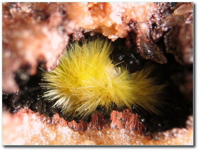
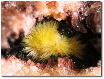
| Species: | Uranophane |
| Formula: | Ca(UO2)2(SiO3OH)2 · 5H2O |
| Confirmation |
|---|
|
| Validity: | Believed Valid |
| Associated Minerals Based on Photo Data: |
|---|
|
| Rutherfordine | ⓘ2 photos of Uranophane associated with Rutherfordine at this locality. |
| Parauranophane | ⓘ1 photo of Uranophane associated with Parauranophane at this locality. |
| Hematite | ⓘ1 photo of Uranophane associated with Hematite at this locality. |
| Data |
|---|
|
| Mineral Data: | Click here to view Uranophane data |
| Locality Data: | Click here to view La Dorgissière Mine, Saint-Amand-sur-Sèvre, Bressuire, Deux-Sèvres, Nouvelle-Aquitaine, France |
| Photo Gallery | View Gallery (7 photos) |
| Data Identifiers |
|---|
|
| Mindat Occurrence Record ID: | 167018 |
| Long-form Identifier: | 1:3:167018:9 |
| GUID (UUID V4): | eaec208d-7d14-4726-8c87-c8fa05e6aae1 |
| Nearest other occurrences of Uranophane |
|---|
|
|
| 2.1km (1.3 miles) | ⓘLa Commanderie mine, Le Temple, Mauléon, Bressuire, Deux-Sèvres, Nouvelle-Aquitaine, France |
| 5.2km (3.2 miles) | ⓘBel Air Mine, La Chapelle-Largeau, Mauléon, Bressuire, Deux-Sèvres, Nouvelle-Aquitaine, France |
| 13.3km (8.2 miles) | ⓘPoitou-La-Gabrielle mine (Poitou mine; La Gabrielle mine), Mortagne-sur-Sèvre, La Roche-sur-Yon, Vendée, Pays de la Loire, France |
| References |
|---|
|
|
| Reference Search (possible matching items) |
|---|
 | | Book | | contributed during discussions, field trips, and mine visits. As cited in the text, many colleagues provided...Steenfelt (Denmark/Greenland), M. Pagel (France), B. Poty (France), J. Royall (Spain), and A. Kuestermeyer...their magmatic evolution as presented in Chapter 6, France. V. I. Kazansky translated and prepared text and... . . . 159 159 159 159 162 162 162 Chapter 6 France .. . . . . . . . . . . . . . . . . . . . . . .... . . . . . . . . . . . . . . . . . . . . . 6.1.1 La Crouzille District, Limousin Region . . . . . . |
|


La Dorgissière Mine, Saint-Amand-sur-Sèvre, Bressuire, Deux-Sèvres, Nouvelle-Aquitaine, France