 | | Report (issue) |
| RESOURCES OF ELKO COUNTY, NEVADA By Roscoe M. Smith Prepared in cooperation with Nevada Bureau of Mines...Acknowledgment -Mining districts Commodities Production Descriptions of mining districts . Alder district-Aura district...district -Beaver district Black Mountain district Bootstrap district Burner district Burns Basin district--...-Carlin district Cave Creek district ----Charleston district_--Coal Mine district~ Contact district Cornucopia...Cornucopia district - -Corral Creek district - Decoy district Delano district Delker districtDivide district |
 | | Journal (article/letter/editorial) |
| and SourceRocksin thePioeheDistrict,LincolnCounty,Nevada PETER O. VIKRE •,* ANDQUENTIN J. BROWNE** ASARCOIncorporated...510EastPlumbLane,Reno,Nevada89502 Abstract In thePioche district, lead,zinc,silver, gold,copper, andmanganese ...priortothelateOligocene. Theserocks nowunderlie thePioche district, alongtwolow-angle detachment faults.Leadandsulfurisotope...ofdeposits atPiocheand inothermultiple-intrusion mining districts intheGreatBasin mayprovide valuable exploration...define intrusive events, to charactercolnCounty, Nevada, anareaof approximately 120km2 (Fig. associated |
 | | Journal (issue) |
| at the State Pit Mauldin Mountain, Montgomery County, Arkansas Art Smith 9118 Concho Street Houston...about 2 miles north of Mount Ida in Montgomery County. Arkansas has been mentioned in several show reports...1983). Most of these specimens have come from the County Continued on page 4 Fig. 1 Planerite with colorless...Mulingisha. or Mulungwishi, which he says is not a mine but a village nearby where minerals are traded (much...barite comes from Shangulowe, an open pit copper mine abandoned in 1943 and mined on and off since by |
 | | Book |
| f. MIMING DISTRICTS and MINERAL RESOURCES of NEVADA by FRANCIS CHURCH LINCOLN i r r i i ; %■... ; 'jxt . 1 — \ MINING DISTRICTS and MINERAL RESOURCES of NEVADA by FRANCIS CHURCH LINCOLN...LINCOLN 0 ll ; RENO NEVADA NEWSLETTER PUBLISHING COMPANY 1923 PREFACE Earlier Works. The object of...infor mation concerning the mining districts and mineral resources of Nevada. No comprehensive work of...peared for a number of years. In the early days of Nevada min ing, from 1866 to 1878, the field was covered |
 | | Journal (issue) |
| from the bank, the Grutt brothers were working in a mine shaft. One morning, an extra heavy charge of dynamite...downtown section and a major part of the residential district was destroyed —and another gold camp was started...locate the barrel of whiskey—but as in all lost mine stories— the unfortunate prospector failed. Thus...is where you find it" Drive to one of these LOST MINE SITES Magnificent 23"x34" full-color map shows the... TOURISM: An Interview With Nevada Governor Sawyer 8 CREDO: My Nevada! NELL MURBARGER 15 RECREATION: |
 | | Report (volume) |
| Range-Colorado Plateau Transition in Southeastern Nevada, Southwestern Utah, and Northwestern Arizona, 1995...Range-Colorado Plateau Transition in Southeastern Nevada, Southwestern Utah, and Northwestern Arizona, 1995...range-Colorado Plateau transition in southeastern Nevada, southwestern Utah, and northwestern Arizona, 1995...no. : I 19.3:82153 1. Geology-Utah. 2. Geology-Nevada. 3. Geology-Arizona. I. Maldonado, Florian. II...along the Pahranagat shear system, southeastern Nevada By Barbara Byron N. Structural geometry resulting |
 | | Report (volume) |
| structures and their control of gold ore at the Drum Mine, westcentral Utah, by C.J. Nutt and C.H. Thorman...setting of the Chief Mining District, eastern Chief Range, Lincoln County, Nevada, by Peter D. Rowley...geometry in the northern Grant Range, east-central Nevada-Implications for oil deposits in Railroad Valley...deformational and migrational events in Utah and eastern Nevada. I i ! \,_ Preface V Chapter A Microstructures...1988). A second major ore district, the Illinois-Kentucky fluorspar district, is also spatially, and perhaps |
 | | Report (issue) |
| MAP OF THE BRISTOL WELL QUADRANGLE, LINCOLN COUNTY, NEVADA By W.R. Page 1 and E.B. Ekren 2 Prepared...in Cooperation With The Las Vegas Valley Water District Open-File Report 95-580 This report is preliminary...mostly lacustrine in origin. In the vicinity of the "mine" in the north-central part of the quadrangle, the...and 2V's of 10° or larger, which is unusual for Nevada sanidines that typically show 2V's of 0°. These...dolomite informal members, exposed in much of eastern Nevada and parts of Utah (Tschanz and Pampeyan, 1970); |
 | Ritchie, Vanessa J., Ilgen, Anastasia G., Mueller, Seth H., Trainor, Thomas P., Goldfarb, Richard J. (2013) Mobility and chemical fate of antimony and arsenic in historic mining environments of the Kantishna Hills district, Denali National Park and Preserve, Alaska. Chemical Geology, 335. 172-188 doi:10.1016/j.chemgeo.2012.10.016 | Journal (article/letter/editorial) |
| and arsenic in historic mining environments of the Kantishna Hills district, Denali National Park and...t r a c t The Kantishna Hills mining district of interior Alaska, USA, located within Denali National...historically largest antimony producer, the Stampede mine. Oxidative weathering of sulfidic tailings and...with historic mining operations has impacted water quality in the region. In the Stampede and Slate Creek...measurements reduced As(III) and Sb(III) were identified in mine waste materials, whereas predominantly oxidized |
 | | Report (issue) |
| 171 G EOLOGY AND ORE DEPOSITS OF THE PIOCHE DISTRICT, NEVADA BY LEWIS G. WESTGATE AND ADOLPH KNOPF UNITED...________________________________________ No. 10 mine.--_._____-___"_________________________________...__________________________________ Poorman mine ____________________________________________________..._______________________________ Wide Awake mine.____________________________________________________...______________________________________ National mine._______________________________________________ |
 | | Report (issue) |
| MINERALS OF NEVADA MINERALS OF NEVADA Peer Hen By CASTOR oan eGORY.C.oFER DOCK NEVADA AND BUREAU... UNIVERSITY Reno & Las Vegas OF NEVADA PRESS GEOLOGY Nevada Bureau of Mines and Geology Special...University of Nevada Press, Reno, Nevada 89557 USA Copyright © 2004 by University of Nevada Press Photographs...otherwise noted Map of Mining Districts and significant mineral occurrences of Nevada by Nevada Bureau of Mines...Cataloging-in-Publication Data Castor, Stephen B, Minerals of Nevada / Stephen B. Castor and Gregory C. Ferdock.— Ist |
| | Report (issue) |
| MINERALS OF NEVADA MINERALS OF NEVADA STEPHEN B. CASTOR and G R EGOR Y C . F E R D OC K l NEVADA BUREAU...association with the UNIVERSITY OF NEVADA PRESS Reno & Las Vegas Nevada Bureau of Mines and Geology Special...University of Nevada Press, Reno, Nevada 89557 USA Copyright© 2004 by Uni versity of Nevada Press Photographs...Districts and si gnificant minernl occurrences of Nevada by Nevada Bureau of Mines and Geology All rights reserved...-Publ ication Dat,i Castor, Stephen B. Minerals of Nevada/ Stephen B. Castor and Gregory C. Ferdock.- rst |
 | | Report (issue) |
| description of the geology, mining history, and production of the major gold-mining districts in 21 States...relations ---------------------------History of gold mining and trends in production_ J\labama -----------...--------------Cleburne County ----------~----------------- Tallapoosa County --------------------------Alaska...------------------Cochise County -----------------------------Gila County --------------------------------Greenlee...ee County ----------------------------R[aricopa County ----------------------------R[ohave County -- |
 | | Report (volume) |
| Director ' Bulletin 648 NOTES ON SOME MINING DISTRICTS IN EASTERN NEVADA BY JAMES M. HILL WASHINGTON GOVERNMENT...Clark County.......................................................'.. Gold Butte mining district.................... Lincoln mine........................................ Bennett mine.........................gneiss............................. Gold Butte Mining Co................................. New Era group...prospects...................................... Elko County............................................. |
 | | Report (volume) |
| 936-N ANTIMONY DEPOSITS OF THE STAMPEDE CREEK AREA KANTISHNA DISTRICT, ALASKA BY DONALD E. WHITE Strategic......................................... 339 Stampede mine................................... 339 Prospects...Geologic map and sections of the Stampede Creek area, Kantishna district, Alaska.. In pocket 50. Geologic...map of the underground workings of the Stampede antimony mine.............. In pocket Figure 38. Index...of the Stampede Creek area......... 333 39. Geologic map of the surface workings of the Stampede antimony |
 | | Report (issue) |
| MINING II THE KOTSDf A-CHTMA, CHISTOCHINA, AND VALDEZ CREEK REGIONS. By FRED H. MOFFIT. KOTSINA-CHITINA...expected in the near future. COPPER PROSPECTS. BONANZA MINE. A .force of men was employed by the Kennicott...Company during the year 1908 in preparing the Bonanza mine for shipping ore. In the early part of the year...from a Dan Creek, Chititu Creek, and the Bonanza mine were visited by members of the Geological Survey...aerial tramway from the camp on National Creek to the mine was begun and about half of the necessary towers |
 | | Journal (issue) |
| sti II being felt more than a century later. Gold mining was also the mainstay of southwestern Oregon's...City, has a keen interest in the history of gold mining. The two worked together for a number of years...the legend of the Blue Bucket mine. This legend of the Blue Bucket mine is the reason a party of miners...transportation points along the Columbia River and gold-mining centers in Baker and Grant Counties in eastern...The place: Griffin Gulch, in what is now Baker County. The date: October 1861. Display of the Griffin |
 | | Journal (article/letter/editorial) |
| telluride attributed to the Boly Fields mine, Lumpkin County, Georgia, was available for $800 from a...Tucson Gem and Mineral Show. The tiny Boly Fields mine closed about 1845, and, although the locality is...vogue. The early twentieth century saw the great stampede to Alaska as well as the discovery of an array...“the Chukotka digger cooperative alone managed to mine more than 3000 nuggets in the gold-producing season...handled by St. Troy Mines and later also by Grizzly Mining, Collector’s Edge, and Earth Resources. Some of |
 | | Journal (issue) |
| Minerals CRAFTS --Edited b y ARTHUR L. EATON MINING A m a t e u r Gem Cutter COMMENT Briefs from... We meant no wrong. Still, we invaded our first mine dump without benefit of permission from owner or...pea-green copper straight from the innards of a mine in Mineral Park, Arizona, blue-agate geodes, lodestones...Creator made a beautiful rock and it somehow got on a mine dump and there is nobody around—well, what do you...to loose stray rocks upon the eaglet's head and mine, I reached the nest. I then signalled Grattan for |
 | | Journal (issue) |
| BROWN HILLS OF NEVADA By MRS. GLADYS THOMAS Fallon, Nevada Those bare brown hills of Nevada, Bold, and brazen...their bare brown beauty. Those gold-lined hills of Nevada, Warm, and gay and serene, But old man winter being...As we deserve. Those ermined-wrapped hills of Nevada, Gold, and haughty, and proud, Until the first...Arizona State College, Flagstaff. July 1—Rodeo, Ely, Nevada. July 2-4—Rodeo, Silver City, N. M. July 3—Days...Eureka, Goldfield, Caliente, Lovelock and Austin, Nevada; Las Vegas, White Sands National Monument and Cimarron |
 | | Journal (issue) |
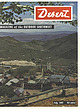
| Dam, from Phoenix, Arizona. Feb. 9—University of Nevada Winter Ski Carnival, Reno. Feb. 9-10—Jaycee Silver...Arizona. Feb. 9-10 — Western Saddle Club 1957 Stampede, Phoenix, Arizona. Feb. 10—Desert Sun Ranchers...Conference Ski Championship Meet, Reno, Nevada. Feb. 16-24—Riverside County Fair and National Date Festival,...FRAIZER NEWS From here and there on the desert MINING Current news of desert mines URANIUM Latest developments...Vague about the exact location, he hinted that the mine might be in Arizona. Roberts, who was a friend of |
 | | Journal (issue) |
| seeing his outfit when he drove through Beatty, Nevada. I was working at the depot there at the time....Company to construct works for handling the ore at the mine. Mr. Mellen is still living. He was 94 in May. He...Artist Discovers the Mojave HENRY MOCKEL 24 LOST MINE: Sullivan's Lost Ledge of Gold HAROLD O. WEIGHT...GHOSTS OF THE GLORY TRAIL by Nell Murbarger. Old mining camps of the West come to life again in these vivid...interesting residents and unusual places in the Sagebrush County of Western America. Filled with human interest |
 | | Report (volume) |
| JARBIDGE, CONTACT, AND ELK MOUNTAIN MINING DISTRICTS ELKO COUNTY, NEVADA BY F. C. SCHRADER WASHINGTON... 58 __.____ 64 4 CONTENTS. The Jarbidge district Continued. Page. Description of properties._________...the west system of veins______________ 66 Pavlak mine. ________1_______ 67 Location _ _ ___________ 67...group__ ____ 86 86 Vulcan group ________ Mahogany mine Amazon-Rainbow group __ __________ Properties of...White Quartz vein 94 CONTENTS. 5 The Jarbidge district Continued. Description of properties Continued |
 | | Journal (article/letter/editorial) |
| with its representation of mining tools clearly proclaim Montana’s mining origins. Montana’s production...published describing the occurrence, collecting, mining, and cutting of the two state gemstones. Figure...2. Granville Stuart established Montana’s first mining camp at Gold Creek in 1860. Geologic Provinces...rocks and gentle terrain where crystals of barite, calcite, and gypsum are found along with petrified wood...view showing the Indian Queen mine ca. 1905 at Farlin, Beaverhead County. 208 ROCKS & MINERALS Downloaded |
 | | Report (volume) |
| Exploration for antimony deposits at the Stampede mine, Kantishna district, Alaska, by Fred Barker__________...structure_____________________________________________ Stampede fault____________________________________________...__________ __ __ _____ Disseminated sulfides along Stampede fault___________________ Trenchingprogram____...______ ___ ____ ________________ ____ _______ Coal mine No. L ________ ____ _______ ____________ _______...Geologic map of the Lower Tunnel level, Stampede mine, Stampede, Alaska. 4. Map of exploration trenches |


