| Locality type: | Mine |
| Classification |
|---|
|
| Species: | Quartz var: Amethyst |
| Formula: | SiO2 |
| Confirmation |
|---|
|
| Validity: | Believed Valid |
| Associated Minerals Based on Photo Data: |
|---|
|
| Goethite | ⓘ1 photo of Amethyst associated with Goethite at this locality. |
| Data |
|---|
|
| Mineral Data: | Click here to view Amethyst data |
| Locality Data: | Click here to view Moselle No. 10 Mine, Phelps County, Missouri, USA |
| Photo Gallery | View Gallery (3 photos) |
| Data Identifiers |
|---|
|
| Mindat Occurrence Record ID: | 208608 |
| Long-form Identifier: | 1:3:208608:8 |
| GUID (UUID V4): | b7c2318c-3e2e-4a0a-9c8b-ab2452be597e |
| Nearest other occurrences of Amethyst |
|---|
|
|
| 8.6km (5.3 miles) | ⓘBuckland mine, Phelps County, Missouri, USA |
| 23.8km (14.8 miles) | ⓘPlank Mine, Dent County, Missouri, USA |
| 24.8km (15.4 miles) | ⓘHawkins Mine, Dent County, Missouri, USA |
| 25.4km (15.8 miles) | ⓘMoselle No. 9 mine, Phelps County, Missouri, USA |
| 51.6km (32.0 miles) | ⓘCherry Valley Mines (Cherry Valley No.1 and 2), Steelville, Crawford County, Missouri, USA |
| 59.4km (36.9 miles) | ⓘMeta mine, Osage County, Missouri, USA |
| 59.9km (37.2 miles) | ⓘScotia No. 1 Mine, Scotia Iron Bed Mines, Hinch, Missouri Brown Iron Belt, Crawford County, Missouri, USA |
| 75.7km (47.0 miles) | ⓘPea Ridge Mine, Washington County, Missouri, USA |
| 77.2km (48.0 miles) | ⓘRueppele Iron Mine (Acid Mine), Stanton, Franklin County, Missouri, USA |
| 79.2km (49.2 miles) | ⓘLeslie mine, Franklin County, Missouri, USA |
| References |
|---|
|
|
| Reference Search (possible matching items) |
|---|
 | | Journal (article/letter/editorial) | | SHERWOOD 106A East 25th, P. 0. Box 436 Oak Grove, Missouri 64075-0436 Downloaded by [Brown University Library]...Louis, Missouri 63129-2704 Figure 1. Counties in Missouri. N o comprehensive list of Missouri mineral...found in Missouri; two of these, fletcherite and starkeyite, were first described from Missouri mines....historic compendium of specimen-producing localities, no attempt was made to list all the state’s many mineral-prcducing...location a~ included at the end of each entry. Adair County Chariton River (40-04-05N 92-4 I -23W). septarian |
|


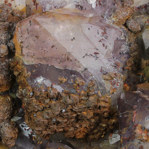
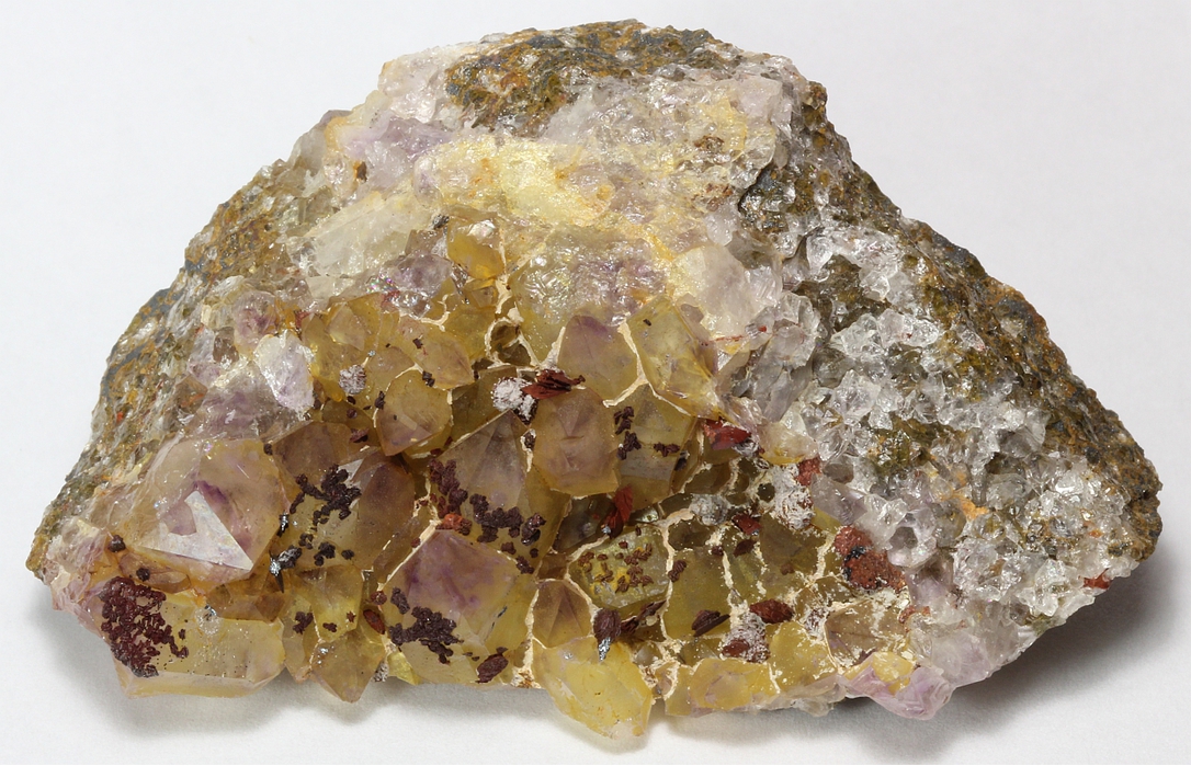


Moselle No. 10 Mine, Phelps County, Missouri, USA