 | | Journal (article/letter/editorial) | | [University of Connecticut] at 20:42 14 January 2015 South Dakota is perhaps best known for its pegmatites, which...Hills are responsible for the accessibility of South Dakota’s itbundant and diverse mineral locations...to be made. The most complete mineralogy of South Dakota and the Black Hills is found in Roberts and...965). Some uncited mineral species are from the South Dakota School of Mines Museum of Geology. Noteworthy...FiridofGt~rnSphultirite ut IIIP Bulinut Zinc Mine, St. Luwrence County, tditor of NPW b r k ” unrl iipptwwl in the No~~er |  | | Report (issue) | | STATE OF SOUTH DAKOTA Nils Boe, Governor MINERALOGY OF THE BLACK HILLS by WILLARD LINCOLN ROBERTS...Associate in Mineralogy Museum of Geology, South Dakota School of Mines and Technology and GEORGE RAPP...Department of Geology and Geological Engineering, South Dakota School of Mines and Technology With the Editorial...Mineralogy South Dakota School of Mines and Technology BULLETIN NUMBER 18 of the South Dakota School of...of Mines and Technology Rapid City, South Dakota PUBLICATIONS STAFF F. L. Partlo J. T. Thomas President |  | | Journal (issue) | | 6 (Right) - Sheet Copper – Flambeau Mine (Rusk County, WI) Figure 2—Dr. Weis’s Personal Memorabilia...Figure 7—Manganoan Calcite – Montreal Mine (Iron County, WI). Figure 3 (left) - “Wonderful World of...beautiful mineral specimens from the Montreal Mine (Iron County, Wisconsin). Most of the specimens came from...An unusual specimen from the Flambeau Mine (Rusk County, Wisconsin) is a sheet copper (figure 6). One of...full color. $15- each or both for $25postpaid in USA Excalibur Mineral Corporation 1885 Seminole Trl—Ste |  | | Report (volume) | | National Forest, South Dakota and Wyoming U.S. GEOLOGICAL SURVEY BULLETIN 1580 SOUTH DAKOTA WYOMING I -«*&...Geology of the Black Hills National Forest, South Dakota and Wyoming We st from. Washington SHOWING...Geology of the Black Hills National Forest, South Dakota and Wyoming By ED DEWITT, J. A. REDDEN, ANNA...and granite (units Wos and Wgr) 12 Oldest part of iron-formation (unit Xif) 12 Proterozoic rocks 12 Stratified...Xcqc) 13 Metaconglomerate (unit Xc) 13 Older part of iron-formation (unit Xif) 13 Older part of metagabbro |  | | Book | | Iaria from the Howard-Montgomery quarry, Howard County, Maryland (by J. S. White) 25:53-54 AFGHANISTAN...ALABAMA Iron phosphate mineral locality at Indian Mountain, Alabama (by H. Harwood) 5:241-244 Iron-manganese...Iron-manganese phosphates of the Williams pegmatites, Coosa County, Alabama (by P. B. Leavens & T. A. Simpson) 6:66-73...18:65-74 Phosphate microminerals of the Indian Mountain area [Georgia and Alabama] (by J.B. Gordon, Jr...ALICE GLORY HOLE The Alice glory hole, Clear Creek County, Colorado (by T. A. Hanson & W. B. Craft) 18:185187 |  | | Report (volume) | | therefore a wide range of colors. Impurities, such as iron, chromium, and copper, also tint the minerals. Care...Del Norte County; Trinity River, Trinity County; Spanish Creek and Gopher Hill, Plumas County; Placerville...Dorado County; Cherokee Flats, Yankee Hill,and Oroville, Butte County; French Corral, Nevada County; Indian...Indian Gulch and Volcano, Amador County; and Alpine Creek, Tulare County. Other western localities are:...Diamond Basin, Ada County, Idaho; Curry County, Oreg.; and Nelson Hill, near Glacier County, Mont. The Great |  | | Report (chapter) | | exceeded in the case of massive sulfide deposits, by iron sulfides such as pyrite FeS2, pyrrhotite Fe1-xS...crystalline, relatively insoluble, hydroxysulfates of iron and aluminum are described by Bigham and Nordstrom...pentahydrate with Cu:Fe:Zn = 70:24:6, from Alameda County, California, gave a melanterite-type X-ray pattern...Jamieson et al. (1999) for heptahydrate salts from Iron Mountain represent Fe:Cu:Zn ratios from electron microprobe...samples from Iron Mountain are about 2 mol % (Alpers et al. 1994). The Richmond deposit at Iron Metal‐sulfate |  | | Book (volume) | | Guide for Rock Hounds in the United States SOUTH DAKOTA This northwestern Great Plains state varies...western counties of Lawrence, Meade, Custer and Pennington the land rises abruptly into the 6,000 sq. mi...Alleghenies, culminate in Harney Peak in southern Pennington Co. At 7,242’ this peak is the highest point...the entire mountain system. The rising granite mass intruded the famed Cretaceous Dakota sandstone, which...continental seas were advancing from the south, the Dakota sandstone represents topset beds, wave reworked |  | | Journal (article/letter/editorial) | | arch of the Palermo mine, North Groton, Grafton County. Rob Lawrence photo, courtesy Bob Whitmore. 242...at 15:01 05 January 2015 LOCATIONS BY COUNTY Belknap County Alton area: arsenopyrite, galena, quartz...area: anorthite, augite, corundum, clinozoisite, goethite, hastingsite, ilmenite, magnetite (lodestone)...occurrence is particularly noteworthy for Carroll County Albany, Blackberry Crossing (includes the Moose...tall, Government Gravel pit, North Conway, Carroll County. Jeff Scovil specimen and photo. Downloaded by |  | | Report (issue) | | occurrence and origin of Precambrian iron ore and manganiferous iron ore UNITED STATES GOVERNMENT PRINTING...Black argillite and slate.____________________ Upper iron-formation lenses._________________ Thickness of...Trommald formation________________________ Source of iron-rich sediments and conditions of sedimentation_...described-___ North range___ _______________________ South range____________________________ Correlation with...___-----------_-------Iron ores and manganiferous iron ores _____________ Iron-ore minerals.________ |  | | Journal (article/letter/editorial) | | location a~ included at the end of each entry. Adair County Chariton River (40-04-05N 92-4 I -23W). septarian...Macon county line. CALCITE crystals enclosing bundles of acicular and minute balls of GOETHITE. earthy...hematite, quartz (Broadhead 1873b, 1877). Audrain County Mexico, in fire clay pits and spoil piles: PYRITE...University Library] at 19:58 29 October 2014 Barton County McKarrow’s coal bank (37-37N 94-28W), 2.5 miles...PICKERINGITE, pyrite, siderite (Broadhead 1873b). Bates County Panther Creek, northwest of Rockville in coal deposits: |  | | Book (volume) | | feet thick in the south, grading to 600 to 800 feet thick in the north. ALEXANDER COUNTY FAYVILLE, area...⎯agate, jasper; d RR siding of Clay⎯agate. CALHOUN COUNTY AREA, shores of the Mississippi R., in the Warsaw...crystals). CRAWFORD COUNTY PALESTINE, area deposits⎯Siderite. EDWARDS COUNTY AREA, T. 1 S, R. 10 E...E, regional deposits⎯Siderite. FULTON COUNTY FARMINGTON, W 6 mi. on Rte. 116 to the Rapatee No. 5 strip...mine⎯pyritized gastropods (Pennsylvanian age). GRUNDY COUNTY AREA: c Regional rd. and RR cuts and banks of Mason |  | | Book (volume) | | feet thick in the south, grading to 600 to 800 feet thick in the north. ALEXANDER COUNTY FAYVILLE, area...⎯agate, jasper; d RR siding of Clay⎯agate. CALHOUN COUNTY AREA, shores of the Mississippi R., in the Warsaw...crystals). CRAWFORD COUNTY PALESTINE, area deposits⎯Siderite. EDWARDS COUNTY AREA, T. 1 S, R. 10 E...E, regional deposits⎯Siderite. FULTON COUNTY FARMINGTON, W 6 mi. on Rte. 116 to the Rapatee No. 5 strip...mine⎯pyritized gastropods (Pennsylvanian age). GRUNDY COUNTY AREA: c Regional rd. and RR cuts and banks of Mason |  | | Journal (article/letter/editorial) | | Arsenic in the Wiśniówka acid mine drainage area (south-central Poland) – Mineralogy, hydrogeochemistry...Arsenic in the Wiśniówka acid mine drainage area (south-central Poland) – Mineralogy, hydrogeochemistry...Arsenic in the Wiśniówka acid mine drainage area (south-central Poland) – mineralogy, hydrogeochemistry...SC the Wiśniówka acid mine drainage (AMD) area, south-central Poland. The basic source of this metalloid...that the saturation indices (SI) of hematite and goethite exhibited the highest values CE (range of 6 |  | | Book (volume) | | in the production of clays. Lesser production of iron, petroleum, natural gas and coal from thick beds...ASHTABULA COUNTY CONNEAUT, area pits, quarries, rd. cuts, etc.⎯cone-in-cone Calcite. CLERMONT COUNTY MILFORD...CLINTON COUNTY WILMINGTON, area of Todd’s Ford, a mineral deposit⎯Hematite. COSHOCTON COUNTY AREA, townships...CUYAHOGA COUNTY CHAGRIN FALLS (on Geauga Co. line), area quarries⎯oilstone. DELAWARE COUNTY DELAWARE...nodules⎯Pyrite (crystals sharply cubic). FRANKLIN COUNTY COLUMBUS, area countywide exposures of blue clay |  | | Book (volume) | | in the production of clays. Lesser production of iron, petroleum, natural gas and coal from thick beds...ASHTABULA COUNTY CONNEAUT, area pits, quarries, rd. cuts, etc.⎯cone-in-cone Calcite. CLERMONT COUNTY MILFORD...CLINTON COUNTY WILMINGTON, area of Todd’s Ford, a mineral deposit⎯Hematite. COSHOCTON COUNTY AREA, townships...CUYAHOGA COUNTY CHAGRIN FALLS (on Geauga Co. line), area quarries⎯oilstone. DELAWARE COUNTY DELAWARE...nodules⎯Pyrite (crystals sharply cubic). FRANKLIN COUNTY COLUMBUS, area countywide exposures of blue clay |  | | Report (issue) | | staining caused by acid-rock drainage in Hickman County, Tennessee. Bibliography for Acid-Rock Drainage...than 4 and containing elevated concentrations of iron and other metals. 12FeS2+45O2+34H2O→ 4[H3OFe(SO...others, 2005), or lactate and molasses that stimulate iron- or sulfur-reducing bacteria to enhance reductive...A., 2005, Acid-rock drainage at Skytop, Centre County, Pennsylvania, 2004: U.S. Geological Survey Open-File...dissolved aluminum (>30 milligrams per liter [mg/L]), iron (>47 mg/L), sulfate (>1,000 mg/L), and base metals |  | | Journal (article/letter/editorial) | | Indian Queen mine ca. 1905 at Farlin, Beaverhead County. 208 ROCKS & MINERALS Downloaded by [University...mines at Butte in Silver Bow County and the Black Pine mine in Granite County have produced many fine crystal...Beaverhead County, the pegmatites of Jefferson County, and the Snowbird mine in Mineral County continue...Highlands Centennial Nugget in 1989 in Silver Bow County. The seventh largest gold nugget found in Montana;...were found in the region. Gold was found to the south in the Beaverhead River area on Grasshopper Creek |  | | Book | | made dramatically apparent to us as spectacular mountain ranges, erupting volcanoes, earthquakes and even...be minerals. Microcline, Crystal Peak, Colorado, USA * 12 x 9x 5 om MINERALS: PRODUCTS OF A CHANGING...zeolites. Calcite (septarian nodule), San Juan County, Utah, USA * 18 x 24x Bem 14 | MINERALS: PRODUCTS...Metamorphic rocks form deep within Earth, often beneath mountain belts. When igneous or sedimentary rocks are heated...10 ct RIGHT: Round brilliant-cut white diamonds, South Africa and Canada « 2.00 ct and 3.06 ct leaves |  | | Report (issue) | | IRON DEPOSITS OF UTAH by Kenneth c. Bullock Geneva Works, U. S. Steel Corporation, near Provo. Courtesy...Acknowledgments · .1 History of the Iron Industry in Utah · .1 Beaver County . . . . . . . . . . . . .2 Beaver...Beaver Lake Mountains deposits . . . . . .2 Bat Ridge iron occurrence . . . . . . . . . . . . . .2 . . . ....Cave mine . . . . . . . . . . . . . . . . · .. 4 Iron mine . . . . . . ......... . . 10 Star Range deposits.... . . . . . . .11 Blawn Mountain prospects . . . . . . . . . . · ... 11 Iron Queen mine . . . . . . |  | | Journal (issue) | | Cove landslide occurred last winter about 13 mi south of Yachats. The 14-page report was produced by DOGAMI...fossil plants of the John Day Formation, Wheeler County, Oregon by Steven R. Manchester, Florida Museum...Formation on the southern slope of Iron Mountain east of Clarno, Wheeler County, Oregon. The Whitecap Knoll...Oblique northwesterly aerial view of the south slope of Iron Mountain, showing (1) position of the lacustrine...lacustrine shales of the Slanting Leaf Beds (Iron Mountain assemblage) of the Bridge Creek flora of the |  | | Journal (article/letter/editorial) | | Wisconsin, Michigan and east-central Minnesota, USA: Implications for future exploration T Theodore...LLC, 34898 University Ave, Cambridge, MN 55008, USA A R T I C L E I N F O A B S T R A C T Keywords:...Wisconsin, Michigan and east-central Minnesota, USA. These cycles are responsible for significant subaerial...mineralization associated with cherty oxide and sulfide facies iron formation within the main volcanic arc sequence... Pelican River Catwillow Hawk Eisenbrey Silica-iron oxide gossan (3–≤30 m locally to 122 m along structures; |  | | Journal (article/letter/editorial) | | could be used in the iron industry. It contained about 2 % quartz, and 2 % iron oxides. ARIZONA — J....dickite (a soft kaolin), some vein quartz, much iron oxide, and a small amount of stibnite." CALIFORNIA...locality in the State is Russell Gulch in Gilpen County. A small but very fine crystal group from Russell...mind. We have only one small rock outcrop in my county (Orange) at Rock Springs near Apopka. "The beaches...dated July 27, 1952, was sent by Wallace Knapp, 60 South St., Rhinebeck, N . Y. He writes: "I've just returned | 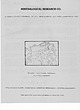 | | Catalog/List | | DRIVE, SAN JOSE, CALIFORNIA 95127 HALITE - Kern County, California (cavernous crystals) GEM ROUGH & SLABS...fl. yellow-green. ARAGONITE 3X4 - Sam Benito County, Califo.fnia - White needles groTdrting in radiating...$3.50 106 CALCITE Var. SAND CALGITE -Badlands, South Dako€a -ifeny doubly terminated xls„ some singles...Ilo $2, 3 X 3 $2.75, 4 X 5 $4.50 San Benito County, California - Greenish hexagonal plates (look like...$2.75, 2X3 $3.50, 3X4 $4.50 - Sa.n Benito County, California - A newl}. discovered mineral from |  | | Book (volume) | | Missouri, Montana, Nebraska, North Dakota, — ; Oregon, South Dakota, Washington, and Wyoming ~ AllanW...Georgia, Kentucky, Mississippi, North Carolina, South Carolina, Tennessee, Virginia, and West Virginia... Missouri, Montana, Nebraska, North Dakota, Oregon, South Dakota, Washington, and Wyoming VOLUME 4:...Missouri, Montana, Nebraska, North Dakota, Oregon, South Dakota, Washington, and Wyoming by Allan W...Minnesota Missouri Montana Nebraska North Dakota Oregon South Dakota Washington vi Contents Wyoming 5505 |
|


Iron Mountain, Pennington County, South Dakota, USA