 | | Journal (issue) | | NUMBER 2 • $25 The Tri-State Mining District Missouri-Kansas-Oklahoma by Denise Bicknell Wendell E...Moore COVER: CALCITE on GALENA and dolomite, 19 cm, from Webb City, Missouri. Mark Pospisil collection...Tucson USA Visit us at these international shows: Houston Ste. Marie Denver Munich USA France USA Germany...and Riverpark Inn Rhodochrosite, Sweet Home Mine, USA, 10 cm Photo: Malte Sickinger MARCUS BUDIL Monaco...Shenandoah, TX 77385 The Tri-State Mining District Missouri-Kansas-Oklahoma Denise Bicknell 16711 East Whimbrel |  | | Report (issue) | | Geology and Ore Deposits of the Picher Field Oklahoma and Kansas GEOLOGICAL SURVEY PROFESSIONAL PAPER...PAPER 588 Geology and Ore Deposits of the Picher Field Oklahoma and Kansas By EDWIN T. McKNIGHT and RICHARD...Member_____________ Grand Falls Chert Member._________ Joplin Member-__-____-_---________ Short Creek Oolite...4. Map showing towns and mine workings in the main part of the Picher field. Geologic map of the Wyandotte...and approximate west limit of L bed in the Picher field. Sections and correlation of the Moccasin Bend Member |  | | Journal (article/letter/editorial) | | give importantgeneral informationon the history of galena-bearing deposits,and that leadsfrom depositsof...in Europe have perhapsbeen the mostactivein the field and Shaw (12) has recentlymadean interesting contributionfrom...leads(includingsamples from Sudbury,Ontario, and Joplin, Missouri) requirethat their historiesbe dividedinto...and others (2) have distinguished "J"-type (from Joplin) and "B"-type (from Bleiberg)leadisotopeassemblages...not (e.g., Keewatin gold quartz veins). Those of Joplin are now well known,and recentwork on vein leadsfrom |  | | Journal (article/letter/editorial) | | Items Dax Landes, France Ojuela Mine, Mapimi, Durango, Mexico Ojuela Mine, Mapimi, Durango, Mexico A t a...Copper Queen Mine, Bisbee, Arizona Copper Queen Mine, Bisbee, Arizona Copper Queen Mine, Bisbee, Arizona...Copper Queen Mine, Bisbee, Arizona Copper Queen Mine, Bisbee, Arizona Copper Queen Mine, Bisbee, Arizona...Copper Queen Mine, Bisbee, Arizona Chessy, France with Uranophane and Mangan-Apatite, Ruggles Mine, Grafton...Conception del Oro, Zacatecas, Mexico Herodsfoot Mine, Cornwall, England Franklin, New Jersey Unknown |  | | Journal (article/letter/editorial) | | (top left). Calcite, 5.5 cm high, Elmwood mine, Smith County. Terry Huizing specimen, Jeff Scovil photo...(above). Fluorite, 13.1 cm wide, Elmwood mine, Smith County. Francis Benjamin specimen, Jeff Scovil photo...(left). Fluorite, 2.5 cm on edge, Elmwood mine, Carthage, Smith County. Terry Huizing specimen and photo. Figure...Figure 4 (right). Cumberland mine, Smith County. Travis Paris photo (2004). Figure 5 (far right page)...barite specimens at the Elmwood zinc mine in middle Tennessee. This mine, opened in 1975, and other nearby |  | | Book (volume) | | instance, a single Spodumene crystal from the Etta Mine near Keystone on the east side of the Mount Rushmore...weighed 90 tons. Also huge crystals of sparkling blue Beryl from the Black Hills pegmatites have measured...BRULE COUNTY AREA: in the Oacoma zone of the Pierre Fm. On Elm Cr. Near its jct. with the Missouri River...rosette up to 5 or 6 inches. CAMPBELL COUNTY MOUND CITY, W to the Missouri R., regional hillsides, ridges,...gravels, etc.petrified wood, wood opal. CORSON COUNTY LITTLE EAGLE: area ridges, slopes, stream beds |  | | Journal (article/letter/editorial) | | ViburnumTrend-typefluidscontainslessradiogeniclead than galena depositedby Tri-State-typefluids.Sulfldesdepositedby...Sheltonet al., 1986). Leach THE Ozarkregionof Missouri,Kansas,Oklahoma,and andRowanhave (1986) proposedthat...smaller Introduction Northern Arkansas, Central Missouri, and Southeast korea foreland basin. These fluids....... -'" Reelfoot Rift sBasin /! CJ(e• C. Missouri ... ? Tr,•l• .•:.... • ........... 'A; •......oil-fieldbrinesmigrateout of sedimentary Na/K ratiosthan do oil-field brines (White, 1968; basinsanddepositoresat favorablesites |  | | Book | | who have been pleasant companions on countless field trips and journeys throughout the state; and those...Gives a sodium flame. Nearly insoluble. COMANCHE COUNTY: SE%, Sec. 4, T.3N., R.15W. The xtals are i to...side by granite, AGATE (See Quartz) CANADIAN COUNTY: South Canadian Rivers. In the gravel bars of...CIMARRON COUNTY: Secs. 7, 8, 9, 10; T.5N., R.2E. Cimarron Meredian Rose agate, algae, jasper, etc. in...widely scattered in the Black Mesa area. DEWEY COUNTY: Agate is found 2 miles east of Seiling in the |  | | Report (issue) | | ...... .............. . 8 Characteristics of mine-shaft water . . . . . . . . . . . . . . . . . ....constituent relationships ..... . 21 Suitability of mine-shaft water for selected uses ..... . 27 Hydrology...showing geologic structure, approximate area o f mine workings , and locations of sampled shafts . . ...apparatus used in collection of water samples from mine shafts............................ 12 4.--Diagram...--Diagram showing water level, approximate location of mine workings, and temperature, pH, and specific conductance |  | | Report (volume) | | MISSOURI BUREAU OF GEOLOGY AND MINES E. R. BUCKLEY, Pb. D., Director and State Geologist. Vol. IV, 2nd... His Excellency, Joseph Vv. Folk, Governor of Missouri, ex-officio President of the Board .............Ruby Trnst. (l and 2 mines). Fig. 2. \Vetak e r mine. III. Ge n era l map s howin g the location of the..... 31 (From Vol. 2, 2nd Series reports of the Missouri Bureau of Geology ancl Mines). VIII. Flint breccla...nn er of occurrence of th e ores ln the Break U p mine.................. 54 XXIII. White Hint and calamine |  | | Journal (article/letter/editorial) | | sphaleritecrystalsknown as "Ruby Jack." Occasionallysmall galena crystals are found in the calcite. The "Ruby Jack"...structureto a far distant and in many respectsdissimilar field. Convincedof the correctnessof their structuralpattern...initially acceptedthe literature on the Tri-State field as a guideand commenced our studieswith the notionthat...and Ageton (pages4•2 and 4x3) in the Picher-Miami field; they mappedthe shale-limestone contact,an old erosionsurface...PicherMiami field we mappedore bodies,structuralfeaturesand all s U.S. Geological Survey Atlas, Joplin district |  | | Journal (article/letter/editorial) | | geologicdata Tri-State, Northern Arkansas,and Central Missouri late cubicgalenasupportmodelsin whichthesedistrictssharegenetic...Valley-typedistricts:NorthernArkansas,Tri-State, Central Missouri, and the Viburnum Trend. Becausesphaleriteoccursthroughout...end-memberore fluids (Viets and tricts studied,the mine name for each sample,and Leach,1990);theymightalsobe...metals.In addition,the data est. ViburnumTrend cubic galena-stage sphalerite mayprovideinsightintotemporalvariationsin...f conphases.For thesedistrictsand the Central Missouri taminationby extremelysmallsolidinclusions of |  | | Report (issue) | | ... Tri-State district, Oklahoma, Kansas, and Missouri ........................................................................... ................. Missouri .............................................................................. Southeastern Missouri district ........................... 56 57 58 61......................................... Getchell mine area (Potosi district) ................ Gilbert........................................... Howell mine area .......................................... |  | Goldhaber, Martin B., Church, Stanley E., Doe, Bruce R., Aleinikoff, John N., Brannon, Joyce C., Podosek, Frank A., Mosier, Elwin L., Taylor, Cliff D., Gent, Carol A. (1995) Lead and sulfur isotope investigation of Paleozoic sedimentary rocks from the southern Midcontinent of the United States; implications for paleohydrology and ore genesis of the Southeast Missouri lead belts. Economic Geology, 90 (7) 1875-1910 doi:10.2113/gsecongeo.90.7.1875 | Journal (article/letter/editorial) | | Paleohydrology and Ore Genesis of the Southeast Missouri Lead Belts MARTIN B. GOLDHABER, STANLEYE. CHURCH...McDonnell Center for theSpace Sciences, St.Louis,Missouri 63130 ELWIN L. MOSIER, CLIFF D. TAYLOR, AND CAROL...the Old andNew LeadBeltsubdistricts of southeast Missouri. Nearly150newanalyses arereported whichcharacterize...the locusof leadbelt mineralization in southeast Missouri. Analyses arealsopresented forvarious leachfractions...thenonoresamples. Ore samples wereanalyzed fromsoutheast Missouri andinclude newdataforbothgalena andnongalena phases |  | | Report (volume) | | Deposits rOf the Steeple Rock Mining District, Grant County "New Mexico M ^: By ROY L. GRIGGS and HOLLY C.... Center-Pennsylvania mine. _____________________________________ East Camp mine ____________________...__________________________ Mohawk mine._______________________________________________ Other mines.-__-_-------...the Carlisle mine area. Geologic map of the Carlisle mine. Sections through the Carlisle mine. FIGURE 1...____ 6. Geologic map of the Center-Pennsylvania mine, 120-foot leveL_------------_--____._-_______..____ |  | | Report (issue) | | . . . . . . . . . . . . . . . . . . . . . . 1 County Listings. . . . . . . . . . . . . . . . . . . .... . . . . . . . 4 Mineral Localities Listed by County . . . . . . . . . . . . . . . . . . . . . . . .... . . . . . . . . . . . . . . . . . . 7 Beaver County . . . . . . . . . . . . . . . . . . . . . . . ... . . . . . . . . . . . . . . . . . 7 Box Elder County . . . . . . . . . . . . . . . . . . . . . . . .... . . . . . . . . . . . . . . . . . . 10 Cache County . . . . . . . . . . . . . . . . . . . . . . . |  | | Report (issue) | | basaltic andesite in the vicinity of the Thanksgiving mine. Angular sand-size clasts of andesite and dacite...Locally highly crossbedded as near the Carnation mine. Angular sand-size clasts of dacite and andesite...of celadonite. Some outcrops, as near the Center mine, are silicified and sericitized. Some units are...Stewart, and J. Taggart (1983)] Rock type Rhyolite Field No. Lab No. -sp. gr. - SR-42-83 D-251858 N Dacite...to the southwest. Abundant pyrite, chalcopyrite, galena, and sphalerite as vug and breccia fillings. Highly |  | | Journal (article/letter/editorial) | | crystalof calcitefrom the Oklahoma-Kansas zinc field was studied with the decrepitation methodof inclusionthermometryby... GrQce Wolker ß ß Lowyer's Blue Goose Midol no.I ß Blue Goose ß FIG. 1. Map showinglocationof...The MiamiPicherdepositsare carefullydescribed, mine by mine,in a classicpaperby Weidman (36). A summaryof...open spaceson top of pink dolomite. Much of the galena in the ores is associated with sphaleriteof this...ccessive stagesindicatedby samples from a given mine. SphaleriteI.--Sphalerite I is the earliestmineraldeposited |  | | Report (volume) | | mineral district ____________ _ 3. Sketch of Faircloth mine adit showing location of limestone samples and amount...limestone samples from the Faircloth vein, Woodford County, Ky _. 5. Mercury content of limestone wallrock...wallrock from the Hoover vein, shaft 1, Cannon County, Tenn _____ 6. Mercury content of a wallrock suite along... B. Strow in a freshly dug basement in Kanawha County, W. Va. Subsequent examination by the U.S. Bureau...minor element in lead-zinc deposits. At Langpele mine, Sweden, however, mercury is currently recovered |  | Kendrick, M. A., Burgess, R., Leach, D., Pattrick, R. A. D. (2002) Hydrothermal Fluid Origins in Mississippi Valley-Type Ore Districts: Combined Noble Gas (He, Ar, Kr) and Halogen (Cl, Br, I) Analysis of Fluid Inclusions from the Illinois-Kentucky Fluorspar District, Viburnum Trend, and Tri-State Districts, Midcontinent United States. Economic Geology, 97 (3) 453-469 doi:10.2113/gsecongeo.97.3.453 | Journal (article/letter/editorial) | | × 10–3. The I/Cl mol ratios are typical of oil field brines and are ubiquitously higher than what is...subdistrict, 5 = Southeast Missouri barite district, 6 = Central Missouri barite district, 7 = Upper...The Viburnum Trend occurs within the Southeast Missouri lead district, which constitutes the world’s largest...Leach, 1994); center = an enlargement of Southeast Missouri stratigraphy (modified from Hagni, 1989); right...Bradbury, 1968). Abbreviations: C. Mis = Central Missouri, I.C. = Indian Creek, O.L.B = Old Lead Belt, Vib |  | | Book | | be minerals. Microcline, Crystal Peak, Colorado, USA * 12 x 9x 5 om MINERALS: PRODUCTS OF A CHANGING...recrystallize as entirely different but stable minerals. Galena It is common for more than one mineral species...oxidizes to form anglesite (lead sulfate). Azurite (blue copper carbonate) can react to form malachite (green...zeolites. Calcite (septarian nodule), San Juan County, Utah, USA * 18 x 24x Bem 14 | MINERALS: PRODUCTS...red; sapphires can be any other color than red, but blue is the most commonly known. In the gem-cutting process |  | | Journal (article/letter/editorial) | | MOVEMENT OF PICHER MINERALIZING FIELD, RICHARD SOLUTIONS IN THE OKLAHOMA-KANSAS. E. STOIBER...solutions which depositedthe ore minerals in the Picher Field of northeaster__n•n Oklahoma and southeastern Kansas...Miami shear trough, the major structure in the field. To the east of the trough, solution movementdirections...investigatorsto be loci of ore depositionin this field. I NTRODUCTIO N. M•.TI-IoI)sof interpretingthe...the Tri-State area. The data are the resultsof field and laboratorystudyof the positionand asymmetric |  | | Report (issue) | | Bannock ene is County. ss 91 Bear Lake Eranklin= County seer County. County ............ Benewah...Benewah County ............ Bingham’ County” -..2.2. Blaine Countyses — es. iBoiseCounty; = =e Bonner County...Bonneville County .......... Boundary County ............ Buttem County ees Camas. County /thn ‘Fremont...‘Fremont ‘County 23 9253 Gem County eee 93) dahon County =e 93 Jefferson County ............ 98 Kootenai...Kootenai County ............... 101. “Latah Countye. veers oes 129 105 +05,Lemh liCounty cancce. tee 130-132 |  | | Book | | and Other Coals 48-49 Directory of Arkansas Coal Mine Operators 49-54 Petroleum and Natural Gas, by...Rare and Useful Minerals Diamond Cave of Newton County 107 107 108 : Soils Surveys in Arkansas,...Authorizing Co-operative Soil Survey Mine Inspection Law Law Creating State Coal Mine Examining Board Oil and Gas.......... 145-152 Law Synopsis of the Arkansas Blue Sky Index Laws Publications of Arkansas Geological..................... ............. 41 Manganese Mine ................. ............................. |  | | Report (issue) | | Report MF U.S. Geological Survey Miscellaneous Field Studies Map P U.S. Geological Survey Professional...cut by many quartz veins and granitic dikes. Some galena veins were uncovered during placer mining; dredge...concentrates from gravel downstream from them were mainly galena. The creek placers are 12-18 ft of gravel beneath...limonite, zircon, garnet, sphene, rutile, pyrite, galena, arsenopyrite, chalcopyrite, and a uranium-thorium...also. Bedrock schist and limestone. Argentiferous galena and pyrite in creek gravels and in colluvial material |
|

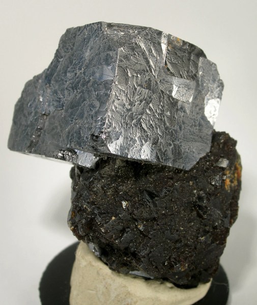


Blue Goose Mine, Joplin Field, Jasper County, Missouri, USA