 | | Book (edition) | | ROCKHOUNDING Utah SECOND EDITION A Guide to the State’s Best Rockhounding Sites WILLIAM A. KAPPELE.... . . . . . . ix Introduction: Welcome to Utah. . . . . . . . . . . . . . . . 1.... . . . . . . . . . 30 South Utah 1. Central: Agate . . . . . . . . . . . . . ... . . . . 2. Hurricane Mesa: Petrified Wood, Agate . . . . . . . . . . . 3. Gooseberry Mesa:...Chalcedony. . . . . . . . . . . 8. Brian Head: Agate . . . . . . . . . . . . . . |  | | Book (edition) | | org/details/rockhoundingutahO00O0kapp Rockhounding Utah William A. Kappele Consulting Editor W.R.C. Shedenhelm...n Data Kappele, William A., 1931— Rockhounding Utah / by William A. Kappele ; consulting editor, W.R...guide)—T.p. verso. ISBN 978-1-56044-446-6 1. Rocks—Utah—Collection and preservation—Guidebooks. Guidebooks...962-0973 or e-mail premiums@GlobePequot.com. 2. Utah- 96-12047 CIP CONTENTS PORTIOWICUCINCOUS reer...ociees Ros eten Ts essere: ii ROCKHOUNDING SITES IN UTAH ie Ceol aleASale exit mee RE Atihid Ramis 2 20 |  | | Journal (issue) | | with one of their four-wheel-drive cars at the head of the Capitol Gorge and at the turn-off to their...SLEEPING RAINBOW GUEST RANCH Via Box 93 Torrey, Utah DESERT • PARADISE FLATS FOREST ON EARTH" • THE... Happily, the wilderness wonderland of southern Utah is less than two-days driving distance for 80 percent...people who will read this magazine. And a southern Utah vacation is within range of every pocketbook. We...entrepreneurs and friendly communities to you. From one Utah visit will spring lifetime friendships for both | 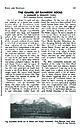 | | Journal (article/letter/editorial) | | given area usually requires effort. In southwestern Utah, however, such information can be had merely by...Highway 91, which, on its way north and south acrosi Utah, follows the line of demarcation between two distinct...Cedar City consists of almost untapped mountains of iron. Eastward, however, the country is quite different—a...Monument. Another sweeping declivity falls from Brian Head (11,315'), and overlooks lavastrewn Kolob Terrace...Chinle and Navajo Formations. Zion National Park, Utah. Photo by Guy Bensusan MO ROCKS AND Downloaded |  | | Journal (issue) | | all meteorites known on earth consist of nickel iron. However, we know that the moon is composed mainly...50 per cent alumina (A1.O,), 13 per cent ferrous iron (FeO), a small amount of magnesia (MgO); also a...angles 3.0% 3 multi twins 0.2% The people in Patrick County, Virginia, have become very proficient in making...(Virginia Geological Survey Bull. 39, “James River Iron and Marble Belt, Virginia,’ 1935, pp. 31-33). Here...textbooks on mineralogy mention Patrick County, the Henry County locality is the best in many respects |  | | Report (volume) | | Transition in Southeastern Nevada, Southwestern Utah, and Northwestern Arizona, 1992 U.S. GEOLOGICAL...circular irrigation patterns ; the city of St. George, Utah, is about 80 km to the south. The southern area...the Caliente caldera complex about at the Nevada-Utah border. Geologic Studies in the Basin and RangeColorado...Transition in Southeastern Nevada, Southwestern Utah, and Northwestern Arizona, 1992 By Robert B. Scott...transition in southeastern Nevada, southwestern Utah, and northwestern Arizona, 1992 I by Robert B. Scott |  | | Book (edition) | | describes sites under of the nearest town and county. and the many maps included book contain such...Chrysocolla, Turquoise LJ Emerald, Beryl ^"^ Agate ** Jade Amethyst nq -* % Gem Hunter's...color, as in emeralds; their pattern, as in moss agate; or their play of eral color, as in opals. Fashion... such as agate and jasper, are described as cryptocrystal- line. For example, an agate nodule may...broken stick, or hackly or jagged, like broken cast iron. Jade breaks with a fibrous or hackly pattern because |  | | Book (edition) | | MARIN COUNTY FREE LIBRARY 3 1111 00289 4184 \ I s Fifth Revised Edition A complete, state-by-state...Chrysocolla, Turquoise LJ Emerald, Beryl *"» Agate ** Jade =p Amethyst ^ X ) y ' £f h % ^...stones will remain." On my own table is a section of agate, cut and polished, its concentric rings of rose...color, as in emeralds; their pattern, as in moss agate; or their play of color, as in opals. Fashion plays...sharp sliver of agate, such as Montana moss agate, is also useful to test minerals near agate in hardness |  | | Journal (issue) | | Seattle, WA 98101 •·, .. • NW Federation Show King County Fairgrounds Enumclaw, WA August 31, Sept 1 & 2...Carolina Minerals and Gem Fes• lival". Mitchell County Chamber of Commerce, The Pinebridge Center, mine...Festivals Coord,nalor, Mitchell County Chamber ol Commerce, Mitchell County Economic Development Commission...specimens. lapidary supplies; contact Mitchell County Chamber of Commerce. (828) 765-9033 or (800) 227-3912...demonstralions, displays, swapping, fluorescent mlnerals, county store, junior acIivilies, NFMS convention, held |  | | Book | | Published by Utah Geological Association and Bryce Canyon Natural History Association Utah Geological Association...Canyon National Park Bryce Canyon, Utah 84717 v,rww.nps.gov / brca Utah Geological Association P.O. Box...Salt Lake City, Utah 84152-0100 wvvv.r.utahgeology.org Copyright© 2003 by the Utah Geological Association...1d..'y Oarke, Graphic Designer, Salt Lake City, Utah Printed in Hong Kong by Regal Printing Limited through...photograph: Goblin Valley State Park Courtesy of Utah Di ision of Parks and Recreation (unknown photographer) |  | | Book | | HfiRIN COUNTY FREE LIBRfiRY 311110G386652Q I V Russell P MacFal A COLOR TREASUF FOR COLLECTORS...to Hunting Locations ? i 9 GIVEN TO THE MARIN COUNTY LIBRARY BY MARI N L MTNF.RAT. SOCTETY DAVID...may be able to buy specimens. map of Keweenaw County. Mich- Part of the U.S. Geological Survey topographic...filled cloth and stow them the head of your in hammer the pack head down. the side in a cloth The...sweater and a windbreaker (both indispensable) rich iron-stained quartz that mines in betray a gold deposit | | | Book | | IOATOUTE CHLORASTROUTEI 2 AMYGDAlOID MINE DUMPS 3 AGATE HARBOR (AGATES THOMSONITE ON BEACH\ )l MUD VLAKE...topographic map of the Delaware q uadrangle o f Keweenaw County, Michigan This ,s an example o f the more picturesque...side pockets Wrap the head of your hammer 1n a cloth and place 11 rn the pack head down The handle should...pegmatites Such prospecting 1s s,m,lar to the search for iron-stained quartz that may betray a gold deposit or...such as the enormous copper mine at Bingham Canyon, Utah, althoug h here some tunnels, known to miners as |  | | Report (issue) | | s | of the Coal Area 9 \ of South-Central Utah it 12 Cory-iled by -'- i K. A. Sargent and...southcentral Utah 2o e { I 7 a j i - Structure map of the coal area of south-central Utah- - - in...in pocket 3. Coal fields in south-central Utah 4. Preliminary generalized map of areas underlain...of 10 south-central Utah 11 Figure 1. 12 - i-- - in pocket Map of Utah showing physiographic...Cretaceous strata, coal zones of south-central Utah 6. 4 25 Kaiparowits Plateau - in pocket 30 |  | | Journal (issue) | | ilmenite and monazite) and the largest exporter of iron ore and coal. It is among the top three producers...discovered in New South Wales during the 1790’s, as were “iron stone” (goethite-hematite) and salt (halite); indeed...mineralogist Richard Chenevix (17741830) evidence of the iron-titanium oxide “menachanite” (ilmenite), then considered...Brown (1773— 1858), actually reported pisolitic “iron ore” from the seabed near Weipa. Colloform pyrolusite...had already to his credit a paper on the hydrous iron phosphate mineral cacoxenite (Vallance, 1977) in |  | | Journal (issue) | | TRAVEL/ADVENTURE MAGAZINE an UTAH VACATION ADVENTURES REPORT FROM FINDER 0 BLACK 8010 NUGGETS UNSTOPPABU...House of Three Turkeys By WILLIS KINNEAR 34 Sego, Utah By LAMBERT FLORIN 35 Desert Dispensary NAME ADDRESS...Expeditions 1699 East 3350 South, Salt Lake City, Utah 84106 Phone 484-4006 6 / Desert Magazine / May...Extending 180 miles in northern Arizona and southern Utah, it is surrounded by the most spectacular desert...Lake Powell concessionaires presently operating in Utah. One of them is at Hall's Crossing, the other at |  | | Report (issue) | | PALEONTOLOGY IN UTAH Miscellaneous Publication 99-1 MISCELLANEOUS PUBLICATION 99-1 UTAH GEOLOGICAL SURVEY...division of 1999 UTAH DEPARTMENT OF NATURAL RESOURCES VERTEBRATE PALEONTOLOGY IN UTAH David D. Gillette...Gillette, Editor Utah Geological Survey ISBN 1-55791-634-9 MISCELLANEOUS PUBLICATION 99-1 UTAH GEOLOGICAL...SURVEY a division of 1999 UTAH DEPARTMENT OF NATURAL RESOURCES STATE OF UTAH Michael O. Leavitt, Governor...NATURAL RESOURCES Kathleen Clarke, Executive Director UTAH GEOLOGICAL SURVEY M. Lee Allison, Director UGS |  | | Report (volume) | | Seismology. New York. Compass-The Compass. Provo, Utah. Condor-The Condor. Berkeley, Calif. Copeia. Ann...Chicago. _ . Los Angeles County Mus. Quart.; Sci. Ser., Paleontology-Los Angeles County Museum Quarterly; Science...Research Projects. [Washington, D. C.]. Utah Acad. Sci. Proc.-Utah Academy of Sciences, Arts and Letters...Proceedings. Salt Lake City, Utah. Utah Geol. Mineralog. Survey Bull.; Circ.-Utah Geological and Mineralogical...Mineralogical Survey Bulletin; Circular. Salt Lake City, Utah. Vt. Geol. Survey BulL-Vermont Geological Survey |  | | Book | | of erosion, Balanced Rock, Arches National Park, Utah Library of Congress Cataloging-in-Publication Data...landscapes of the Four Corners region where Arizona, Utah, Colorado, and New Mexico meet. Also known as the...Utah's slickrock country, Arches National Park, Utah Acknowledgments This book fulfills my dream of...the Parks, Monuments, and Wildlands of Southern Utah), Frank DeCourten (Shadows of Time), Wendell Duffield...Ranney (Geology of Sedona’s Red Rocks), and the Utah Geological Association (Geology of Utah's Parks |  | | Report (volume) | | search: Hershey, H. G. , 2. scale: Spieker, E. M., 3. Iron-range rocks, origin: Tanton, Distribution in geologic...described. Div. Mines, 1; Jenkins, O. P., Choctaw County, Highway 17 area: 3. Toulmin, L. D., Jr., 3. Minor:...and potash in H. D., 6. gravels, analyses: Lamar, Iron, Birmingham area: Thoenen, J. E., 8a. J. R., 2....analysis: KelH. D., 5. ler, W. D., 3. Talladega County, hematiteOklahoma, potash agstone, granite magnetite...ground water: Powham, C. E. ell, W. J., 4. Marengo County: Newton, J. G., 1. Core-drilling program, ChattanooMica: |  | | Report (volume) | | DIRECTOR BULLETIN 338 THE IRON ORES OF THE IRON SPRINGS DISTRICT SOUTHERN UTAH BY C. K. LEITH AND E.................... CHAPTER VI. DESCRIPTION OF THE IRON ORES ............................. Distribution....................... CHAPTER VII. ORIGIN OF THE IRON ORES. ................................. 73 73 75..... CHAPTER VIII. COMPARISON OF IRON SPRINGS IRON ORES WITH OTHER IRON ORES.............................Structural dissimilarities of Iron Springs deposits to other classes of iron-ore deposits.............. |  | | Report (volume) | | Mendenhall, Director Bulletin 912 SPIRIT LEVELING IN UTAH 1897-1938 J. G. STAACK Chief Topographic Engineer...station marks and benchmarks ______ 2. Index map of Utah showing the quadrangles into which the State has...____ ni 605394 Page 2 5 SPIRIT LEVELING IN UTAH, 1897-1938 J. G. STAACK, Chief Topographic Engineer...bulletin contains the results of all spirit leveling in Utah done by the Geological Survey, United States Department...Survey are not included. Cooperation. Leveling in Utah by the Geological Survey prior to 1922 was carried |  | | Book | | r(5a3side EOLOGY of UTAH HALKA CHRONIC Digitized by the Internet Archive in 2014 https://archive...org/details/roadsidegeologyoOOchro_0 roadside VJeology of Utah Halka Chronic MOUNTAIN PRESS PUBLISHING COMPANY...ation Data Chronic, Halka. Roadside geology of Utah / Halka Chronic. cm. (Roadside geology series) p... — Utah—Guide-books. ravel— 1981— Guide-books. QE169.C48 1989 557.92— dc20 dc20 t I. 2. Utah Title...visible on the surface. A more detailed, full-color Utah Geological Highway Map is available from bookstores |  | | Report (volume) | | glacial epoch J (Wyoming) Blacks Fork glacial stage l (Utah) Brisco glacial substage 2 (Colorado) Buffalo...glacial stage 2 (Colorado) Little Dry glacial stage 1 (Utah) Long Draw glacial substage 2 (Colorado) Monarch...glacial stage 2 (Colorado) Provo epoch l or stage * (Utah) River glacial stage 2 (Colorado) St. Eugene interglacial...substage 2 (Colorado) Smith Fork glacial stage l (Utah) Spokane glaciation 1 (Washington) Sprague glacial...glaciation 2 Farewell glaeiation 2 Healy glaciation 2 Iron Creek glaciation 2 Itkillik glaciation 2 Johnston |  | | Report (issue) | | locality, or civil division (city, village, or county) named for a physical feature is always listed...information is usually self-explanatory, for example: county seat. Feature Class (second column) The terms listed...their definitions. County (third column) This column lists the name of the county in which the entity...place, feature, or area lies in more than one county, the county listed is the one in which the center of...in the case of a stream, valley, or arroyo, the county listed is the one in which the mouth of the feature |  | | Report (volume) | | 74, Ph miles east of Dutchtown, Cape Girardeau County, Mo. Type section cut by northtrending fault with...stream in NEIA sec. 33, T. 16 N., R. 14 E, Wayne County. Named after village of Abington, about 3 miles...Named for Adam Peak in Osgood Mountains, Humboldt County. Occupies belt about 21f2 miles long on western...western slope of range west of Adam Peak, from head of East Fork of Eden Creek on north to ridge east of Goughs...Portlandian) age. Mapped around Adobe Flat in Stanislaus County. Well exposed west of Wilcox Ridge in sec. 23, |
|

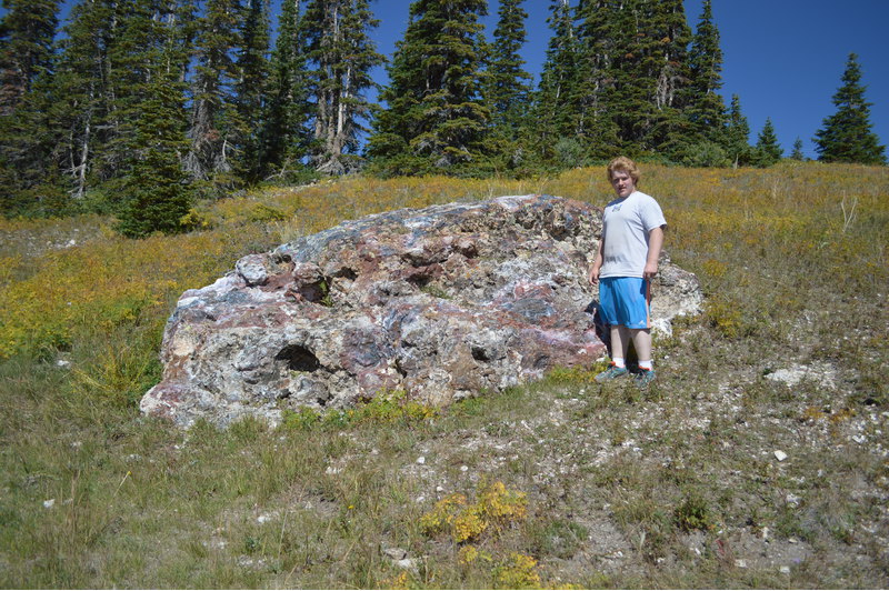


Brian Head, Iron County, Utah, USA