 | Capistrant, P. L., Hitzman, M. W., Wood, D., Kelly, N. M., Williams, G., Zimba, M., Kuiper, Y., Jack, D., Stein, H. (2015) Geology of the Enterprise Hydrothermal Nickel Deposit, North-Western Province, Zambia. Economic Geology, 110 (1) 9-38 doi:10.2113/econgeo.110.1.9 | Journal (article/letter/editorial) | | Enterprise Hydrothermal Nickel Deposit, North-Western Province, Zambia Patricia L. Capistrant,1,* Murray W...AIRIE Quantum Minerals Ltd, Zambia, Plot 3805, Zambia Road, Ndola, Zambia Program, Dept. of Geosciences...the eastern edge of the Kabompo dome in the North-Western Province of Zambia. The deposit area contains...rocks. The host rocks contain significant kyanite, talc, and magnesian chlorite. Silicification and magnesian...the eastern edge of the Kabompo dome in the North-Western Province of Zambia (Fig. 1) approximately 300 |  | | Journal (article/letter/editorial) | | Deposit at Kalumbila, Kabompo Dome: The Copperbelt Ore Shale in Northwestern Zambia NICK STEVEN† Rockwater...Zambian Copperbelt on the southeastern flank of the Kabompo dome in the Middle Unit of the Lufilian arc. Kalumbila...granitic gneiss such as that exposed in the adjacent Kabompo basement dome. The metasedimentary sequence grades...target. Kalumbila occurs within a moderately (40o) north- northwest-dipping band of Wamikumbi Formation carbonaceous...mineralization at the Kalumbila prospect in North Western province, Zambia (Fig. 1). This mineral deposit type |  | Cosi, M., De Bonis, A., Gosso, G., Hunziker, J., Martinotti, G., Moratto, S., Robert, J.P., Ruhlman, F. (1992) Late proterozoic thrust tectonics, high-pressure metamorphism and uranium mineralization in the Domes Area, Lufilian Arc, Northwestern Zambia. Precambrian Research, 58 (1) 215-240 doi:10.1016/0301-9268(92)90120-d | Journal (article/letter/editorial) | | mineralization in the Domes Area, Lufilian Arc, northwestern Zambia M. Cosi a, A. D e B o n i s a, G. G o s s o b,...mineralization in the Domes Area, Lufilian Arc, northwestern Zambia. In: G. Ga~iland K. Schulz (Editors), Precambrian...well-preserved quartzites with high Mg content, talc-bearing, extremely foliated schists intercalated...kilometers in the Domes Area of the Northwestern Province of Zambia, close to the Zairean border (Fig. I ). It...southern Africa between the Congo Craton in the north and the Kalahari in the south, form a curved zone |  | | Journal (article/letter/editorial) | | Uranium in the KatangaSystem of Northwestern LUIGI Zambia MENEGHEL AGIP S.p.A.-ZambiaBranch,Lusaka,Zambta...baseof the Lower Roan formationat the marginsof the Kabompo, Mwombezhi, and Solwezi domes. The mineralization...of the arc, particularly at Kalongwe,Menda, KaIn Zambia,the sequenceis subdividedfrom bottom sompi,Swambo...exposed, 56 U OCCURRENCE, KATANGA SYSTEM, NW ZAMBIA 57 FIG.1. Distribution of the Katangasystem (afterDemesmaeker...NW ZAMBIA 59 60 LUIGI MENEGHEL .. i' /.. .. 4- U OCCURRENCE, KATANGA SYSTEM, NW ZAMBIA •o |  | Eglinger, Aurélien, Ferraina, Clément, Tarantola, Alexandre, André-Mayer, Anne-Sylvie, Vanderhaeghe, Olivier, Boiron, Marie-Christine, Dubessy, Jean, Richard, Antonin, Brouand, Marc (2014) Hypersaline fluids generated by high-grade metamorphism of evaporites: fluid inclusion study of uranium occurrences in the Western Zambian Copperbelt. Contributions to Mineralogy and Petrology, 167 (2) doi:10.1007/s00410-014-0967-9 | Journal (article/letter/editorial) | | inclusion study of uranium occurrences in the Western Zambian Copperbelt Aurélien Eglinger • Clément...2014 Abstract In the Pan-African Lufilian belt (Western Zambian Copperbelt), uranium mineralizations, preferentially...preferentially scattered in kyanite ± talc micaschists (metamorphosed evaporitic sediments) or concentrated...studied in Lolwa and Mitukuluku (Domes region, Western Zambian Copperbelt), two mineralizing stages are...scenario for U mineralizations in the Lufilian belt (Zambia) renowned for its Cu mineralizations associated |  | Bernau, Robin, Roberts, Stephen, Richards, Mike, Nisbet, Bruce, Boyce, Adrian, Nowecki, James (2013) The geology and geochemistry of the Lumwana Cu (± Co ± U) deposits, NW Zambia. Mineralium Deposita, 48 (2) 137-153 doi:10.1007/s00126-012-0424-5 | Journal (article/letter/editorial) | | geochemistry of the Lumwana Cu (± Co ± U) deposits, NW Zambia Robin Bernau & Stephen Roberts & Mike Richards...Abstract The Lumwana Cu (± Co ± U) deposits of NW Zambia are large, tabular, disseminated ore bodies, hosted...shadows on porphyroblasts, suggest a top to the north shear sense. The sulphides are deformed by a strong...Copperbelt, which straddles the border between Zambia and the Democratic Republic of Congo, is host to...provincial capital of Solwezi, in the North Western Province of Zambia and represent one of the most significant |  | Eglinger, Aurélien, Vanderhaeghe, Olivier, André-Mayer, Anne-Sylvie, Goncalves, Philippe, Zeh, Armin, Durand, Cyril, Deloule, Etienne (2016) Tectono-metamorphic evolution of the internal zone of the Pan-African Lufilian orogenic belt (Zambia): Implications for crustal reworking and syn-orogenic uranium mineralizations. Lithos, 240. 167-188 doi:10.1016/j.lithos.2015.10.021 | Journal (article/letter/editorial) | | zone of the Pan-African Lufilian orogenic belt (Zambia): Implications for crustal reworking and syn-orogenic...zone of the Pan-African Lufilian orogenic belt (Zambia): Implications for crustal reworking and syn-orogenic...zone of the Pan-African Lufilian orogenic belt (Zambia): Implications for crustal reworking and ...Targeting, University of Western Australia, 35 Stirling Highway, D Western Australia 6009 Université...zone of the Pan-African Lufilian orogenic belt (Zambia) hosts a dozen uranium PT occurrences mostly |  | | Journal (article/letter/editorial) | | database from the western extension of the Central Africa Copperbelt in northwestern Zambia R. M. Key, B....geochemical survey was undertaken in the extreme north-west of Zambia with three primary objectives: (i) to provide...sequence of Neoproterozoic Katanga strata within the western part of the Lufilian Arc (a Pan African orogenic...deposits in the Central African Copperbelt of northern Zambia and the Democratic Republic of Congo [DRC]), and...contamination of streams in the Copperbelt areas of Zambia and the Democratic Republic of Congo due to their |  | Eglinger, Aurélien, Tarantola, Alexandre, Durand, Cyril, Ferraina, Clément, Vanderhaeghe, Olivier, André-Mayer, Anne-Sylvie, Paquette, Jean-Louis, Deloule, Etienne (2014) Uranium mobilization by fluids associated with Ca–Na metasomatism: A P – T – t record of fluid–rock interactions during Pan-African metamorphism (Western Zambian Copperbelt) Chemical Geology, 386. 218-237 doi:10.1016/j.chemgeo.2014.07.028 | Journal (article/letter/editorial) | | interactions during Pan-African metamorphism (Western Zambian Copperbelt) Aurélien Eglinger a,⁎, Alexandre...occurrences are known in the Western Zambian Copperbelt (Domes region, Zambia). The hostrocks, Neoproterozoic...Neoproterozoic kyanite ± talc micaschists, have been interpreted as meta-evaporites that formed part of an epicontinental...present study focuses on the Solwezi dome in the Western Zambian Copperbelt. Two distinct uranium mineralization...different stages of uranium mineralization in kyanite ± talc micaschists, interpreted to be Pan-African metamorphosed |  | | Thesis/Dissertation | | GEOCHEMISTRY OF THE KANSANSHI CU-(AU) DEPOSIT, NORTH-WESTERN PROVINCE, ZAMBIA by Timothy J. Mac Intyre © Copyright...REGION AT THE KANSANSHI CU-(AU) DEPOSIT, NORTH-WESTERN PROVINCE, ZAMBIA .....................................Kansanshi stratigraphy to the western Domes region (Mwombezhi and Kabompo Domes) ........................GEOLOGY OF THE KANSANSHI CU-(AU) DEPOSIT, NORTH-WESTERN PROVINCE, ZAMBIA .....................................‘SNOWBALL EARTH’ DIAMICTITE SEQUENCE IN NORTHWESTERN ZAMBIA .......... 122 4.1 Introduction ............. |  | Sillitoe, Richard H., Perelló, José, Creaser, Robert A., Wilton, John, Wilson, Alan J., Dawborn, Toby (2017) Age of the Zambian Copperbelt. Mineralium Deposita, 52 (8) 1245-1268 doi:10.1007/s00126-017-0726-8 | Journal (article/letter/editorial) | | Sediment-hosted Cu deposits . Central African Copperbelt . Zambia . Molybdenite . Re-Os ages . Synorogenic Alan...Copperbelt—the world’s most important metallogenic province of this type, with ~220 Mt of contained Cu. Early...versus synorogenic models at the metallogenic province scale. In this paper, 15 new Re-Os age determinations...during inversion of the rift basins and concomitant north-vergent folding and thrusting that define the PanAfrican...200 km Tenke Fungurume Kamoa ZCB Likasi 11° ZAMBIA Magnetic footprint of Hook batholith DRC h is |  | | Journal (article/letter/editorial) | | and defines a structure which is coii\'cx to tlie north. 'Ihree major ph,ises of deformation characterize...strike-slip faults developed sequentially from south to north, and probably to a slow c o n v c r g e i i c ~\relocity...Katangan terranes in Congo (Cailteux, 1990)and in Western Zambia (Cosi et al., 1992), led to the conclusion...Major strikc-slip fault systems wcre documented in Zambia (De Swardt ct al., 1965; Drysdall et al., 1972;...tectonic evolution of the Lufilian arc in Congo and Zambia, and the age of the major deformation events in |  | | Other Paper | | Appendix II-2 Structure of Mineral Rights in Zambia Type of Right Place of Application Required Documents...Countries Prospecting (Exploration) Country Zambia Duration for approval 2 years, twice renewable... Stage Exploration Exploration West Central Zambia 265km northeast of Lusaka 60km south of Lusaka...Mineral Development and Exploration Projects in Zambia 1 84 African Eagle Resources (UK) Copper,...Minerals Copper Copper 6 /Phelps Dodge Mining (Zambia) African Eagle Resources (UK) Copper Commodity |  | | Journal (article/letter/editorial) | | Democratic Republic of Congo (Congo hereafter) and Zambia, which represent the most economically important...northward convex structure, straddling the Congo–Zambia border and called “Lufilian Arc”. It was formed...50-km-wide region from the Mwinilunga district in northwestern Zambia (Brock, 1961; Steven, 2000), east-northeastwards...Likasi (Congo), and southeastwards to Bwana Mkubwa (Zambia) and Lonshi (Fig. 1). The Katangan sedimentary...between these two formations (François, 1974). In Zambia, only a dominantly argillaceous unit, called “Mwashia” |  | Turlin, François, Eglinger, Aurélien, Vanderhaeghe, Olivier, André-Mayer, Anne-Sylvie, Poujol, Marc, Mercadier, Julien, Bartlett, Ryan (2016) Synmetamorphic Cu remobilization during the Pan-African orogeny: Microstructural, petrological and geochronological data on the kyanite-micaschists hosting the Cu(–U) Lumwana deposit in the Western Zambian Copperbelt of the Lufilian belt. Ore Geology Reviews, 75. 52-75 doi:10.1016/j.oregeorev.2015.11.022 | Journal (article/letter/editorial) | | kyanite-micaschists hosting the Cu(–U) Lumwana deposit in the Western Zambian Copperbelt of the Lufilian belt François...Rennes Cedex, France Barrick Limited, Lumwana, Zambia a r t i c l e i n f o Article history: Received...internal zone of the Lufilian belt known as the Western Zambian Copperbelt in which a primary Cu mineralization...metasedimentary sequence. Cu(–U) occurrences in the Western Zambian Copperbelt are hosted by kyanite-micaschists...recrystallization of the sulfides in top to the north C3 shear bands associated with rutile crystals yielding |  | | Report (chapter) | | of Central Africa (Katanga Province of Democratic Republic of Congo, Zambia, and eastern Angola) is exposed...southern part of the Lufilian belt in what is now Zambia. From: Arnaud, E., Halverson, G. P. & Shields-Zhou...Ma) in the southern part of the Roan rift basin (Zambia) terminated deposition of the Roan Group platform...in a NE direction from eastern Angola across NW Zambia and into southern DRC (Unrug 1987, 1988; Kampunzu...(Democratic Republic of Congo) and in adjacent areas of Zambia (modified after Cahen & Lepersonne 1979). Fig |  | | Journal (article/letter/editorial) | | Minerals Ltd (FQM) is situated in the North-Western province of Zambia (Figure 1), a region of the Central...annual production at 770,598 t as of 2016 (Bank of Zambia, 2016) but also well-endowed with Ni, Cu, Co U...projects between 2000 and 2014 (Mining for Zambia, a Zambia Chamber of Mines Initiative, 2017). The project...is dominated by the metamorphic basement of the Kabompo dome in the NW and is overlain by the rocks of...successfully used RF to refine geological mapping in western Tasmania, subsampling a geological map as training |  | | Journal (article/letter/editorial) | | sediment-hosted copper- and cobalt-producing metallogenic province in the world (Fig. 1). It hosts over 80 deposits... er L ufili a 11° n Fig. 2 Lubumbashi Kabompo Western Middle Lu filian 12°S Solwezi Musoshi Kasumbalesa...Biano Fm Nguba 600 Kundelungu ? Eclogite in NW Zambia Marinoan/Petit Conglomérat Sturtian/Grand Conglomérat...Lufilian (“external fold-andthrust belt”), the Western Middle Lufilian (“Domes region”) and the Eastern...Eastern Middle Lufilian zone, both around and farther north of the Kafue basement inlier, deformation in the |  | Kitt, Shawn, Kisters, Alexander, Steven, Nick, Maiden, Ken, Hartmann, Karl (2016) Shear-zone hosted copper mineralisation of the Omitiomire deposit — Structural controls of fluid flow and mineralisation during subduction accretion in the Pan-African Damara Belt of Namibia. Ore Geology Reviews, 75. 1-15 doi:10.1016/j.oregeorev.2015.10.035 | Journal (article/letter/editorial) | | gneisses in the Domes Region of the Lufilian Arc in Zambia. © 2015 Elsevier B.V. All rights reserved. 1....large deposits of the Central African Copperbelt in Zambia and the Democratic Republic of Congo (Selley et...and burial of originally trench sediments during north- or northwestward subduction of the Kalahari below...1991; Miller, 2008; Meneghini et al., 2014). To the north, the SZ prism borders against the magmatic arc of...version of this article.) plunges to both the north and south (Fig. 3). In outcrop, the lineation is |  | Kampunzu, A.B., Tembo, F., Matheis, G., Kapenda, D., Huntsman-Mapila, P. (2000) Geochemistry and Tectonic Setting of Mafic Igneous Units in the Neoproterozoic Katangan Basin, Central Africa: Implications for Rodinia Break-up. Gondwana Research, 3 (2) 125-153 doi:10.1016/s1342-937x(05)70093-9 | Journal (article/letter/editorial) | | Department of Geology, University of Zambia, PO. Box 32379, Lusaka, Zambia Technical University, Section of...(Democratic Republic of Congo, hereafter Congo, and Zambia) provide the basis for the geodynamic interpretation...Neoproterozoic basins straddling the present-day Congo-Zambia border region, approximately 0.9 to 0.5 Ga ago...breakup to embryonic continental haIf-graben (cf. western branch of the EARS) and then to extended continental... 1988; Porada, 1989). These are, from south to north (Fig. 2), the Katangan High (I), the Synclinorial |  | | Journal (article/letter/editorial) | | ........................................ Nkana north limb .............................................................................. The Katanga Province ................................................Anglo American Corp. 9 I0 CHAMBISHI Cu NKANA NORTH LIMB Operating Prospect Rhodesran Selection Trust...KALABA Cu ........ 22 25 CHIZERA LALAFUTA 24 WESTERN 25 SABLE 26 M.A.I., 27 EUREKA 28 MILLBERG...Closed Rhodesia Anglo American Corp 32 CHONGWE NORTH Prospect Rhodesion Selechon Trust Lid :53 CHONGWE |  | | Conference Proceedings (Volume) | | View of the Aitik open pit copper mine in the very north of Sweden. Mining operations started in 1968 and...Southern Cross greenstone belt, Yilgarn Craton, Western Australia: midcrustal granite-related replacement...& Nigel J. Cook The Nihe iron deposit, Anhui Province, eastern China: skarn, IOCG or porphyritic iron...Neoproterozoic rocks in the Lufilian belt, Domes region, Zambia .................................................the ages of Baiyanghe Be-U deposit in Xinjiang province, northwest China ........................... |  | | Journal (article/letter/editorial) | | RHODESIA. 109 5. :The GEOLOGY Of PART of NORTH-WESTERN RHODESIA. B y ROBEaT MURRAY-HUGHES,F . G . S...London on May 31, 2016 part 2-1 OF PART OF NORTH-WESTERN I~IIODESIA. 111 the first of which was to...and healthful country, which is bounded on the north by the Belgian Congo, on the east by Nyasaland and...taken at the Sable Antelope Mine in the Mumbwa district, showed an average distribution over the months...roughly run diagonally across the country from north-west to south-east. They are as follows : - ~2 |  | | Book | | Magmatic-Hydrothermal History of the Río Blanco-Los Bronces District, Central Chile: Development of World’s Greatest...Chuquicamata District, Northern Chile Geologic Overview of the Escondida Porphyry Copper District, Northern...± Molybdenum Deposits of the Ertsberg-Grasberg District, Papua, Indonesia Clyde A. Leys, Mark Cloos,...Schuh, Richard A. Leveille, Isabel Fay, and Robert North 269 Stephen E. Box, Boris Syusyura, Reimar Seltmann...N. Moreto, André Luiz Silva Pestilho, Mineral Province, Brazil Gustavo Henrique Coelho de Melo, Marco |  | | Journal (issue) | | Karroo Basalt, Zambezi Valley • • • Plate VII North Scarp, Zambezi Valley X • • • J IJ 143 J...Minerals Concession of 13,000 sq. rniles, and the North Charterland Concession of 10,000 sq. miles. A carefully...River, and certain areas bordering the Barotse Province, were not traversed, because ,vork in surrounding...parallels of south latitude. It is bounded on the north by the Belgian Congo and the Mandated Territory...south tip of the Katanga pedicle, whence it runs north-east to leave the territory about half way between |
|

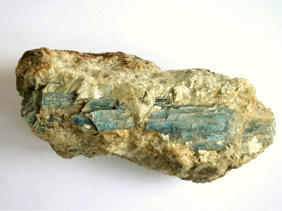


Kabompo, Kabompo District, North-Western Province, Zambia