 | | Report (issue) | | of the Petersburg A-2 Quadrangle, Southeastern Alaska By David A. Brew1 Open-File Report 97-156-A ...or product names is for descriptive purposes only and does not imply endorsement by the U.S. Government...QUADRANGLE, SOUTHEASTERN ALASKA By David A. Brew INTRODUCTION This map and its accompanying information...part of the State of Alaska Division of Geological and Geophysical Surveys and the U.S. Department of...Interior Bureau of Land Management Alaska Minerals Section (Juneau, Alaska) mineral-resource studies of part |  | | Report (issue) | | DESCRIPTION OF MAP UNITS AND CORRELATION OF MAP UNITS FOR THE PETERSBURG-WRANGELL AREA 1:63,360-SCALE GEOLOGIC...GEOLOGIC MAPS, SOUTHEASTERN ALASKA Open-File Report 97-156-O By David A. Brew and Donald J. Grybeck This...or product names is for descriptive purposes only and does not imply endorsement by the U.S. Government...Description of Map Units and Correlation of Map Units for the Petersburg-Wrangell Area 1:63,360-Scale...360-Scale Geologic Maps, Southeastern Alaska By David A. Brew1 and Donald J. Grybeck2 Open-File Report 97-156-O |  | | Report (issue) | | database on mines, prospects and mineral occurrences throughout Alaska. File ReAlsaousrkcae Dat Distribution...Petersburg l:250,000-scale quadrangle, southeastern Alaska This and related reports are accessible through the...the author of this compilation: Donald J. Grybeck and Henry C. Berg U.S. Geological Survey 4200 University...786-7424 dgrybeck@usgs. gov This report is preliminary and has not been reviewed for conformity with U.S. Geological...only and does not imply endorsement by the U.S. Government. OPEN-FILE REPORT 98-784 j Alaska Resource |  | | Report (issue) | | Petersburg and parts of the Port Alexander and Sumdum 1:250,000 quadrangles, southeastern Alaska By David...Susan M. Karl , and Susan J. Hunt* Open-File Report 84-405 This report is preliminary and has not been...standards and strati graphic nomenclature. *Menlo Park, California ^Reston, Virginia ^Anchorage, Alaska Preliminary...Petersburg and parts of the Port Alexander and Sumdum 1:250,000 quadrangles, southeastern Alaska By David...David A. Brew, A. T. Ovenshine, Susan M. Karl, and Susan J. Hunt INTRODUCTION This report consists of three |  | | Report (issue) | | MINERAL DEPOSITS OF THE WRANGELL DISTRICT. By A. F. BUDDINGTON. INTRODUCTION. This report is based on...southern part of the Wrangell mining district during three months in 1921. F. E. and C. W. Wright l made...reconnaissance of the Ketchikan and Wrangell districts in 1905, and the accompanying map (PI. 1) is in...their work. Further details of mining developments and economic resources of this district may be found...summary reports on the mineral resources of Alaska for 1904 and later years. GENERAL GEOLOGY. Intrusive |  | | Report (issue) | | GEOLOGICAL SURVEY Map and description of the mineral deposits in the Petersburg and Eastern Port Alexander...Alexander Quadrangles, Southeastern Alaska D. J. Grybeck 1 , H. C. Berg 1 , and S. M. Karl 1 U. S. GEOLOGICAL...preliminary and has not been reviewed for conformity with Geological Survey standards and nomenclature...* Anchorage, Alaska MAP AND DESCRIPTION OF THE MINERAL DEPOSITS IN THE PETERSBURG AND EASTERN PORT...PORT ALEXANDER QUADRANGLES, SOUTHEASTERN ALASKA Donald J. Grybeck Henry C. Berg Susan M. Karl INTRODUCTION |  | | Report (issue) | | geologic summary, metallogenesis, and mineral resources of southeastern Alaska Henry C. Berg* Open-File Report...preliminary and has not been reviewed for conformity with IJ.S Geoloaical Survey editorial standards and stratiaraphic...stratiaraphic nomenclature. 1 Anchorage, Alaska 1984 CONTENTS Page Abstract............................................................... Epiqenetic and syngenetic deposits................................Descriptions of metallic mineral deposits in southeastern Alaska.... 73 Appendix: Bradfield Canal quadrangle. |  | | Report (volume) | | m 800 GEOLOGY AND MINERAL DEPOSITS OF SOUTHEASTERN ALASKA BY A. F. BUDDINGTON AND THEODORE CHAPIN...________________________________________ Earlier explorations and surveys, by Theodore Chapin.___ _________ Notes on...Geography _. Location and extent___-_______-___________________---_____--__ Population and settlements... -...----_----_-_-----_--------_---------------_--____ Vegetation and timber supply, by Theodore Chapin . Agricultural...________________________ _________ Sea-cut benches and platforms.______________________. -_-__--___ Karst |  | | Report (issue) | | RECONNAISSANCE FOR URANIUM AND THORIUM IN ALASKA, 1962 By Helmuth Wedow, Jr. and other* UNITED STATES...RECONNAISSANCE FOR URANIUM AND THORIUM IN ALASKA, 1952 By Helmuth Wedow, Jr. and others This report concerns...on behalf of the U. S. Atomic JSnergy Commission and is published-with the permission of the Commission... PRELIMINARY SUMMARY OF RECONNAISSANCE FOR URANIUM AND THORIUM IN ALASKA, 1952 CONTENTS Page Page Abstract .................... Circle quadrangle, by W. S. West and J. J. Matzko ................... Hope Creek area |  | | Report (issue) | | Mineral Resources of Alaska, 1956 GEOLOGICAL SURVEY BULLETIN 1058 UNITED STATES GOVERNMENT PRINTING...deposits in southeastern Alaska, 1952, by J. R. Houston, R. G. Bates, R. S. Velikanje, and Helmuth Wedow, Jr...__ __ ____ _ Geology and ore deposits in the Reid Inlet area, Glacier Bay, Alaska, by D. L. Rossman--...Geikie Inlet area, Glacier Bay, Alaska, by J. F. Seitz___ Geology and coal resources of the Little Susitna...Matanuska coal field, Alaska, by F. F. Barnes and Daniel SokoL___________ Geology and ore deposits of northwestern |  | | Report (volume) | | Geologic Studies in Alaska by the U.S. Geological Survey, 1991 AVAILABILITY OF BOOKS AND MAPS OF THE U.S...year are listed in the most recent annual "Price and Availability List" Publications that are listed in...but not listed in the most recent annual "Price and Availability List" are no longer available. Prices...sale in microfiche from U.S. Geological Survey Book and Open-File Report Sales, Box 25425, Denver, CO 80225...Volcanoes, Preliminary Determination of Epicenters), and some miscellaneous reports, including some of the |  | | Report (issue) | | THE URANIUM POSSIBILITIES OF ALASKA* By Helmuth Wedow9 Max G 0 White, and Robert M0 Moxham^ March 1951...preliminary and has not been edited or reviewed for conformity with U, So Geological Survey standards and nomenclature...done'on behalf of the U, S, Atomic Energy Commission and is released with the permission of the Commissiono...authors 7 opinions of the uranium possibilities of Alaska through March 1951 S the date of the completion...investigations .................. 1U The Alaskan regions and their uranium possibilities .... 17 Seward Peninsula-Kobuk |  | Nokleberg, W.J., Bundtzen, T.K., Berg, H.C., Brew, D.A., Grybeck, Donald, Robinson, M.S., Smith, T.E., Yeend, W.E. (1988) Metallogeny and major mineral deposits of Alaska. Open-File Report Vol. 1988 (88-73) US Geological Survey doi:10.3133/ofr8873 | Report (issue) | | GEOLOGICAL SURVEY Metallogeny and Major Mineral Deposits of Alaska by 1 Thomas K. BundtzenS 7 Henry...E. Smith ? t and Warren Yeend 1 Open-File Report 88-73 This report is preliminary and has not been...standards and stratigraphic nomenclature. Any use of trade names is for descriptive purposes only and does...S.G.S. ' U.S. Geological Survey ^ Alaska Division of Geological and Geophysical Surveys * 115 Malvern...metalliferous mineral deposits of Alaska, and on recent and older published articles and summaries of Alaskan mineral |  | | Report (volume) | | Significant Metalliferous Lode Deposits and Placer Districts of Alaska By WARREN j. NOKLEBERG, THOMAS K. BUNDTZEN...DONALD GRYBECK, MARK S. ROBINSON, THOMAS E. SMITH, and WARREN YEEND U.S. GEOLOGICAL SURVEY BULLETIN 1786...OFFICE, WASHINGTON : 1987 For sale by the Books and Open-File Reports Section U.S. Geological Survey...Significant metalliferous lode deposits and placer districts of Alaska. U.S. Geological Survey Bulletin 1786...No.: 119.3:1786 1. Placer deposits-Alaska. 2. Ore deposits-Alaska. I. Nokleberg, Warren j. II. Series |  | | Report (volume) | | INVESTIGATIONS OF MINERAL RESOURCES OF ALASKA IN 1905 By ALFRED H. BROOKS AND OTHERS WASHINGTON GOVERNMENT PRINTING.................................... Southeastern Alaska................................................................................... Southwestern Alaska...................................................................................... Lynn Canal and Tanana Valley route.................................................................. MARKETS FOR ALASKA COAL, by G. C. Martin......................... |  | | Report (issue) | | FRONT COVER Top: Ryan Lode Mine gold recovery plant and heap leach pads bask in late evening rainbow. Photo...McGroarty (left) and Jim Vohden (right) of the Alaska Division of Mining & Water Management, and Bronwen Wang...the Greens Creek Mine on Admiralty Island west of Juneau, Alaska. Photo by Jan Nauman. GEOLOGY LIBRARY...ip nw si 9" K.H. Clautice + ee J.L. Nauman Alaska Department of Natural Resources Division of Geological...Aw Coy aei e Lo $€0 “Changes for the better” and “resurgence” are probably the best phrases that apply |  | Brew, D.A., Grybeck, D.J., Taylor, C.D., Jachens, R.C., Cox, D.P., Barnes, D.F., Koch, R.D., Morin, R.L., Drinkwater, J.L. (1996) Undiscovered mineral resources of southeastern Alaska; revised mineral-resource-assessment-tract descriptions. Open-File Report Vol. 1996 (96-716) US Geological Survey doi:10.3133/ofr96716 | Report (issue) | | David F. Barnes 1 Richard D.Koch1 Robert L.Morin 1 and James L. Drinkwater1 U.S. Geological Survey Open-File...Open-File Report 96-716 This report is preliminary and has not been edited or reviewed for conformity with...or product names is for descriptive purposes only and does not imply endorsement by the U.S. Government...Bames 1 , Richard D. Koch 1 , Robert L. Morin 1 , and James L. Drinkwater1 iU.S. Geological Survey, Menlo...This report presents revisions, re-descriptions, and additions to the mineral-resource-assessment-tract |  | | Report (issue) | | Department of Energy Keith Schreiner, U.S. Fish and Wildlife Service Richard Stenmark, National Park...Management, the National Park Service, the U.S. Fish and Wildlife Service, the Minerals Management Service...Forest Service, and the Department of Energy As mandated by Section 7077 of the Alaska National Interest...Executive summary _________ Oil and gas __ ______ Uranium ______________ Coal and peat ___ Geothermal resources...______________ Nonfuel minerals ___________________ Critical and strategic minerals _________ Introduction ______ |  | | Book (volume) | | .............................................1 Alaska ......................................................................................412 Rhode Island ........................................................................................4 Alaska County and Stream Map ............................................................105 Colorado – Canon City Area Site Map .............................................................107 Colorado – Central City Area Site Map ................................. |  | | Book (volume) | | THE GEOLOGY OF ALASKA The Geology of North America 'll L *• / ^ X, ^x /yj 5*? ^^vrA. j /X XxT &...Geology of North America Volume G-l The Geology of Alaska Edited by George Plafker U.S. Geological Survey...345 Middlefield Road Menlo Park, California 94025 and Henry C. Berg 115 Malvern Avenue Fullerton, California...possible by members and friends of the Geological Society of America, corporations, and government agencies...list of individuals, corporations, and government agencies giving and/or pledging more than $50,000 in |  | | Book (volume) | | .............................................1 Alaska.......................................................................................352 Rhode Island .................................................Deposits..................493 Appendix H - Igneous and Metamorphic Rock Types ............................field, collecting gem and mineral samples somewhere in the United States or Canada, and each year I spend...started this annual process, I decided to find a new and more complete reference to reduce my research time |  | | Book (volume) | | .............................................1 Alaska.......................................................................................352 Rhode Island .................................................Deposits..................495 Appendix H - Igneous and Metamorphic Rock Types ............................field, collecting gem and mineral samples somewhere in the United States or Canada, and each year I spend...started this annual process, I decided to find a new and more complete reference to reduce my research time | 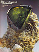 | | Journal (issue) | | Wayne and Dona Leicht, 332 Forest Avenue No. 8, Laguna Beach, Cal. 92651 (714) 494-7695 ... 49 Open...Open Mon.-Sat. 10-5. photo by Harold and Erica Van Pelt, Los Angeles • Note our m. ■ Beach, CA 9 2 6 5...Rosenzweig Tampa, PL Richard W. Thomssen Carson City, NV ‘ Associate Photographers Nelly Bariand Sorbonne...Germany Eric Offermann Arlesheim, Switzerland Harold and Erica Van Pelt Los Angeles, CA Julius Weber Mamaroneck...602-299-5274 ( promotions and Book Saies Gale Thomssen 1601 Fairview Dr., Suite C Carson City, NV 89701 702-883-2598 |  | | Report (issue) | | the U.S. Fish and Wildlife Service, the Department of Agriculture--Forest Service, and the Department...Department of Energy As mandated by Section 1011 of the Alaska National Interest Lands Conservation Act, Public...Bureau of Land Management Philip Bigsby, U.S. Fish and Wildlife Service Kenneth Bird, U.S., Geological Survey...S. Fish and Wildlife Service Robert HOekzema, Bureau of Mines HOward Metsker, U.S. Fish and Wildlife...Nadeau, U.S. Fish and Wildlife Service Tbm Pitbnan, Bureau of Mines Robert Putz, U.S. Fish and Wildlife Service |  | | Report (volume) | | Interior U.S. Geological Survey Geologic Studies in Alaska by the U.S. Geological Survey, 1997 U.S. Geological...Peninsula that provide surface runoff and sediment load into Lapp Lagoon and the Bering Sea. Recent geochemical...geochemical studies (see article by Parnow and others, this volume) indicate that stream sediments collected...concentrations of arsenic and tin, reflecting the presence of known tin-bearing granites and associated mineral...deposits in this area. Although detrital arsenic and tin may be naturally entering the nearshore marine |
|
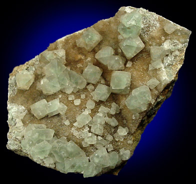
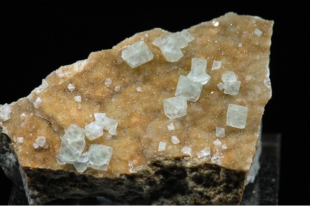
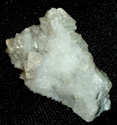


Zarembo Island, Chatham Strait, Wrangell City and Bourough, Alaska, USA