| Locality type: | Mine |
| Classification |
|---|
|
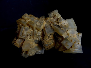
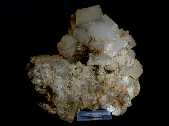
| Species: | Fluorite |
| Formula: | CaF2 |
| Confirmation |
|---|
|
| Validity: | Believed Valid |
| Associated Minerals Based on Photo Data: |
|---|
|
| Chalcopyrite | ⓘ2 photos of Fluorite associated with Chalcopyrite at this locality. |
| Malachite | ⓘ1 photo of Fluorite associated with Malachite at this locality. |
| Data |
|---|
|
| Mineral Data: | Click here to view Fluorite data |
| Locality Data: | Click here to view Alt & Neu Bescheert Glück Mines, Lichtenberg, Hof District, Upper Franconia, Bavaria, Germany |
| Photo Gallery | View Gallery (10 photos) |
| Data Identifiers |
|---|
|
| Mindat Occurrence Record ID: | 98436 |
| Long-form Identifier: | 1:3:98436:8 |
| GUID (UUID V4): | 642f4544-5149-4c53-935a-5d07a3d26fb6 |
| Nearest other occurrences of Fluorite |
|---|
|
|
| 0.4km (0.2 miles) | ⓘFriedensgrube, Lichtenberg, Hof District, Upper Franconia, Bavaria, Germany |
| 4.5km (2.8 miles) | ⓘLiselotte mine (Kemlas prospect), Kemlas, Issigau, Hof District, Upper Franconia, Bavaria, Germany |
| 5.2km (3.2 miles) | ⓘTännig, Bad Lobenstein, Saale-Orla District, Thuringia, Germany |
| 12.4km (7.7 miles) | ⓘSiebenhitz, Köditz, Hof District, Upper Franconia, Bavaria, Germany |
| 12.9km (8.0 miles) | ⓘStöckaten, Siebenhitz, Köditz, Hof District, Upper Franconia, Bavaria, Germany |
| 16.5km (10.3 miles) | ⓘHenneberg Quarry, Weitisberga, Wurzbach, Saale-Orla District, Thuringia, Germany |
| 23.5km (14.6 miles) | ⓘWiedersberg, Triebel, Vogtlandkreis, Saxony, Germany |
| 30.0km (18.6 miles) | ⓘGrüne Tanne mine, Oelsnitz, Vogtlandkreis, Saxony, Germany |
| 31.1km (19.3 miles) | ⓘReinersreuth quarry (Köhlerloh quarry), Reinersreuth, Sparneck, Hof District, Upper Franconia, Bavaria, Germany |
| 31.3km (19.4 miles) | ⓘDiabase quarries, Bösenbrunn, Vogtlandkreis, Saxony, Germany |
| References |
|---|
|
|


Alt & Neu Bescheert Glück Mines, Lichtenberg, Hof District, Upper Franconia, Bavaria, Germany