| Locality | Latitude | Longitude | Distance | Bearing |
|---|
| Kirbyville, Berks County, Pennsylvania, USA | 40° 28' 27" N | 75° 51' 30" W | 0.0km (0.0 miles) | |
| Moselem Springs, Richmond Township, Berks County, Pennsylvania, USA | 40° 29' 8" N | 75° 50' 18" W | 2.1km (1.3 miles) | |
| Richmond Township, Berks County, Pennsylvania, USA | 40° 28' 59" N | 75° 49' 10" W | 3.4km (2.1 miles) | |
| Maidencreek Township, Berks County, Pennsylvania, USA | 40° 26' 49" N | 75° 53' 15" W | 3.9km (2.4 miles) | |
| Fleetwood, Berks County, Pennsylvania, USA | 40° 27' 14" N | 75° 48' 59" W | 4.2km (2.6 miles) | |
| Blandon, Maidencreek Township, Berks County, Pennsylvania, USA | 40° 26' 27" N | 75° 53' 12" W | 4.4km (2.7 miles) | |
| E.B. Wade Mine, Blandon, Maidencreek Township, Berks County, Pennsylvania, USA | 40° 25' 59" N | 75° 52' 59" W | 5.0km (3.1 miles) | |
| Keystone Ocher Co. Mine (C.K. Williams & Co. Mine #1), Fleetwood, Berks County, Pennsylvania, USA | 40° 27' 0" N | 75° 48' 0" W | 5.6km (3.5 miles) | |
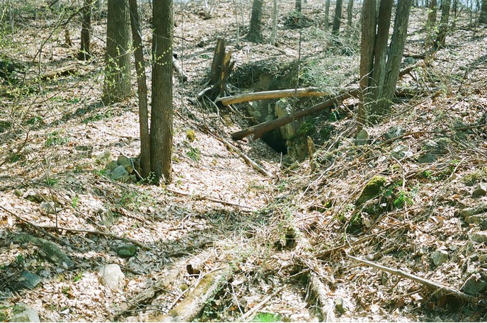
| Temple, Muhlenberg Township, Berks County, Pennsylvania, USA | 40° 24' 30" N | 75° 55' 18" W | 9.0km (5.6 miles) | |
| Muhlenberg Township, Berks County, Pennsylvania, USA | 40° 23' 32" N | 75° 55' 41" W | 10.8km (6.7 miles) | |
| Oley Township, Berks County, Pennsylvania, USA | 40° 22' 59" N | 75° 46' 14" W | 12.5km (7.8 miles) | |
| Antietam Reservoir, Lower Alsace Township, Berks County, Pennsylvania, USA | 40° 21' 20" N | 75° 52' 9" W | 13.2km (8.2 miles) | |
| Henry Erwin & Sons Mine, Topton, Berks County, Pennsylvania, USA | 40° 30' 0" N | 75° 42' 6" W | 13.6km (8.4 miles) | |
| Topton, Berks County, Pennsylvania, USA | 40° 30' 11" N | 75° 42' 5" W | 13.7km (8.5 miles) | |
| Bern Township, Berks County, Pennsylvania, USA | 40° 23' 53" N | 75° 59' 30" W | 14.1km (8.7 miles) | |
| Lower Alsace Township, Berks County, Pennsylvania, USA | 40° 20' 44" N | 75° 52' 22" W | 14.3km (8.9 miles) | |
| Greenawald, Berks County, Pennsylvania, USA | 40° 36' 11" N | 75° 52' 19" W | 14.4km (9.0 miles) | |
| Oley Valley Quarry (Oley Stone Quarry; Eastern Industries Quarry), Oley Township, Berks County, Pennsylvania, USA | 40° 21' 0" N | 75° 47' 42" W | 14.8km (9.2 miles) | |
| Wilson P. Long Mine, Hancock, Berks County, Pennsylvania, USA | 40° 30' 15" N | 75° 40' 59" W | 15.2km (9.4 miles) | |
| Hancock, Berks County, Pennsylvania, USA | 40° 30' 16" N | 75° 40' 57" W | 15.3km (9.5 miles) | |
| Peters Red Ochre Mine, Reading, Berks County, Pennsylvania, USA | 40° 19' 59" N | 75° 55' 0" W | 16.4km (10.2 miles) | |
| Reading, Berks County, Pennsylvania, USA | 40° 19' 59" N | 75° 56' 0" W | 16.9km (10.5 miles) | |
| John P. Lance Mine, Neversink Mountain, Neversink Mountain Preserve, Reading, Berks County, Pennsylvania, USA | 40° 19' 31" N | 75° 54' 24" W | 17.0km (10.6 miles) | |
| Neversink Mountain, Neversink Mountain Preserve, Reading, Berks County, Pennsylvania, USA | 40° 19' 18" N | 75° 53' 35" W | 17.2km (10.7 miles) | |
| Pennsylvania Uranium Mining Company Shaft, Shanesville, Earl Township, Berks County, Pennsylvania, USA | 40° 22' 15" N | 75° 42' 12" W | 17.4km (10.8 miles) | |
| Spring Township, Berks County, Pennsylvania, USA | 40° 21' 0" N | 75° 59' 29" W | 17.8km (11.1 miles) | |
| Shanesville, Earl Township, Berks County, Pennsylvania, USA | 40° 21' 51" N | 75° 41' 50" W | 18.3km (11.4 miles) | |
| Rittenhouse Gap Mine (Rittenhouse Gap Iron Mines), Rittenhouse Gap, Berks County, Pennsylvania, USA | 40° 28' 0" N | 75° 37' 45" W | 19.4km (12.1 miles) | |
| Rittenhouse Gap, Berks County, Pennsylvania, USA | 40° 28' 4" N | 75° 37' 41" W | 19.5km (12.1 miles) | |
| Fritz Island Mines, Cumru Township, Berks County, Pennsylvania, USA | 40° 18' 20" N | 75° 55' 24" W | 19.5km (12.1 miles) | |


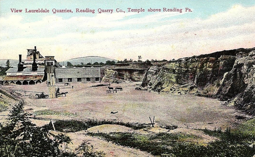


Laureldale Quarries, Temple, Muhlenberg Township, Berks County, Pennsylvania, USA