 | | Report (chapter) | | of Mining in the Southeast Missouri Lead District and Description of Mine Processes, Regulatory Controls...Environmental Effects, and Mine Facilities in the Viburnum Trend Subdistrict By Cheryl M. Seeger1 Chapter...Mining Issues in Southeastern Missouri Edited by Michael J. Kleeschulte Missouri Department of Natural Resources...............................................7 Missouri Lead Study....................................................10 Early Mining in Southeastern Missouri.............................................. |  | | Journal (article/letter/editorial) | | Resources Geology and Earth Resources Olympia, Washington 98504 T he Midwest contains two of the greatest...Oklahoma, Kansas, and Missouri and the world-class Viburnum Trend of southeastern Missouri. Deposits in both...districts. THE TRI-STATE DISTRICT History of the Missouri Portion of the Tri-State District The Tri-State...Tri-State district, extending from southwestern Missouri through Kansas into Oklahoma (fig. l), was one of the...small-scale mining in 1849 on Turkey Creek in Joplin, Missouri (Dressel 1989). The history of the district | 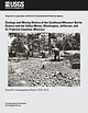 | | Report (issue) | | History of the Southeast Missouri Barite District and the Valles Mines, Washington, Jefferson, and St. Francois...Francois Counties, Missouri Scientific Investigations Report 2016–5173 U.S. Department of the Interior...History of the Southeast Missouri Barite District and the Valles Mines, Washington, Jefferson, and St. Francois...Francois Counties, Missouri By Douglas N. Mugel Prepared in cooperation with the U.S. Environmental Protection...history of the Southeast Missouri Barite District and the Valles Mines, Washington, Jefferson, and St. Francois |  | | Journal (article/letter/editorial) | | Copper-Cobalt-Nickel Mineralization of Southeast Missouri KENNETHB. HOPmALL, 225 NorthElliott Street,Olney...Geology andGeophysics, University of Missouri-Rolla, Rolla,Missouri 65401-0249 Abstract The mainrift structureof...extendingfromnortheastern Arkansas throughthe Missouri"bootheel" andwestern Kentuckyinto southernIllinois...passing throughthe MineLa Motte-Fredericktown subdistrict of the Southeast Missourilead-zinc-copper mining...Cu, Co, andNi in the region--particularlyin the Mine La Motte-Fredericktown subdistrict.Supportingev |  | | Report (issue) | | deposits of selected mines in the VIBURNUM TREND, MISSOURI ~ _. 0 0 w (!) a: ..J <{ a: ::> I~ z...DEPOSITS OF SELECTED MINES IN THE VIBURNUM TREND, MISSOURI: Mo. Dept. of Nat. Resources, Geological Survey... CONTENTS 1 introduction to the southeast missouri lead district page 3 stratigraphic and facies...magmont mine page 21 4 buick mine page 31 5 fletcher mine page 41 6 ozark lead company mine page...deposits of selected mines in the VIBURNUM TREND, MISSOURI J ,. . ~:·~ ;i. ' 1'......,,,11o.-~ l'o.,.. |  | | Journal (article/letter/editorial) | | SHERWOOD 106A East 25th, P. 0. Box 436 Oak Grove, Missouri 64075-0436 Downloaded by [Brown University Library]...Louis, Missouri 63129-2704 Figure 1. Counties in Missouri. N o comprehensive list of Missouri mineral...found in Missouri; two of these, fletcherite and starkeyite, were first described from Missouri mines....location a~ included at the end of each entry. Adair County Chariton River (40-04-05N 92-4 I -23W). septarian...septarian concretions about 2 miles north of the Macon county line. CALCITE crystals enclosing bundles of acicular |  | | Report (issue) | | Ozark Mountains and Reelfoot Rift, Southeastern Missouri and Northeastern Arkansas Implications for Mississippi...Superintendent of Documents Government Printing Office Washington, DC 20402 (Check or money order must be payable...St. SPOKANE, Washington-U.S. Post Office Bldg., Rm. 135, West 904 Riverside Ave. WASHINGTON, D.C.-Main...Residents of Alaska may order maps from ROLLA, Missouri-1400 Independence Rd. US. Geological Survey, Earth...Ozark Mountains and Reelfoot Rift, Southeastern Missouri and Northeastern Arkansas Implications for Mississippi |  | | Report (issue) | | Region Rosiclare, Illinois to Ironton and Viburnum, Missouri June 30-July 8, t 989 Field Trip Guidebook Tt47...Gerdemann Jay M.Gregg American Geophysical Union, Washington, D.C. T147/Hagni Copyright 1989 American Geophysical...Geophysical Union 2000 Florida Ave., N.W., Washington, D.C. 20009 ISBN: 0-87590-588-9 Printed in the...Peabody Drive Champaign, IL 61820 Eva B. Kisvarsanyi Missouri Dept. of Natural Resources Div. of Geology and...Dept. of Geology and Geophysics University of Missouri - Rolla Rolla, MO 65401 Associate Leaders: James |  | Goldhaber, Martin B., Church, Stanley E., Doe, Bruce R., Aleinikoff, John N., Brannon, Joyce C., Podosek, Frank A., Mosier, Elwin L., Taylor, Cliff D., Gent, Carol A. (1995) Lead and sulfur isotope investigation of Paleozoic sedimentary rocks from the southern Midcontinent of the United States; implications for paleohydrology and ore genesis of the Southeast Missouri lead belts. Economic Geology, 90 (7) 1875-1910 doi:10.2113/gsecongeo.90.7.1875 | Journal (article/letter/editorial) | | Paleohydrology and Ore Genesis of the Southeast Missouri Lead Belts MARTIN B. GOLDHABER, STANLEYE. CHURCH...McDonnell Center for theSpace Sciences, St.Louis,Missouri 63130 ELWIN L. MOSIER, CLIFF D. TAYLOR, AND CAROL...the Old andNew LeadBeltsubdistricts of southeast Missouri. Nearly150newanalyses arereported whichcharacterize...the locusof leadbelt mineralization in southeast Missouri. Analyses arealsopresented forvarious leachfractions...thenonoresamples. Ore samples wereanalyzed fromsoutheast Missouri andinclude newdataforbothgalena andnongalena phases |  | | Report (issue) | | Concerning Lead Mining Issues in Southeastern Missouri Scientific Investigations Report 2008–5140 U...Besser, U.S. Geological Survey). Bottom, West Fork Mine (photograph courtesy of Michael J. Kleeschulte,...Concerning Lead Mining Issues in Southeastern Missouri Edited by Michael J. Kleeschulte Contributions...concerning lead mining issues in southeastern Missouri: U.S. Geological Survey Scientific Investigations...mining along the Viburnum Trend Subdistrict of southeastern Missouri has occurred for more than 40 years |  | | Journal (article/letter/editorial) | | Figure 1. Postcard view of the Waukon iron mine, Allamakee County, cia. 1912. John Taylor collection. ARTHUR...Unfortunately. with today’s environmental laws and mine and quarry regulations. the prolific collecting...Iowa Geological Survey. Localities by County Allamakee County Lansing, Lansing lead mines = Captain...(crystals), dolomite, galena, goethite, hemimorphite, marcasite, pyrite, quartz (drusy), smithsonite (Garvin,...yellow to purple color-zoned, cubic), gypsum, marcasite, pyrite, siderite, sphalerite (Prior 1994). Waukon |  | | Journal (article/letter/editorial) | | Caldwell Stone Company quarry, Danville, Boyle County. Terry Huizing specimen and photo. K entucky...Commonwealth is Black Mountain in the Appalachians (Harlan County) at 4,139 feet. The lowest point is the floor of...of the Reed quarry near Grand Rivers (Livingston County) in western Kentucky, at 100 feet below sea level...small, nondiamondiferous kimberlite in Elliott County in eastern Kentucky and alnöite intrusions in Crittenden...between the intersection of the New Madrid and Rough Creek–Shawneetown fault zones and is part of the larger |  | | Journal (article/letter/editorial) | | heavy subject. While most of the galena mined in Missouri has been in the form of sparse to massive disseminations...of the crystal surfaces as they are found in the mine. Some areas or entire mines may be notable for the...discoverer of Fletcber-Viburnum, Pea Ridge, Indian Creek and other main ore bodies. An Exploration Geologist...found mostly bedded deposits in carbonate rocks in Missouri, although there are some small vein type deposits...the last few years. An interesting feature of Missouri galena is its anomolous nature in regard to age |  | | Journal (article/letter/editorial) | | (NMNS51066). figure 2 (leftI: Galena. Crawford mine, Pirher, Oklahoma, Tri-State district; 6' 2 cm across;...(opposite page): Galena, St. Joseph Lead mine, Viburnum, Missouri, Viburnum Trend district; 6 cm on edge;...Resources Geolog> and Karth Resources Oljmpia, Washington 98504 T H E W O R L D ' S P R I M A R Y S O...the mines of the Viburnum Trend in southeastern Missouri accounted for 90 percent of the United States'...Beales (1967). The source of lead in southeastern Missouri is described by Doe and Delevaux (1972). M V T |  | | Book (volume) | | instance, a single Spodumene crystal from the Etta Mine near Keystone on the east side of the Mount Rushmore...BRULE COUNTY AREA: in the Oacoma zone of the Pierre Fm. On Elm Cr. Near its jct. with the Missouri River...rosette up to 5 or 6 inches. CAMPBELL COUNTY MOUND CITY, W to the Missouri R., regional hillsides, ridges,...gravels, etc.petrified wood, wood opal. CORSON COUNTY LITTLE EAGLE: area ridges, slopes, stream beds...Hounds in the United States CUSTER COUNTY AREA: The November Mine, 1.2 mi. SE of the Needles Eye Tunnel |  | Bevans, H.E., Skelton, John, Kenny, J.F., Davis, Jerri V. (1984) Hydrology of area 39, Western region, Interior Coal Province, Kansas and Missouri. Open-File Report Vol. 1984 (83-851) US Geological Survey doi:10.3133/ofr83851 | Report (issue) | | REGION, INTERIOR COAL PROVINCE KANSAS AND MISSOURI MISSOURI RIVER SOUTH GRAND RIVER LITTLE OSAGE RIVER... ERRATUM Hydrology of Area 39, Kansas and Missouri, Western Region, Interior Coal Province by...5 10 25 50 100 0.707 3.98 9.92 25.6 47.6 83.8 Missouri streams: 2 5 10 25 50 100 Standard error, in...WESTERN REGION, INTERIOR COAL PROVINCE KANSAS AND MISSOURI BY H.E. BEVANS, JOHN SKELTON, J.F. KENNY, AND...................................... 32 6.1 Coal-mine drainage ...................................... |  | | Journal (article/letter/editorial) | | Figure I (left). Barite crystal group from the Lamb mine; largest crystal 4.0 cm. H. Prior specimen, S. Blyskal...by 5 cm) of clear barite crystals from the Lamb mine; largest crystal 3.3 cm. H. Prior specimen, S. Blyskal...Blyskal photo. Some Mines & Minerals of Morgan County, Missouri During the summer of 1991 the authors began...barite and lead mining activities of Morgan County, Missouri, with the intent to provide a mineralogical...St. Louis, Missouri 63129-2704 L ocated in Morgan County, Missouri, the central Missouri mining district |  | | Report (issue) | | Superintendent of Documents Government Printing Office Washington, D.C. 20402 (Check or money order must be payable...authorized agents of the Superintendent of Documents: WASHINGTON, D.C.-Main Interior Bldg., 2600 corridor, 18th...California-Customhouse, Rm. 504,555 Battery St. SPOKANE, Washington-U.S. Courthouse, Rm. 678, West 920 Riverside...the following Geological Survey offices: ROLLA, Missouri-1400 Independence Rd. DENVER, Colorado-Map Distribution...rocks UNITED STATES GOVERNMENT PRINTING OFFICE, WASHINGTON: 1988 DEPARTMENT OF THE INTERIOR DONALD PAUL |  | | Journal (article/letter/editorial) | | Brushy Creek Mine REYNOLDS COUNTY, MISSOURI LES PRESMYK De Natura P. 0. Box 1273 Gilbert, Arizona 85299...Library] at 14:11 25 December 2014 T he Brushy Creek mine is most famous for its yellowish to gray calcite...crystals, some approaching 12 inches in length, with marcasite sprinkled on one or more crystal faces. The solution...other areas of the mine. In 1994 Doe Run Company, owner of the Brushy Creek mine, accepted a proposal...of Top-Gem Minerals to mine the solution cavity. History The southeast Missouri lead district is the largest |  | | Report (issue) | | . . . . . . . . . . . . . . . . . . . . . . 1 County Listings. . . . . . . . . . . . . . . . . . . .... . . . . . . . 4 Mineral Localities Listed by County . . . . . . . . . . . . . . . . . . . . . . . .... . . . . . . . . . . . . . . . . . . 7 Beaver County . . . . . . . . . . . . . . . . . . . . . . . ... . . . . . . . . . . . . . . . . . 7 Box Elder County . . . . . . . . . . . . . . . . . . . . . . . .... . . . . . . . . . . . . . . . . . . 10 Cache County . . . . . . . . . . . . . . . . . . . . . . . |  | | Journal (issue) | | pyrite Brushy Creek Mine, Oates, Viburnum Trend District, Reynolds County, Missouri Source: The Minerals...Minerals of Missouri. Photo: Kevin Conroy. Is it uvarovite, like the label says? ........... p. 14 2019...contest results ............... p. 15 AFMS: American Indian fossil legends .... p. 16 EFMLS: Safety matters...Newsletter Galena, Petrovitsa deposit, Borieva Mine, Madan orefield, Rhodope Mountains, Smolyan Oblast...of Kansas, Illinois, and Missouri; the Viburnum Trend District of Missouri; and other mining areas north |  | | Book | | our knowledge and enjoyment of this great owners, mine and quarry operators and science by collecting....where someone else is working. Don't go into old mine workings. Be careful about walking on slippery rocks...the objective of the trip. If the destination is a mine dump to hunt for micromounts, a 10 power hand lens...required. Write U.S. Department of Agriculture, Washington, D.C. 20250 for National Forest Service maps...Vermillion Range, where the Soudan mine is the oldest and deepest mine in the state, and the high grade |  | | Journal (article/letter/editorial) | | (top left). Calcite, 5.5 cm high, Elmwood mine, Smith County. Terry Huizing specimen, Jeff Scovil photo...(above). Fluorite, 13.1 cm wide, Elmwood mine, Smith County. Francis Benjamin specimen, Jeff Scovil photo...(left). Fluorite, 2.5 cm on edge, Elmwood mine, Carthage, Smith County. Terry Huizing specimen and photo. Figure...Figure 4 (right). Cumberland mine, Smith County. Travis Paris photo (2004). Figure 5 (far right page)...barite specimens at the Elmwood zinc mine in middle Tennessee. This mine, opened in 1975, and other nearby |  | | Journal (article/letter/editorial) | | across, on blue thomsonite. Lucky Peak Dam, Ada County; Lanny Ream specimen and photo. Figure 3 (below)...cut near Pinehurst, Adams County; Lanny Ream specimen and photo. Ada County Lucky Peak Dam, on east side...LEVYNE, PHILLIPSITE, and THOMSONITE. Adams County Alaska mine, Seven Devils district: azurite, grossular...grossular, malachite, powellite, and scheelite. Arkansas mine, Seven Devils district: grossular. Blue Jacket claim...and stilbite. Copper Bo~' mine, Seven Devils district: epidote. Helena mine (reportedly just northwest |  | | Journal (article/letter/editorial) | | ATYPICAL OREBODY IN THE BRUSHY CREEK MINE, VIBURNUM TREND, MVT DISTRICT, MISSOURI: EARLY Cu-(Ni-Co)-Zn-RICH...of Geological Sciences, University of Missouri, Columbia, Missouri 65211 Abstract Mississippi Valley-type...within the lower Bonneterre Dolomite of the Brushy Creek mine, more than 30 m below the main ore-bearing horizon...Observations of drill cores and samples from active mine faces, and mineral textural relationships in thin...the historically mined ores of the Indian Creek and Fredericktown-Mine La Motte districts to the north and |
|


