| Classification |
|---|
|
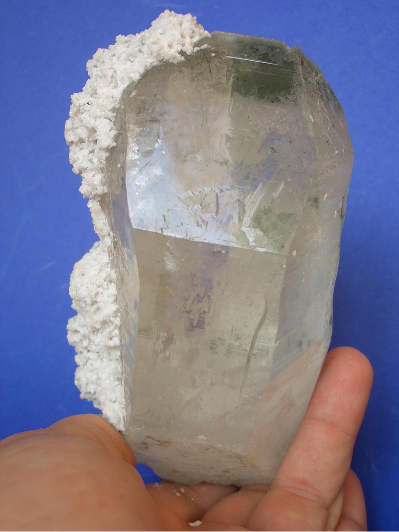
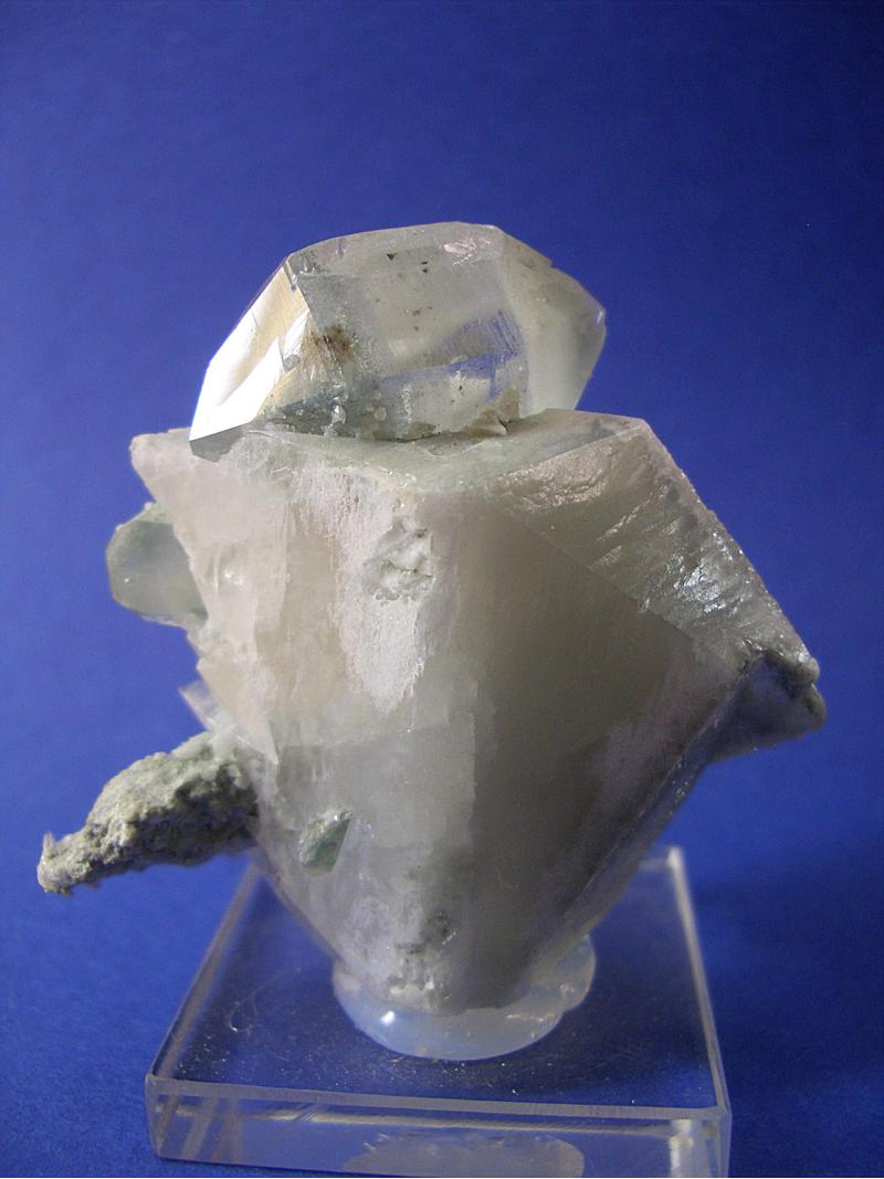
| Species: | Quartz var: Rock Crystal |
| Formula: | SiO2 |
| Confirmation |
|---|
|
| Validity: | Believed Valid |
| Associated Minerals Based on Photo Data: |
|---|
|
| Calcite | ⓘ3 photos of Rock Crystal associated with Calcite at this locality. |
| Hematite | ⓘ1 photo of Rock Crystal associated with Hematite at this locality. |
| Dolomite | 1 photo of Rock Crystal associated with Dolomite at this locality. |
| Data |
|---|
|
| Mineral Data: | Click here to view Rock Crystal data |
| Locality Data: | Click here to view Anger valley duct, SAFE Power station, Remsach, Bad Gastein, St. Johann im Pongau District, Salzburg, Austria |
| Photo Gallery | View Gallery (2 photos) |
| Data Identifiers |
|---|
|
| Mindat Occurrence Record ID: | 521767 |
| Long-form Identifier: | 1:3:521767:0 |
| GUID (UUID V4): | 925ab349-ccd8-4238-a475-106121c51eaf |
| Nearest other occurrences of Rock Crystal |
|---|
|
|
| 1.6km (1.0 miles) | ⓘB 167 Road cut, Bad Gastein, St. Johann im Pongau District, Salzburg, Austria |
| 4.0km (2.5 miles) | ⓘEckelgruben, Bad Hofgastein, St. Johann im Pongau District, Salzburg, Austria |
| 4.1km (2.6 miles) | ⓘStubnerkogel, Böckstein, Bad Gastein, St. Johann im Pongau District, Salzburg, Austria |
| 5.4km (3.4 miles) | ⓘAnderl cleft, Stuhlwald, Böckstein, Bad Gastein, St. Johann im Pongau District, Salzburg, Austria |
| 5.5km (3.4 miles) | ⓘTischkogel, Böckstein, Bad Gastein, St. Johann im Pongau District, Salzburg, Austria |
| 5.5km (3.4 miles) | ⓘSpider cleft, Patschg-Stuhl, Böckstein, Bad Gastein, St. Johann im Pongau District, Salzburg, Austria |
| 5.6km (3.5 miles) | ⓘRiepler building, Böckstein, Bad Gastein, St. Johann im Pongau District, Salzburg, Austria |
| 5.9km (3.7 miles) | ⓘMunicipal quarry (Dick quarry), Böckstein, Bad Gastein, St. Johann im Pongau District, Salzburg, Austria |
| 5.9km (3.7 miles) | ⓘBöckfeld Alp, Böckstein, Bad Gastein, St. Johann im Pongau District, Salzburg, Austria |
| 5.9km (3.7 miles) | ⓘZitterauer Tisch, Böckstein, Bad Gastein, St. Johann im Pongau District, Salzburg, Austria |
| References |
|---|
|
|


Anger valley duct, SAFE Power station, Remsach, Bad Gastein, St. Johann im Pongau District, Salzburg, Austria