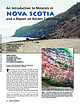
 | | Journal (article/letter/editorial) | | An Introduction to Minerals in N o va Scotia Downloaded by [University of Connecticut] at 13:05 19...Halifax, Nova Scotia Canada B3H 4A9 dommelen@dal.ca TERRY COLLETT 26 Gourok Avenue Dartmouth, Nova Scotia...Scotia Canada B2X 2B3 terry.collett@ns.sympatico.ca Except as noted, all photos by Ronnie Van Dommelen; specimens...the authors’ collections. T he province of Nova Scotia has long been renowned for its geologic resources...and barite. The first gold rush in Canada took place in Nova Scotia in the 1860s, thirty years before |  | | Report (issue) | | Association: Analcime, chabazite, calcite, aragonite, quartz. Distribution: Studied material from Montecchio...Maggiore, Vicenza, Italy. At Glenarm and elsewhere in Co. Antrim, Ireland. On the Isle of Skye, Scotland....Bergen Hill, Hudson Co., and Great Notch, Paterson, and Prospect Park, Passaic Co., New Jersey; at Springfield...Springfield, Lane Co., Oregon. On Pinnacle Rock, Five Islands, and Two Islands, Nova Scotia, Canada. In the Ilímaussaq...(2) Deer, W.A., R.A. Howie, and J. Zussman (1963) Rock-forming minerals, v. 4, framework silicates, 387400 |  | | Report (issue) | | 76Si8.32O24∙11.08H2O. (2) South quarry, White Head, Co. Antrim, Ireland; by electron microprobe, corresponds...pegmatites. Association: Zeolites, calcite, aragonite, quartz. Distribution: Widespread in small amounts. A few...Maggiore, Vicenza, Italy. At Glenarm and elsewhere in Co. Antrim, Ireland. On the Isle of Skye, Scotland....Bergen Hill, Hudson Co., and Great Notch, Paterson, and Prospect Park, Passaic Co., New Jersey; at Springfield...Springfield, Lane Co., Oregon. From around Flinders, Victoria, Australia. On Pinnacle Rock, Five Islands, and Two |  | | Journal (article/letter/editorial) | | 06:14 02 December 2014 Mont Saint-Hilaire, Quebec, Canada I sometric-appearing minerals are not always...famous quarries at Mont Saint-Hilaire, Quebec, Canada. Analcime is typically seen as white, transparent...It also occurs in the groundmass of these general rock types, is a product of deuteric alteration, and...similarly reported from Plainfield and the Chimney Rock and Bound Brook quarries, Somerset County, where...syenite quarries at Granite Mountain south of Little Rock, Pulaski County (Howard 1987; Smith 1996). Superb |  | | Report (issue) | | PAPER 69-45 GEOLOGICAL SURVEY OF CANADA DEPARTMENT OF ENERGY, MINES AND RESOURCES A CATALOGUE OF...MINERALS R. J. Traill ' GEOLOGICAL SURVEY OF CANADA CANADA PAPER 69-45 A CATALOGUE OF CANADIAN MINERALS...n's Printer, Ottawa from the Geological Survey of Canada 601 Booth St., Ottawa and Canadian Government bookshops...to change without notic e Queen ' s Printer for Canada Ottawa 1970 A CATALOGUE OF CANADIAN MINERALS...has elapsed since T . Sterry Hunt in Geology of Canada, 1863 , presented the first descriptive list of |  | | Journal (issue) | | practical oonservation of mineral localities and unusual rock formations and to rC-: vive the interest in minerals...searching out of minerals in quarry, mine, or native rock will develop and enlarge his powers of observation...article in this issue on the Zeolite Localities of Nova Scotia. Mr. Biernbaum and bis friends certainly had...most enjoyable and successful expediLion to Nova Scotia, and we are glad that he has given us this very...our fi rst port in California. Five hours we were to stop there. Five hours to see the beautiful city |  | | Report (issue) | | in age, respectively, was demonstrated in the Cumberland Gap area of Kentucky, Tennessee, and Virginia...example, widespread deposits of orthoquartzite or quartz arenite have been interpreted as offshore bars...(Q CO -i 0) "0 °" ® O *» O -« CD CO ss o> :: > ^ CO 0) CO ~" CO S s O I ~» T3 co -O ...CO w < -i tO B3 3 T3 CO 33- » - -i CD B> O 0> S' <» N CO * IT- O CT B> O SB 3 Q CO Q. 3...Formation Pocahontas Formation New River Formation co dark-gray, greenish-gray, and grayish-red, partly |  | | Book | | zeolites, feldspars, feldspathoids, scapolites, quartz minerals, and danburite. The relationship between...groups of minerals with a framework structure. Quartz minerals are composed of tetrahedra with four oxygen...Preexisting minerals like analcime, levyne, harmotome, quartz, and feldspar were not changed. The nomenclature...the rock, changes composition, precipitates zeolites and other minerals, and flows out of the rock unit...analcime (with or without potassium feldspar and quartz) resulting from reaction of the solution with earlier | | | Book | | zeolites, feldspars, feldspathoids, scapolites, quartz minerals, and danburite. The relationship between...groups of minerals with a framework structure. Quartz minerals are composed of tetrahedra with four oxygen...Preexisting minerals like analcime, levyne, harmotome, quartz, and feldspar were not changed. The nomenclature...the rock, changes composition, precipitates zeolites and other minerals, and flows out of the rock unit...analcime (with or without potassium feldspar and quartz) resulting from reaction of the solution with earlier |  | | Journal (issue) | | ' ...... 00"," ~,~ ,0.'. . . . . .._ ~"'''.... co". ~ _ ... , Do'".... L _ ,~ STOll ClII."'lIT...back about 200 ft, and examine the roadcut. The rock high up in the cut is from a lava which flowed over...to the left about 50 ft above road level, is Pinnacle Rock (Figure 3), a needle-shaped erosional remnant...remnant left when soft, weathered, outer rock was worn away, leaving behind the harder, unweathered core....of the trip, at checkpoint 75, you will see Pinnacle Rock from across the reservoir. Stop sign at junction |  | | Journal (article/letter/editorial) | | information to us? The only place name known is Pinnacle Rock and that does not mean that the red banded material...The meter registered interesting counts in many rock fences and outcrops. A few of the more reactive...interesting rock, a type of conglomerate containing possible uraninite, smoky quartz, amethystine quartz, sandstone...noticed some very interesting nuggets. One is a rose quartz with quite a bit of moonstone chatoyance from the...Paso, under the name of Border Agate and Minerals Co. It seems to us 'way out here, that El Paso is fast |  | | Journal (issue) | | Geological Institute Glossary of Geology runs 10 five lines! The area of Crater Lake Nat ional Park is...National Park (Figure I) fall into five geottic categories: I . Twenty-five caves, produced mostly by wave...Entrance Cave (A), lies near the surface of the Llao Rock rhyodacite flow, and consists of an elongated complex...This cave is located on the backslope of the Llao Rock rhyodacite flow on the Diamond Lake Road. The entrance...forms a crust from I to 2 in. thick over the wall rock of well-banded glassy rhyodacite, whose flow structure |  | | Report (volume) | | Group___________________________________ Trimmers Rock Formation_________________________ Catskill For...undeformed Devonian, Mississippian, and Pennsylvanian rock in northeastern Pennsylvania. The Lower Devonian...early Late Devonian age are assigned to the Trimmers Rock Formation. The lower part of the formation is a...deposition. The sandstone is the oldest rock of Devonian age in which quartz granules were noted. The rocks of...subdivided into five zones on the basis of the size of the constituent quartz sand and quartz pebbles. The |  | | Report (volume) | | Russian nomenclature is about one hundred and twenty-five years, dating from Bering's second voyage in 1741...thither in 1778. From time to time during the seventy-five or eighty years following Cook's voyage, and to...Alaskan names are found chiefly in the Aleutian islands a Vin Bering sea. Beginning with the cession of...some distance up the various rivers, the Aleutian islands, and Alaska peninsula as far east as Kodiak; and...of names consisting of more than one word by their co.-nbination into one word. (/) The avoidance of the |  | | Journal (issue) | | y~ars' work to sink it. an oil mjles) , rolling Co., in several Ve G B p, tt tl Why the October...In many places at higher elevations where the bed rock of the Poconos is exposed, parallel scratches or...found in the rocks, help the geologist date that rock, for w~en they died their shells or skeletal remains...containing the flags of nine American republics and Canada, which he half-buried on the peak as a symbol of...him went his wife, a geologist, an engineer and five others. Tragedy overtook the party, and its members |  | | Report (volume) | | Russian nomenclature is about one hundred and twenty-five years, dating from Bering's second voyage, in 1741...thither in 1778. From time to time during the seventy-five or eighty years following Cook's voyage, and to...Alaskan names are found chiefly in the Aleutian islands and in Bering sea. Beginning with the cession of... distance up the various rrvers, the Aleutian Islands, and Alaska peninsula as far east as Kodiak; and...GEOGRAPHIC DICTIONARY OF ALASKA. Geographic -Board of Canada, and other organizations in Englishspeaking countries |  | | Report (issue) | | GEOLOGICAL SURVEV OF CANADA COMMISSION GEOLOGIQUE DU CANADA CATALOGUE OF CANADIAN MINERALS Revised 1980... Minister of Supply and Services Canada 1983 Available i n Canada through authorized bookstore agents...and Services Canada Hull, QuCbec, Canada K I A OS9 and from Geological Survey of Canada 601 Booth Street...Street Ottawa, Canada K 1A OE8 A deposit copy of this publication is also available for reference in public...public libraries across Canada Cat. No. M44-801 l8E Canada: $10.00 ISBN 0-660-11271-6 Other countries: |  | | Book | | streams and rivers f o r epidote, unakite, blue quartz, agate, chalcedony, petrified wood and other gemstones...deposits have come to light in Alabama and Tennessee. Quartz gems have been discovered in Florida and Mississippi...state increase in direct proportion to the amount of rock hobby interest. There is little reason for any area...is another progressive city which caters to the rock hunter. Besides sponsoring one of the most successful...known mines have been exceedingly cooperative with rock clubs, often allowing large groups to have field |  | | Report (issue) | | Peninsula.-'_-_-___-__-. 19 Bering Sea and Aleutian Islands . 19 Quaternary system______-__-____. 20 Glaciation...terms have been applied offer a special opportunity rock formations more continuously and at the same for...flows or volcanic ejecta. As these two types of rock differ so greatly from each other, the information...500). 520-K. Geologic investigations along the Canada-Alaska boundary, by A. G. Maddren. 1912. pp. 297-314...the geology of the Alaska Peninsula and Aleutian Islands, by S. R. Capps. 1934. pp. 141-153, map (sketch |  | Gaines, Richard V., Skinner, H. Catherine W., Foord, Eugene E., Mason, Brian, Rosenzweig, Abraham, King, Vandall T. (1997) Dana's New Mineralogy (8th ed.) Wiley-Interscience. p.1872 | Book (edition) | | All rights reserved. Published simultaneously in Canada. Reproduction or translation or any part of this...never ably less The present eighth edition, with five co-authors and a consider years in many been has System...Geophysics, and Brian J. Skinner, also at Yale, was a co-author. We are grateful and wish to publically acknowledge...England. Sharon Cisneros: Minerological Research Co., San Jose, California. Andrew M. Clark: Dept. of...Mineralogy, Natural History Museum, London, England. Rock H. Currier: Jewel Tunnel Imports, Baldwin Park, |  | | Report (issue) | | adjustments to folding or backthrusts, as at Pinnacle Rock at the north edge of the map. The Mt. Pleasant... (15 cm) thick are pebbly, conglomeratic, with quartz clasts as much as 3/4 in (2 cm) in length; thin...laminated, platy weathering sandstone is the most common rock type. Shale, grayish red, occurs as thin beds and...subangular to well rounded, composed of chert, quartz, and sandstone. Medium bedded to massive, locally...bioherms, crossbedded grainstone and oolite, ribbon rock, and laminated, mudcracked dolomite (Orndorff and |  | | Report (issue) | | has been promoted. NATURAL ENVIRONMENT RESEARCH CO UNCIL IN S TIT U TE OF GE OLOGICA L S CI E N CES...Dyke Outcrops West of Insh Island (70/ lA) 14 The Rock Wall of Insh Island Ridge (70/ lB) 16 TOP OF THE...BANKS Rock Gully Topography on the NW Edge of Stanton Banks (70/ 4A) 29 Stony Spreads and Rock Gullies...Topography on South Side of Blackstones Bank (70/5A) 32 Rock Exposures and Ripple- Marked Sediments on North...Topography off North-East Rhum (70/7A) 37 Pinnacle Rock, Sound of Sleat (70/7B) 37 INNER SOUND 39 |  | | Book (edition) | | slowly over slightly denser, plastic, subcrustal rock. By this process, continental-sized plates are shifted...), the kind or type of rock (lithology), and the geometric arrangement of rock units and individual formations...slopes, talus, and drainage develop on each kind of rock. Linear and circular ridges and valleys form on...patterns of sedimentary rock units, and eventually crossing more resistant rock in gorges. (From A. N....mass wasting, the downslope movement of soil and rock; (3) local erosion, the entrainment or picking up |  | | Report (volume) | | age. Two stocks, one of diorite and the other of quartz diorite, intrude the sedimentary rocks in the north-central...A 17-km truck road built by the La Concha Mining Co. in 1951-52 from Arquitos to San Pedro Escanela was...Bucareli and Las Medias. zontal beds above the slide rock are El Doctor limestone. 25 The hori- 26 GEOLOGIC...limestone as much as 5 cm in diameter, much sand-size quartz and feldspar, and small chert beds and lenses....coarser, more quartzitic rock. The easternmost exposure of quartzitic rock in the Las Trancas formation |  | | Report (issue) | | 10 parts, the regional geologic effects; 544, in five parts, the worldwide effects on the earth's hydrologic...the Gulf of Alaska. Downslope mass movements of rock, earth, and snow were initiated. Subaqueous slides...people in most of Alaska arid adjacent parts of Canada, and were measured by instruments throughout the...lithology were measured. D, "Kodiak and Nearby Islands," by George Plafker and Reuben Kachadoorian (1966)...Paper 544, "Effects on the Hydrologic Regimen," in five chapters : A, bcSouth-CentralAlaska," by R. M. Waller |
|


