 | | Journal (issue) | | photo. Tracking Down Texas Minerals: Mayfield Manganese Prospect, Jeff Davis Co. Arthur Smith 9118 Concho...Houston, Texas 77036 1 • For quite a few years now I have been trying to assemble data on Texas mineralogy...from Walter Mayfield manganese prospect, Jeff Davis County, Texas. men ofa black botryoidal manganese oxide...about 22 miles south ofVan Hom in Je ff Davis County, Texas (Baker I 934). However, the mineral is ca...fluorite (McAnulty 1974) also no description and quartz. The quartz Antero Aquamarines By Mark I. Jacobson, |  | | Journal (article/letter/editorial) | | MICROMINERALS FROM THE SCENIC LOOP ROAD CUTS IN JEFF DAVIS COUNTY, TEXAS. E. Grundel (a project of the Micromineralogists...VA 22204. The Trans-Pecos Region (TPR) of West Texas is an area of thousands of square miles of generally...geology, both published and unpublished lists of Texas mineral localities mention relatively few specimen-producing...through the heart of the picturesque Davis Mountains in Jeff Davis County. Here basalt, rhyolite, trachyte...feldspar group (probably microcline), magnetite, quartz (some as scepters), and zircon. The results of |  | | Journal (article/letter/editorial) | | Texas mineral locality INDEX Whereas Texas is well known for its vastness, cattle industry, and oil...I T S T O P O G R A P H Y A N D G E O L O G Y , Texas, the second largest state, has produced relatively...famous localities. A s this article will show, Texas has had—or currently has—nu merous mineral occurrences...produce good specimens; yet when specimens from Texas are sought in collections and dealers' stocks, few...some basic facts that help explain the situation. Texas has very little federal land in its mineralized |  | | Journal (article/letter/editorial) | | Houston, Texas 77001 Ignimbrites of the Seven Springs Formation, Barrilk Mountains, Western Texas ABSTRACT...Springs Formation of the Barrilla Mountains, western Texas, consists of 4 tuff units, 3 ignimbrite units, and...phenocrysts in a matrix of glass, alkali feldspar, and quartz. The percentage of anorthoclase phenocrysts, the...INTRODUCTION The northeastern Davis Mountains and Barrilla Mountains of western Texas (Fig. 1) contain a complex...from an apparent vent area in the north-central Davis Mountains. The rhyolites are shown to be liquid |  | | Report (issue) | | Resource Areas of the Basin and Range Province of Texas Compiled by Christopher D. Henry and Jonathan G...Economic Geology, The University of Texas at Austin, Austin, Texas, and Michelle Frodey Hutchins, U.S...deposits within the Basin and Range Province in West Texas occur largely as vein and replacement deposits containing...prospects or open cuts. Culberson Brewster County U Fluorite, U, Mo, Hg Hg, fluorite Ag, Pb,...vicinity of 29°20'N. lat.; 103°40'W. long. Southern Davis Mountains Christmas Mountains Mariscal Solltario |  | | Journal (article/letter/editorial) | | ANDERSON, JR. , University of Texas at Arlington, Arlington, Department of Texas 76010 Snowflake Texture...observations (Anderson, 1970, p. 289): (1) Phenocrysts of quartz and feldspar commonly are fragments of crystals...from either a magma or a glass if the feldspar and quartz were contemporaneous during most of the crystallization...crystallization, with fewer nuclei for the quartz." Essentially the same conclusion was reached by Geijer (1913...its relationship to ash-flow tuff in the Davis Mountains of Texas (Anderson, 1969, p. 2078). Green correctly |  | | Report (volume) | | CHARLES D. WALCOTT, DIRECTOR A. G-AZETTEEK OF TEXAS (SEOCGSTD ZEIDITIOZNT) BY HENRY GLANNETT WASHINGTON...bulletin, the revised manuscript of a gazetteer of Texas. This is a second edition, the first edition having-...Geological Survey. 1 A GAZETTEER OF TEXAS. HENRY GANNETT. AREA. Texas, formerly a State of Mexico, was...present dimensions. The present boundary line of Texas is as follows: Beginning in the Gulf of Mexico at...channel of the Rio Grande to its mouth. The area of Texas is 265,780 square miles. It stretches in latitude |  | | Report (issue) | | ¥ TEXAS ROCKS AND \ r - An Amateur’s Guide ;s ROSELLE M. GIRARD A b OF ECONOMIC GEOLOGY V N IVERSITY...The University of Texas Austin, Texas Peter T. Flawn, Director Guidebook 6 TEXAS ROCKS AND MINERALS...Rock identification charts Descriptions of some Texas rocks and minerals Anhydrite ................................................................... Quartz .................................................Composition, hardness, and specific gravity of some Texas minerals Pace 25 26 39 40 43 43 43 44 45 46 47 |  | Parker, Don F., White, John C., Ren, Minghua, Barnes, Melanie (2017) Basement control of alkalic flood rhyolite magmatism of the Davis Mountains volcanic field, Trans-Pecos Texas, U.S.A. Lithos, 292. 234-249 doi:10.1016/j.lithos.2017.09.011 | Journal (article/letter/editorial) | | rhyolite magmatism of the Davis Mountains Volcanic field, Trans-Pecos Texas, U.S.A. Don F. Parker, John...rhyolite magmatism of the Davis Mountains Volcanic field, Trans-Pecos Texas, U.S.A., (2017), doi: 10.1016/j...RHYOLITE MAGMATISM OF THE DAVIS MOUNTAINS VOLCANIC FIELD, TRANS-PECOS TEXAS, U.S.A. Parker, Don F.a*,...Vegas, NV 89154, U.S.A. d Dept. of Geosciences, Texas Tech University, Lubbock, TX 79409, U.S.A. US ...~37.4 Ma from widespread centers within ED the Davis Mountains Volcanic Field (DMVF), covered approximately |  | | Report (issue) | | Austin Austin, Texas 78712 JOHN T. LONSDALE, Director Report of Investigations — No. 42 Texas Gemstones...OFECONOMIC GEOLOGY The University of Texas at Austin Austin, Texas 78712 JOHN T. LONSDALE, Director —...— No. 42 Report of Investigations Texas Gemstones By Elbert A. King, Jr. February 1961 — — — Second...gemstones Cabochon gems Faceted gems Tumbled gems Texas gemstones Amber Augite Beryl Celestite Diamond Epidote...Jet Labradorite Microcline Obsidian Opal _ Pearl Quartz Chalcedony Sanidine Spinel Tektite (bediasite) |  | | Report (volume) | | Highway 49 (Skyway Road) near town of Abel, Cleburne County. Absaroka Supergroup/Volcanic Supergroup U ABRK03...volcanic field, Yellowstone National Park, Park County, Wyo. Academy Church Shale Member (Springer Formation)...W1/2NW1/4NE1/4SE1/4 sec. 1, T. 3 s., R. 2 E., Carter County. Adams Formation ADMS01 1. Holocene 2. Alaska (SE)...Quadrangle, lat 45° N., long 70°50'-55' W., Oxford County. Adamstown Member (Frederick Limestone) U ADMS06...section W of Lime Kiln in Frederick Valley, Frederick County. Named for town of Adamstown. Adobe Town Member |  | | Journal (article/letter/editorial) | | rocks of the Eastern Trans-Pecos Magmatic Province, Texas Dennis O. Nelson, Kerri L. Nelson, Keith D. Reeves...Geology, Sul Ross State University, Alpine, TX 79832, USA Abstract. The Trans-Pecos Magmatic Province (TPMP)...alkalic belt of the TPMP, the Big Bend region and the Davis Mountains, have been analyzed for major and trace...to trachyte; stage II, trachyte to quartz trachyte; stage II1, quartz trachyte to rhyolite/comendite; and...Inc., 815N. Wooten, Colorado Springs, CO 80915, USA Offprint requests to: D.O. Nelson * Present address: |  | | Book (edition) | | gem stones mon dull are as hard or harder than quartz, a com- mineral everywhere present as dust which...Hardness Scale 6. Orthoclase 1. Talc 2. Gypsum 7. Quartz Topaz Corundum 10. Diamond 3. Colcite 8. 4...Your will scratch orthoclase feldspar but not quartz. In making hardness appears to be a scratch paper...the general arrange- ment of these surfaces. Quartz and amethyst, for example, are frequently crystallized...SPODUMENE DANBURITE DATOLITE GARNET FLUORITE QUARTZ CRYSTALS SPINEL STAUROLITE •^^ VESUVIANITE |  | | Report (issue) | | Saline Ground Water in the Basins. of Westernmost Texas 1 \1 U.S. GEOLOGICAL SURVEY Open-File Report 78-663... N. M. 87125 Prepared in cooperation with the Texas Department of Water Resources Availability of...Saline Ground Water in the Basins of Westernmost Texas By Joseph S. Gates, Donald E. White, W. D. Stanley...cooperation with the Texas Department of Water Resources October 1978 Reproduced by the Texas Department of... 5. 6. 7. 8. 9. 10. Map showing westernmo~t Texas ·and the areas covered by larger-scale maps in this |  | | Report (issue) | | CULBERSON, AND PRESIDIO COUNTIES IN WESTERNMOST TEXAS By Joseph S. Gates and Donald E. White U.S. Geological...U.S. G~ological Survey in cooperatiori with the Texas Water Development Board 1976 ... ..J I I I I...---------------"':"----- ,. _, '·. ,. I Culberson County Airport No. 1 test hole-------------------------Drilling...---------------------------.-------------------J. C. Davis No. 1 test Drilling and hole------------------...Geophysical and drilling-time logs for Culberson County Airport No. 1 test hole (HL-47-58-603) on Wildhorse | 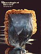 | | Journal (issue) | | R. Kampf Natural History Museum of Los Angeles County Arthur Roe Tucson, AZ Abraham Rosenzweig University...Urals, Soviet Union; the Morefield mine, Amelia County, Virginia; and the Anjanabonoina pegmatite in Madagascar...mica schist country rock and consists of milky quartz, abun dant muscovite, amazonite, phenakite, pale...season. The mineral assemblage in cludes milky quartz, kaolinized feldspar, schorl, abundant muscovite...fergusonite. Ferraz (1929) also observed dark smoky quartz, hematite, pyrite, xenotime, red almandine and |  | | Report (issue) | | ——— Lincoln County _______________——— Clark County __________————————— Esmeralda County __—_______————...__—_______———— Mineral County _________________ Lyon County _______________———— Humboldt County ________________...____________________———_— Santa Cruz County ________________ Yuma County _______________—— Deposits in other...___ Hinsdale County _________________ Rio Grande County ________________ Custer County ___________________...___________________ Dolores County __________________ Deposits in other areas ______________ New Mexico __________________—___ |  | | Report (issue) | | Geological Survey's cored section in Dorchester County, South Carolina. Richard Cifelli, U.S. National...35-36). Because of space limitations, State and County names used in the well citations are abbreviated...Glynn ——————————— GLY Houston———-———————— HO Jeff Davis ——————————JD Laurens———————————— LA Liberty —————————————...well (GA-PU-OT-1, section E-E', pi. 1) in Pulaski County, Ga. Unmetamorphosed Paleozoic strata, consisting...well (GA-LOW-OT-1, section F-F', pi. 1) in Lowndes County, Ga. Milton and Hurst (1965) provide a detailed |  | | Report (issue) | | Suite 1010, Fort Worth, Texas 76102; 192 Stonewall Jackson, Conroe, Texas 77302 2 Abstract—American... 1 Bueyeros well (sec. 32, T31N, R31E, Harding County, New Mexico) in 1916. The Tubb Sandstone (Permian...crestal portion in Hartley and Oldham Counties, Texas. The significant interpretational difference made...southwestern Hartley County and the Bravo subdivision in northwestern Oldham County, Texas. Although then (1970)...complex and largely in New Mexico rather than in Texas, the name Bravo Dome was retained. The possibility |  | | Report (issue) | | Age-Spectrum Data for the Davis Mountains, Trans-Pecos volcanic field, Texas by Michael J. Kunk U.S....22092 Christopher D. Henry1 Texas Bureau of Economic Geology Austin, Texas and Henry Gortesini Jr. U.S... INTRODUCTION The Davis Mountains are the largest single part of the Trans-Pecos Texas volcanic field,...largest alkalic province in North America. The Davis Moutains are similar to other mid-Cenozoic volcanic...lesser intermediate and mafic rocks. Secondly, Davis Mountains rocks are alkalic; peralkaline rocks are |  | | Report (volume) | | California. Economic geology. Chromite, El Dorado County: Cater, F. W., Jr. Healdsburg quadrangle: Gealey...W. K. Mercur~·, New Almaden mines, Santa Clara County: Bailey, E. H. San Francisco Bay counties: Bowen...Bowen, 0. E , Jr., 3 Mineral resources, Fresno County: Logan, C. A. Geologic maps. Bitterwater Cre€k area:...Seismology. New York City. Compass-The Compass. Austin, Texas. Condor-The Condor. Berkeley, Calif. Conn. Geol...Lancaster, Pa. Field & Lab.-Field & Laboratory. Dallas, Texas. Fieldiana Geology. Chicago. Fla. Geol. Survey Bull |  | | Book (volume) | | from 18’ to 27’ long. In addition, gem Garnets, Quartz crystals, Topaz and Tourmaline add to the fascination...beds, excavations, etc.Selenite roses. BRULE COUNTY AREA: in the Oacoma zone of the Pierre Fm. On Elm...gray Barite rosette up to 5 or 6 inches. CAMPBELL COUNTY MOUND CITY, W to the Missouri R., regional hillsides...gravels, etc.petrified wood, wood opal. CORSON COUNTY LITTLE EAGLE: area ridges, slopes, stream beds...Guide for Rock Hounds in the United States CUSTER COUNTY AREA: The November Mine, 1.2 mi. SE of the Needles |  | | Report (issue) | | 00unse Geology of the Solitario, Trans-Pecos Texas Charles E. Corry WOCE Hydrographic Programme Office...Dallas, Texas 75222 Fred W. McDowell Department of Geological Sciences University of Texas at Austin...Austin Austin, Texas 78712 Kenneth A. Phillips P.O. Box 54 Arvada, Colorado 80001 SPECIAL PAPER a ss a ...ion Data Geology of the Solitario, Trans-Pecos Texas / Charles E. Corry. p. cm.—(Special paper ; 250)...(Geology)—Texas—Presidio County. 2. Domes (Geology)-Texas—Brewster County. 3. Geology—Texas—Presidio County |  | | Book (volume) | | ASHTABULA COUNTY CONNEAUT, area pits, quarries, rd. cuts, etc.⎯cone-in-cone Calcite. CLERMONT COUNTY MILFORD...CLINTON COUNTY WILMINGTON, area of Todd’s Ford, a mineral deposit⎯Hematite. COSHOCTON COUNTY AREA, townships...CUYAHOGA COUNTY CHAGRIN FALLS (on Geauga Co. line), area quarries⎯oilstone. DELAWARE COUNTY DELAWARE...nodules⎯Pyrite (crystals sharply cubic). FRANKLIN COUNTY COLUMBUS, area countywide exposures of blue clay...HIGHLAND COUNTY SINKING SPRING, area ore deposit (most important in Ohio) ⎯Hematite. HOCKING COUNTY AREA |  | | Book (volume) | | ASHTABULA COUNTY CONNEAUT, area pits, quarries, rd. cuts, etc.⎯cone-in-cone Calcite. CLERMONT COUNTY MILFORD...CLINTON COUNTY WILMINGTON, area of Todd’s Ford, a mineral deposit⎯Hematite. COSHOCTON COUNTY AREA, townships...CUYAHOGA COUNTY CHAGRIN FALLS (on Geauga Co. line), area quarries⎯oilstone. DELAWARE COUNTY DELAWARE...nodules⎯Pyrite (crystals sharply cubic). FRANKLIN COUNTY COLUMBUS, area countywide exposures of blue clay...HIGHLAND COUNTY SINKING SPRING, area ore deposit (most important in Ohio) ⎯Hematite. HOCKING COUNTY AREA |
|


Kokernot o6 Ranch, Jeff Davis County, Texas, USA