 | | Report (issue) |
| CALITI ES OF UTAH by Kenneth C. Bullock UTAH GEOLOGICAL AND MINERAL SURVEY a division of the UTAH DEPARTMENT...JANUARY 1981 MINERALS AND MINERAL LOCALITIES OF UTAH by Kenneth C. Bullock Nature displays her most.... . . . . . 1 Chapter I. Mining Districts of Counties and the State of Utah. . . . . . . . . . . . .... . . . . . . . . . . . . . . . . . . . . . . 1 County Listings. . . . . . . . . . . . . . . . . . . .... . . . . . . . . . . . 1 Chapter II. Mining Districts of Utah . . . . . . . . . . . . . . . . . . . |
 | | Journal (article/letter/editorial) |
| azurite, Utah boasts an array of mineral species. AN OVERVIEW OF RECENT Mineral Collecting in Utah Downloaded...Drive Salt Lake City, Utah 84106-3313 JAMES R. WILSON Weber State University Ogdeo, Utah 84408-2507 PAULA...PAULA N. WILSON University of Utah Salt Lake City, Utah 84112-1183 sion to visit or collect material; indeed...to collectors. Many specimens were produced when mining districts were active in the late 1800s through...districts mentioned below, most historically active mining districts in the state have been inactive for decades |
 | | Report (issue) |
| IRON DEPOSITS OF UTAH by Kenneth c. Bullock Geneva Works, U. S. Steel Corporation, near Provo. Courtesy...Courtesy of U. S. Steel Corporation . UTAH GEOLOGICAL AND MINERALOGICAL -SURVEY affiliated with THE COLLEGE...AND MINERAL INDUSTRIES University of Utah, Salt Lake City, Utah BULLETIN 88 PRICE $4.50 DECEMBER...the Iron Industry in Utah · .1 Beaver County . . . . . . . . . . . . .2 Beaver Lake Mountains deposits... .2 . . . . . . . . . . .2 Black Rock mine . . . Skylark mine . . . . . . . . . . . . . . . . . . . |
 | | Report (issue) |
| of the Richfield I°x2° quadrangle, west-central Utah Thomas A. Steven I and Hal T. Morris 2 Open-File...geologic map of the Richfield I°x2° quadrangle, Utah, showing source areas for volcanogenic-hydrothermal...uranium deposits in the Richfield I°x2° quadrangle, Utah ii 43 44 47 ABSTRACT The geology of the Richfield... INTRODUCTION The Richfield I°x2° quadrangle in western Utah has been studied as part of the U.S. Geological...of the Richfield I°x2° quadrangle, west-central Utah: U.S. Geological Survey Open-File Report 83-583 |
 | | Report (issue) |
| Oxidized Zinc Deposits of the United States Part 2. Utah By ALLEN V. HEYL GEOLOGICAL SURVEY BULLETIN ...detailed study of the supergene zinc deposits of Utah UNITED STATES GOVERNMENT PRINTING OFFICE, WASHINGTON...___________ ____ __ ________ ____ Silver Islet district ___________________ ~_____________________ Cache...County_______________________________________________ Beaver Creek lead-zinc mine________________________________..._______ Utah County_________________________________________________ American Fork district (Alta ar |
 | | Report (issue) |
| of the Richfield 1°X2° Quadrangle, West-Central Utah Summary Mineral Resource Appraisal of the Richfield...Richfield 1°X2° Quadrangle, West-Cen.tral Utah By Thomas A. Steven and Hal T. Morris U.S.GEOLOGICAL SURVEY...23 23 ILLUSTRATIONS Page FIGURE Index map of Utah showing location of Richfield 1 °X2° quadrangle...geographic features of the Richfield 1 °X2° quadrangle, Utah. Numbered circles indicate 2 localities discussed...mineralization in the Richfield 1 °X2° quadrangle, Utah . . . . . . . . . . . . . . . . . . . . . . . . |
 | | Book (volume) |
| instance, a single Spodumene crystal from the Etta Mine near Keystone on the east side of the Mount Rushmore...beds, excavations, etc.Selenite roses. BRULE COUNTY AREA: in the Oacoma zone of the Pierre Fm. On Elm...gray Barite rosette up to 5 or 6 inches. CAMPBELL COUNTY MOUND CITY, W to the Missouri R., regional hillsides...gravels, etc.petrified wood, wood opal. CORSON COUNTY LITTLE EAGLE: area ridges, slopes, stream beds...Hounds in the United States CUSTER COUNTY AREA: The November Mine, 1.2 mi. SE of the Needles Eye Tunnel |
 | | Journal (article/letter/editorial) |
| Geology Vol. 72, 1977, pp. 1285-1320 Sunnyside Mine,EurekaMiningDistrict,SanJuanCounty, Colorado'Geochemistry... The Sunnysidemine, in the Eureka mining district, San Juan County, Colorado, produces700 tons/day of...geologicaland •09 o MONTROSE iO =1 'IsUN NYs IDE MINE __ <[I •-•:1 Ii iI •I -- •' • •U•AN•O COLa...southwesternColorado showing location of the Sunnyside mine and calderas of the San Juan volcanicfield. (Modified...depositionat the Sunnysidemine, Eureka mining district, San Juan County, Colorado (Fig. 1). The rediscoveryin |
 | | Report (edition) |
| ON THE LOUISVILLE AND NASHVILLE RAILROAD, GILMER COUNTY, GEORGIA. . . " -.. ~. . ~- .. _ .......chapter on the serpentine deposits of Cherokee County, known to the trade as V erd Antique marble. Care...THE DEVELOPMENT OF THE MARBLE INDUSTRY IN PICKENS COUNTY, GEORGIA .. (I) Tht:! Georgia Marble Company ....GEOLOGY ..... 31-34 CHAPTER IV MARBLES OF FANNIN COUNTY. ................... 35-43 Description of Individual... . . . . . 35-43 CHAPTER V MARBLES OF GILMER COUNTY ..................... 44-48. Description of Individual |
 | | Report (volume) |
| Ore Deposits of the Freeland-Lamartine District, Clear Creek County, Colorado GEOLOGICAL SURVEY BULLETIN...Ore Deposits of the Freeland-Lamartine District, Clear Creek County, Colorado By J. E. HARRISON and J. D...____________________ 73 Production from the district.___________________________________ Classification...mine_____________________________________________ Belle Creole tunnel____________________________________________...mine___________________________________________________ Brighton mine.____________________________________________ Crazy |
 | | Report (volume) |
| of Science A. I. M. E___ American Institute of Mining and Metallurgical Engineers Acad_ _______ Academy...fm________ franc. ___---_ front__--__Ft___..-- Company, County Collections Colorado Commission,Committee Communications...development diagram, etc. Direcci6n Dissertation district distribution Division Doctoral, Document Doctoral...Meteorological, etc. Michigan microscopic, etc. Mimeographed Mining Minnesota mineral resources Mineralogic, etc. Miscellaneous...v. 29. Washington, D. C. American Institute of Mining and Metallurgical Engineers: Technical Publications |
 | | Journal (article/letter/editorial) |
| the 1997 Denver Show c Part 2: The Discovery, Mining History, Geology, and Specimen Mineralogy of Selected...in Colorado and the mining history and geology/mineralogy of the Front Range mining districts. In part...Gulch. THE CENTRAL COLORADO MINERAL BELT LAKE COUNTY 3,396,000 ounces, 1860-1 990 (Davis and Streufert...7 by 2.5 cm (8.5 ounces), Ground Hog mine, Gilman, Eagle County. Harvard Mineralogical Museum specimen...boom-and-bust cycle common to almost all these early placer mining camps, but it managed to hold on (barely) because |
 | | Report (edition) |
| https://books.google.com GEORGIA ILMER MARBLE ,.COUNTY BLUFF FRONTISPIECE I. PLATE GEOLOGICAL SURVEY... W. HARRISON, State Printer, Manager 1894 G .COUNTY EORGIA MARBLE ,BLUFF ILMER FRONTISPIECE I. PLATE... 21 THE MARBLES OF FANNIN COUNTY... IV. THE MARBLES OF GILMER COUNTY........ V. VI. 9 13 30 THE...THE MARBLES OF PICKENS COUNTY .... 35 THE MARBLES OF CHEROKEE COUNTY……... 50 VII. THE SEMI-CRYSTALLINE...DEVELOPMENT OF THE MARBLE INDUSTRY IN PICKENS COUNTY, GEORGIA. In 1840, Fritz T. Simmons began quarrying |
 | | Journal (article/letter/editorial) |
| THE SUNNYSIDE MINE EUREKA MINING DISTRICT SAN JUAN COUNTY, COLORADO TOM ROSEMEYER Box 586 Ouray, Colorado...Colorado 81427 The Sunnyside mine is Colorado's largest underground gold producer and to date has produced...mountain valley at an elevation of 12,240 feet, the mine was originally located on the shores of the now-drained...early 1900s, at the height of mining activity, the sprawling Sunnyside mine complex was a self-contained...boardinghouses, a hospital, and a commissary. Winters at the mine were long and harsh, often with snow depths of 10 |
 | | Report (issue) |
| Professional Paper Ill THE ORE ~DEPOSITS OF UTAH BY B. S. BUTLER, G. F. LOUGHLIN, V. C. HEIKES...81 83 84 84 85 87 87 87 87 THE ORE DEPOSITS OF UTAH. By B. S. BuTLER. PART !._:_GENERAL FEATURES. INTRODUCTION...INTRODUCTION. reports are those on the Mercur district, by J. E. Spurr and S. F. Emmons; the Bingham... began district, by J. M. Boutwell, Arthur Keith, and field work on the ore deposits of Utah in the S...S. F. Emmons; the Park City district, by J. M. FIELD .WORK AND AUTHORSHIP. summer of 1908 by making |
 | | Report (issue) |
| zinc, tungsten, and copper. In 1896 world-renowned mining engineer Thomas ''T.A." Rickard called the San...San Juans one of Colorado's four great mining regions along with Leadville, Cripple Creek, and Central City...during the eighteenth century, were the first to mine in the San Juans. One of the earliest recorded expeditions...Above: August sunrise on middle Blue Lake, Ouray County Photo Jack Brauer/WideRange Photo LLC, 2010 Facing...Domfnguez Escalante 1776 expedition through Colorado, Utah, Arizona and New Mexico Ho for the San Juans! 5 |
 | | Journal (article/letter/editorial) |
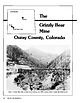
| Grizzly Bear Mine Ouray County, Colorado Grizzly Bear Mine Figure 1: Grizzly Bear mine in Bear Creek...Creek Canyon, circa 1900; courtesy Ouray County Historical Society. 302 ROCKS AND M I N E R A L S In...rhodochrosite crystals. In 1981, deeper exploration of the mine pro duced additional outstanding specimens of rhodochrosite...of the Silverton quadrangle, briefly mentions the mine and the occurrence of rhodochrosite crystals. It...appears that not many specimens were saved from early mining operations, as only a few specimens are known to |
 | | Report (issue) |
| PHYSICAL SCI. COUNTY REPORT 7 GEOLOGY AND MINERAL RESOURCES OF IMPERIAL COUNTY, CALIFORNIA Uk ... R&daubced. oj COUNTY IMPERIAL Gedifansua By Paul K. Morton Geologist COUNTY REPORT California...Sand Hills, as viewed toward the northwest from County Park. The prevailing wind direction, as indicated...PREFACE vi ABSTRACT vii INTRODUCTION Summary of County 1 Mineral Trends and Needs Principal Geographic...Quaternary lake beds Eastern and northeastern Imperial County Sedimentary breccia 1 1 1 1 1 19 19 19 1 Andesite |
 | | Report (issue) |
| GEORGETOWN QlJADRANGLE (TOGETHER 'VITH THE EMPIRE DISTRICT) COLORADo· BY JOSIAH E. SPURR AND GEORGE H...Boulder County.............. . . . . . . . . . . . ......... . ....... . 103 Ores in Gilpin County .......Creek County ............................ . 103 Ores from the Argentine to the Tenmile district .. : .................. . 104 Ores of the Tenmile 'district ...................................................Ores of the Leadville district ................... . 104 Ores of the Redcliff district ................. |
 | | Journal (issue) |
| MARCH–APRIL 2019 Articles The Candelaria District Mineral County, Nevada .................................by P. M. Adams Atacamite from the New Cornwall mine, Kadina, South Australia .........................COVER: ATACAMITE, 10.5 cm, from the New Cornwall mine, Kadina, South Australia. Collection of (and photo...$315/three years, (Canada) $180/one year, (outside USA other than Canada) $259 per year Subscription (individuals...break to collect minerals at the famous Red Cloud mine. Everyone had fun on the trip, and Graham found |
 | | Journal (issue) |
| MAY HIGHLIGHTS in mining this month 1961 New California asbestos mine and mill planned near Copperopolis...Craigmont completes copper mine stripping in southern British Columbia and moves in mining equipment. Mill construction...registered from 50 mining companies in many parts of the United States and abroad the mining industry begins..........++++4: 28 Meramec Mining Company's Pea Ridge, Missouri iron ore mine development is right on schedule...which to plan mining method «o.oo... ccce cence wee senaeeeeees 30 WHAT'S GOING ON IN MINING Rocky Mountain |
 | | Report (volume) |
| Geophysical Union.. Transactions, American Institute of Mining and Metallurgical Engineers _..._ American Journal...Colorado Mining Association publications . Economic Geology. _ . _ ___... Engineering and Mining Journal...of Sedimentary Petrology_...__._ Mines Magazine Mining Engineering ........___..._...._____ Advances in...Report ____________ ___._ Utah Geological and Mineralogical Survey.... Utah Geological Society, Guidebook...Guidebook to the Geology of Utah __..______._.______ Wyoming Geological Association Guidebook Miscellaneous |
 | | Journal (article/letter/editorial) |
| marbles in Washington, D. C. or the mellowed pink, creole and white marble buildings on the Emory University...the columns of the United States Capitol or the Lincoln Memorial. You may go into the buildings where the... a pink with varying amounts of green veining; Creole, with a white background and abundant dark grey...veining. All of these are medium to coarse-grained calcite marbles and except for the Etowah, in such vast...minerals for sale. Here you will likely see fine calcite crystals from the mines at Tate. Some of these |
 | | Report (volume) |
| 50. II. Tertiary History of the G-rand Caiion District, with atlas, by Clarence E. Dutton, Capt. U. S... Geology of the Comstocls Lode and the Washoe District, with atlas, by George F. Becker. 1882. 4°. xv...of 21 sheets folio. Price $11.00. IV. Conistock Mining and Miners, by Eliot Lord. 1883. 4°. xiv, 451 pp...Price $1.20. VIII. Paleontology of the Eureka District, by Charles Doolittle Walcott. 1884. 4°. xiii...46 pi. and maps. Price $1.75. XII. Geology and Mining Industry of Leadville, Colorado, with atlas, by |
 | | Report (issue) |
| predecessor organization, the Manhattan Engineer District ; and, to a lesser extent, by staff members of...United States. The pre-1940 history of uranium mining and geology is concerned largely with veins in...New Mexico; in Big Indian Wash and White Canyon, Utah; and in the Gas Hills, Wyoming. Very large deposits...Sierra Ancha region, Arizona ; and the Marysvale district, Utah. All the Western States, including Arizona...Nevada, New Mexico, and FRANK W. OsTERWALD Oregon, Utah, Washington, and Wyoming, contain veins that have |


