| Locality type: | Mine |
| Classification |
|---|
|
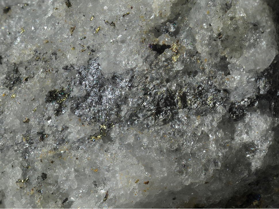
| Species: | Molybdenite |
| Formula: | MoS2 |
| Confirmation |
|---|
|
| Validity: | Believed Valid |
| Associated Minerals Based on Photo Data: |
|---|
|
| Chalcopyrite | ⓘ2 photos of Molybdenite associated with Chalcopyrite at this locality. |
| Data |
|---|
|
| Mineral Data: | Click here to view Molybdenite data |
| Locality Data: | Click here to view Bärenbad Mine, Scharnbachgraben, Hollersbach im Pinzgau, Zell am See District, Salzburg, Austria |
| Photo Gallery | View Gallery (2 photos) |
| Data Identifiers |
|---|
|
| Mindat Occurrence Record ID: | 235446 |
| Long-form Identifier: | 1:3:235446:0 |
| GUID (UUID V4): | 4711b8ca-d84f-4eb6-aa9f-c424046ea5fc |
| Nearest other occurrences of Molybdenite |
|---|
|
|
| 4.5km (2.8 miles) | ⓘGaiswand mine, Haidbachgraben, Mittersill, Zell am See District, Salzburg, Austria |
| 5.2km (3.3 miles) | ⓘRettenbach (Rettenbachgraben), Mittersill, Zell am See District, Salzburg, Austria |
| 5.5km (3.4 miles) | ⓘEmerald deposit, Leckbachgraben, Nasenkopf mountain, Bramberg am Wildkogel, Zell am See District, Salzburg, Austria |
| 5.5km (3.4 miles) | ⓘFazenwand, Bramberg am Wildkogel, Zell am See District, Salzburg, Austria |
| 6.4km (4.0 miles) | ⓘWestern ore field, Mittersill Scheelite deposit, Mittersill, Zell am See District, Salzburg, Austria |
| 8.2km (5.1 miles) | ⓘEastern ore field, Mittersill Scheelite deposit, Mittersill, Zell am See District, Salzburg, Austria |
| 8.7km (5.4 miles) | ⓘKleiner Finagl west slope, Neukirchen am Großvenediger, Zell am See District, Salzburg, Austria |
| 10.3km (6.4 miles) | ⓘKnappenwand, Knappenwand area, Neukirchen am Großvenediger, Zell am See District, Salzburg, Austria |
| 10.6km (6.6 miles) | ⓘHochfeld Mine, Neukirchen am Großvenediger, Zell am See District, Salzburg, Austria |
| 10.9km (6.8 miles) | ⓘSaukopf, Neukirchen am Großvenediger, Zell am See District, Salzburg, Austria |
| References |
|---|
|
|


Bärenbad Mine, Scharnbachgraben, Hollersbach im Pinzgau, Zell am See District, Salzburg, Austria