| Locality type: | Quarry |
| Classification |
|---|
|
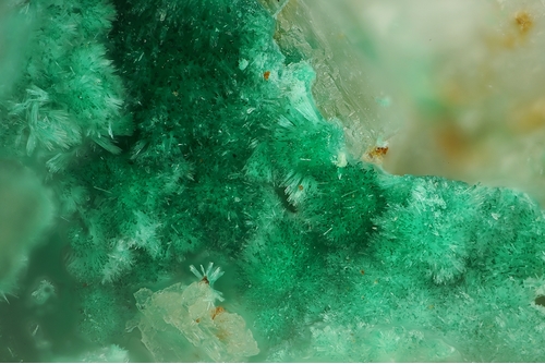
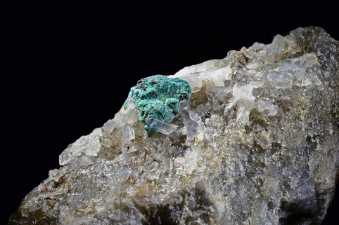
| Species: | Malachite |
| Formula: | Cu2(CO3)(OH)2 |
| Confirmation |
|---|
|
| Validity: | Believed Valid |
| Associated Minerals Based on Photo Data: |
|---|
|
| Quartz | ⓘ1 photo of Malachite associated with Quartz at this locality. |
| Tourmaline | ⓘ1 photo of Malachite associated with Tourmaline at this locality. |
| Hematite | ⓘ1 photo of Malachite associated with Hematite at this locality. |
| Data |
|---|
|
| Mineral Data: | Click here to view Malachite data |
| Locality Data: | Click here to view Lohning quarry (Lohninger quarry), Rauris, Zell am See District, Salzburg, Austria |
| Photo Gallery | View Gallery (8 photos) |
| Data Identifiers |
|---|
|
| Mindat Occurrence Record ID: | 258129 |
| Long-form Identifier: | 1:3:258129:3 |
| GUID (UUID V4): | 08f40b73-2658-4718-96ed-dccc18689202 |
| Nearest other occurrences of Malachite |
|---|
|
|
| 1.3km (0.8 miles) | ⓘKaiserer quarry (Deisl quarry), Rauris, Zell am See District, Salzburg, Austria |
| 1.6km (1.0 miles) | ⓘSchreiberhäusl slag locality, Rauris, Zell am See District, Salzburg, Austria |
| 1.7km (1.1 miles) | ⓘAstenschmiede slag locality, Rauris, Zell am See District, Salzburg, Austria |
| 3.5km (2.1 miles) | ⓘNortheast slope, Ritterkopf, Ritterkopf massif, Rauris, Zell am See District, Salzburg, Austria |
| 4.3km (2.7 miles) | ⓘGamskarlgraben, Grieswies, Grieswies - Krumlkeeskopf area, Rauris, Zell am See District, Salzburg, Austria |
| 6.4km (4.0 miles) | ⓘErfurt way, Grieswies-Schafkar, Grieswies - Krumlkeeskopf area, Rauris, Zell am See District, Salzburg, Austria |
| 7.2km (4.5 miles) | ⓘAugustin adit, Rauriser Goldberg, Kolm-Saigurn, Alteck - Hoher Sonnblick area, Rauris, Zell am See District, Salzburg, Austria |
| 7.2km (4.5 miles) | ⓘProspect above Augustin adit, Rauriser Goldberg, Kolm-Saigurn, Alteck - Hoher Sonnblick area, Rauris, Zell am See District, Salzburg, Austria |
| 7.3km (4.5 miles) | ⓘGold mine (Goldzeche), Zirmsee area, Heiligenblut am Großglockner, Spittal an der Drau District, Carinthia, Austria |
| 7.3km (4.5 miles) | ⓘKälbergrat, Große Fleiß valley, Heiligenblut am Großglockner, Spittal an der Drau District, Carinthia, Austria |
| References |
|---|
|
|


Lohning quarry, Rauris, Zell am See District, Salzburg, Austria