| Classification |
|---|
|
| Species: | Muscovite |
| Formula: | KAl2(AlSi3O10)(OH)2 |
| Comments: | In quartz-sericite veinlets around the orebody. |
| Confirmation |
|---|
|
| Validity: | Believed Valid |
| Data |
|---|
|
| Mineral Data: | Click here to view Muscovite data |
| Locality Data: | Click here to view Three-R Mine group, Three-R Canyon, Palmetto Mining District, Patagonia Mountains, Santa Cruz County, Arizona, USA |
| Data Identifiers |
|---|
|
| Mindat Occurrence Record ID: | 988929 |
| Long-form Identifier: | 1:3:988929:3 |
| GUID (UUID V4): | e18f1ea7-43e6-4698-83b0-0ac62bb47ca8 |
| Localities for Muscovite in this Region |
|---|
|
| Three-R Mine (3R Mine), Three-R Mine group, Three-R Canyon, Palmetto Mining District, Patagonia Mountains, Santa Cruz County, Arizona, USA |
| Nearest other occurrences of Muscovite |
|---|
|
|
| 1.0km (0.6 miles) | ⓘFlux Mine (Goshen Mine), Flux Gulch, Alum Gulch, Harshaw Mining District, Patagonia Mountains, Santa Cruz County, Arizona, USA |
| 1.2km (0.7 miles) | ⓘBlue Eagle Mine (Blue Eagle 1 and 2 claims; Copper Ledge; Hillside Copper Mine), Blue Eagle and Exposed Reef group, Alum Gulch, Harshaw Mining District, Patagonia Mountains, Santa Cruz County, Arizona, USA |
| 2.1km (1.3 miles) | ⓘChief Mine (Chief group of claims), Flux Gulch, Alum Gulch, Harshaw Mining District, Patagonia Mountains, Santa Cruz County, Arizona, USA |
| 2.9km (1.8 miles) | ⓘVentura Mine group (Morris group; George Morris Mine; George Morris Gold claim; Old Timer Mine; Homestake Mine; Georgia Mines), Ventura Canyon, Cox Gulch, Palmetto Mining District, Patagonia Mountains, Santa Cruz County, Arizona, USA |
| 3.3km (2.0 miles) | ⓘAztec Mine (Aztec group of claims; Aztec Mine group; Andes group), Aztec Gulch, Alum Gulch, Harshaw Mining District, Patagonia Mountains, Santa Cruz County, Arizona, USA |
| 3.4km (2.1 miles) | ⓘHumboldt Mine, Alum Gulch, Harshaw Mining District, Patagonia Mountains, Santa Cruz County, Arizona, USA |
| 3.4km (2.1 miles) | ⓘPat Alunite deposit (Pat property; Patagonia property), Palmetto Mining District, Patagonia Mountains, Santa Cruz County, Arizona, USA |
| 4.0km (2.5 miles) | ⓘSunnyside & Volcano Mines (Sunnyside Mine group; Volcano-Sunnyside Mine; Sunnyside Mine), Alum Gulch, Harshaw Mining District, Patagonia Mountains, Santa Cruz County, Arizona, USA |
| 4.1km (2.5 miles) | ⓘTrench Mine, Trench and Josephine Mine group (Josephine Mines; Trench group of claims; Lunch Cans prospect), Alum Gulch, Harshaw Mining District, Patagonia Mountains, Santa Cruz County, Arizona, USA |
| 4.8km (3.0 miles) | ⓘRed Mountain Mine (Red Mountain Copper prospect; Gem Mine; Carlton property; Ten Grand Mine; Red Mountain project), Red Mountain, Patagonia Mountains, Santa Cruz County, Arizona, USA |
| References |
|---|
|
|
| Reference Search (possible matching items) |
|---|
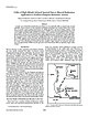 | | Journal (article/letter/editorial) | | Exploration: Application to Northern Patagonia Mountains, Arizona BYRON R. BERGER,† TRUDE V. V. KING, LAURIE...assemblages in the southeastern Santa Rita and northern Patagonia mountains, Arizona. Two concealed porphyry... AVIRIS data were acquired over the Patagonia and adjacent Santa Rita mountain ranges in 1996 as part...affects ground-water quality in the Santa Cruz River Basin, Arizona (Fig. 1). Large areas of advanced argillic...in the northern Patagonia Mountains and adjacent southeasternmost Santa Rita Mountains. Several porphyry |  | | Report (volume) | | 582 MINERAL DEPOSITS OF THE SANTA RITA AND PATAGONIA MOUNTAINS ARIZONA BY FRANK C. SCHRADER WITH CONTRIBUTIONS...17 Climate and vegetation. 18 _._ History of mining and present conditions___________________ 20 ...______-_____________ Mountains _ __________ _ Santa Rita and Patagonia ranges ______ _ Empire Mountains ________________________...________________________ San Cayetano Mountains . ______ __ __ Canelo Hills____________________________ Valleys...Valleys ___________'__-_________________ Santa Cruz Valley-________________ __ Cienega Valley_________________________ |
|


