Tuckabianna Goldfield, Cue Shire, Western Australia, Australia
This page is currently not sponsored. Click here to sponsor this page.

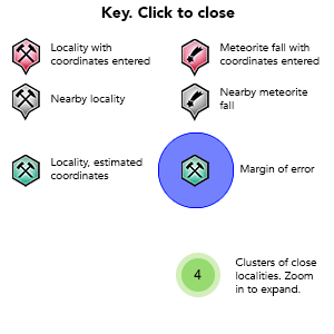
Key
Lock Map
| Latitude & Longitude (WGS84): | 27° 30' 24'' South , 118° 6' 18'' East |
|---|---|
| Latitude & Longitude (decimal): | -27.50670,118.10508 |
| GeoHash: | G#: qe5gx893z |
| Locality type: | Ore Field |
| Köppen climate type: | BWh : Hot deserts climate |
Located 26 km east south east of Cue. The goldfield is on the same greenstone belt as Mainland, The Island and Moyagee goldfields listed under The Island (Austin) Goldfield on Mindat. The Tuckabianna Goldfield stretches north-east of the Webbs Patch gold area (eastern part of Mainland) for some 20 kilometres.
Gold was discovered in the Tuckabianna area in 1913, and mined on a small scale and intermittently until 1988, producing 53 000oz of gold. Between 1988-1997, 500 000oz of gold came from 17 open pits, following the shear zone from north-east to south-west along a 10 kilometre length. The mines are presently operated by Silver Lake Resources.
Gold is mostly found in banded iron formations, and to a lesser extent in the margins of quartz-feldspar porphyry dykes, and in narrow isolated rafts of banded iron formation, within the greenstone belt. The banded iron formations are hosted in felsic volcanics, which have been structurally deformed by shear zones. Gold is associated with quartz-carbonate-pyrite-pyrrhotite stringers in these zones. The mines follow a regional shear zone of the Moyagee Shear, and sub-parallel Lena Shear to the east, and the Tuckabianna Shear.
The southern most deposit is the Venus open pit, with several open pits and underground mines stretching north-east to the Rapier open pit at its northern limit. Deposits are found both north and south of the Cue-Wondinong Road. A processing plant is located central to the deposits, constructed by Silver Lake Resources in 2013, and at the time of writing in care and maintenance.
Most mining ceased in this field circa 1997.
Further north, Silver Lake Resources Acquired the leases in the area in 2007 and commenced exploring the Hollandaire prospect for gold, bismuth, molybdenum, silver and copper. Nearby on the Cullens Resources lease they are exploring for arsenic, lead-cadmium, and cobalt-manganese at Coloniel and Mt Eelya mines.
Commodity List
This is a list of exploitable or exploited mineral commodities recorded from this region.Mineral List
Mineral list contains entries from the region specified including sub-localities10 valid minerals.
Rock Types Recorded
Note: this is a very new system on mindat.org and data is currently VERY limited. Please bear with us while we work towards adding this information!
Rock list contains entries from the region specified including sub-localities
Select Rock List Type
Alphabetical List Tree DiagramLocalities in this RegionShow map
Australia
- Western Australia
- Western Australia
This page contains all mineral locality references listed on mindat.org. This does not claim to be a complete list. If you know of more minerals from this site, please register so you can add to our database. This locality information is for reference purposes only. You should never attempt to
visit any sites listed in mindat.org without first ensuring that you have the permission of the land and/or mineral rights holders
for access and that you are aware of all safety precautions necessary.
References
Sort by Year (asc) | by Year (desc) | by Author (A-Z) | by Author (Z-A)
Ferguson, K.M. (1999) Lead Zinc and Silver Deposits of Western Australia, Geological Survey of Western Australia.
Vella, L.J. (1994) Geophysical setting of BIF-hosted gold deposits at Tuckabianna, Western Australia. 241-256. In (eds. Denith, M.C., Frankcombe, K.F., Ho, S.E., Shepherd, J.M., Groves, D.I., Trench, A.) Geophysical Signatures of Western Australian Mineral Deposits, Geology and Geophysics Department (Key Centre) & UWA Extension, The University of Western Australia, Publication 26.
External Links
http://www.silverlakeresources.com.au/project/murchison-goldfield/tuckabianna
http://www.mutinygold.com.au/projects/white-well/project
http://www.cullenresources.com.au/projects_base_metals.php
http://www.mutinygold.com.au/projects/white-well/project
http://www.cullenresources.com.au/projects_base_metals.php


Pinnacles Gold Mine, Tuckabianna Goldfield, Cue Shire, Western Australia, Australia