| Locality | Latitude | Longitude | Distance | Bearing |
|---|
| Natural Bridge gieseckite locality, Natural Bridge, Wilna, Jefferson County, New York, USA | 44° 4' 15" N | 75° 29' 39" W | 0.0km (0.0 miles) | |
| Natural Bridge calcite locality, Natural Bridge, Wilna, Jefferson County, New York, USA | 44° 4' 44" N | 75° 29' 49" W | 0.9km (0.6 miles) | |
| Farr property, Natural Bridge station, Diana Township, Lewis County, New York, USA | 44° 4' 24" N | 75° 28' 22" W | 1.7km (1.1 miles) | |
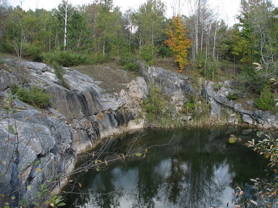
| Carbola Mine (Carbola Chemical Company Mine), Natural Bridge station, Diana Township, Lewis County, New York, USA | 44° 4' 41" N | 75° 28' 10" W | 2.1km (1.3 miles) | |
| Sterlingbush cave, Diana, Lewis County, New York, USA | 44° 6' 42" N | 75° 29' 43" W | 4.5km (2.8 miles) | |
| Gouverneur Talc Company No. 4 Quarry (Valentine deposit), Diana Township, Lewis County, New York, USA | 44° 7' 22" N | 75° 22' 41" W | 10.9km (6.8 miles) | |
| Diana, Diana Township, Lewis County, New York, USA | 44° 7' 15" N | 75° 22' 3" W | 11.5km (7.2 miles) | |
| Rylestone Marble Quarry, Gouverneur, St. Lawrence County, New York, USA | 44° 10' 59" N | 75° 30' 29" W | 12.5km (7.8 miles) | |
| Dickson Mine, Antwerp, Antwerp, Jefferson County, New York, USA | 44° 12' 0" N | 75° 35' 59" W | 16.6km (10.3 miles) | |
| Shirtliff Mine, Philadelphia, Philadelphia, Jefferson County, New York, USA | 44° 9' 0" N | 75° 42' 30" W | 19.2km (11.9 miles) | |
| Sterling Mine, Antwerp, Jefferson County, New York, USA | 44° 14' 17" N | 75° 35' 27" W | 20.1km (12.5 miles) | |
| Whitton prospect, Rose Road, Pitcairn, St. Lawrence County, New York, USA | 44° 12' 56" N | 75° 20' 5" W | 20.5km (12.7 miles) | |
| Keene Mine, Antwerp, Jefferson County, New York, USA | 44° 15' 0" N | 75° 33' 59" W | 20.7km (12.9 miles) | |
| Sylvia Lake Mine (deposit), Sylvia Lake, Gouverneur, St. Lawrence County, New York, USA | 44° 15' 0" N | 75° 25' 0" W | 20.8km (12.9 miles) | |
| Pitcairn, St. Lawrence County, New York, USA | 44° 11' 0" N | 75° 16' 59" W | 20.9km (13.0 miles) | |
| Caledonia Mine, Spragueville, St. Lawrence County, New York, USA | 44° 15' 29" N | 75° 32' 14" W | 21.1km (13.1 miles) | |
| Kearney Mine, Spragueville, St. Lawrence County, New York, USA | 44° 15' 29" N | 75° 32' 14" W | 21.1km (13.1 miles) | |
| Balmat, Balmat-Edwards Zinc Mining District, St. Lawrence County, New York, USA | 44° 14' 53" N | 75° 23' 43" W | 21.2km (13.2 miles) | |
| ZCA No. 1 Mine (St. Joe No. 1 Mine), Balmat, Balmat-Edwards Zinc Mining District, St. Lawrence County, New York, USA | 44° 15' 0" N | 75° 24' 4" W | 21.2km (13.2 miles) | |
| Balmat Mine, Balmat, Balmat-Edwards Zinc Mining District, St. Lawrence County, New York, USA | 44° 15' 0" N | 75° 24' 0" W | 21.3km (13.2 miles) | |
| Toothaker Creek prospects, Cooper Hill, Toothaker Creek State Forest, Pitcairn, St. Lawrence County, New York, USA | 44° 12' 24" N | 75° 18' 18" W | 21.4km (13.3 miles) | |
| Empire State No. 2 Mine, Balmat, Balmat-Edwards Zinc Mining District, St. Lawrence County, New York, USA | 44° 15' 8" N | 75° 23' 58" W | 21.5km (13.4 miles) | |
| Morgan Mine, Antwerp, Jefferson County, New York, USA | 44° 15' 0" N | 75° 35' 59" W | 21.6km (13.4 miles) | |
| Wight Mine, Sylvia Lake, Fowler, St. Lawrence County, New York, USA | 44° 15' 0" N | 75° 22' 59" W | 21.8km (13.5 miles) | |
| Dominion Mine, Sylvia Lake, Fowler, St. Lawrence County, New York, USA | 44° 15' 27" N | 75° 24' 20" W | 21.9km (13.6 miles) | |
| Toothaker Pond prospect, Cooper Hill, Toothaker Creek State Forest, Pitcairn, St. Lawrence County, New York, USA | 44° 12' 17" N | 75° 17' 29" W | 22.0km (13.7 miles) | |
| Loomis 1 Mine, Sylvia Lake, Fowler, St. Lawrence County, New York, USA | 44° 15' 34" N | 75° 23' 51" W | 22.3km (13.9 miles) | |
| Empire State No. 4 Mine, Balmat, Balmat-Edwards Zinc Mining District, St. Lawrence County, New York, USA | 44° 15' 50" N | 75° 24' 33" W | 22.5km (14.0 miles) | |
| ZCA No. 3 Mine, Balmat, Balmat-Edwards Zinc Mining District, St. Lawrence County, New York, USA | 44° 15' 59" N | 75° 24' 8" W | 22.9km (14.3 miles) | |
| Ontario Talc Company Mine, Fullerville, St. Lawrence County, New York, USA | 44° 15' 0" N | 75° 20' 30" W | 23.3km (14.5 miles) | |


Farr property, Natural Bridge station, Diana Township, Lewis County, New York, USA