| Locality | Latitude | Longitude | Distance | Bearing |
|---|
| France Stone Co. Middle Point Quarry, Middle Point, Ridge Township, Van Wert County, Ohio, USA | 40° 51' 11" N | 84° 27' 44" W | 1.3km (0.8 miles) | |
| Ridge Township quarry, Middle Point, Ridge township, Van Wert County, Ohio, USA | 40° 51' 19" N | 84° 29' 50" W | 4.2km (2.6 miles) | |
| Suever Stone Co. quarry, Delphos, Van Wert County, Ohio, USA | 40° 50' 17" N | 84° 20' 59" W | 8.4km (5.2 miles) | |
| Delphos, Allen County, Ohio, USA | 40° 50' 37" N | 84° 20' 22" W | 9.1km (5.7 miles) | |
| Bloomlock Quarry, Delphos, Allen County, Ohio, USA | 40° 46' 51" N | 84° 21' 37" W | 11.0km (6.9 miles) | |
| National Lime & Stone Co. Rimer quarry, Rimer, Putnam County, Ohio, USA | 40° 53' 4" N | 84° 12' 40" W | 20.1km (12.5 miles) | |
| Stoneco Scott Quarry, Scott, Van Wert County, Ohio, USA | 40° 58' 9" N | 84° 38' 56" W | 21.2km (13.1 miles) | |
| Kossuth, Auglaize County, Ohio, USA | 40° 39' 33" N | 84° 20' 53" W | 23.4km (14.5 miles) | |
| Buckland, Moulton Township, Auglaize County, Ohio, USA | 40° 37' 22" N | 84° 15' 35" W | 30.3km (18.8 miles) | |
| National Lime & Stone Co. quarry, Buckland, Moulton Township, Auglaize County, Ohio, USA | 40° 37' 7" N | 84° 15' 53" W | 30.5km (18.9 miles) | |
| Charloe, Paulding County, Ohio, USA | 41° 7' 53" N | 84° 26' 2" W | 30.7km (19.1 miles) | |
| Lima, Bath Township, Allen County, Ohio, USA | 40° 44' 33" N | 84° 6' 18" W | 31.4km (19.5 miles) | |
| National Lime and Stone Co. Quarry, Lima, Bath Township, Allen County, Ohio, USA | 40° 44' 0" N | 84° 5' 59" W | 32.2km (20.0 miles) | |
| Pleasant Mills Quarry, Adams County, Indiana, USA | 40° 44' 21" N | 84° 49' 45" W | 34.7km (21.6 miles) | |
| Stoneco Auglaize Quarry, Junction, Paulding County, Ohio, USA | 41° 10' 40" N | 84° 25' 48" W | 35.9km (22.3 miles) | |
| Junction, Paulding County, Ohio, USA | 41° 11' 35" N | 84° 27' 30" W | 37.5km (23.3 miles) | |
| Decatur City Engineering, Adams County, Indiana, USA | 40° 49' 54" N | 84° 55' 41" W | 40.6km (25.2 miles) | |
| Putnam Stone Co. quarry, Riley township, Putnam County, Ohio, USA | 40° 59' 32" N | 83° 59' 52" W | 40.7km (25.3 miles) | |
| Edgerton Quarry, Allen County, Indiana, USA | 41° 4' 17" N | 84° 50' 57" W | 41.4km (25.7 miles) | |
| Schumacher Stone Company Quarry, Pandora, Putnam County, Ohio, USA | 40° 56' 9" N | 83° 57' 51" W | 41.6km (25.8 miles) | |
| Pandora, Putnam County, Ohio, USA | 40° 56' 53" N | 83° 57' 39" W | 42.1km (26.2 miles) | |
| Krick-Tyndall Pit, Adams County, Indiana, USA | 40° 48' 46" N | 84° 57' 30" W | 43.3km (26.9 miles) | |
| Gilboa Quarry, Blanchard township, Putnam County, Ohio, USA | 41° 0' 52" N | 83° 56' 3" W | 46.6km (28.9 miles) | |
| Bluffton Stone Company Quarry, Bluffton, Richland Township, Allen County, Ohio, USA | 40° 53' 10" N | 83° 53' 34" W | 46.7km (29.0 miles) | |
| Bluffton, Richland Township, Allen County, Ohio, USA | 40° 53' 43" N | 83° 53' 19" W | 47.2km (29.3 miles) | |
| Karch Stone Quarry (Bryant Plant), Adams County, Indiana, USA | 40° 34' 23" N | 84° 52' 26" W | 47.7km (29.7 miles) | |
| Adams City Highway Department, Adams County, Indiana, USA | 40° 39' 29" N | 84° 57' 15" W | 48.0km (29.8 miles) | |
| Woodburn Stone Quarry & Plant, Allen County, Indiana, USA | 41° 8' 38" N | 84° 53' 20" W | 49.0km (30.5 miles) | |
| Stone Street Quarry, Allen County, Indiana, USA | 40° 56' 2" N | 85° 3' 59" W | 52.8km (32.8 miles) | |
| Linn Grove Quarry (No. 1 Quarry), Adams County, Indiana, USA | 40° 39' 26" N | 85° 3' 10" W | 55.6km (34.5 miles) | |

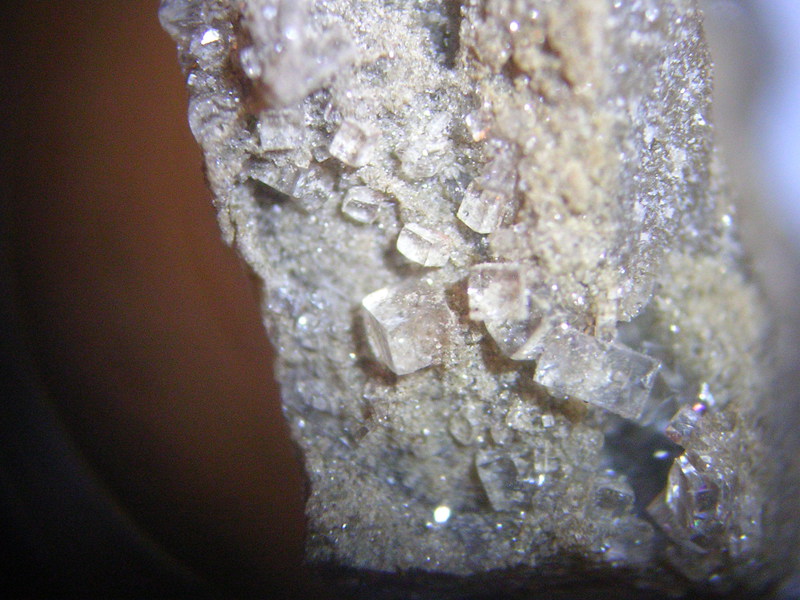


Suever Stone Co. quarry, Delphos, Van Wert County, Ohio, USA