| Locality | Latitude | Longitude | Distance | Bearing |
|---|
| Keene, Kern County, California, USA | 35° 13' 24" N | 118° 33' 43" W | 0.0km (0.0 miles) | |
| Woodford, Tehachapi Mountains, Kern County, California, USA | 35° 12' 45" N | 118° 33' 9" W | 1.5km (0.9 miles) | |
| Loop Ranch, Woodford, Tehachapi Mountains, Kern County, California, USA | 35° 13' 32" N | 118° 32' 13" W | 2.3km (1.4 miles) | |
| Keene deposit (Mountain Summit Lime Company), Keene, Kern County, California, USA | 35° 13' 57" N | 118° 31' 42" W | 3.2km (2.0 miles) | |
| Walabu Mine (Walibu Mine; Cudde Back Mine; Cuddeback Mine; Cuddiback Mine), Woodford, Tehachapi Mountains, Kern County, California, USA | 35° 12' 23" N | 118° 31' 27" W | 4.0km (2.5 miles) | |
| Hixson lease prospect, Woodford, Tehachapi Mountains, Kern County, California, USA | 35° 12' 3" N | 118° 31' 5" W | 4.7km (2.9 miles) | |
| Fickert-Durnal prospect (Fickert Durnal), Woodford, Tehachapi Mountains, Kern County, California, USA | 35° 11' 57" N | 118° 30' 56" W | 5.0km (3.1 miles) | |
| Oracle prospect, Millersville, Loraine Mining District, Kern County, California, USA | 35° 16' 17" N | 118° 31' 42" W | 6.1km (3.8 miles) | |
| Top of the World Mine, Millersville, Loraine Mining District, Kern County, California, USA | 35° 16' 0" N | 118° 31' 0" W | 6.3km (3.9 miles) | |
| Unnamed Sb occurrence [1], Millersville, Loraine Mining District, Kern County, California, USA | 35° 16' 26" N | 118° 31' 48" W | 6.3km (3.9 miles) | |
| Shoestring prospect [2], Millersville, Loraine Mining District, Kern County, California, USA | 35° 16' 51" N | 118° 31' 20" W | 7.3km (4.5 miles) | |
| Unspecified Hg mine [2], Tehachapi, Tehachapi Mountains, Kern County, California, USA | 35° 12' 0" N | 118° 28' 0" W | 9.1km (5.6 miles) | |
| Caliente, Kern County, California, USA | 35° 17' 27" N | 118° 37' 36" W | 9.5km (5.9 miles) | |
| Wiggins Mine (Wiggens Mine), Millersville, Loraine Mining District, Kern County, California, USA | 35° 14' 53" N | 118° 27' 39" W | 9.6km (6.0 miles) | |
| Got Rocks deposit (Wilderness Rock), Tehachapi, Tehachapi Mountains, Kern County, California, USA | 35° 9' 6" N | 118° 30' 9" W | 9.6km (6.0 miles) | |
| Ferris Mine (Golden group; Jack Rabbit Mine), Millersville, Loraine Mining District, Kern County, California, USA | 35° 17' 48" N | 118° 29' 45" W | 10.1km (6.3 miles) | |
| Blackhawk Mine, Millersville, Loraine Mining District, Kern County, California, USA | 35° 15' 47" N | 118° 27' 38" W | 10.2km (6.4 miles) | |
| Zenda Mine, Millersville, Loraine Mining District, Kern County, California, USA | 35° 17' 23" N | 118° 28' 4" W | 11.3km (7.0 miles) | |
| Ritter Ranch deposit (Iron Blossom deposit), Loraine, Loraine Mining District, Kern County, California, USA | 35° 15' 33" N | 118° 26' 40" W | 11.4km (7.1 miles) | |
| Studhorse Canyon Mine (Studhorse Canyon property), Loraine, Loraine Mining District, Kern County, California, USA | 35° 15' 54" N | 118° 26' 39" W | 11.7km (7.2 miles) | |
| Hart Mine, Millersville, Loraine Mining District, Kern County, California, USA | 35° 19' 10" N | 118° 29' 50" W | 12.2km (7.6 miles) | |
| Millersville, Loraine Mining District, Kern County, California, USA | 35° 18' 14" N | 118° 27' 28" W | 13.0km (8.1 miles) | |
| Cowboy Mine (Old Cowboy Mine; Gold Peak Mine; Gold Peak and Cowboy Mines; Zada Mine), Loraine, Loraine Mining District, Kern County, California, USA | 35° 17' 26" N | 118° 26' 38" W | 13.1km (8.1 miles) | |
| Caliente Creek occurrence, Millersville, Loraine Mining District, Kern County, California, USA | 35° 18' 21" N | 118° 27' 20" W | 13.3km (8.3 miles) | |
| Deerhunter Mine (Deerhunter prospect), Millersville, Loraine Mining District, Kern County, California, USA | 35° 18' 16" N | 118° 27' 6" W | 13.5km (8.4 miles) | |
| Atlas Mine, Sugarloaf Mountain, Loraine Mining District, Kern County, California, USA | 35° 14' 6" N | 118° 24' 27" W | 14.1km (8.8 miles) | |
| Unnamed limestone quarry [1], Sugarloaf Mountain, Loraine Mining District, Kern County, California, USA | 35° 10' 22" N | 118° 25' 3" W | 14.3km (8.9 miles) | |
| Tehachapi, Tehachapi Mountains, Kern County, California, USA | 35° 7' 55" N | 118° 26' 53" W | 14.5km (9.0 miles) | |
| Loraine, Loraine Mining District, Kern County, California, USA | 35° 18' 16" N | 118° 26' 8" W | 14.6km (9.1 miles) | |
| Lee deposit, Tehachapi, Tehachapi Mountains, Kern County, California, USA | 35° 6' 21" N | 118° 29' 23" W | 14.7km (9.1 miles) | |


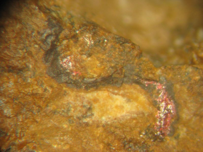


Hixson lease prospect, Woodford, Tehachapi Mountains, Kern County, California, USA