Hollister, San Benito County, California, USAi
| Regional Level Types | |
|---|---|
| Hollister | - not defined - |
| San Benito County | County |
| California | State |
| USA | Country |
This page is currently not sponsored. Click here to sponsor this page.


Latitude & Longitude (WGS84):
36° 51' 8'' North , 121° 24' 2'' West
Latitude & Longitude (decimal):
Köppen climate type:
Nearest Settlements:
| Place | Population | Distance |
|---|---|---|
| Hollister | 37,462 (2017) | 0.1km |
| Ridgemark | 3,016 (2011) | 5.4km |
| Tres Pinos | 476 (2011) | 9.9km |
| San Juan Bautista | 1,961 (2017) | 12.2km |
| Aromas | 2,650 (2015) | 21.9km |
Nearest Clubs:
Local clubs are the best way to get access to collecting localities
Local clubs are the best way to get access to collecting localities
| Club | Location | Distance |
|---|---|---|
| Salinas Valley Rock and Gem Club | Salinas, California | 30km |
Mindat Locality ID:
29357
Long-form identifier:
mindat:1:2:29357:9
GUID (UUID V4):
844c6fb3-8b80-4db6-be4f-adc29358f907
A city founded in 1868 (in what was then Monterey County). Hollister claims the title of "Earthquake Capital of the World" and shares that title with Coalinga and Parkfield.
Hollister presents a prime example of aseismic creep anywhere in the world. The Calaveras Fault (a branch of the San Andreas Fault system) bisects the city N-S (roughly along Locust Avenue and Powell Street). The streets running E-W traversing the fault have significant visible offsets.
Select Mineral List Type
Standard Detailed Gallery Strunz Chemical ElementsCommodity List
This is a list of exploitable or exploited mineral commodities recorded from this region.Mineral List
Mineral list contains entries from the region specified including sub-localities2 valid minerals.
Detailed Mineral List:
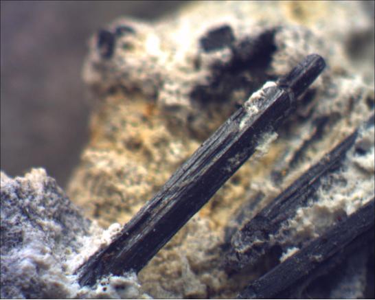
| ⓘ Chromite Formula: Fe2+Cr3+2O4 Localities: |
| ⓘ Zaratite Formula: Ni3(CO3)(OH)4 · 4H2O ? Localities: Description: Occurs on chromite. |
Gallery:
List of minerals arranged by Strunz 10th Edition classification
| Group 4 - Oxides and Hydroxides | |||
|---|---|---|---|
| ⓘ | Chromite | 4.BB.05 | Fe2+Cr3+2O4 |
| Group 5 - Nitrates and Carbonates | |||
| ⓘ | Zaratite | 5.DA.15 | Ni3(CO3)(OH)4 · 4H2O ? |
List of minerals for each chemical element
| H | Hydrogen | |
|---|---|---|
| H | ⓘ Zaratite | Ni3(CO3)(OH)4 · 4H2O ? |
| C | Carbon | |
| C | ⓘ Zaratite | Ni3(CO3)(OH)4 · 4H2O ? |
| O | Oxygen | |
| O | ⓘ Chromite | Fe2+Cr23+O4 |
| O | ⓘ Zaratite | Ni3(CO3)(OH)4 · 4H2O ? |
| Cr | Chromium | |
| Cr | ⓘ Chromite | Fe2+Cr23+O4 |
| Fe | Iron | |
| Fe | ⓘ Chromite | Fe2+Cr23+O4 |
| Ni | Nickel | |
| Ni | ⓘ Zaratite | Ni3(CO3)(OH)4 · 4H2O ? |
Localities in this Region
- California
- San Benito County
Other Regions, Features and Areas containing this locality
This page contains all mineral locality references listed on mindat.org. This does not claim to be a complete list. If you know of more minerals from this site, please register so you can add to our database. This locality information is for reference purposes only. You should never attempt to
visit any sites listed in mindat.org without first ensuring that you have the permission of the land and/or mineral rights holders
for access and that you are aware of all safety precautions necessary.
References


Hollister, San Benito County, California, USA