Log InRegister
Quick Links : The Mindat ManualThe Rock H. Currier Digital LibraryMindat Newsletter [Free Download]
Home PageAbout MindatThe Mindat ManualHistory of MindatCopyright StatusWho We AreContact UsAdvertise on Mindat
Donate to MindatCorporate SponsorshipSponsor a PageSponsored PagesMindat AdvertisersAdvertise on Mindat
Learning CenterWhat is a mineral?The most common minerals on earthInformation for EducatorsMindat ArticlesThe ElementsThe Rock H. Currier Digital LibraryGeologic Time
Minerals by PropertiesMinerals by ChemistryAdvanced Locality SearchRandom MineralRandom LocalitySearch by minIDLocalities Near MeSearch ArticlesSearch GlossaryMore Search Options
Search For:
Mineral Name:
Locality Name:
Keyword(s):
 
The Mindat ManualAdd a New PhotoRate PhotosLocality Edit ReportCoordinate Completion ReportAdd Glossary Item
Mining CompaniesStatisticsUsersMineral MuseumsClubs & OrganizationsMineral Shows & EventsThe Mindat DirectoryDevice SettingsThe Mineral Quiz
Photo SearchPhoto GalleriesSearch by ColorNew Photos TodayNew Photos YesterdayMembers' Photo GalleriesPast Photo of the Day GalleryPhotography

Calcite from
Arkaroola Bore, Arkaroola Region (Arkaroola Wilderness Sanctuary; Arkaroola Station), North Flinders Ranges, Flinders Ranges, South Australia, Australia


Classification
Species:Calcite
Formula:CaCO3
Confirmation
Validity:Believed Valid
Associated Minerals Based on Photo Data:
Actinoliteā“˜2 photos of Calcite associated with Actinolite at this locality.
Stilbite Subgroupā“˜1 photo of Calcite associated with Stilbite Subgroup at this locality.
Ilmeniteā“˜1 photo of Calcite associated with Ilmenite at this locality.
Data
Mineral Data:Click here to view Calcite data
Locality Data:Click here to view Arkaroola Bore, Arkaroola Region (Arkaroola Wilderness Sanctuary; Arkaroola Station), North Flinders Ranges, Flinders Ranges, South Australia, Australia
Data Identifiers
Mindat Occurrence Record ID:928680
Long-form Identifier:1:3:928680:1
GUID (UUID V4):34f63562-5e3c-4e0b-81ac-7c7a419dca64
Nearest other occurrences of Calcite
4.3km (2.7 miles) ā“˜The Pinnacles Pegmatites, Arkaroola Region (Arkaroola Wilderness Sanctuary; Arkaroola Station) , North Flinders Ranges, Flinders Ranges, South Australia, Australia
4.6km (2.9 miles) ā“˜Radium Creek (Median Section), Mt Painter area, Arkaroola Region (Arkaroola Wilderness Sanctuary; Arkaroola Station), North Flinders Ranges, Flinders Ranges, South Australia, Australia
6.9km (4.3 miles) ā“˜Mt Gee, Arkaroola Region (Arkaroola Wilderness Sanctuary; Arkaroola Station), North Flinders Ranges, Flinders Ranges, South Australia, Australia
10.9km (6.8 miles) ā“˜Wooltana Cave, Wooltana homestead area, North Flinders Ranges, Flinders Ranges, South Australia, Australia
12.0km (7.4 miles) ā“˜Woodlamulka Mines, Wooltana homestead area, North Flinders Ranges, Flinders Ranges, South Australia, Australia
14.1km (8.8 miles) ā“˜Black Queen Mine, Yudnamutana District, Arkaroola Region (Arkaroola Wilderness Sanctuary; Arkaroola Station), North Flinders Ranges, Flinders Ranges, South Australia, Australia
14.1km (8.8 miles) ā“˜Wheal Turner (Red Bluff Mine; Wheal Turner Mine), Yudnamutana District, Arkaroola Region (Arkaroola Wilderness Sanctuary; Arkaroola Station), North Flinders Ranges, Flinders Ranges, South Australia, Australia
14.2km (8.8 miles) ā“˜Pinnacles Mine, Yudnamutana District, Arkaroola Region (Arkaroola Wilderness Sanctuary; Arkaroola Station), North Flinders Ranges, Flinders Ranges, South Australia, Australia
14.3km (8.9 miles) ā“˜Yudnamutana Mine, Yudnamutana District, Arkaroola Region (Arkaroola Wilderness Sanctuary; Arkaroola Station), North Flinders Ranges, Flinders Ranges, South Australia, Australia
14.4km (8.9 miles) ā“˜Mount McDonnell Mine (MacDonnell; Mount McDonald; Mt McDonald; Prince Albert), Yudnamutana District, Arkaroola Region (Arkaroola Wilderness Sanctuary; Arkaroola Station), North Flinders Ranges, Flinders Ranges, South Australia, Australia
References
Reference Search (possible matching items)
Report (issue)
taken from the Library NN GU 1900 TP CATALOGUE SOUTH OF AUSTRALIAN MINERALS: 1983 by R.J. Noble...Government Printer, South Australia, 1983 REF 349.994, N668c Noble, R. A. Catalogue of South Australian minerals...(Robert John), 1946ā€”supiic LIBRARY Catalogue of South Australian minerals: 1983. Bibliography. ISBN 0...Mineralogyā€”South Australia. |. Just, J. (Juri). Il. Johnson, J. E. (James Eric). Ill. South Australia. Dept...and Energy. IV. Title. (Series: Handbook (South Australia. Dept. of Mines and Energy); 7) 549.99423
Journal (article/letter/editorial)
The Paralana hot springs, Northern Flinders Ranges, South Australia JoeĢˆl Brugger a,b,*, Ngaire Long c...Adelaide, South Australia; b South Australian Museum, North Terrace, Adelaide, South Australia, Australia...Geosciences, Monash University, Victoria 3800, Australia Cooperative Research Centre for Landscape Environments...ACT 0200, Australia e School of Earth Sciences, The University of Melbourne, Vic 3010, Australia Received...Mesoproterozoic Mt. Painter Inlier (Northern Flinders Ranges, South Australia) is located in a zone of anomalously
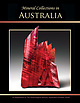
Journal (issue)
Mineral Collections in Australia A Supplement To The Mineralogical Record, Septemberā€“October 2020 ... Mineral Collections in Australia Organized by Robert Sielecki Designed by Wendell Wilson with Photography...Septemberā€“October, 2020 Mineral Collections in Australia A Supplement to The Mineralogical Record Septemberā€“October...Zinc Corporation mine, Broken Hill, New South Wales, Australia. Collection of the Australian Museum; ex...Top row from left: ā€¢ 6 cm, Kalgoorlie, Western Australia; Lee Spencer collection, John Chapman photo. ā€¢
Journal (article/letter/editorial)
cleavage on {001} and imperfect on {100}. Its density ranges from about 3.4 to 3.6. Epidote is monoclinic (2/m)...common minerals that include, among others, quartz, calcite, vesuvianite, scapolite, talc, wollastonite, and...collectĀ­ ed from veins exposed along State Highway 229 south of Martinsville, Henry County, Virginia. The U.S...occurs at a number of localities along the Tennessee-North Carolina border, particularly on Roan Mountain....Wilson farm near Bakersville, Mitchell County, North CaroliĀ­ na. Well-crystallized, stubby, dark green
Journal (article/letter/editorial)
com/locate/apgeochem Groundwater in the Broken Hill region, Australia: recognising interaction with bedrock and...Exploration, c/- Geoscience Australia, GPO Box 378, Canberra, ACT 2601, Australia b CSIRO Division of Exploration...Exploration and Mining, PO Box 136, North Ryde, NSW 1670, Australia c Research School of Earth Sciences...Australian National University, Canberra, ACT 0200, Australia Abstract The supergiant Pbā€“Znā€“Ag Broken Hill...outcrop of the Proterozoic Curnamona Province of Australia. The vast majority of this Province is concealed
Journal (article/letter/editorial)
Research Institute, University of South Australia, Adelaide 5095, Australia ABSTRACT Chemical calculations...typified by the neutralization of 2 H+ by 1 mole of calcite: CaCO3 + 2 H+ ā†’ Ca2+ + CO2 + H2O (pH < 6.4) (2)...typically have a greater overall ANC compared to calcite per mole of mineral. This fact has been determined...neutralizationcapacity (Paktunc 1999a) show that 1 mole of calcite is required to neutralize 1 mole of sulfuric acid...silicate minerals after depletion of the accessible calcite. Similarly, at the Waiteā€“Amulet tailings impoundment
 
Mineral and/or Locality  
Mindat Discussions Facebook Logo Instagram Logo Discord Logo
Mindat.org is an outreach project of the Hudson Institute of Mineralogy, a 501(c)(3) not-for-profit organization.
Copyright © mindat.org and the Hudson Institute of Mineralogy 1993-2024, except where stated. Most political location boundaries are Ā© OpenStreetMap contributors. Mindat.org relies on the contributions of thousands of members and supporters. Founded in 2000 by Jolyon Ralph.
Privacy Policy - Terms & Conditions - Contact Us / DMCA issues - Report a bug/vulnerability Current server date and time: April 26, 2024 13:19:39
Go to top of page