 | | Journal (article/letter/editorial) | | Houston, Texas 77036 ROBERT 0. FAY Oklahoma Geological Survey Norman, Oklahoma 73019 Downloaded by [The Aga...713 15th Street NW Ardmore, Oklahoma 73401 OKLAHOMA Figure 1. Oklahoma counties. Mineral Locality...Although perhaps best known for its gypsum crystals and barite roses, Oklahoma also boasts a variety of other...minerals available from Oklahoma and think primarily of the prolific gypsum crystals that are easily...hundred years, extends into the northeast corner of Oklahoma and has produced notable specimens. Unfortunately | 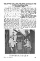 | | Journal (article/letter/editorial) | | COLLECTING ZINC, LEAD AND OTHER MINERALS IN THE PICHER, OKLAHOMA AREA By GARDINER E. GREGORY Director: The...states. We enjoyed excellent collecting in the Picher, Oklahoma ar~a. . My wI~e Anne and 1 were accompanied...trailer, and the Romalewski' s tented out. The Picher area contains a zinc-lead deposit, which also extends...drilling near Commerce, Oklahoma. By 1916 large scale operations existed in the Picher Field. The decline or...meteoric rise of the Picher Field. The largest mining company in the area is the Eagle-Picher Corporation, who | 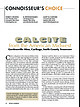 | Huizing, Terry E., Richards, R. Peter, Clifford, Janet H., Cook, Robert B. (2017) Connoisseur's Choice: Calcite from the American Midwest, Gordonsville Mine, Carthage, Smith County, Tennessee. Rocks & Minerals, 92 (1) 46-63 doi:10.1080/00357529.2017.1241690 | Journal (article/letter/editorial) | | American Midwest Gordonsville Mine, Carthage, Smith County, Tennessee C alcite is ubiquitous in the American...collector for more than forty years, she enjoys field trips, exhibiting at mineral shows, volunteering...Tennessee Lead-Zinc district near Carthage in Smith County. Calcite from this locality is noted for high luster...cm tall, from the Ben Hogan quarry in Lawrence County, Arkansas. Terry Huizing specimen (No. TEH 273)...dolostone at the Black Rock quarries of the Lawrence County Zinc district. Specimens often feature calcite |  | | Journal (article/letter/editorial) | | figure 2 (leftI: Galena. Crawford mine, Pirher, Oklahoma, Tri-State district; 6' 2 cm across; Harvard Mineralogical...crystals are also common. Smithsonite, cerussite, gypsum, and limonite were present in the oxidized zone...of the 1970s. The last remaining operator, Eagle-Picher Indus tries, closed the Bear Hole mine in February...of the Crescent Formation, Robertson Pit, Mason County, Washington" (January/February 1988). From 1961...open Figure 10: Shullsburg mine and mill, Eagle-Picher Co., Shullsburg, Wisconsin, Upper Mississippi Valley |  | | Report (issue) | | Geology and Ore Deposits of the Picher Field Oklahoma and Kansas GEOLOGICAL SURVEY PROFESSIONAL PAPER... 588 Geology and Ore Deposits of the Picher Field Oklahoma and Kansas By EDWIN T. McKNIGHT and RICHARD...towns and mine workings in the main part of the Picher field. Geologic map of the Wyandotte quadrangle. Isopach...bed and approximate west limit of L bed in the Picher field. Sections and correlation of the Moccasin Bend...and dolomitized areas in part of the Picher zinc-lead field, Oklahoma and Kansas: 5. Northwest sheet. 6 | 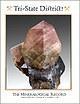 | | Journal (issue) | | The Tri-State Mining District Missouri-Kansas-Oklahoma by Denise Bicknell Wendell E. Wilson 2017 The...Tucson USA Visit us at these international shows: Houston Ste. Marie Denver Munich USA France USA Germany...and Riverpark Inn Rhodochrosite, Sweet Home Mine, USA, 10 cm Photo: Malte Sickinger MARCUS BUDIL Monaco... The Tri-State Mining District Missouri-Kansas-Oklahoma Denise Bicknell 16711 East Whimbrel Circle Conroe...settled Tri-State area of Missouri, Kansas, and Oklahoma suspected the world of wealth that lay just beneath |  | | Report (issue) | | RESOURCES IN LEAD-ZINC MINED AREAS IN CHEROKEE COUNTY, KANSAS, AND ADJACENT AREAS U.S. GEOLOGICAL SURVEY...RESOURCES IN LEAD-ZINC MINED AREAS IN CHEROKEE COUNTY, KANSAS, AND ADJACENT AREAS By Timothy B. Spruill...samples from lower level of Consolidated NO. 2 mine, Oklahoma 49 18. Graphs showing sulfate concentrations...in eastern and western parts of the Picher Field, Cherokee County, Kansas 46 13. Comparison of selected...and lower levels of mines in the Picher Field, Kansas and Oklahoma 48 14. Summary of low-flow water-quality |  | | Report (issue) | | Oklahoma, A Summary of Activities of the U.S. Geological Survey, Water Resources Division, in Fiscal...GEOLOGICAL SURVEY OPEN-FILE REPORT 94-38 Oklahoma City, Oklahoma 1994 U.S. DEPARTMENT OF THE INTERIOR...NW 66th Street, Building 7 Box 25286, MS 517 Oklahoma City, OK 73116 Denver, CO 80225 CONTENTS Page.............................................. 3 Oklahoma District organization chart.....................Types of investigations and sources of funding for Oklahoma in 1991-92................................ 5 List |  | | Report (issue) | | BIBLIOGRAPHY OF OKLAHOMA HYDROLOGY REPORTS PREPARED BY THE U.S. GEOLOGICAL SURVEY AND PRINCIPAL COOPERATING...GEOLOGICAL SURVEY Open-File Report 93-448 Oklahoma City, Oklahoma 1993 U.S. DEPARTMENT OF THE INTERIOR...Geological Survey 202 NW 66th Street, Bldg. 7 Oklahoma City, Oklahoma 73116 Copies of this report can be purchased...and Maps ..........24 Oklahoma Water Resources Board.............. 25 Oklahoma District library ........................... 3 General information on Oklahoma water resources and publications ............ |  | | Journal (article/letter/editorial) | | the world. These are the Tri-State district of Oklahoma, Kansas, and Missouri and the world-class Viburnum...from southwestern Missouri through Kansas into Oklahoma (fig. l), was one of the primary zinc-producing...titled “Minerals of the Vanadinite Mine, Mohave County, Arizona.” 400 ROCKS 81 MINERALS rized in Lasnianis...Mining did not start in Kansas until 1877 and in Oklahoma until 1891. In 1853 lead mining began at Granby...the Granby Mining and Smelting Company. In Jasper County, a large lead deposit was discovered by J. B. Sargent |  | | Report (issue) | | because of the possibility that researchers in the field of geochemistry might refer to the data or conclusions...ABANDONED LEAD AND ZINC MINES IN NORTHEASTERN OKLAHOMA AND SOUTHEASTERN KANSAS Page D-3 D-5 D-5 D-8 ...CHAPTER F.- ORGANIC COMPOUNDS IN GROUND WATER Page Field comparison of ground-water sampling devices for.............................. Evaluation of four field-determined characteristics used as water-quality...location of Tar Creek sampling sites near Picher, Oklahoma......................... D-2. Map showing |  | | Report (issue) | | OKLAHOMA, A SUMMARY OF ACTIVITIES OF THE U.S. GEOLOGICAL SURVEY, WATER RESOURCES DIVISION, IN FISCAL...GEOLOGICAL SURVEY Open-File Report 91-492 Oklahoma City, Oklahoma 1991 U.S. DEPARTMENT OF THE INTERIOR...Water Resources Division 202 NW 66** St., Bldg. 7 Oklahoma City, OK 73116 Copies of this report can be purchased...the U.S. Geological Survey .............. 3 Oklahoma District organization chart 4 ................Types of investigations and sources of funding for Oklahoma in 1988-90 List of cooperators ...... 5 .. |  | | Report (volume) | | constitute ores. In the San Rafael Swell area, Emery County, Utah, and particularly at Temple Mountain within... Minnesota, Missouri, Nebraska, North Dakota, Oklahoma, South Dakota, and Texas: Geol. Soc. America Bull...Devil No. 6 deposit [San Rafael Swell area, Emery County, Utah] had 0.105 percent uranium in two hydrocarbons...the lower Permian dolomites of the Panhandle gas field, Texas, and in dolomites of the Seven Rivers gypsiferous...obtained from the Sun field, Starr County, Tex.; Navarro Crossing, Navarro County, Tex.; and the Fitts |  | | Journal (article/letter/editorial) | | found textured quartz in the jasperoid bodies of Picher Field in the Pb-Zn Mississippi Valley Type district...is particularly evident when observed with the gypsum plate inserted in an optical microscope. The quartz... (a) sample B2, crossed polarized light (CPL), gypsum plate inserted (GPI); (b) sample PO, CPL, GPI;...quartz); (f) sample AS, CPL. The dimensions of the field of view are indicated by the white bars on each...extinct under the microscope (i.e., red with the gypsum plate inserted: Figs. 4a–4c) upon sample rotation |  | | Book | | sinkhole, Hamilton County 20 Bear Creek Fault 21 Cimarron River bed, Grant County 26 A dust storm near...Basin, Clark County 39 St. Jacob’s Well, Clark County 40 The bridge at Keiger Creek, Clark County Red Hills...Hills, Barber County 47 A slump feature, Barber County 48 Satin spar from the Red Hills 49 Flowerpot Mound...Mound, Barber County 50 The Arkansas River west of Winfield 60 62 A geode from the Winfield Limestone ...Chautauqua County 67 Big Brutus, Cherokee County 78 79 Phosphate nodules, Cherokee County Strip pits |  | | Report (issue) | | OKLAHOMA A Summary of Activities of the U.S. GEOLOGICAL SURVEY WATER RESOURCES DIVISION in Fiscal Years...GEOLOGICAL SURVEY Open-File Report 88-172 Oklahoma City, Oklahoma 1988 DEPARTMENT OF THE INTERIOR DONALD...Resources Division 215 Dean A. MoGee, Room 621 Oklahoma City, Oklahoma 73102 Copies of this report can be purchased...Conservancy Dist. Oklahoma Conservation Commission USQS Cooperative Matching Funds Oklahoma Dept. of Transportation...Transportation Oklahoma Water Resources Board City of Oklahoma City Grand River Dan Authority Central Oklahoma |  | | Report (issue) | | International, LLC P.O. Box 263, East Hampton, CT 06424, USA Phone 1.860.267.1512; fax 1.860.267.7225 www.lapisint...at the Crystal River quarry, Lecanto in Citrus County Florida. Collection Francis Benjamin; photo Jeff...twin on {1 OTI} from the Leiping mine, Guiyang County, Hunan, China. Collection Frederic Escaut; photo...(0001} from St. Clair Lime quarry, Sequoyah County, Oklahoma. Collection Terry Huizing; photo Jeff Scovil...CHRISTIAN WEISE VERLAG, GERMANY AND LAPIS INTERNATIONAL, USA To Our Readers: As we established our company, |  | | Report (Issue volume) | | State Geological Survey of :\'.orth Dakota. Oklahoma: Oklahoma Geological Survey. Pennsylvania: Pennsylvania...Sutton ------------------ ---------- ----- - 549 Oklahoma, by L . G. Southard, K. S. Johnson, and J. F..... ____________ . _- . - . - _. . . . . .. _. _ Gypsum __ .__________ __ ______ ______ ____ .____ ______...Tenn., Wash. Graphite .. ..... .......... ... Tex. Gypsum ... .. . ... ..... . .... .. Mich., Calif., Tex...Carolina .. ___ North Dakota_ ___ Ohio____________ _ Oklahoma _______ Oregon ____ _______ _ Pennsylvania . _ |  | | Journal (article/letter/editorial) | | Center, Lakewood, CO 80225, USA b P.O. Box 1052, Evergreen, CO 80439, USA Received 12 May 1993; accepted...which is needed to reduce sulfate, with sedimentary gypsum (or anhydrite) which is the source of sulfate to...typical of Mississippi Valley-type deposits, bedded gypsum, an early isotopically light calcite, native sulfur...Formation, Thompson-Temperly zinc-lead mine, Lafayette County, Wisconsin. In: W.E. Dean (Editor), Organics and... 1970. Geology and ore deposits of the Picher Field Oklahoma and Kansas. U.S. Geol. Surv, Prof. Pap. |  | | Report (volume) | | maps included. Subject. .Subject. Areas covered by field trips. History of various organizations or geological...mineralogic, paleontologic, etc. Listed by name of field. Subject and area. Subject and area. Subject and...Gems and gem materials. Cunacla, Baffin Island ': Field. D. S. M. 3 Emerald, absorption spectrum : .A-oclerson...rather than indexed separately. The San Ardo oil field is not found under S, but in its proper alphabetical...series. Ottawa. Canada Dominion Observatory Pubs. Canada r»ominion Observatory Publica- tions. Ottawa. Canada |  | | Report (issue) | | OKLAHOMA: A SUMMARY OF ACTIVITIES OF THE U.S. GEOLOGICAL SURVEY WATER RESOURCES DIVISION FOR 1983 By...GEOLOGICAL SURVEY OPEN-FILE REPORT 83-767 Oklahoma City, Oklahoma 1983 UNITED STATES DEPARTMENT OF THE...Old Post Office Bldg. 215 Dean A. McGee Avenue Oklahoma City, OK 73102 Telephone: (405) 231-4256 CONTENTS............................... 4 OK 79-007 -- Oklahoma water-use data system...........................in Oklahoma............................... 5 OK 70-031 -- Flood-prone area mapping in Oklahoma.... |  | Amstutz, G. C., Goresy, A. El, Frenzel, G., Kluth, C., Moh, G., Wauschkuhn, A., Zimmermann, R.A. - Eds. (1982) Ore Genesis. Springer Berlin, Heidelberg. doi:10.1007/978-3-642-68344-2 | Book | | have undergone a decisive shift, not only in our field of research but also in many neighboring natural...the Tri-State District of Missouri, Kansas, and Oklahoma, U.S.A. R.D. Hagni (With 6 Figures) . . . . ....Sulphosalt Mineralization in the Myrthengraben Gypsum Deposit, Semmering, Lower Austria W. Tufar (With...carbonates disappear. Locally, anhydrite, silica, gypsum and sulphide cement can be observed. Detailed studies...balance ores are concentrated only within the ore field of the "Conrad" Mine (Konstantinovich 1972; Narkelun |  | Amstutz, G. C., Goresy, A. EI, Frenzel, G., Kluth, C., Moh, G., Wauschkuhn, A., Zimmermann, R.A. - Eds. (1982) Ore Genesis - The State of the Art - A Volume in Honour of Professor Paul Ramdohr on the Occasion of His 90th Birthday With Special Reference to His Main Scientific Interests - Special Publication of the Society for Geology Applied to Mineral Deposits No. 2. Springer Berlin Heidelberg. | Book | | have undergone a decisive shift, not only in our field of research but also in many neighboring natural...the Tri-State District of Missouri, Kansas, and Oklahoma, U.S.A. R.D. Hagni (With 6 Figures) . . . . ....Sulphosalt Mineralization in the Myrthengraben Gypsum Deposit, Semmering, Lower Austria W. Tufar (With...carbonates disappear. Locally, anhydrite, silica, gypsum and sulphide cement can be observed. Detailed studies...balance ores are concentrated only within the ore field of the "Conrad" Mine (Konstantinovich 1972; Narkelun |  | | Report (issue) | | THE 'miNITY RIVER 'miBUTARY AREA TEXAS AND OKLAHOMA Compiled by 'lHE UNITED STATES DEPAR'IUENT OF...C . 1-'ou.<'ltain, end D. N. I:iDney • • • • • Gypsum and auhycr'i ·i:e ".Jy l>. u. Kinney • • • • •...98 Dolomite .:nd ~~~nesian Limestone • • • J,Ol Gypsum • • • • • • • • • • • • • • • • 106 Helium • •...Director ot the Oklahoma State Geolo!ical Survey at l~orman, Oklahoma. The Oklahoma Geological S.urvey...out-of-~rint information on the mineral resources of Oklahoma. · Definition of Trinity River Tributary Area |  | | Journal (issue) | | Trust Tourmaline, 10 cm, from the Malkhan pegmatite field, Krasnyi Chikoy, Chitinskaya Oblast, Zabaykalski...from the British mine, Broken Hill, Yancowinna County, New South Wales, Australia. Tourmaline, 10 cm...(spodumene), 11 cm, from the Pala Chief mine, San Diego County, California. Tourmaline, 11 cm, from the Santa...crystals on matrix, 10 cm, from the Amo mine, Ximeng County, Yunnan Province, China. Barite on dolomite, 12...from the Wushan spessartine mine, Tongbai, Yunxiao County, Zhangzhou Prefecture, Fujian, China. Jeff Scovil |
|


Picher Field, Ottawa County, Oklahoma, USA