 | | Report (issue) |
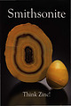
| Smithsonite slice and egg, 5.8 and 2.7 cm tall Masua Mine, Carbonia-lglesias, Sardinia, Italy Cal and Kerith...Smithsonite, 9.2 cm wide 400 Foot Level, Kelly Mine, Magdalena District Socorro County, New Mexico Steve Neely...photos are by Jeff Scovil. No. 13: Smithsonite Think Zinc! ISBN 978-0-9790998-6-1 Publisher Lithographie...ch· ualwa, Mexico La Plante photo n� sp ct, Attica, Greece ion; Scovil photo ne xi repaired) umeb, Namibia...1867. ·thsonian Smithsonite First Oxide Zone, Tsu Mine, Tsumeb, Nami 10cm tall Brent Lockhart coll Joe |
 | | Book |
| AND MINING AREAS SLICK ROCK DISTRICT GYPSUM VALLEY DISTRICT BULL CANYON DISTRICT URAVAN DISTRICT GATEWAY...GATEWAY DISTRICT (EASTERN GATEWAY AREA) MC ELMO CREEK DRAINAGE AREA LA SAL CREEK AREA PARADOX DISTRICT BEAVER...VALLEY (BIG INDIAN) DISTRICT MOAB DISTRICT GREEN RIVER DISTRICT THOMPSONS DISTRICT INTER-RIVER REGION...REGION DRY VALLEY DISTRICT COTTONWOOD AND BUTLER WASH AREAS MONTEZUMA CANYON DISTRICT SEVEN-MILE CANYON...PLATES Paradox Basin Uranium Districts Uranium Mining Areas Within Districts Paradox Basin Domes and |
 | | Report (issue) |
| Geological Survey Board and the Colorado Metal Mining Fund PAPER 289 Geology and Ore Deposits of...__ _ 1 f _____ _ Page Page 1 2 5 5 5 5 5 6 6 6 7 8 8 9 10 ll 12 13 13 15 16 18 18 18 19 19 19...________ -----_-------------------------Location of mining districts _____ ---- __ ----------- ~~~~~i~~~...mineralization_---_----Mines. and prospects _______ -- --- - - - -- -- -- - - -- -- - --- Tincup mining district ________...features _____ -_- __ Gold Cup mine _______ ---------------------Other mines and prospects __________________ |
 | | Report (issue) |
| Geological Survey and Robert A. McColly U.S. Bureau of Mines STUDIES RELATED TO WILDERNESS Bureau of Land Management...U. S. Geological Survey and the U. S. Bureau of Mines to conduct mineral surveys on certain areas to determine...and geophysical investigations and a survey of mines and prospects indicate that those parts of the Eagle...undiscovered molybdenum resources. However, there has been no recorded production of molybdenum in the region and...materials are abundant and accessible outside the area. No new mineral occurrence was located during this study |
 | | Report (issue) |
| detailed to visit a number of widely separated mining districts in Nevada and northeastern California...days of September were spent in the Yellow Pine district, Nevada's new and largest zinc camp. This report...report is based on a hasty inspection of most of the mines in an area of approximately 384 square miles. The...whose acquaintance with the mines, roads, water holes, and people of the district did much to expedite the...the work. The mining men of the district extended many courtesies. Their open hospitality was much appreciated |
 | | Report (volume) |
| SMITH, Director ' Bulletin 648 NOTES ON SOME MINING DISTRICTS IN EASTERN NEVADA BY JAMES M. HILL....... 39 3 4 CONTENTS. Page. Deposits and mines..............................................................................'.. Gold Butte mining district........................................ Location............... Lincoln mine........................................ Bennett mine.........................gneiss............................. Gold Butte Mining Co................................. New Era group |
 | | Book |
| Record. Inc. Tucson, Arizona All rights reserved. No part of this work may be copied, digitized, reproduced...Mount Malosa, Chilwa alkaline province, Zomba district. "Illite" is the name of a series of incompletely...Springfield show ( 1995: 582). Madawaska [Faraday] mine near Bow Lake, Hastings County. Some of the world's...property of, the old Madawaska uranium mine (called the Faraday mine before 1964). The mineral assemblage...collected molybdenite specimens showing crystals to 6 cm (see this entry for Molybdenite), and in a second |
 | | Report (issue) |
| ...... ·- ......... . J,5 Historical sketch of mining and smelting in New Mexico....... . . . . . . ........... . . , ... -.. . Rio Hondo. (Twining) district . . . . . . . . . . . . . ......................::.:::.::: ::: :::: :: ':::: :: ::::. Red River district. ..................•......... -~ . . ...........·::-; : : :. ::.·.i?:5.•.:...,. .... Black.Copper mine ........ ............. ~ ... .. . .... ·.........._ •• __ • ~. _·_: :: . . __ . _•... __ •Jay Hawk mine ........... ~ ........ .. ........ . .. .. . .. |
 | | Report (issue) |
| If you no longer need thii pnblication write to the Geological Surrey in Washington for an official mailing...the STATE BUREAU OF MINES AND MINERAL RESOURCES OF THE NEW MEXICO SCHOOL OF MINES GEOLOGICAL SURVEY PROFESSIONAL...the STATE BUREAU OF MINES AND MINERAL RESOURCES OF THE NEW MEXICO SCHOOL OF MINES UNITED STATES GOVERNMENT............. Bedding-plane faults of the Eureka district Interpretation of original conditions along the...deposits................ Deposits of the Sylvanite district......................... ' Types of deposits. |
 | | Report (issue) |
| - .. ---- ... - ._-.- ---------- BULLETIN NO.6. '£Hl~ IRON ORES 0]' MINNESOTA, THEIR GEOLOGY...group (2). The impure jaspilitic-hematite-alJd-limonite group .... . (3). The carbonated iron group ....distribution of the crystalline iron ores of Minnesota .. . (6). Comparisons wiLh Michigan and Wisconsin...........for the future ..................... . f 1 2 4 6 7 8 10 11 11 23 24 36 38 47 47 67 71 81 105...METHODS OF EXPLORATION AND MINING, AND DESCRIPTIONS OF THE VARIOUS MINES Early methods of exploration |
 | | Report (issue) |
| GEOLOGY AND ORE DEPOSITS OF THE OCEUR D'ALENE DISTRICT, IDAHO BY RANSO~IE FREDERICK LESLIE AND FRANK...:: :.·.: -l. • ••• • •••• • ••• ...·. .. .. 6.£'!:' .-;_"6··. .0 • ~ • • •.. • ... • : ........: .:: ::.... ..... . . 65 Structural subdivisions of the district. . ................................•.. .. ......-Structure-Continued. Structural subdivisions of the district-Continued. Page. Southeastern area ... _. ___..._________ . _..... __ ._ .... _.... __ 78 History of mining development .. ______ .. ___ . __________ . _______ |
 | | Report (volume) |
| ........... Copper deposits of the White Mesa district, Ariz., by J. M. Hill............ Survey publications...deposits of the Dome district, Idaho, by J. B. Umpleby.... The Yellow Pine mining district, Clark County, Nev...MANGANESE: Preliminary report on the red iron ores of east Tennessee, northeast Alabama, and northwest Georgia...Mont.... ' IV. Sketch map of the Yellow Pine mining district, Clark County, Nev.. V. Map showing relation...transportation routes, and industrial centers in east Tennessee........ VI. Map showing relation of outcrops |
 | | Report (volume) |
| oxides; blue represents rock and soil with little or no iron-oxide content; and white represents snow. Satellite...bibliographical references. Supt. of Docs. no.: I 19.3.2127 1. Mines and mineral resources--Colorado-San Juan...famous mining districts, such as those at Rico and La Plata, but there is no significant mining being...Foley, and Anthony B. Gibbons Exploration and Mining History ............................................................................... . Mining Districts .......................................... |
 | | Journal (issue) |
| Volume Thirty, Number Five Articles The Mex-Tex mine, Bingham, N ew M exico............................Van Pelt. Long thought to be from the "Sapucaia mine," this speci men and others (representing the first...quartz crystals) actually came from the Berilo Branco mine. See the article beginning on page 361.___________...around.” What should be done? “That’s a question no one really has an answer for,” says Smith. We know...HILE SUPPLY LASTS. We are buying collections and mining memorabilia GET ON OUR MAILING LIST! The M ineralogical |
 | | Report (volume) |
| Kolar Gold-field, being a description of Quartz-Mining and Gold-Recovery as practised in India, by F...F. H. C.E., F.G.S., Hatch, Ph.D., Assoc. M. Mining Inst. Geological Survey Specialist^ of India...9—22 Structure and gold-contents CHAPTER III. Mining Practice. Development and stoping 23 Pumping...Ventilation 28 28 Illumination Development and mining costs .28 . CHAPTER IV. Surface Equipment...stores 56 57 • . . 57 . 60 — Labour 3. Mine Economics, and supplies — (a) VI. (a) European |
 | | Report (volume) |
| GEORGE OTIS SMITH, DIRECTOR BULLETIN 594 SOME MINING DISTRICTS IN NORTHEASTERN CALIFORNIA AND NORTHWESTERN...GEORGE OTIS SMITH, DIRECTOR BULLETIN 594 SOME MINING DISTRICTS IN NORTHEASTERN CALIFORNIA AND NORTHWESTERN...Summary of occurrences of the ore deposits 2 27 30 Mining districts 2 Hayden Hill, Lassen County, Cal 2 30...36 Character of vein filling 3 42 CONTENTS. Mining districts—Continued. Hayden Hill, Lassen County...shoots Milling High Grade district, Modoc County, Cal Location History of mining Accessibilty Previous descriptions |
 | | Report (issue) |
| • ' > • • • • - •• • • lNSTtTUTE -OJ: 6-E!ltQ!'.1'.': ~i_ • • • ~- ' ' f. ' " 1L1bi·ar:...due to the war in the~ publications relating to mining a.nd me-t ·a llurgical sta.t istics. Labour, health...and Hungary Czechoslovakia France •• • Germany Greece ••• .... Italy ••• •• • •• • I ••• • t...sodium. 1\.lkalis a,nd alkaJine carbonn,tes have no action on silver, even whe.n the met.a l is melted...itP, or·es. 1 1 • 1 1 1 1 1 39734 A 3 6 Silver alloys with most othe1· n1e.t als, but only |
 | | Report (issue) |
| PINE CREEK DISTRICT, IDAHO. By EDWARD L. JONES, Jr. INTRODUCTION. The Pine Creek district, Idaho, lies...lies immediately west and south of the Wardner district of the Coeur d'Alene region. Only a small part...Calkins 1 in 1904. At that time the Pine Creek district had been only slightly developed, but under the...relations of the northeastern part of the area are shown, no attempt being made to indicate the complicated fault...& Sullivan and adjacent mines. TOPOGRAPHY. Drainage. The Pine Creek district lies mostly in the drainago |
 | | Report (issue) |
| the Mo_jave Desert, includz"ng mountain ranges 6,ooo-7,000 feet in altitude UNITED STATES GOVERNMENT...ground water_____ ______________ Depth to water in mines _____________________ Geology___ _____________ _______________...________ Mineralogy of the contact zone at the Dewey mine by Jewell J. Glass ________________ Description...Black Mountain area___ __ _______ ____ 75 Hills east of Erie_ _ _ _ _ _ _ _ _ _ __ _ _ _ __ __ 77 McCullough..._____________ 81 Hills east of Hackberry Mountain ____ 82 Hackberry Mountain and hills east of Providence Mountains_ |
 | | Report (issue) |
| CHARLES D. WALCOTT, DIRECTOR GEOLOGY ASPEN MINING DISTRICT, COLORADO WITH ATLAS JOSIAH EDWARD SFURR ...structure 130 131 Description of sections Aspen district 127 128 Faulting Resume 120 125 Description...structure in the Aspen district 137 CHAPTER III. 143 Description of mines and productive localities...Aspen Mountain mining map West Aspen Mountain Tourtelotte Park Tonrtelotte Park mining map. Smuggler Mountain...Mountain Mollie Gibson mine ... Smuggler mine Summary of Mollie Gibson and Smuggler geology.. Cowenhoven |
 | | Report (issue) |
| .., 00 Professional Paper No. 38 . A, Economic Geology, 47 Series < ^ . (B, Descriptive Gwlogy, 59 ...DIRECTOR ECONOMIC GEOLOGY OF THE BINGHAM MINING DISTRICT, UTAH By JOHN MASON BODTWELL WITH A SECTION...GOVERNMENT PRINTING 1905 OFFIOB Professional Paper No. 38 I A, Economic Geology, 4? Series 4 . (B, Descriptors...DIRECTOR ECONOMIC GEOLOGY OF THE BINGHAM MINING ^DISTRICT, UTAH By JOHN MASON BOUTWELL WITH A SECTION...... 25 PART I. AREAL GEOLOGY OF THE BINGHAM DISTRICT, BY ARTHUR KEITH. Geography...............--. |
 | | Book |
| A substantial proportion of the output of the mines, quarries, raw state or in the form of manufactures...are not likely to underestimate the role of the mine and of the miner in the modern industrial world...investment of hundreds of millions of dollars in mining ventures. Yet the close relationship between mineral...thought about outside of those sections in which mining is the sole source of income. The serious-minded...Chile is vitally concerned in the well-being of the mines that directly or indirectly furnish his sustenance |
 | | Report (issue) |
| pegmatite mining inN ew England _______ _ Mica mining ______________________________ _ Feldspar mining ___...___________________________ _ Mining methods ___________________________ _ Geologic setting of the deposits...of Connecticut ___ _ Geology of the Middletown district ___________ _ Rock units ____________________________...structural analysis of mica deposits to prospecting and mining _______________________ _ Recognition of the type...known deposits ______________ _ Descriptions of mines and prospects __________________ _ Maine ______ |
 | | Report (issue) |
| Majesty the Queen in Right of Canada, 2000 Catalogue No. M41-8-57E ISBN 0-660-17726-9 Available in Canada...Castle-Trethewey mine, Gowganda. The specimen measures 9 cm by 5 cm. National Mineral Collection specimen no. 45683...Pond mine, Timmins. The specimen measures 6 cm across. National Mineral Collection specimen no. 66493... Frontispiece. The original Hollinger (Timmins) mine, 1910, before it was destroyed by fire in 1911....Northland mine Net Lake (Barton) mine Cedar Lake (Trebor, Cuniptau) mine Little Dan mine Sherman mine Temagami |
 | | Report (issue) |
| Mexico Bureau of Mines & Mineral Resources A DIVISION OF NEW MEXICO INSTITUTE OF MINING & TECHNOLOGY Mineral...Affairs In cooperation with: New Mexico Bureau of Mines and Mineral Resources New Mexico Oil Conservation...Engineer U.S. Bureau of Mines SOCORRO1977 NEW MEXICO INSTITUTE OF MINING & TECHNOLOGY Cibutus R. HOLMES.... Director, &M.—Pub. Other ROBERT W. EVEI.ETH, Mining Engineer K. BABF.TTE FARIS. X-ray Lab Manager ROUSSEAU...RENAULT, Senior Geologist JAMES NI. ROBERTSON. Mining Geologist GuE . rritEN H. ROYBAL, Coal Geologist |


Mine No. 6, Agrileza mines, Lophos, Lavrion Mining District, Lavreotiki, East Attica, Attica, Greece