| Locality | Latitude | Longitude | Distance | Bearing |
|---|
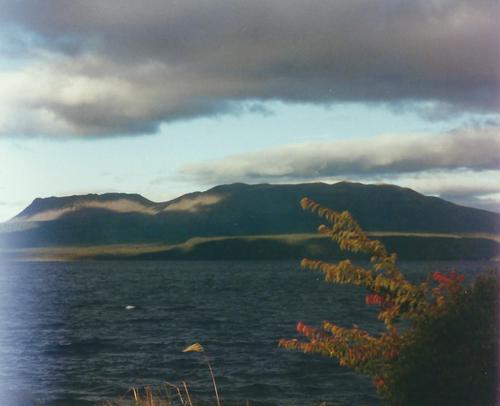
| Mount Tarawera, Okataina, Rotorua District, Bay of Plenty Region, New Zealand | 38° 13' 23" S | 176° 30' 24" E | 0.0km (0.0 miles) | |
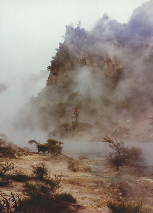
| Waimangu Valley, Rotorua District, Bay of Plenty Region, New Zealand | 38° 17' 6" S | 176° 23' 22" E | 12.3km (7.7 miles) | |
| Rainbow Mountain Thermal Area, Waiotapu (Wai-O-Tapu), Rotorua District, Bay of Plenty Region, New Zealand | 38° 19' 9" S | 176° 22' 42" E | 15.5km (9.6 miles) | |
| Okataina, Rotorua District, Bay of Plenty Region, New Zealand | 38° 5' 51" S | 176° 25' 28" E | 15.7km (9.7 miles) | |
| Tikitapu Nature Walk, Rotorua District, Bay of Plenty Region, New Zealand | 38° 11' 0" S | 176° 19' 51" E | 16.0km (9.9 miles) | |
| Waiotapu (Wai-O-Tapu), Rotorua District, Bay of Plenty Region, New Zealand | 38° 21' 33" S | 176° 22' 10" E | 19.3km (12.0 miles) | |
| Tikitere Hot Springs, Rotorua District, Bay of Plenty Region, New Zealand | 38° 3' 32" S | 176° 21' 37" E | 22.3km (13.8 miles) | |
| Te Puia (Whakarewarewa), Rotorua District, Bay of Plenty Region, New Zealand | 38° 9' 47" S | 176° 15' 14" E | 23.1km (14.3 miles) | |
| Kawerau Geothermal field, Kawerau District, Bay of Plenty Region, New Zealand | 38° 3' 32" S | 176° 43' 15" E | 26.2km (16.3 miles) | |
| Haparangi, Rotorua District, Bay of Plenty Region, New Zealand | 38° 13' 41" S | 176° 12' 0" E | 26.8km (16.6 miles) | |
| Mount Ngongotaha, Rotorua District, Bay of Plenty Region, New Zealand | 38° 7' 5" S | 176° 11' 52" E | 29.4km (18.3 miles) | |
| Hendersons Quarry, Mount Ngongotaha, Rotorua District, Bay of Plenty Region, New Zealand | 38° 5' 47" S | 176° 12' 33" E | 29.6km (18.4 miles) | |
| Te Kopia geothermal area, Rotorua District, Bay of Plenty Region, New Zealand | 38° 23' 59" S | 176° 13' 0" E | 32.1km (19.9 miles) | |
| Broadlands (Ohaaki), Taupo District, Waikato Region, New Zealand | 38° 30' 43" S | 176° 19' 55" E | 36.4km (22.6 miles) | |
| Ruatapu Cave (Alum Cave), Orakeikorako Thermal Area (Orakei Korako; The Hidden Valley), Taupo District, Waikato Region, New Zealand | 38° 28' 32" S | 176° 9' 3" E | 41.8km (26.0 miles) | |
| Ohakuri prospect, Taupo District, Waikato Region, New Zealand | 38° 24' 29" S | 176° 5' 15" E | 42.0km (26.1 miles) | |
| Orakeikorako Thermal Area (Orakei Korako; The Hidden Valley), Taupo District, Waikato Region, New Zealand | 38° 28' 24" S | 176° 8' 47" E | 42.0km (26.1 miles) | |
| Ohakuri East prospect, Taupo District, Waikato Region, New Zealand | 38° 24' 38" S | 176° 4' 59" E | 42.4km (26.4 miles) | |
| Ngatamariki thermal area (Pavlova Spring), Wairakei, Taupo District, Waikato Region, New Zealand | 38° 31' 54" S | 176° 10' 24" E | 45.0km (27.9 miles) | |
| Atiamuri, Taupo District, Waikato Region, New Zealand | 38° 23' 43" S | 176° 1' 49" E | 45.8km (28.4 miles) | |
| Ongaroto Road, Atiamuri, Taupo District, Waikato Region, New Zealand | 38° 23' 45" S | 176° 0' 24" E | 47.7km (29.6 miles) | |
| Te Puke Goldfield, Western Bay of Plenty District, Bay of Plenty Region, New Zealand | 37° 49' 42" S | 176° 15' 17" E | 49.1km (30.5 miles) | |
| Flemings Freehold Mine (Te Puke Reefs; Masseys Reef), Te Puke Goldfield, Western Bay of Plenty District, Bay of Plenty Region, New Zealand | 37° 49' 40" S | 176° 15' 17" E | 49.2km (30.6 miles) | |
| Muirs Reef, Te Puke Goldfield, Western Bay of Plenty District, Bay of Plenty Region, New Zealand | 37° 49' 29" S | 176° 15' 24" E | 49.4km (30.7 miles) | |
| Waikato River, Taupo District, Waikato Region, New Zealand | 38° 36' 49" S | 176° 10' 17" E | 52.3km (32.5 miles) | |
| Lake Rotokawa, Wairakei, Taupo District, Waikato Region, New Zealand | 38° 37' 28" S | 176° 11' 30" E | 52.4km (32.6 miles) | |
| Wairakei, Taupo District, Waikato Region, New Zealand | 38° 37' 8" S | 176° 6' 14" E | 56.3km (35.0 miles) | |
| Tauhara geothermal field, Taupo District, Waikato Region, New Zealand | 38° 40' 5" S | 176° 9' 3" E | 58.4km (36.3 miles) | |
| Wairakei geothermal area (Craters of the Moon), Wairakei, Taupo District, Waikato Region, New Zealand | 38° 38' 36" S | 176° 4' 8" E | 60.3km (37.5 miles) | |
| Roadcut Section, Poihipi Road, Taupo District, Waikato Region, New Zealand | 38° 35' 8" S | 175° 57' 12" E | 62.8km (39.1 miles) | |
Minerals recorded nearby (within 20 km)
Rock types recorded nearby (within 20 km)
Entries shown in red are rocks recorded for this region.


Mount Tarawera, Okataina, Rotorua District, Bay of Plenty Region, New Zealand