| Locality type: | Mine |
| Classification |
|---|
|
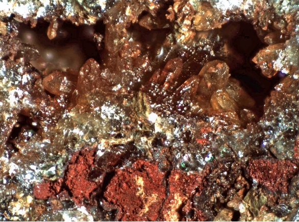
| Species: | Quartz |
| Formula: | SiO2 |
| Confirmation |
|---|
|
| Validity: | Confirmed |
| Confirmation Methods: | Visually Identified |
| Associated Minerals Based on Photo Data: |
|---|
|
| Hematite | ⓘ6 photos of Quartz associated with Hematite at this locality. |
| Chalcopyrite | ⓘ1 photo of Quartz associated with Chalcopyrite at this locality. |
| Gold | ⓘ1 photo of Quartz associated with Gold at this locality. |
| Kaolinite | ⓘ1 photo of Quartz associated with Kaolinite at this locality. |
| Muscovite | ⓘ1 photo of Quartz associated with Muscovite at this locality. |
| Malachite | ⓘ1 photo of Quartz associated with Malachite at this locality. |
| Sericite | ⓘ1 photo of Quartz associated with Sericite at this locality. |
| Data |
|---|
|
| Mineral Data: | Click here to view Quartz data |
| Locality Data: | Click here to view Golden Wonder Mine (Eighty-Five claim; 85 Mine), Oxbow Estates, Payson Mining District (Green Valley Mining District), Mazatzal Mountains, Gila County, Arizona, USA |
| Data Identifiers |
|---|
|
| Mindat Occurrence Record ID: | 1244362 |
| Long-form Identifier: | 1:3:1244362:4 |
| GUID (UUID V4): | e1c8752e-6e3d-4d7c-b8c3-40b4eaca7d13 |
| Nearest other occurrences of Quartz |
|---|
|
|
| 0.2km (0.1 miles) | ⓘUnnamed Agate occurrence (1), Payson, Payson Mining District (Green Valley Mining District), Mazatzal Mountains, Gila County, Arizona, USA |
| 4.7km (2.9 miles) | ⓘPayson, Payson Mining District (Green Valley Mining District), Mazatzal Mountains, Gila County, Arizona, USA |
| 4.9km (3.0 miles) | ⓘOxbow Mine (Oxbow claim; Golden Wreath claim; Golden Wreath Mine; Osborn prospect), Oxbow Gulch, Moore Mountain area, Oxbow Estates, Payson Mining District (Green Valley Mining District), Mazatzal Mountains, Gila County, Arizona, USA |
| 11.4km (7.1 miles) | ⓘBeauty 1-7 claims, Gibson Peak area, Payson Mining District (Green Valley Mining District), Mazatzal Mountains, Gila County, Arizona, USA |
| 14.0km (8.7 miles) | ⓘUnnamed Chalcedony occurrence (1), Payson, Payson Mining District (Green Valley Mining District), Mazatzal Mountains, Gila County, Arizona, USA |
| 18.3km (11.4 miles) | ⓘDiamond Point (Diamond Rim), Tonto Village, Gila County, Arizona, USA |
| 26.8km (16.6 miles) | ⓘKohl’s Ranch fossil locality, Gila County, Arizona, USA |
| 28.4km (17.6 miles) | ⓘMaricopa Mine, Sunflower Mining District (Mazatzal Mountains Mining District; Quicksilver Mining District), Maricopa County, Arizona, USA |
| 29.6km (18.4 miles) | ⓘJones Beryllium prospect, Mailbox Mesa, Young area, Spring Creek Mining District, Gila County, Arizona, USA |
| 30.4km (18.9 miles) | ⓘStory Mine (Tri-Metals Mine; Saddle Mountain Mine), Lion Mountain, Maricopa County, Arizona, USA |
| References |
|---|
|
|


Golden Wonder Mine, Oxbow Estates, Payson Mining District, Mazatzal Mountains, Gila County, Arizona, USA