| Classification |
|---|
|
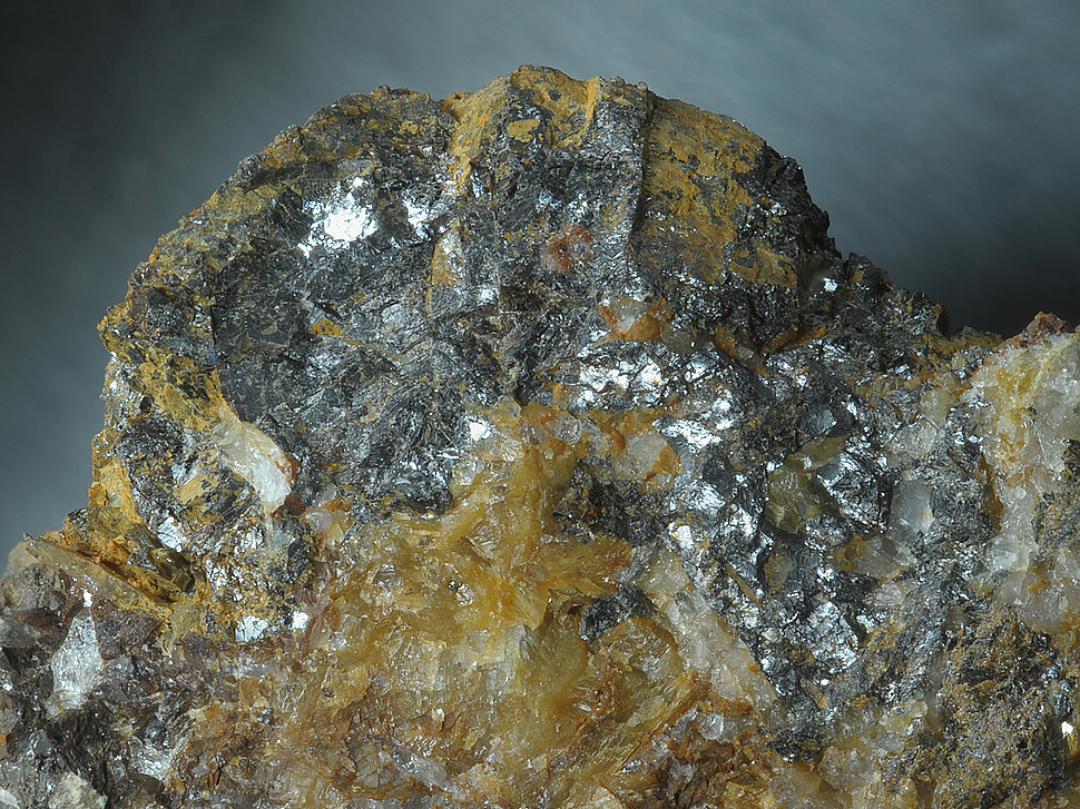
| Species: | Sphalerite |
| Formula: | ZnS |
| Confirmation |
|---|
|
| Validity: | Believed Valid |
| Associated Minerals Based on Photo Data: |
|---|
|
| Linarite | ⓘ1 photo of Sphalerite associated with Linarite at this locality. |
| Carbonatecyanotrichite | ⓘ1 photo of Sphalerite associated with Carbonatecyanotrichite at this locality. |
| Siderite | ⓘ1 photo of Sphalerite associated with Siderite at this locality. |
| Data |
|---|
|
| Mineral Data: | Click here to view Sphalerite data |
| Locality Data: | Click here to view Strabaleben (Strabeleben), Wurten, Flattach, Spittal an der Drau District, Carinthia, Austria |
| Data Identifiers |
|---|
|
| Mindat Occurrence Record ID: | 703566 |
| Long-form Identifier: | 1:3:703566:1 |
| GUID (UUID V4): | 80aeaea5-0f4b-4ea5-b482-0d0d9cf2052a |
| Nearest other occurrences of Sphalerite |
|---|
|
|
| 0.9km (0.6 miles) | ⓘStübele, Wurten, Flattach, Spittal an der Drau District, Carinthia, Austria |
| 2.0km (1.3 miles) | ⓘGold Mines, Alteck, Wurten, Flattach, Spittal an der Drau District, Carinthia, Austria |
| 2.8km (1.7 miles) | ⓘRauriser Goldberg, Kolm-Saigurn, Alteck - Hoher Sonnblick area, Rauris, Zell am See District, Salzburg, Austria |
| 2.8km (1.7 miles) | ⓘTorleiten (incl. Feldseescharte), Wurten, Flattach, Spittal an der Drau District, Carinthia, Austria |
| 3.9km (2.4 miles) | ⓘProspect above Augustin adit, Rauriser Goldberg, Kolm-Saigurn, Alteck - Hoher Sonnblick area, Rauris, Zell am See District, Salzburg, Austria |
| 4.2km (2.6 miles) | ⓘModereck south slope (Freudental; Kempen), Große Zirknitz valley, Zirknitz, Großkirchheim, Spittal an der Drau District, Carinthia, Austria |
| 4.2km (2.6 miles) | ⓘTrömmern, Große Zirknitz valley, Zirknitz, Großkirchheim, Spittal an der Drau District, Carinthia, Austria |
| 4.5km (2.8 miles) | ⓘBockhart adit, Siglitz - Bockhart gold mining district, Bad Gastein, St. Johann im Pongau District, Salzburg, Austria |
| 4.6km (2.9 miles) | ⓘKELAG water tunnel, Großkirchheim, Spittal an der Drau District, Carinthia, Austria |
| 4.8km (3.0 miles) | ⓘLeidenfrost, Hoher Sonnblick, Alteck - Hoher Sonnblick area, Rauris, Zell am See District, Salzburg, Austria |
| References |
|---|
|
|


Strabaleben, Wurten, Flattach, Spittal an der Drau District, Carinthia, Austria