| Locality | Latitude | Longitude | Distance | Bearing |
|---|
| Roche de Boeuf Island, Maumee River, Waterville, Lucas County, Ohio, USA | 41° 29' 12" N | 83° 43' 42" W | 8.8km (5.5 miles) | |
| Wood County Stone and Construction Co. Quarry, Portage, Wood County, Ohio, USA | 41° 20' 8" N | 83° 39' 11" W | 9.3km (5.8 miles) | |
| Hanson Aggregates Midwest Inc. Waterville Quarry, Waterville, Lucas County, Ohio, USA | 41° 29' 30" N | 83° 43' 55" W | 9.5km (5.9 miles) | |
| Granger Island, Maumee River, Waterville, Lucas County, Ohio, USA | 41° 29' 42" N | 83° 42' 49" W | 9.6km (6.0 miles) | |
| Portage, Wood County, Ohio, USA | 41° 19' 36" N | 83° 39' 2" W | 10.2km (6.4 miles) | |
| Waterville, Lucas County, Ohio, USA | 41° 30' 3" N | 83° 43' 5" W | 10.3km (6.4 miles) | |
| Stoneco Portage Quarry, Portage, Wood County, Ohio, USA | 41° 19' 10" N | 83° 38' 53" W | 11.0km (6.9 miles) | |
| Precision Aggregate Company Quarry, Portage, Wood County, Ohio, USA | 41° 18' 47" N | 83° 38' 35" W | 11.9km (7.4 miles) | |
| Whitehouse Quarry, Whitehouse, Lucas County, Ohio, USA | 41° 30' 48" N | 83° 47' 58" W | 14.0km (8.7 miles) | |
| Whitehouse, Lucas County, Ohio, USA | 41° 31' 8" N | 83° 48' 14" W | 14.7km (9.1 miles) | |
| Monclova, Lucas County, Ohio, USA | 41° 33' 31" N | 83° 43' 58" W | 16.8km (10.4 miles) | |
| Pugh Quarry, Weston, Wood County, Ohio, USA | 41° 19' 49" N | 83° 52' 50" W | 17.0km (10.6 miles) | |
| Maumee, Lucas County, Ohio, USA | 41° 33' 46" N | 83° 39' 13" W | 17.6km (11.0 miles) | |
| Custar, Wood County, Ohio, USA | 41° 17' 5" N | 83° 50' 39" W | 18.0km (11.2 miles) | |
| Stoneco Lime City Quarry, Lime City, Wood County, Ohio, USA | 41° 32' 7" N | 83° 33' 51" W | 18.3km (11.4 miles) | |
| Stoneco Maumee Quarry, Maumee, Lucas County, Ohio, USA | 41° 34' 30" N | 83° 40' 26" W | 18.7km (11.6 miles) | |
| Old France Stone Co. quarry, Luckey, Troy Township, Wood County, Ohio, USA | 41° 27' 16" N | 83° 29' 21" W | 18.7km (11.6 miles) | |
| Cardinal Aggregates Quarry, Lime City, Wood County, Ohio, USA | 41° 31' 51" N | 83° 32' 59" W | 18.8km (11.7 miles) | |
| Luckey, Troy Township, Wood County, Ohio, USA | 41° 27' 2" N | 83° 29' 14" W | 18.8km (11.7 miles) | |
| Charles H. Sawyer Quarry, Lime City, Wood County, Ohio, USA | 41° 32' 36" N | 83° 33' 53" W | 19.0km (11.8 miles) | |
| France Stone Co. quarry, North Baltimore, Wood County, Ohio, USA | 41° 11' 25" N | 83° 41' 10" W | 24.4km (15.1 miles) | |
| North Baltimore, Wood County, Ohio, USA | 41° 10' 58" N | 83° 40' 41" W | 25.3km (15.7 miles) | |
| West Millgrove, Wood County, Ohio, USA | 41° 14' 38" N | 83° 29' 28" W | 25.6km (15.9 miles) | |
| MacRitchie Materials Inc. Quarry, West Millgrove, Wood County, Ohio, USA | 41° 14' 32" N | 83° 28' 57" W | 26.2km (16.3 miles) | |
| Woodville, Sandusky County, Ohio, USA | 41° 27' 3" N | 83° 21' 56" W | 28.7km (17.8 miles) | |
| Martin Marietta Aggregates Quarry, Woodville, Sandusky County, Ohio, USA | 41° 27' 48" N | 83° 21' 29" W | 29.6km (18.4 miles) | |
| Area Aggregates Inc. Quarry, Woodville, Sandusky County, Ohio, USA | 41° 25' 44" N | 83° 21' 1" W | 29.7km (18.5 miles) | |
| Silica, Sylvania Township, Lucas County, Ohio, USA | 41° 40' 53" N | 83° 44' 31" W | 30.4km (18.9 miles) | |
| Nelson Purtee Construction Co. Quarry, Genoa, Clay Township, Ottawa County, Ohio, USA | 41° 30' 30" N | 83° 21' 51" W | 30.5km (19.0 miles) | |
| Toledo Stone and Glass Sand Quarry, Silica, Sylvania Township, Lucas County, Ohio, USA | 41° 41' 9" N | 83° 44' 21" W | 30.9km (19.2 miles) | |
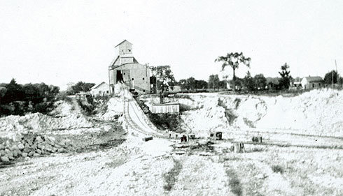


Wood County Stone and Construction Co. Quarry, Portage, Wood County, Ohio, USA