| Locality | Latitude | Longitude | Distance | Bearing |
|---|
| Mt Ida, Montgomery County, Arkansas, USA | 34° 33' 24" N | 93° 38' 2" W | 0.0km (0.0 miles) | |
| Monroe-Robbins Mine, Mt Ida, Montgomery County, Arkansas, USA | 34° 32' 42" N | 93° 37' 6" W | 1.9km (1.2 miles) | |
| Lebow Copper Deposit, Montgomery County, Arkansas, USA | 34° 33' 26" N | 93° 40' 41" W | 4.0km (2.5 miles) | |
| Wegner Quartz Crystal Mines, Mt Ida, Montgomery County, Arkansas, USA | 34° 31' 12" N | 93° 39' 8" W | 4.4km (2.7 miles) | |
| Montgomery County Quarry, Mauldin Mountain Quarries, Mauldin Mountain, Montgomery County, Arkansas, USA | 34° 35' 48" N | 93° 39' 11" W | 4.8km (3.0 miles) | |
| Avatar Crystal Mine, Mt Ida, Montgomery County, Arkansas, USA | 34° 30' 2" N | 93° 37' 27" W | 6.3km (3.9 miles) | |
| Mount Ida Mountain Mine, Mt Ida, Montgomery County, Arkansas, USA | 34° 29' 44" N | 93° 38' 30" W | 6.8km (4.2 miles) | |
| Forgotten Aye Mine, Montgomery County, Arkansas, USA | 34° 30' 0" N | 93° 35' 54" W | 7.1km (4.4 miles) | |
| Diamond Drill Carbon Co. No. 3 prospect, Mt Ida, Montgomery County, Arkansas, USA | 34° 37' 0" N | 93° 36' 24" W | 7.1km (4.4 miles) | |
| Mauldin Mountain Quarries, Mauldin Mountain, Montgomery County, Arkansas, USA | 34° 35' 43" N | 93° 41' 53" W | 7.3km (4.5 miles) | |
| Burch Lode Mine, Montgomery County, Arkansas, USA | 34° 30' 18" N | 93° 35' 6" W | 7.3km (4.5 miles) | |
| Mauldin Mountain, Montgomery County, Arkansas, USA | 34° 35' 43" N | 93° 41' 54" W | 7.3km (4.5 miles) | |
| Ocus Stanley's Mine, Fisher Mountain, Mt Ida, Montgomery County, Arkansas, USA | 34° 30' 13" N | 93° 33' 42" W | 8.9km (5.5 miles) | |
| Fisher Mountain, Mt Ida, Montgomery County, Arkansas, USA | 34° 30' 13" N | 93° 33' 36" W | 9.0km (5.6 miles) | |
| Crystal Pyramid Mine (Drain Mine), Montgomery County, Arkansas, USA | 34° 30' 0" N | 93° 33' 48" W | 9.0km (5.6 miles) | |
| High Peak, Norman, Montgomery County, Arkansas, USA | 34° 28' 22" N | 93° 36' 15" W | 9.7km (6.0 miles) | |
| High Peak Quartz Mine, High Peak, Norman, Montgomery County, Arkansas, USA | 34° 28' 22" N | 93° 36' 15" W | 9.7km (6.0 miles) | |
| Hoyt-Williams Prospect, Montgomery County, Arkansas, USA | 34° 33' 53" N | 93° 44' 45" W | 10.3km (6.4 miles) | |
| Magic Presance Mine, Montgomery County, Arkansas, USA | 34° 35' 42" N | 93° 44' 18" W | 10.5km (6.5 miles) | |
| Hog Jaw Mine, Hog Jaw, Montgomery County, Arkansas, USA | 34° 34' 59" N | 93° 45' 0" W | 11.0km (6.8 miles) | |
| Collier Creek Mine, Mt Ida, Montgomery County, Arkansas, USA | 34° 27' 56" N | 93° 34' 55" W | 11.2km (7.0 miles) | |
| Silver, Montgomery County, Arkansas, USA | 34° 32' 4" N | 93° 30' 36" W | 11.6km (7.2 miles) | |
| Rubicon Mine, Silver, Montgomery County, Arkansas, USA | 34° 31' 59" N | 93° 30' 29" W | 11.8km (7.3 miles) | |
| Eureka Mine, Silver, Montgomery County, Arkansas, USA | 34° 31' 59" N | 93° 30' 29" W | 11.8km (7.3 miles) | |
| Zarelda Mine, Silver, Montgomery County, Arkansas, USA | 34° 31' 59" N | 93° 30' 29" W | 11.8km (7.3 miles) | |
| Montezuma Mine, Silver, Montgomery County, Arkansas, USA | 34° 31' 59" N | 93° 30' 29" W | 11.8km (7.3 miles) | |
| Montrose Mine, Silver, Montgomery County, Arkansas, USA | 34° 31' 59" N | 93° 30' 29" W | 11.8km (7.3 miles) | |
| Norman, Montgomery County, Arkansas, USA | 34° 27' 18" N | 93° 40' 48" W | 12.1km (7.5 miles) | |
| Hog Jaw, Montgomery County, Arkansas, USA | 34° 35' 57" N | 93° 45' 24" W | 12.2km (7.6 miles) | |
| Mcgrew Mine, Montgomery County, Arkansas, USA | 34° 33' 6" N | 93° 46' 12" W | 12.5km (7.8 miles) | |
Minerals recorded nearby (within 12.5 km)
Rock types recorded nearby (within 12.5 km)
Entries shown in red are rocks recorded for this region.


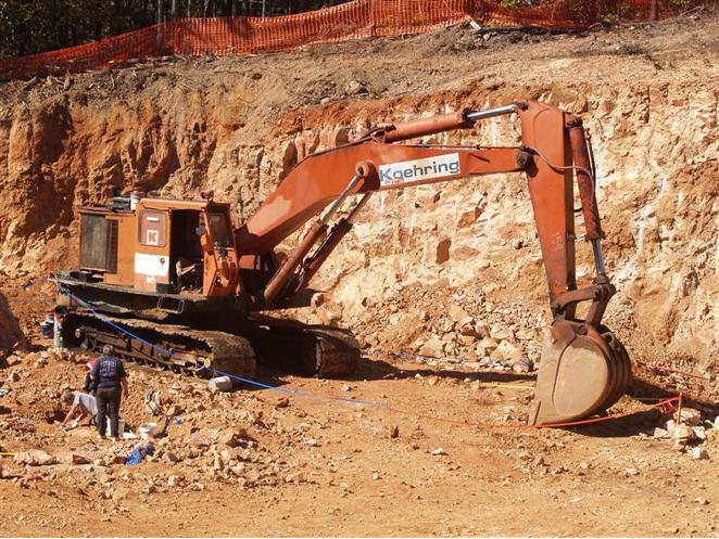


Wegner Quartz Crystal Mines, Mt Ida, Montgomery County, Arkansas, USA