| Locality type: | Mine |
| Classification |
|---|
|
| Species: | Quartz |
| Formula: | SiO2 |
| Confirmation |
|---|
|
| Validity: | Believed Valid |
| Data |
|---|
|
| Mineral Data: | Click here to view Quartz data |
| Locality Data: | Click here to view Spar Pocket Mine, Sempe Mine (Sempa mine; Senpa mine; Senpe mine), Hiriart Mountain (Hariat Mtn; Harriot Mtn; Heriart Mtn; Heriot Mtn; Hiriat Hill), Pala, Pala Mining District, San Diego County, California, USA |
| Data Identifiers |
|---|
|
| Mindat Occurrence Record ID: | 685333 |
| Long-form Identifier: | 1:3:685333:4 |
| GUID (UUID V4): | 45e01925-b806-478d-b46c-a701e991db6b |
| Nearest other occurrences of Quartz |
|---|
|
|
| 0.1km (0.1 miles) | ⓘSan Pedro Mine (Pedro mine), Hiriart Mountain (Hariat Mtn; Harriot Mtn; Heriart Mtn; Heriot Mtn; Hiriat Hill), Pala, Pala Mining District, San Diego County, California, USA |
| 0.2km (0.1 miles) | ⓘWhite Queen Mine (Queen mine; White Queen prospect), Hiriart Mountain (Hariat Mtn; Harriot Mtn; Heriart Mtn; Heriot Mtn; Hiriat Hill), Pala, Pala Mining District, San Diego County, California, USA |
| 0.2km (0.1 miles) | ⓘSempe Mine (Sempa mine; Senpa mine; Senpe mine), Hiriart Mountain (Hariat Mtn; Harriot Mtn; Heriart Mtn; Heriot Mtn; Hiriat Hill), Pala, Pala Mining District, San Diego County, California, USA |
| 0.3km (0.2 miles) | ⓘVanderberg Mine (MS 5391; Naylor Rock; Naylor-Vanderburg mine; Sickler group; Vandenburg mine; Vanderburg mine), Hiriart Mountain (Hariat Mtn; Harriot Mtn; Heriart Mtn; Heriot Mtn; Hiriat Hill), Pala, Pala Mining District, San Diego County, California, USA |
| 0.4km (0.2 miles) | ⓘAnita Mine (MS 6859), Hiriart Mountain (Hariat Mtn; Harriot Mtn; Heriart Mtn; Heriot Mtn; Hiriat Hill), Pala, Pala Mining District, San Diego County, California, USA |
| 0.5km (0.3 miles) | ⓘCenter Drive prospect, Hiriart Mine (MS 5391), Hiriart Mountain (Hariat Mtn; Harriot Mtn; Heriart Mtn; Heriot Mtn; Hiriat Hill), Pala, Pala Mining District, San Diego County, California, USA |
| 0.6km (0.4 miles) | ⓘK. C. Naylor Mine (MS 5391; Naylor mine), Hiriart Mountain (Hariat Mtn; Harriot Mtn; Heriart Mtn; Heriot Mtn; Hiriat Hill), Pala, Pala Mining District, San Diego County, California, USA |
| 0.7km (0.4 miles) | ⓘKaterina Mine (Ashley mine; Caterina mine; Catherin mine; Catherina mine; Katrina mine), Hiriart Mountain (Hariat Mtn; Harriot Mtn; Heriart Mtn; Heriot Mtn; Hiriat Hill), Pala, Pala Mining District, San Diego County, California, USA |
| 0.7km (0.4 miles) | ⓘHiriart Mine (MS 5391), Hiriart Mountain (Hariat Mtn; Harriot Mtn; Heriart Mtn; Heriot Mtn; Hiriat Hill), Pala, Pala Mining District, San Diego County, California, USA |
| 0.8km (0.5 miles) | ⓘFargo Mine (MS 5391), Hiriart Mountain (Hariat Mtn; Harriot Mtn; Heriart Mtn; Heriot Mtn; Hiriat Hill), Pala, Pala Mining District, San Diego County, California, USA |
| References |
|---|
|
|
| Reference Search (possible matching items) |
|---|
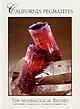 | | Journal (issue) | | Cooper Nottingham, England Anthony R. Kampf L.A. County Mus. of Nat. Hist. Los Angeles, CA Joseph A. Mandarino...Articles Gem and rare-element pegmatites of southern California . . . . . . . . . . . . . . . . . . . . . . ... History of the Tourmaline Queen mine, San Diego County, California . . . . . . . . . . . . . . . . ...year. *Continued on p. 455 COVER: ELBAITE on quartz, 20 cm, one of the famous “blue cap” tourmalines...discovered at the Tourmaline Queen mine, San Diego County, California, by Ed Swoboda and Bill Larson. The | 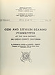 | | Report (issue) | | STATE OF CALIFORNIA EARL WARREN. Governor DEPARTMENT OF NATURAL RESOURCES WARREN T. HANNUM, Director...Director DIVISION OF MINES FERRY BUILDING. SAN FRANCISCO OLAF P. 11 JENKINS. Chief SPECIAL REPORT 7-A...LITHIUM-BEARING PEGMATITES OF THE PALA DISTRICT, SAN DIEGO COUNTY, CALIFORNIA By RICHARD H. JAHNS and LAUREN...Archive in 2012 with funding from University of California, Davis Libraries http://archive.org/details...LITHIUM-BEARING PEGMATITES OF THE PALA DISTRICT, SAN DIEGO COUNTY, CALIFORNIA! By Richard H. Jahns* and Lauren |  | | Report (issue) | | Archive in 2012 with funding from University of California, Davis Libraries http://www.archive.org/det...MINERAL RESOURCES OF SAN DIEGO COUNTY, CALIFORNIA By F. HAROLD WEBER JR., California Division of Mines...Stewart COUNTY REPORT California Division of Mines Ferry Building, LIBRARY UNIVERSITY OF CALIFORNIA DAVIS...DAVIS San 3 and Geology Francisco, 1963 ^ OF STATE OF CALIFORNIA EDMUND G. BROWN, Governor J?...CAMPBELL, Director AND GEOLOGY State Geologist COUNTY REPORT ^ Price $8.00 3 CONTENTS Page ABSTRACT |  | | Journal (article/letter/editorial) | | GEM-Bearing Granitic Pegmatite-Aplite Dikes, San Diego Co., California Bruce E. Taylor I *, Eugene E. F o o r...Geology, Stanford University, Stanford, California 94305, USA aAbteilung Geochemie, Mineralogisches Institut... granitic pegmatite-aplite dikes in southern California have been known for gem-quality minerals and...with formation of " q u e n c h aplite" in the pocket zone, nearly to 565 ~ C. Subsolidus formation of...(6D .... = - 9 0 to - 1 3 0 ) in the Mesa Grande district crystallized in the presence of, or exchanged |  | | Journal (article/letter/editorial) | | now 90 years old. He described the Aaron's Ledge Mine where he once worked. Following his directions,...long way down the valley but could not find the mine. He told me on return that the trail turns a sharp...stone wall. This mine was op erated by Mr. Lamb and is also known as the Lamb Mine. After operating...found that as sayed one ounce of gold per ton. The mine is located at the foot of the ridge that marks the...of the Mott Mica Mine and is the highest elevation in the town. Went to Joe Hill Mine which is just off |  | | Report (issue) | | discussion of one of the world' s great mining fields its geology', mining historyp, and potential UNITED STATES...p pattern.._____-_-___-_-_-_---____ History of mining ___________________------___ Mineralogy of the...ILLUSTRATIONS [Plates in pocket] PLATE FIGURE 1. 2. 3. 4. Map showing towns and mine workings in the main...sheet. 11. Maps of three levels of the Tulsa-Quapaw mine and diagrammatic sections of the TulsaQuapaw and...bed overlapped by shaly facies of K bed in Kenoyer mine.__________________________________________________________ |
|


