| Locality type: | Mine |
| Classification |
|---|
|
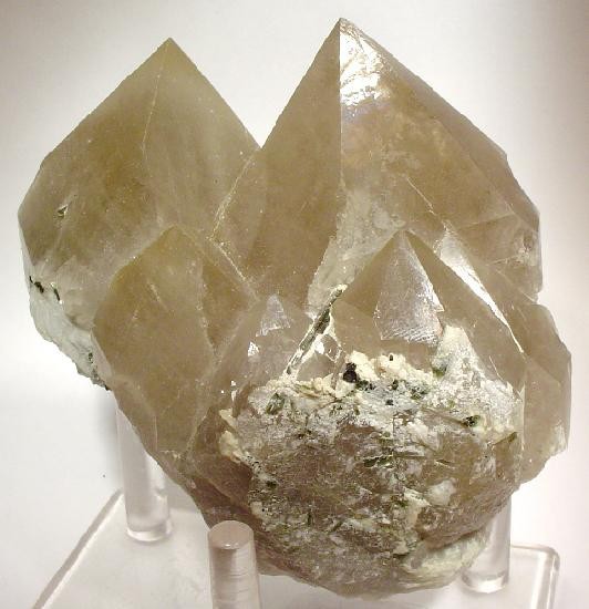
| Species: | Quartz |
| Formula: | SiO2 |
| Confirmation |
|---|
|
| Validity: | Believed Valid |
| Associated Minerals Based on Photo Data: |
|---|
|
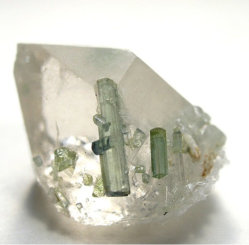
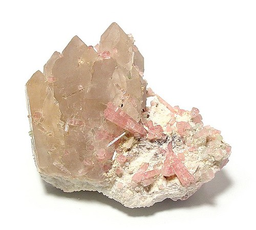
| Albite | ⓘ17 photos of Quartz associated with Albite at this locality. |
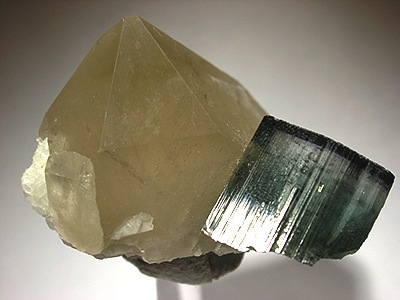
| Elbaite | ⓘ15 photos of Quartz associated with Elbaite at this locality. |
| Cleavelandite | ⓘ15 photos of Quartz associated with Cleavelandite at this locality. |
| Tourmaline | ⓘ9 photos of Quartz associated with Tourmaline at this locality. |
| Lepidolite | ⓘ6 photos of Quartz associated with Lepidolite at this locality. |
| Aquamarine | ⓘ4 photos of Quartz associated with Aquamarine at this locality. |
| Morganite | ⓘ3 photos of Quartz associated with Morganite at this locality. |
| Microcline | ⓘ1 photo of Quartz associated with Microcline at this locality. |
| Pääkkönenite | ⓘ1 photo of Quartz associated with Pääkkönenite at this locality. |
| Stibiotantalite | ⓘ1 photo of Quartz associated with Stibiotantalite at this locality. |
| Data |
|---|
|
| Mineral Data: | Click here to view Quartz data |
| Locality Data: | Click here to view Cryo-Genie Mine (Cryogenie Mine; Cindy B-Cryogenie claim; Lost Valley Truck Trail prospect), Warner Springs, Warner Springs Mining District, San Diego County, California, USA |
| Photo Gallery | View Gallery (10 photos) |
| Data Identifiers |
|---|
|
| Mindat Occurrence Record ID: | 96648 |
| Long-form Identifier: | 1:3:96648:7 |
| GUID (UUID V4): | 1b7cfc78-4533-4a28-81ec-fb7ed2e05d1c |
| Nearest other occurrences of Quartz |
|---|
|
|
| 2.3km (1.4 miles) | ⓘDonna prospects (Donna Lode; LVSEC2 claim; Sunset mine; The Donna Mine claim), Warner Springs, Warner Springs Mining District, San Diego County, California, USA |
| 4.6km (2.8 miles) | ⓘCarmelita Mine (Big Spring mine; Blue Gem claim; Crest Gem mine; Elinor deposit; Elinor mine; Estudillo mine; French Pete mine; MS 6130; Peter Cabat mine), Chihuahua Valley, Warner Springs Mining District, San Diego County, California, USA |
| 6.2km (3.9 miles) | ⓘPearson deposit, Chihuahua Valley, Warner Springs Mining District, San Diego County, California, USA |
| 8.9km (5.5 miles) | ⓘBlue Lady Mine (Blue Tourmaline claim; Blue Bell deposit; Blue Bell mine; Exposition claim; Panama claim; San Diego claim; San Diego group), Chihuahua Valley, Warner Springs Mining District, San Diego County, California, USA |
| 10.2km (6.4 miles) | ⓘUnnamed Tourmaline occurrence, Lost Valley, Warner Springs Mining District, San Diego County, California, USA |
| 10.7km (6.6 miles) | ⓘCarlsbad Mines (Carlsbad deposit; Carlsbad group), Lost Valley, Warner Springs Mining District, San Diego County, California, USA |
| 11.9km (7.4 miles) | ⓘMaple Lode Mine (Maple claim), Aguanga Mountain, Oak Grove, Aguanga Mountain Mining District (Smith Mountain Mining District), San Diego County, California, USA |
| 12.2km (7.6 miles) | ⓘMountain Lily Mine (Emeralite No. 2 claim; Gem Mine No. 1 claim; Ware mine), Aguanga Mountain, Oak Grove, Aguanga Mountain Mining District (Smith Mountain Mining District), San Diego County, California, USA |
| 14.0km (8.7 miles) | ⓘBlue Chihuahua Mine (Blue Dog), Iron Spring Mountain, Cooper Canyon Mining District, Riverside County, California, USA |
| 14.3km (8.9 miles) | ⓘPawnee Mine (Oak Grove Mine; Carr Mine), Beauty Peak, Riverside County, California, USA |
| References |
|---|
|
|


Cryo-Genie Mine, Warner Springs, Warner Springs Mining District, San Diego County, California, USA