| Locality | Latitude | Longitude | Distance | Bearing |
|---|
| North Tankardstown mine, Knockmahon, Bonmahon (Bunmahon), Waterford County, Munster, Ireland | 52° 8' 22" N | 7° 20' 31" W | 6.4km (4.0 miles) | |
| Tankardstown mine (Knockmahon Mine), Knockmahon, Bonmahon (Bunmahon), Waterford County, Munster, Ireland | 52° 8' 21" N | 7° 20' 34" W | 6.5km (4.0 miles) | |
| Bonhiva lode, Knockmahon, Bonmahon (Bunmahon), Waterford County, Munster, Ireland | 52° 8' 17" N | 7° 21' 1" W | 7.0km (4.3 miles) | |
| Stage mine, Knockmahon, Bonmahon (Bunmahon), Waterford County, Munster, Ireland | 52° 8' 17" N | 7° 21' 6" W | 7.1km (4.4 miles) | |
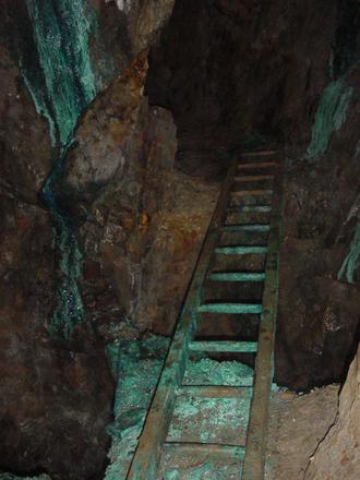
| Knockmahon Mine, Knockmahon, Bonmahon (Bunmahon), Waterford County, Munster, Ireland | 52° 9' 0" N | 7° 22' 0" W | 7.4km (4.6 miles) | |
| Bonmahon (Bunmahon), Waterford County, Munster, Ireland | 52° 8' 24" N | 7° 21' 56" W | 7.8km (4.8 miles) | |
| Trawnamoe mine, Bonmahon (Bunmahon), Waterford County, Munster, Ireland | 52° 8' 3" N | 7° 22' 27" W | 8.6km (5.4 miles) | |
| Croughaun Hill, Kilmacthomas, Waterford County, Munster, Ireland | 52° 15' 1" N | 7° 26' 45" W | 15.1km (9.4 miles) | |
| Hook Lighthouse, Hook Head, Wexford County, Leinster, Ireland | 52° 7' 25" N | 6° 55' 45" W | 23.5km (14.6 miles) | |
| Clonmel, Waterford County, Munster, Ireland | 52° 21' 20" N | 7° 41' 24" W | 35.4km (22.0 miles) | |
| Thomastown (Grennan), Kilkenny County, Leinster, Ireland | 52° 31' 36" N | 7° 8' 13" W | 40.3km (25.1 miles) | |
| Ballingarry old Colliery, Tipperary County, Munster, Ireland | 52° 35' 34" N | 7° 34' 28" W | 51.3km (31.9 miles) | |
| Ballingarry Colliery, Tipperary County, Munster, Ireland | 52° 36' 2" N | 7° 33' 49" W | 51.8km (32.2 miles) | |
| Mardyke Colliery, Tipperary County, Munster, Ireland | 52° 35' 1" N | 7° 38' 30" W | 52.4km (32.6 miles) | |
| Coalbrook Colliery, Tipperary County, Munster, Ireland | 52° 36' 10" N | 7° 34' 50" W | 52.5km (32.6 miles) | |
| Coalbrook & Bolintlea Colliery, Tipperary County, Munster, Ireland | 52° 36' 10" N | 7° 34' 50" W | 52.5km (32.6 miles) | |
| Lisnamrock Colliery, Tipperary County, Munster, Ireland | 52° 36' 10" N | 7° 34' 50" W | 52.5km (32.6 miles) | |
| Kilkenny, Kilkenny County, Leinster, Ireland | 52° 38' 51" N | 7° 15' 20" W | 52.8km (32.8 miles) | |
| Ballyphilip Opencast, Tipperary County, Munster, Ireland | 52° 36' 6" N | 7° 36' 7" W | 53.0km (32.9 miles) | |
| Boulea Colliery, Tipperary County, Munster, Ireland | 52° 36' 42" N | 7° 33' 55" W | 53.0km (32.9 miles) | |
| Ballynunty Colliery, Tipperary County, Munster, Ireland | 52° 35' 13" N | 7° 38' 57" W | 53.0km (32.9 miles) | |
| Ballyphilip Colliery, Tipperary County, Munster, Ireland | 52° 36' 7" N | 7° 36' 10" W | 53.0km (33.0 miles) | |
| Knockalonga Colliery, Tipperary County, Munster, Ireland | 52° 36' 27" N | 7° 35' 14" W | 53.1km (33.0 miles) | |
| Commons No.2 Colliery, Tipperary County, Munster, Ireland | 52° 37' 27" N | 7° 32' 52" W | 53.8km (33.4 miles) | |
| The Commons Colliery, Tipperary County, Munster, Ireland | 52° 37' 30" N | 7° 32' 44" W | 53.8km (33.5 miles) | |
| Earl's Hill Colliery, Tipperary County, Munster, Ireland | 52° 36' 25" N | 7° 36' 50" W | 53.8km (33.5 miles) | |
| Lickfinn Opencast, Tipperary County, Munster, Ireland | 52° 36' 6" N | 7° 38' 2" W | 54.0km (33.5 miles) | |
| Ballinastick Old Colliery, Tipperary County, Munster, Ireland | 52° 36' 40" N | 7° 36' 57" W | 54.3km (33.8 miles) | |
| Ballynastick Colliery, Tipperary County, Munster, Ireland | 52° 36' 40" N | 7° 36' 57" W | 54.3km (33.8 miles) | |
| Ballinastick New Colliery, Tipperary County, Munster, Ireland | 52° 36' 40" N | 7° 36' 57" W | 54.3km (33.8 miles) | |


Knockmahon Mine, Knockmahon, Bonmahon, Waterford County, Munster, Ireland