Silver Hill Mine group, Silver Hill, Silver Hill Mining District, Waterman Mining District, Pima County, Arizona, USAi
| Regional Level Types | |
|---|---|
| Silver Hill Mine group | Group of Mines (Abandoned) |
| Silver Hill | Hill |
| Silver Hill Mining District | Mining District |
| Waterman Mining District | Mining District |
| Pima County | County |
| Arizona | State |
| USA | Country |
This page is currently not sponsored. Click here to sponsor this page.


Latitude & Longitude (WGS84):
32° 20' 48'' North , 111° 28' 18'' West
Latitude & Longitude (decimal):
Type:
Group of Mines (Abandoned) - last checked 2024
Age:
541 ± 1.0 to 252.17 ± 0.06 Ma
Geologic Time:
Köppen climate type:
Nearest Settlements:
| Place | Population | Distance |
|---|---|---|
| Avra Valley | 6,050 (2011) | 17.8km |
| Nelson | 259 (2011) | 21.1km |
| Picture Rocks | 9,563 (2011) | 21.2km |
| Marana | 41,315 (2017) | 25.2km |
| Red Rock | 169 (2011) | 28.9km |
Mindat Locality ID:
3386
Long-form identifier:
mindat:1:2:3386:5
GUID (UUID V4):
65c66df8-4365-4cef-8828-3d53347e5dd4
A former small underground Cu-Ag-Pb-Au mine group located in the NW ¼ sec. 31, T.12S., R.9E. (Silver Bell Peak 15 minute topo map) on 5 patented claims and 12 unpatented claims, 4 miles (6.44 km) SE of Silver Bell. Produced 1916-1947.
Owned at times, or in part, by the Silver Hill Consolidated Copper Co.; Ohio Arizona Copper Co.; Silver Hill Mines Co.; Mr. Phil Snyder; Mr. A.R. Byrd; and the Arizona Copper Bell Mining Co. The Silver Hill Mine is included in the operations and ownership of the Indiana-Arizona Mine.
Mineralization is a replacement deposit with lensing veins and some limestone replacements containing copper and lead carbonates and sulfides along faults and fractures in Paleozoic limestone and quartzite. An associated rock unit is granite.
Workings include one shaft 400 feet (ca. 122 m) deep, one drift 300 feet (ca. 91 m) long, one 100 ton ore bin as of 1966. The total length of the workings is 213.36 meters. Originally prospected in the late 1800s and worked sporadically from 1916 to 1947, producing at least 16,000 tons of ore averaging about 3.5% Cu, 3.5 oz. Ag/T, 0.6% Pb and minor Au.
Select Mineral List Type
Standard Detailed Gallery Strunz Chemical ElementsCommodity List
This is a list of exploitable or exploited mineral commodities recorded from this region.Mineral List
Mineral list contains entries from the region specified including sub-localities20 valid minerals.
Rock Types Recorded
Note: data is currently VERY limited. Please bear with us while we work towards adding this information!
Rock list contains entries from the region specified including sub-localities
Select Rock List Type
Alphabetical List Tree DiagramDetailed Mineral List:
| ⓘ Aurichalcite Formula: (Zn,Cu)5(CO3)2(OH)6 |
| ⓘ Azurite Formula: Cu3(CO3)2(OH)2 |
| ⓘ Beudantite Formula: PbFe3(AsO4)(SO4)(OH)6 |
| ⓘ 'Bindheimite' Formula: Pb2Sb2O6O |
| ⓘ Braunite Formula: Mn2+Mn3+6(SiO4)O8 Habit: Micro-crystals |
| ⓘ Brochantite Formula: Cu4(SO4)(OH)6 |
| ⓘ Calcite Formula: CaCO3 |
| ⓘ Cerussite Formula: PbCO3 |
| ⓘ Cuprite Formula: Cu2O |
| ⓘ Dolomite Formula: CaMg(CO3)2 References: |
| ⓘ Galena Formula: PbS |
| ⓘ Hemimorphite Formula: Zn4Si2O7(OH)2 · H2O |
| ⓘ Jarosite Formula: KFe3+3(SO4)2(OH)6 |
| ⓘ Libethenite Formula: Cu2(PO4)(OH) Habit: Micro-crystals |
| ⓘ Malachite Formula: Cu2(CO3)(OH)2 |
| ⓘ Murdochite Formula: Cu12Pb2O15Cl2 |
| ⓘ Osarizawaite Formula: Pb(Al2Cu2+)(SO4)2(OH)6 Colour: Blue Description: Attractive massive to micro-crystalline material. |
| ⓘ Plattnerite Formula: PbO2 |
| ⓘ Rosasite Formula: (Cu,Zn)2(CO3)(OH)2 |
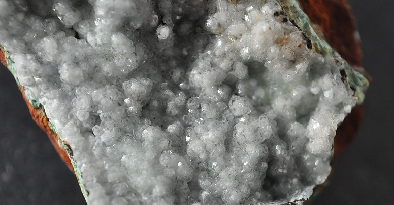
| ⓘ Smithsonite Formula: ZnCO3 Habit: Small rhombohedra Colour: Pale blue Description: Small crystals & pale blue botryoidal masses. Dry Bone ore. |
| ⓘ Willemite Formula: Zn2SiO4 Habit: Small, barrel-shaped Description: Occurs near head of the inclined surface tram. |
Gallery:

List of minerals arranged by Strunz 10th Edition classification
| Group 2 - Sulphides and Sulfosalts | |||
|---|---|---|---|
| ⓘ | Galena | 2.CD.10 | PbS |
| Group 3 - Halides | |||
| ⓘ | Murdochite | 3.DB.45 | Cu12Pb2O15Cl2 |
| Group 4 - Oxides and Hydroxides | |||
| ⓘ | Cuprite | 4.AA.10 | Cu2O |
| ⓘ | Plattnerite | 4.DB.05 | PbO2 |
| ⓘ | 'Bindheimite' | 4.DH.20 | Pb2Sb2O6O |
| Group 5 - Nitrates and Carbonates | |||
| ⓘ | Smithsonite | 5.AB.05 | ZnCO3 |
| ⓘ | Calcite | 5.AB.05 | CaCO3 |
| ⓘ | Dolomite | 5.AB.10 | CaMg(CO3)2 |
| ⓘ | Cerussite | 5.AB.15 | PbCO3 |
| ⓘ | Azurite | 5.BA.05 | Cu3(CO3)2(OH)2 |
| ⓘ | Malachite | 5.BA.10 | Cu2(CO3)(OH)2 |
| ⓘ | Rosasite | 5.BA.10 | (Cu,Zn)2(CO3)(OH)2 |
| ⓘ | Aurichalcite | 5.BA.15 | (Zn,Cu)5(CO3)2(OH)6 |
| Group 7 - Sulphates, Chromates, Molybdates and Tungstates | |||
| ⓘ | Brochantite | 7.BB.25 | Cu4(SO4)(OH)6 |
| ⓘ | Jarosite | 7.BC.10 | KFe3+3(SO4)2(OH)6 |
| ⓘ | Osarizawaite | 7.BC.10 | Pb(Al2Cu2+)(SO4)2(OH)6 |
| Group 8 - Phosphates, Arsenates and Vanadates | |||
| ⓘ | Libethenite | 8.BB.30 | Cu2(PO4)(OH) |
| ⓘ | Beudantite | 8.BL.05 | PbFe3(AsO4)(SO4)(OH)6 |
| Group 9 - Silicates | |||
| ⓘ | Willemite | 9.AA.05 | Zn2SiO4 |
| ⓘ | Braunite | 9.AG.05 | Mn2+Mn3+6(SiO4)O8 |
| ⓘ | Hemimorphite | 9.BD.10 | Zn4Si2O7(OH)2 · H2O |
List of minerals for each chemical element
| H | Hydrogen | |
|---|---|---|
| H | ⓘ Aurichalcite | (Zn,Cu)5(CO3)2(OH)6 |
| H | ⓘ Azurite | Cu3(CO3)2(OH)2 |
| H | ⓘ Beudantite | PbFe3(AsO4)(SO4)(OH)6 |
| H | ⓘ Brochantite | Cu4(SO4)(OH)6 |
| H | ⓘ Hemimorphite | Zn4Si2O7(OH)2 · H2O |
| H | ⓘ Jarosite | KFe33+(SO4)2(OH)6 |
| H | ⓘ Libethenite | Cu2(PO4)(OH) |
| H | ⓘ Malachite | Cu2(CO3)(OH)2 |
| H | ⓘ Osarizawaite | Pb(Al2Cu2+)(SO4)2(OH)6 |
| H | ⓘ Rosasite | (Cu,Zn)2(CO3)(OH)2 |
| C | Carbon | |
| C | ⓘ Aurichalcite | (Zn,Cu)5(CO3)2(OH)6 |
| C | ⓘ Azurite | Cu3(CO3)2(OH)2 |
| C | ⓘ Calcite | CaCO3 |
| C | ⓘ Cerussite | PbCO3 |
| C | ⓘ Dolomite | CaMg(CO3)2 |
| C | ⓘ Malachite | Cu2(CO3)(OH)2 |
| C | ⓘ Rosasite | (Cu,Zn)2(CO3)(OH)2 |
| C | ⓘ Smithsonite | ZnCO3 |
| O | Oxygen | |
| O | ⓘ Aurichalcite | (Zn,Cu)5(CO3)2(OH)6 |
| O | ⓘ Azurite | Cu3(CO3)2(OH)2 |
| O | ⓘ Beudantite | PbFe3(AsO4)(SO4)(OH)6 |
| O | ⓘ Bindheimite | Pb2Sb2O6O |
| O | ⓘ Braunite | Mn2+Mn63+(SiO4)O8 |
| O | ⓘ Brochantite | Cu4(SO4)(OH)6 |
| O | ⓘ Calcite | CaCO3 |
| O | ⓘ Cerussite | PbCO3 |
| O | ⓘ Cuprite | Cu2O |
| O | ⓘ Dolomite | CaMg(CO3)2 |
| O | ⓘ Hemimorphite | Zn4Si2O7(OH)2 · H2O |
| O | ⓘ Jarosite | KFe33+(SO4)2(OH)6 |
| O | ⓘ Libethenite | Cu2(PO4)(OH) |
| O | ⓘ Malachite | Cu2(CO3)(OH)2 |
| O | ⓘ Murdochite | Cu12Pb2O15Cl2 |
| O | ⓘ Osarizawaite | Pb(Al2Cu2+)(SO4)2(OH)6 |
| O | ⓘ Plattnerite | PbO2 |
| O | ⓘ Rosasite | (Cu,Zn)2(CO3)(OH)2 |
| O | ⓘ Smithsonite | ZnCO3 |
| O | ⓘ Willemite | Zn2SiO4 |
| Mg | Magnesium | |
| Mg | ⓘ Dolomite | CaMg(CO3)2 |
| Al | Aluminium | |
| Al | ⓘ Osarizawaite | Pb(Al2Cu2+)(SO4)2(OH)6 |
| Si | Silicon | |
| Si | ⓘ Braunite | Mn2+Mn63+(SiO4)O8 |
| Si | ⓘ Hemimorphite | Zn4Si2O7(OH)2 · H2O |
| Si | ⓘ Willemite | Zn2SiO4 |
| P | Phosphorus | |
| P | ⓘ Libethenite | Cu2(PO4)(OH) |
| S | Sulfur | |
| S | ⓘ Beudantite | PbFe3(AsO4)(SO4)(OH)6 |
| S | ⓘ Brochantite | Cu4(SO4)(OH)6 |
| S | ⓘ Galena | PbS |
| S | ⓘ Jarosite | KFe33+(SO4)2(OH)6 |
| S | ⓘ Osarizawaite | Pb(Al2Cu2+)(SO4)2(OH)6 |
| Cl | Chlorine | |
| Cl | ⓘ Murdochite | Cu12Pb2O15Cl2 |
| K | Potassium | |
| K | ⓘ Jarosite | KFe33+(SO4)2(OH)6 |
| Ca | Calcium | |
| Ca | ⓘ Calcite | CaCO3 |
| Ca | ⓘ Dolomite | CaMg(CO3)2 |
| Mn | Manganese | |
| Mn | ⓘ Braunite | Mn2+Mn63+(SiO4)O8 |
| Fe | Iron | |
| Fe | ⓘ Beudantite | PbFe3(AsO4)(SO4)(OH)6 |
| Fe | ⓘ Jarosite | KFe33+(SO4)2(OH)6 |
| Cu | Copper | |
| Cu | ⓘ Aurichalcite | (Zn,Cu)5(CO3)2(OH)6 |
| Cu | ⓘ Azurite | Cu3(CO3)2(OH)2 |
| Cu | ⓘ Brochantite | Cu4(SO4)(OH)6 |
| Cu | ⓘ Cuprite | Cu2O |
| Cu | ⓘ Libethenite | Cu2(PO4)(OH) |
| Cu | ⓘ Malachite | Cu2(CO3)(OH)2 |
| Cu | ⓘ Murdochite | Cu12Pb2O15Cl2 |
| Cu | ⓘ Osarizawaite | Pb(Al2Cu2+)(SO4)2(OH)6 |
| Cu | ⓘ Rosasite | (Cu,Zn)2(CO3)(OH)2 |
| Zn | Zinc | |
| Zn | ⓘ Aurichalcite | (Zn,Cu)5(CO3)2(OH)6 |
| Zn | ⓘ Hemimorphite | Zn4Si2O7(OH)2 · H2O |
| Zn | ⓘ Rosasite | (Cu,Zn)2(CO3)(OH)2 |
| Zn | ⓘ Smithsonite | ZnCO3 |
| Zn | ⓘ Willemite | Zn2SiO4 |
| As | Arsenic | |
| As | ⓘ Beudantite | PbFe3(AsO4)(SO4)(OH)6 |
| Sb | Antimony | |
| Sb | ⓘ Bindheimite | Pb2Sb2O6O |
| Pb | Lead | |
| Pb | ⓘ Beudantite | PbFe3(AsO4)(SO4)(OH)6 |
| Pb | ⓘ Bindheimite | Pb2Sb2O6O |
| Pb | ⓘ Cerussite | PbCO3 |
| Pb | ⓘ Galena | PbS |
| Pb | ⓘ Murdochite | Cu12Pb2O15Cl2 |
| Pb | ⓘ Osarizawaite | Pb(Al2Cu2+)(SO4)2(OH)6 |
| Pb | ⓘ Plattnerite | PbO2 |
Other Databases
| Link to USGS MRDS: | 10108968 |
|---|
Localities in this Region
- Arizona
- Pima County
- Waterman Mining District
- Silver Hill Mining District
- Silver Hill
- Silver Hill Mine group
- Silver Hill
- Silver Hill Mining District
- Waterman Mining District
- Pima County
Other Regions, Features and Areas containing this locality
Mexico
- Sierra Madre OccidentalMountain Range
North America
- Sonoran DesertDesert
North America PlateTectonic Plate
- Basin and Range BasinsBasin
- Mazatzal DomainDomain
USA
- Arizona
- Pima County
- Waterman MountainsMountain Range
- Pima County
This page contains all mineral locality references listed on mindat.org. This does not claim to be a complete list. If you know of more minerals from this site, please register so you can add to our database. This locality information is for reference purposes only. You should never attempt to
visit any sites listed in mindat.org without first ensuring that you have the permission of the land and/or mineral rights holders
for access and that you are aware of all safety precautions necessary.
References
Quick NavTopCommoditiesMineral ListRock TypesOther DatabasesLocalities in RegionOther RegionsReferences


Silver Hill Mine group, Silver Hill, Silver Hill Mining District, Waterman Mining District, Pima County, Arizona, USA