| Locality | Latitude | Longitude | Distance | Bearing |
|---|
| Kerschbaum quarry, Rainbach im Mühlkreis, Freistadt District, Upper Austria, Austria | 48° 35' 23" N | 14° 28' 17" E | 4.5km (2.8 miles) | |
| Resch quarry (Leopoldschlag quarry), Gurhof, Leopoldschlag, Freistadt District, Upper Austria, Austria | 48° 36' 41" N | 14° 32' 31" E | 7.7km (4.8 miles) | |
| Summerau, Rainbach im Mühlkreis, Freistadt District, Upper Austria, Austria | 48° 33' 7" N | 14° 26' 50" E | 8.1km (5.0 miles) | |
| Lachovice, Vyšší Brod, Český Krumlov District, South Bohemian Region, Czech Republic | 48° 38' 24" N | 14° 18' 45" E | 9.5km (5.9 miles) | |
| Malý Stradov, Stradov, Omlenice, Český Krumlov District, South Bohemian Region, Czech Republic | 48° 43' 16" N | 14° 27' 37" E | 10.8km (6.7 miles) | |
| Moserberg, Grünbach, Freistadt District, Upper Austria, Austria | 48° 32' 44" N | 14° 32' 50" E | 11.8km (7.3 miles) | |
| Affetschlag, Bad Leonfelden, Urfahr-Umgebung District, Upper Austria, Austria | 48° 34' 0" N | 14° 17' 21" E | 12.8km (8.0 miles) | |
| Friepeß quarry, Plochwald, Sandl, Freistadt District, Upper Austria, Austria | 48° 35' 43" N | 14° 36' 33" E | 12.9km (8.0 miles) | |
| Spörbichl quarry (Posthöf quarry), Windhaag bei Freistadt, Freistadt District, Upper Austria, Austria | 48° 33' 11" N | 14° 34' 41" E | 12.9km (8.0 miles) | |
| Plochwald, Sandl, Freistadt District, Upper Austria, Austria | 48° 35' 37" N | 14° 36' 44" E | 13.2km (8.2 miles) | |
| Appenau, Bad Leonfelden, Urfahr-Umgebung District, Upper Austria, Austria | 48° 32' 1" N | 14° 18' 36" E | 13.9km (8.6 miles) | |
| Weinzierl, Bad Leonfelden, Urfahr-Umgebung District, Upper Austria, Austria | 48° 31' 27" N | 14° 19' 5" E | 14.3km (8.9 miles) | |
| Sternstein, Vorderweißenbach, Urfahr-Umgebung District, Upper Austria, Austria | 48° 33' 34" N | 14° 16' 3" E | 14.6km (9.1 miles) | |
| Oberrauchenödt, Grünbach, Freistadt District, Upper Austria, Austria | 48° 31' 28" N | 14° 34' 8" E | 14.6km (9.1 miles) | |
| Hundsberg, Sandl, Freistadt District, Upper Austria, Austria | 48° 34' 47" N | 14° 37' 47" E | 14.8km (9.2 miles) | |
| Unterlaimbach, Bad Leonfelden, Urfahr-Umgebung District, Upper Austria, Austria | 48° 31' 45" N | 14° 17' 16" E | 15.4km (9.6 miles) | |
| Weinbergholz quarry, St. Oswald bei Freistadt, Freistadt District, Upper Austria, Austria | 48° 31' 39" N | 14° 35' 49" E | 15.8km (9.8 miles) | |
| Gunnersdorf, Lasberg, Freistadt District, Upper Austria, Austria | 48° 29' 46" N | 14° 32' 1" E | 15.9km (9.9 miles) | |
| Königsau, Sandl, Freistadt District, Upper Austria, Austria | 48° 32' 34" N | 14° 37' 36" E | 16.5km (10.2 miles) | |
| Lasberger Granit quarry, Gunnersdorf, Lasberg, Freistadt District, Upper Austria, Austria | 48° 29' 26" N | 14° 32' 38" E | 16.8km (10.4 miles) | |
| Moravice, Frymburk, Český Krumlov District, South Bohemian Region, Czech Republic | 48° 40' 55" N | 14° 13' 13" E | 17.3km (10.8 miles) | |
| Friepeß quarry, Steinwald, Sandl, Freistadt District, Upper Austria, Austria | 48° 31' 27" N | 14° 38' 30" E | 18.6km (11.6 miles) | |
| Steinwald, Sandl, Freistadt District, Upper Austria, Austria | 48° 31' 21" N | 14° 38' 43" E | 18.9km (11.7 miles) | |
| Schönegg, Vorderweißenbach, Urfahr-Umgebung District, Upper Austria, Austria | 48° 34' 52" N | 14° 11' 18" E | 19.1km (11.9 miles) | |
| Lest, Kefermarkt, Freistadt District, Upper Austria, Austria | 48° 27' 16" N | 14° 29' 56" E | 19.4km (12.1 miles) | |
| Ramberg, Reichenau im Mühlkreis, Urfahr-Umgebung District, Upper Austria, Austria | 48° 27' 42" N | 14° 20' 31" E | 19.5km (12.1 miles) | |
| Blansky´les granulite massif, Světlík, Český Krumlov District, South Bohemian Region, Czech Republic | 48° 45' 0" N | 14° 15' 0" E | 19.7km (12.2 miles) | |
| Stiftungsberg, St. Oswald bei Freistadt, Freistadt District, Upper Austria, Austria | 48° 28' 53" N | 14° 36' 17" E | 20.0km (12.5 miles) | |
| Besednice sever I, Besednice moldavite occurrences, Besednice, Český Krumlov District, South Bohemian Region, Czech Republic | 48° 47' 39" N | 14° 33' 2" E | 20.5km (12.8 miles) | |
| Besednice moldavite occurrences, Besednice, Český Krumlov District, South Bohemian Region, Czech Republic | 48° 47' 31" N | 14° 33' 56" E | 20.8km (12.9 miles) | |
Minerals recorded nearby (within 20 km)
Rock types recorded nearby (within 20 km)
Entries shown in red are rocks recorded for this region.


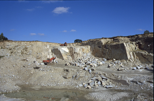


Resch quarry, Gurhof, Leopoldschlag, Freistadt District, Upper Austria, Austria