| Locality | Latitude | Longitude | Distance | Bearing |
|---|
| "Taczalin" Quartz Mine, Taczalin, Gmina Legnickie Pole, Legnica County, Lower Silesian Voivodeship, Poland | 51° 9' 11" N | 16° 18' 57" E | 0.7km (0.4 miles) | |
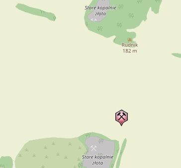
| Rudnik basalt quarry, Mikołajowice, Gmina Legnickie Pole, Legnica County, Lower Silesian Voivodeship, Poland | 51° 8' 14" N | 16° 16' 19" E | 3.0km (1.9 miles) | |
| Sosnowica Mountain, Strachowice, Gmina Legnickie Pole, Legnica County, Lower Silesian Voivodeship, Poland | 51° 8' 8" N | 16° 15' 24" E | 4.0km (2.5 miles) | |
| Złoty Las Gold Mines, Sosnowica Mountain, Strachowice, Gmina Legnickie Pole, Legnica County, Lower Silesian Voivodeship, Poland | 51° 7' 55" N | 16° 15' 36" E | 4.0km (2.5 miles) | |
| Mikołajowice quarry, Mikołajowice, Gmina Legnickie Pole, Legnica County, Lower Silesian Voivodeship, Poland | 51° 7' 1" N | 16° 16' 51" E | 4.5km (2.8 miles) | |
| Pawłowice Wielkie basalt quarry, Gmina Wądroże Wielkie, Jawor County, Lower Silesian Voivodeship, Poland | 51° 6' 17" N | 16° 16' 24" E | 6.0km (3.7 miles) | |
| Lubień quarry, Lubień, Gmina Legnickie Pole, Legnica County, Lower Silesian Voivodeship, Poland | 51° 7' 40" N | 16° 13' 26" E | 6.4km (4.0 miles) | |
| Janowice quarry, Gmina Ruja, Legnica County, Lower Silesian Voivodeship, Poland | 51° 7' 37" N | 16° 24' 20" E | 7.6km (4.7 miles) | |
| Gravel pit, Nowa Wieś Legnicka, Gmina Legnickie Pole, Legnica County, Lower Silesian Voivodeship, Poland | 51° 9' 24" N | 16° 11' 12" E | 8.3km (5.2 miles) | |
| Jenków slates quarry, Gmina Wądroże Wielkie, Jawor County, Lower Silesian Voivodeship, Poland | 51° 4' 25" N | 16° 23' 37" E | 10.9km (6.8 miles) | |
| "Bartnica" mine (Brachów), Gmina Męcinka, Jawor County, Lower Silesian Voivodeship, Poland | 51° 6' 2" N | 16° 8' 51" E | 12.6km (7.8 miles) | |
| Żarecka Góra basalt quarry, Słup, Gmina Męcinka, Jawor County, Lower Silesian Voivodeship, Poland | 51° 5' 5" N | 16° 7' 25" E | 14.9km (9.2 miles) | |
| Słup basalt quarry, Słup, Gmina Męcinka, Jawor County, Lower Silesian Voivodeship, Poland | 51° 5' 50" N | 16° 6' 11" E | 15.5km (9.6 miles) | |
| Męcinka basalt quarry, Męcinka, Gmina Męcinka, Jawor County, Lower Silesian Voivodeship, Poland | 51° 4' 47" N | 16° 7' 5" E | 15.5km (9.6 miles) | |
| Dunino halloysite quarry, Gmina Krotoszyce, Legnica County, Lower Silesian Voivodeship, Poland | 51° 8' 43" N | 16° 4' 31" E | 16.1km (10.0 miles) | |
| Rogoźnica II quarry, Rogoźnica, Gmina Strzegom, Świdnica County, Lower Silesian Voivodeship, Poland | 51° 0' 33" N | 16° 16' 32" E | 16.3km (10.1 miles) | |
| Winna Góra quarry, Piotrowice, Gmina Męcinka, Jawor County, Lower Silesian Voivodeship, Poland | 51° 3' 37" N | 16° 7' 13" E | 16.6km (10.3 miles) | |
| Rogoźnica-Las quarry, Rogoźnica, Gmina Strzegom, Świdnica County, Lower Silesian Voivodeship, Poland | 51° 0' 21" N | 16° 16' 28" E | 16.7km (10.4 miles) | |
| Zimnik II quarry, Zimnik, Gmina Mściwojów, Jawor County, Lower Silesian Voivodeship, Poland | 51° 0' 38" N | 16° 14' 16" E | 16.7km (10.4 miles) | |
| Mecinka II basalt quarry, Męcinka, Gmina Męcinka, Jawor County, Lower Silesian Voivodeship, Poland | 51° 5' 0" N | 16° 5' 41" E | 16.7km (10.4 miles) | |
| Rogoźnica III quarry, Rogoźnica, Gmina Strzegom, Świdnica County, Lower Silesian Voivodeship, Poland | 51° 0' 14" N | 16° 18' 27" E | 16.7km (10.4 miles) | |
| Zimnik I quarry, Zimnik, Gmina Mściwojów, Jawor County, Lower Silesian Voivodeship, Poland | 51° 0' 25" N | 16° 15' 21" E | 16.7km (10.4 miles) | |
| Czernica II quarry, Czernica, Gmina Dobromierz, Świdnica County, Lower Silesian Voivodeship, Poland | 51° 0' 41" N | 16° 13' 30" E | 16.9km (10.5 miles) | |
| Czernica I quarry, Czernica, Gmina Dobromierz, Świdnica County, Lower Silesian Voivodeship, Poland | 51° 0' 34" N | 16° 13' 17" E | 17.2km (10.7 miles) | |
| "Gross Rosen" quarry, Rogoźnica, Gmina Strzegom, Świdnica County, Lower Silesian Voivodeship, Poland | 50° 59' 57" N | 16° 16' 49" E | 17.4km (10.8 miles) | |
| Paszowice quarry, Gmina Paszowice, Jawor County, Lower Silesian Voivodeship, Poland | 51° 0' 43" N | 16° 11' 38" E | 17.7km (11.0 miles) | |
| Schist occurrence, Graniczna, Gmina Strzegom, Świdnica County, Lower Silesian Voivodeship, Poland | 50° 59' 54" N | 16° 21' 23" E | 17.7km (11.0 miles) | |
| Graniczna granite quarry, Graniczna, Gmina Strzegom, Świdnica County, Lower Silesian Voivodeship, Poland | 50° 59' 38" N | 16° 21' 36" E | 18.2km (11.3 miles) | |
| Gniewków II quarry, Gniewków, Gmina Dobromierz, Świdnica County, Lower Silesian Voivodeship, Poland | 50° 59' 44" N | 16° 14' 16" E | 18.3km (11.4 miles) | |
| Wekom II quarry, Kostrza, Gmina Strzegom, Świdnica County, Lower Silesian Voivodeship, Poland | 50° 59' 28" N | 16° 15' 29" E | 18.5km (11.5 miles) | |


Rudnik basalt quarry, Mikołajowice, Gmina Legnickie Pole, Legnica County, Lower Silesian Voivodeship, Poland