| Locality | Latitude | Longitude | Distance | Bearing |
|---|
| Fitjarfjellet, Fitjar, Vestland, Norway | 59° 55' 29" N | 5° 23' 31" E | 6.1km (3.8 miles) | |
| Tindane pegmatite (Stord elbaite occurrence), Fitjarfjellet, Fitjar, Vestland, Norway | 59° 55' 19" N | 5° 26' 39" E | 8.2km (5.1 miles) | |
| Bekkjarvik, Austevoll, Vestland, Norway | 60° 0' 26" N | 5° 12' 4" E | 8.4km (5.2 miles) | |
| Høgholmen, Fitjar, Vestland, Norway | 59° 53' 44" N | 5° 18' 52" E | 8.4km (5.2 miles) | |
| Lunnøykalven, Austevoll, Vestland, Norway | 60° 1' 8" N | 5° 7' 29" E | 12.8km (7.9 miles) | |
| Tysnes Island meteorite, Tysnesøya, Tysnes, Vestland, Norway | 60° 0' 0" N | 5° 37' 0" E | 16.1km (10.0 miles) | |
| Barlindedalen Lead Prospect, Stord, Vestland, Norway | 59° 49' 49" N | 5° 24' 37" E | 16.2km (10.1 miles) | |
| Folderøy, Bømlo, Vestland, Norway | 59° 47' 54" N | 5° 18' 17" E | 19.3km (12.0 miles) | |
| Stordø Pyrite Mines, Stord, Vestland, Norway | 59° 47' 36" N | 5° 25' 18" E | 20.4km (12.6 miles) | |
| Midtøya, Tysnes, Vestland, Norway | 59° 55' 45" N | 5° 41' 38" E | 20.6km (12.8 miles) | |
| Litlabø, Stord, Vestland, Norway | 59° 47' 21" N | 5° 25' 18" E | 20.8km (12.9 miles) | |
| Tveit Mine, Huglo Island, Stord, Vestland, Norway | 59° 49' 54" N | 5° 35' 41" E | 21.3km (13.2 miles) | |
| Kvernavika, Bømlo, Vestland, Norway | 59° 48' 0" N | 5° 8' 1" E | 22.0km (13.7 miles) | |
| Sakseidvegen Quarry, Bømlo, Vestland, Norway | 59° 46' 37" N | 5° 14' 57" E | 22.1km (13.7 miles) | |
| Bremnes Seashore AS, Kvernavika, Bømlo, Vestland, Norway | 59° 48' 0" N | 5° 7' 54" E | 22.1km (13.7 miles) | |
| Russeklubben, Stord, Vestland, Norway | 59° 47' 35" N | 5° 32' 20" E | 22.9km (14.2 miles) | |
| Siggjarvåg, Bømlo, Vestland, Norway | 59° 45' 55" N | 5° 19' 10" E | 22.9km (14.2 miles) | |
| Alsvågen, Bømlo, Vestland, Norway | 59° 46' 20" N | 5° 9' 49" E | 24.0km (14.9 miles) | |
| Lindøya, Bømlo, Vestland, Norway | 59° 45' 13" N | 5° 13' 23" E | 24.9km (15.5 miles) | |
| Ølve mining district, Kvinnherad, Vestland, Norway | 59° 59' 35" N | 5° 47' 5" E | 25.2km (15.7 miles) | |
| Forlandveien roadcut, Sund, Øygarden, Vestland, Norway | 60° 11' 4" N | 5° 6' 28" E | 26.8km (16.7 miles) | |
| Austfjorden, Sund, Øygarden, Vestland, Norway | 60° 10' 45" N | 5° 5' 9" E | 26.9km (16.7 miles) | |
| Dyråsen Mine, Ølve mining district, Kvinnherad, Vestland, Norway | 60° 2' 12" N | 5° 48' 49" E | 27.7km (17.2 miles) | |
| Dyngebekken, Bømlo, Vestland, Norway | 59° 43' 40" N | 5° 11' 33" E | 28.2km (17.5 miles) | |
| Bjørnavika, Bømlo, Vestland, Norway | 59° 43' 17" N | 5° 13' 15" E | 28.5km (17.7 miles) | |
| Roadcut Rv 555, Sund, Øygarden, Vestland, Norway | 60° 12' 11" N | 5° 4' 50" E | 29.4km (18.2 miles) | |
| Venjaneset, Fusa, Bjørnafjorden, Vestland, Norway | 60° 12' 20" N | 5° 35' 34" E | 29.8km (18.5 miles) | |
| Carl Olsen Lode, Bømlo gold mines, Lykling, Bømlo, Vestland, Norway | 59° 42' 50" N | 5° 10' 31" E | 29.9km (18.6 miles) | |
| Storhougen Mine, Bømlo gold mines, Lykling, Bømlo, Vestland, Norway | 59° 42' 38" N | 5° 10' 11" E | 30.4km (18.9 miles) | |
| Guldgruben, Attramadalen Mines (Atramdal), Ølve mining district, Kvinnherad, Vestland, Norway | 60° 1' 50" N | 5° 52' 0" E | 30.4km (18.9 miles) | |
Minerals recorded nearby (within 20 km)
Rock types recorded nearby (within 20 km)
Entries shown in red are rocks recorded for this region.


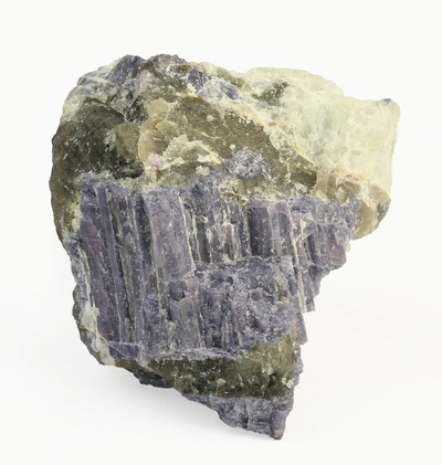


Tindane pegmatite, Fitjarfjellet, Fitjar, Vestland, Norway