Nevada Massachusetts Tungsten Mine, Nevada Massachusetts Company, Pershing County, Nevada, USAi
| Regional Level Types | |
|---|---|
| Nevada Massachusetts Tungsten Mine | Mine (Active) |
| Nevada Massachusetts Company | County |
| Pershing County | County |
| Nevada | State |
| USA | Country |
This page is currently not sponsored. Click here to sponsor this page.
Latitude & Longitude (WGS84):
40° 46' 40'' North , 118° 8' 3'' West
Latitude & Longitude (decimal):
Type:
Mine (Active) - last checked 2020
Köppen climate type:
Nearest Settlements:
| Place | Population | Distance |
|---|---|---|
| Imlay | 171 (2011) | 13.1km |
| Humboldt | 119 (2011) | 21.8km |
| Winnemucca | 7,887 (2017) | 39.9km |
Mindat Locality ID:
343784
Long-form identifier:
mindat:1:2:343784:4
GUID (UUID V4):
9825c404-339a-465d-af7d-1381d2bbc6d4
Structure: Basin And Range Fault Block, Faults, Stock And Dike Intrusions. Stank Fault Strikes N-S For 1.5 Miles. Strata West Side Of Fault Dips East, East Side Of Fault Dips 70 West. Strata Strikes N20e. Post-Mineral Faults Also Present.
Alteration: Silicification, Albitization
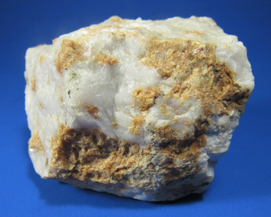
Deposit type: W skarn
Geology: Orebody appears to be a pendant like mass. Triassic sediments intruded by granodiorite stocks and dikes, producing contact metamorphism (garnet-epidote-wollastonite-tremolite). These were followed by andesite dikes.
Ore(s): Next To Dikes, But Not In Them, Tactite Bodies.
Select Mineral List Type
Standard Detailed Gallery Strunz Chemical ElementsCommodity List
This is a list of exploitable or exploited mineral commodities recorded at this locality.Mineral List
4 valid minerals.
Rock Types Recorded
Note: data is currently VERY limited. Please bear with us while we work towards adding this information!
Select Rock List Type
Alphabetical List Tree DiagramDetailed Mineral List:
| ⓘ Epidote Formula: (CaCa)(AlAlFe3+)O[Si2O7][SiO4](OH) |
| ⓘ 'Garnet Group' Formula: X3Z2(SiO4)3 |
| ⓘ Pyrite Formula: FeS2 |
| ⓘ Quartz Formula: SiO2 |
| ⓘ Scheelite Formula: Ca(WO4) |
Gallery:
List of minerals arranged by Strunz 10th Edition classification
| Group 2 - Sulphides and Sulfosalts | |||
|---|---|---|---|
| ⓘ | Pyrite | 2.EB.05a | FeS2 |
| Group 4 - Oxides and Hydroxides | |||
| ⓘ | Quartz | 4.DA.05 | SiO2 |
| Group 7 - Sulphates, Chromates, Molybdates and Tungstates | |||
| ⓘ | Scheelite | 7.GA.05 | Ca(WO4) |
| Group 9 - Silicates | |||
| ⓘ | Epidote | 9.BG.05a | (CaCa)(AlAlFe3+)O[Si2O7][SiO4](OH) |
| Unclassified | |||
| ⓘ | 'Garnet Group' | - | X3Z2(SiO4)3 |
List of minerals for each chemical element
| H | Hydrogen | |
|---|---|---|
| H | ⓘ Epidote | (CaCa)(AlAlFe3+)O[Si2O7][SiO4](OH) |
| O | Oxygen | |
| O | ⓘ Epidote | (CaCa)(AlAlFe3+)O[Si2O7][SiO4](OH) |
| O | ⓘ Quartz | SiO2 |
| O | ⓘ Scheelite | Ca(WO4) |
| O | ⓘ Garnet Group | X3Z2(SiO4)3 |
| Al | Aluminium | |
| Al | ⓘ Epidote | (CaCa)(AlAlFe3+)O[Si2O7][SiO4](OH) |
| Si | Silicon | |
| Si | ⓘ Epidote | (CaCa)(AlAlFe3+)O[Si2O7][SiO4](OH) |
| Si | ⓘ Quartz | SiO2 |
| Si | ⓘ Garnet Group | X3Z2(SiO4)3 |
| S | Sulfur | |
| S | ⓘ Pyrite | FeS2 |
| Ca | Calcium | |
| Ca | ⓘ Epidote | (CaCa)(AlAlFe3+)O[Si2O7][SiO4](OH) |
| Ca | ⓘ Scheelite | Ca(WO4) |
| Fe | Iron | |
| Fe | ⓘ Epidote | (CaCa)(AlAlFe3+)O[Si2O7][SiO4](OH) |
| Fe | ⓘ Pyrite | FeS2 |
| W | Tungsten | |
| W | ⓘ Scheelite | Ca(WO4) |
Other Databases
| Link to USGS MRDS: | 10042502 |
|---|
Other Regions, Features and Areas containing this locality
North America PlateTectonic Plate
- Auld Lang Syne BasinBasin
- Basin and Range BasinsBasin
- Golconda-Roberts Mountain DomainDomain
- Havallah BasinBasin
- West Nevada Permian-Triassic BasinBasin
USA
- Lake LahontanLake
- Nevada
- Mill City Mining DistrictMining District
This page contains all mineral locality references listed on mindat.org. This does not claim to be a complete list. If you know of more minerals from this site, please register so you can add to our database. This locality information is for reference purposes only. You should never attempt to
visit any sites listed in mindat.org without first ensuring that you have the permission of the land and/or mineral rights holders
for access and that you are aware of all safety precautions necessary.


Nevada Massachusetts Tungsten Mine, Nevada Massachusetts Company, Pershing County, Nevada, USA