| Locality type: | Mine |
| Classification |
|---|
|
| Species: | Sphalerite |
| Formula: | ZnS |
| Confirmation |
|---|
|
| Validity: | Believed Valid |
| Associated Minerals Based on Photo Data: |
|---|
|
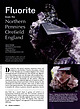
| Fluorite | ⓘ26 photos of Sphalerite associated with Fluorite at this locality. |
| Ankerite | ⓘ13 photos of Sphalerite associated with Ankerite at this locality. |
| Quartz | ⓘ10 photos of Sphalerite associated with Quartz at this locality. |
| Siderite | ⓘ9 photos of Sphalerite associated with Siderite at this locality. |
| Galena | ⓘ3 photos of Sphalerite associated with Galena at this locality. |
| Calcite | ⓘ2 photos of Sphalerite associated with Calcite at this locality. |
| Chalcopyrite | ⓘ1 photo of Sphalerite associated with Chalcopyrite at this locality. |
| Dolomite | ⓘ1 photo of Sphalerite associated with Dolomite at this locality. |
| Data |
|---|
|
| Mineral Data: | Click here to view Sphalerite data |
| Locality Data: | Click here to view Allenheads Mine (Beaumont Mine), Allendale, Northumberland, England, UK |
| Photo Gallery | View Gallery (3 photos) |
| Data Identifiers |
|---|
|
| Mindat Occurrence Record ID: | 120015 |
| Long-form Identifier: | 1:3:120015:7 |
| GUID (UUID V4): | e412c8cc-4146-4f0e-9cab-e1c63cc13793 |
| Nearest other occurrences of Sphalerite |
|---|
|
|
| 3.1km (2.0 miles) | ⓘFrazer's Hush Mine, Rookhope, Stanhope, County Durham, England, UK |
| 3.4km (2.1 miles) | ⓘSt Peter's Mine, Sparty Lea, Allendale, Northumberland, England, UK |
| 3.7km (2.3 miles) | ⓘGroverake Mine, Rookhope, Stanhope, County Durham, England, UK |
| 3.7km (2.3 miles) | ⓘSwinhope Moor, Allendale, Northumberland, England, UK |
| 4.1km (2.5 miles) | ⓘNorth Groverake Quarry, Rookhope, Stanhope, County Durham, England, UK |
| 4.1km (2.5 miles) | ⓘBurtree Pasture Mine (Breckonsyke Mine; Broadmea Mine), Cowshill, Stanhope, County Durham, England, UK |
| 4.2km (2.6 miles) | ⓘPark Level Mine, Killhope Burn, Stanhope, County Durham, England, UK |
| 4.3km (2.7 miles) | ⓘBurtree Slits, Cowshill, Stanhope, County Durham, England, UK |
| 5.7km (3.5 miles) | ⓘOld Middlehope Mine, Ireshopeburn, Stanhope, County Durham, England, UK |
| 5.7km (3.6 miles) | ⓘBarneycraig Mine, Coalcleugh, West Allen, Northumberland, England, UK |
| References |
|---|
|
|
| Reference Search (possible matching items) |
|---|
 | | Journal (article/letter/editorial) | | Mountains, centered on the Weardale area of northern England, have yielded enormous amounts of both lead and...partner in UK Mining Ventures,which is operating a specimen-recoveryproject at the Rogerley mine in Weardale...Weardale, England. His most recent article for Rocks & Minerals was titled “The Rogerley Mine, Weardale,... County Durham, England” and appeared in the January/February 2000 issue. 378 ROCKS & MINERALS Downloaded...cost of rehabilitating and running an underground mine, coupled with everincreasing environmental concerns |  | | Journal (article/letter/editorial) | | From the North Pennines Orefield England Figure 1. The Groverake mine, located in upper Rookhopeburn,...operating commercial fluorspar mine in the North Pennines, closing in 1999. Mine waste heaps (known locally...nineteenth centuries can be seen on the hills above the mine site. Figure 2 (left). A scattering of numerous...matrix, 14 × 10 × 7 cm, recovered from the Cambokeels mine in the early 1980s. Figure 3 (right). A penetration-twinned...× 4-cm specimen was recovered from the Rogerley mine in 2013. 306 ROCKS & MINERALS Figure 4. General |  | | Book (edition) | | Stainmore The northern one-third of the Backbone of England, that ridge of hilly country known since last century...subject of V ()lume 2. A small part of the Northumberland Trough as far as the Roman Wall is included...Pit Coal (the I~ondon Lead Company) and the W Beaumont Con1pany. The heyday of lead mining seemed to...a cavity in the Great Limestone flats, Boltsburn Mine. Collected by Sir Arthur Russell and now in the...sheets 19 and 25, and parts of 13, 24, 26, 31, 32 (England and Wales) LONDON: HMSO 1990 . I\. © C,rown |  | | Book (edition) | | MEMOIRS OF THE GEOLOGICAL SURVEY OF GREAT BRITAIN ENGLAND AND WALF�S GEOLOGY OF THE NORTHERN PENNINE OREFIELD...inserted on the six-inch maps, and all available mine-sections were reduced to the common scale of 200...made by him. The willing co-operation of all the mine-owners and operators and their staffs made possible... B. Laporte & Co., the Owners of Settlingstones Mine Ltd., Holmside ·& South Moor Colliery Co. Ltd.,...MINERAL DEPOSITS :-DETAILS, AREA 3, WEST CHAPTER ALLENDALE CHAPTER IX. CHAPTER x.- WEN1' CHAP'tER |
|


Allenheads Mine, Allendale, Northumberland, England, UK