| Locality | Latitude | Longitude | Distance | Bearing |
|---|
| Gravel pit, Nowa Wieś Legnicka, Gmina Legnickie Pole, Legnica County, Lower Silesian Voivodeship, Poland | 51° 9' 24" N | 16° 11' 12" E | 3.1km (1.9 miles) | |
| Dunino halloysite quarry, Gmina Krotoszyce, Legnica County, Lower Silesian Voivodeship, Poland | 51° 8' 43" N | 16° 4' 31" E | 5.9km (3.7 miles) | |
| Lubień quarry, Lubień, Gmina Legnickie Pole, Legnica County, Lower Silesian Voivodeship, Poland | 51° 7' 40" N | 16° 13' 26" E | 7.2km (4.5 miles) | |
| "Bartnica" mine (Brachów), Gmina Męcinka, Jawor County, Lower Silesian Voivodeship, Poland | 51° 6' 2" N | 16° 8' 51" E | 7.9km (4.9 miles) | |
| Sosnowica Mountain, Strachowice, Gmina Legnickie Pole, Legnica County, Lower Silesian Voivodeship, Poland | 51° 8' 8" N | 16° 15' 24" E | 8.5km (5.3 miles) | |
| Słup basalt quarry, Słup, Gmina Męcinka, Jawor County, Lower Silesian Voivodeship, Poland | 51° 5' 50" N | 16° 6' 11" E | 8.9km (5.5 miles) | |
| Złoty Las Gold Mines, Sosnowica Mountain, Strachowice, Gmina Legnickie Pole, Legnica County, Lower Silesian Voivodeship, Poland | 51° 7' 55" N | 16° 15' 36" E | 8.9km (5.5 miles) | |
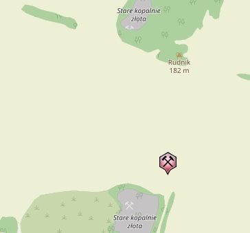
| Rudnik basalt quarry, Mikołajowice, Gmina Legnickie Pole, Legnica County, Lower Silesian Voivodeship, Poland | 51° 8' 14" N | 16° 16' 19" E | 9.4km (5.8 miles) | |
| Żarecka Góra basalt quarry, Słup, Gmina Męcinka, Jawor County, Lower Silesian Voivodeship, Poland | 51° 5' 5" N | 16° 7' 25" E | 9.8km (6.1 miles) | |
| Męcinka basalt quarry, Męcinka, Gmina Męcinka, Jawor County, Lower Silesian Voivodeship, Poland | 51° 4' 47" N | 16° 7' 5" E | 10.5km (6.5 miles) | |
| Mecinka II basalt quarry, Męcinka, Gmina Męcinka, Jawor County, Lower Silesian Voivodeship, Poland | 51° 5' 0" N | 16° 5' 41" E | 10.5km (6.6 miles) | |
| Mikołajowice quarry, Mikołajowice, Gmina Legnickie Pole, Legnica County, Lower Silesian Voivodeship, Poland | 51° 7' 1" N | 16° 16' 51" E | 11.0km (6.9 miles) | |
| Pawłowice Wielkie basalt quarry, Gmina Wądroże Wielkie, Jawor County, Lower Silesian Voivodeship, Poland | 51° 6' 17" N | 16° 16' 24" E | 11.5km (7.1 miles) | |
| Krzyżowa Góra quarry, Sichów, Gmina Męcinka, Jawor County, Lower Silesian Voivodeship, Poland | 51° 5' 28" N | 16° 2' 32" E | 11.7km (7.3 miles) | |
| "Taczalin" Quartz Mine, Taczalin, Gmina Legnickie Pole, Legnica County, Lower Silesian Voivodeship, Poland | 51° 9' 11" N | 16° 18' 57" E | 11.8km (7.3 miles) | |
| Bogaczowice, Gmina Męcinka, Jawor County, Lower Silesian Voivodeship, Poland | 51° 4' 20" N | 16° 3' 59" E | 12.5km (7.8 miles) | |
| Winna Góra quarry, Piotrowice, Gmina Męcinka, Jawor County, Lower Silesian Voivodeship, Poland | 51° 3' 37" N | 16° 7' 13" E | 12.6km (7.8 miles) | |
| Rudolf adit, Męcinka, Gmina Męcinka, Jawor County, Lower Silesian Voivodeship, Poland | 51° 3' 44" N | 16° 4' 53" E | 13.1km (8.1 miles) | |
| Kozów bazalt quarry, Gmina Złotoryja, Złotoryja County, Lower Silesian Voivodeship, Poland | 51° 8' 1" N | 15° 57' 49" E | 13.6km (8.5 miles) | |
| Hintermühlergang vein, Chełmiec, Gmina Męcinka, Jawor County, Lower Silesian Voivodeship, Poland | 51° 3' 14" N | 16° 4' 54" E | 13.9km (8.7 miles) | |
| Pillow lavas quarry, Sichów, Gmina Męcinka, Jawor County, Lower Silesian Voivodeship, Poland | 51° 4' 42" N | 16° 0' 42" E | 14.1km (8.8 miles) | |
| Dębowa Góra heaps, Męcinka, Gmina Męcinka, Jawor County, Lower Silesian Voivodeship, Poland | 51° 3' 12" N | 16° 4' 10" E | 14.3km (8.9 miles) | |
| Wilcza iron mine, Stanisławów, Gmina Męcinka, Jawor County, Lower Silesian Voivodeship, Poland | 51° 4' 20" N | 16° 0' 36" E | 14.7km (9.1 miles) | |
| Chełmiec mine, Chełmiec, Gmina Męcinka, Jawor County, Lower Silesian Voivodeship, Poland | 50° 46' 29" N | 16° 13' 0" E | 14.9km (9.3 miles) | |
| Max Emil Alexander mine (Jerzyków heaps PGI #9-10), Chełmiec, Gmina Męcinka, Jawor County, Lower Silesian Voivodeship, Poland | 51° 2' 31" N | 16° 5' 32" E | 15.0km (9.3 miles) | |
| Leszczyna, Gmina Złotoryja, Złotoryja County, Lower Silesian Voivodeship, Poland | 51° 4' 59" N | 15° 58' 59" E | 15.2km (9.5 miles) | |
| Unnamed limestone quarry, Leszczyna, Gmina Złotoryja, Złotoryja County, Lower Silesian Voivodeship, Poland | 51° 4' 32" N | 15° 59' 30" E | 15.4km (9.5 miles) | |
| Le-33 borehole, Leszczyna, Gmina Złotoryja, Złotoryja County, Lower Silesian Voivodeship, Poland | 51° 4' 47" N | 15° 58' 58" E | 15.5km (9.6 miles) | |
| Stanisławów baryte mine, Pomocne, Gmina Męcinka, Jawor County, Lower Silesian Voivodeship, Poland | 51° 3' 39" N | 16° 0' 44" E | 15.6km (9.7 miles) | |
| Mieszczańska Mtn., Złotoryja, Złotoryja County, Lower Silesian Voivodeship, Poland | 51° 7' 44" N | 15° 56' 4" E | 15.7km (9.8 miles) | |
Minerals recorded nearby (within 15.7 km)
Rock types recorded nearby (within 15.7 km)
Entries shown in red are rocks recorded for this region.


Rudnik basalt quarry, Mikołajowice, Gmina Legnickie Pole, Legnica County, Lower Silesian Voivodeship, Poland