San Cataldo sulphur mines, San Cataldo (San Cattaldo), Caltanissetta Province, Sicily, Italyi
| Regional Level Types | |
|---|---|
| San Cataldo sulphur mines | Group of Mines |
| San Cataldo (San Cattaldo) | Commune |
| Caltanissetta Province | Province |
| Sicily | Autonomous Region |
| Italy | - not defined - |
This page is currently not sponsored. Click here to sponsor this page.

Latitude & Longitude (WGS84):
37° North , 13° East (est.)
Estimate based on other nearby localities or region boundaries.
Margin of Error:
~8km
Locality type:
Group of Mines
Köppen climate type:
Other Languages:
Italian:
Miniere di zolfo di San Cataldo, San Cataldo (San Cattaldo), Libero consorzio comunale di Caltanissetta (Provincia di Caltanissetta), Sicilia, Italia
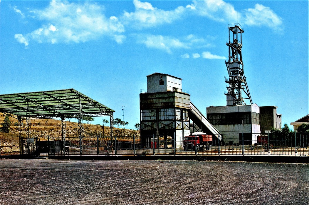
In the municipal territory of San Cataldo were exploited numerous sulphur mines, the most known of which are:
- Zubi mines, Tabita mines (Tabita Curattolo: 37°30'4"N, 13°58'14"E; Tabita Rinaldi: 37°30'1"N, 13°58'10"E; Tabita Urso: 37°30'9"N, 13°58'4"E; Tabita Manganaro Morreale: 37°29'59"N, 13°57'58"E; Tabita Chinnici: 37°30'8"N, 13°57'54"E;), and Marcato Vallone mine (37°31'1"N, 13°57'54"E) on the east;
- Barbaraso mine and the Gabbara group of mines in the middle;
- the mines Apaforte, Bosco, Dragaito (37°29'26"N, 13°53'9"E), Grotticelli Mandra di Mezzo (37°28'20"N, 13°54'34"E), Mandra di Mezzo Amico-Principe (37°28'27"N, 13°53'38"E), Palo Dragaito (37°29'29"N, 13°53'31"E), Pergola (37°29'32"N, 13°53'59"E), and Stincone on the west.
Select Mineral List Type
Standard Detailed Gallery Strunz Chemical ElementsCommodity List
This is a list of exploitable or exploited mineral commodities recorded from this region.Mineral List
Mineral list contains entries from the region specified including sub-localities4 valid minerals.
Detailed Mineral List:
| ⓘ Calcite Formula: CaCO3 Localities: Reported from at least 6 localities in this region. Reference: Jervis, G. (1881) I tesori sotterranei dell'Italia. Vol. 3: Regioni delle Isole. Sardegna e Sicilia. Addenda ai precedenti volumi. Loescher, Torino, XXII+539 pp. |
| ⓘ Celestine Formula: SrSO4 Reference: Del Caldo, A., Moro, C., Gramaccioli, C.M., and Boscardin, M. (1973) Guida ai minerali. Fratelli Fabbri Editori, Milano, 208 pp. |
| ⓘ Gypsum Formula: CaSO4 · 2H2O Localities: Reported from at least 6 localities in this region. Reference: Jervis, G. (1881) I tesori sotterranei dell'Italia. Vol. 3: Regioni delle Isole. Sardegna e Sicilia. Addenda ai precedenti volumi. Loescher, Torino, XXII+539 pp.; Del Caldo, A., Moro, C., Gramaccioli, C.M., and Boscardin, M. (1973) Guida ai minerali. Fratelli Fabbri Editori, Milano, 208 pp. |
| ⓘ Sulphur Formula: S8 Localities: Reported from at least 7 localities in this region. Reference: Jervis, G. (1881) I tesori sotterranei dell'Italia. Vol. 3: Regioni delle Isole. Sardegna e Sicilia. Addenda ai precedenti volumi. Loescher, Torino, XXII+539 pp.; Del Caldo, A., Moro, C., Gramaccioli, C.M., and Boscardin, M. (1973) Guida ai minerali. Fratelli Fabbri Editori, Milano, 208 pp.; Mezzadri, P. (1988) La serie gessoso solfifera della Sicilia e altre memorie geo-minerarie. Roberto De Nicola Editore, Roma, 874 pp. |

Gallery:
List of minerals arranged by Strunz 10th Edition classification
| Group 1 - Elements | |||
|---|---|---|---|
| ⓘ | Sulphur | 1.CC.05 | S8 |
| Group 5 - Nitrates and Carbonates | |||
| ⓘ | Calcite | 5.AB.05 | CaCO3 |
| Group 7 - Sulphates, Chromates, Molybdates and Tungstates | |||
| ⓘ | Celestine | 7.AD.35 | SrSO4 |
| ⓘ | Gypsum | 7.CD.40 | CaSO4 · 2H2O |
List of minerals for each chemical element
| H | Hydrogen | |
|---|---|---|
| H | ⓘ Gypsum | CaSO4 · 2H2O |
| C | Carbon | |
| C | ⓘ Calcite | CaCO3 |
| O | Oxygen | |
| O | ⓘ Calcite | CaCO3 |
| O | ⓘ Gypsum | CaSO4 · 2H2O |
| O | ⓘ Celestine | SrSO4 |
| S | Sulfur | |
| S | ⓘ Sulphur | S8 |
| S | ⓘ Gypsum | CaSO4 · 2H2O |
| S | ⓘ Celestine | SrSO4 |
| Ca | Calcium | |
| Ca | ⓘ Calcite | CaCO3 |
| Ca | ⓘ Gypsum | CaSO4 · 2H2O |
| Sr | Strontium | |
| Sr | ⓘ Celestine | SrSO4 |
References
Sort by
Year (asc) Year (desc) Author (A-Z) Author (Z-A)Jervis, G. (1881) I tesori sotterranei dell'Italia. Vol. 3: Regioni delle Isole. Sardegna e Sicilia. Addenda ai precedenti volumi. Loescher, Torino, XXII+539 pp.
Del Caldo, A., Moro, C., Gramaccioli, C.M., and Boscardin, M. (1973) Guida ai minerali. Fratelli Fabbri Editori, Milano, 208 pp.
Mezzadri, P. (1988) La serie gessoso solfifera della Sicilia e altre memorie geo-minerarie. Roberto De Nicola Editore, Roma, 874 pp.
Localities in this Region
- Sicily
- Caltanissetta Province
- San Cataldo (San Cattaldo)
- San Cataldo sulphur mines
- San Cataldo (San Cattaldo)
- Caltanissetta Province
Other Regions, Features and Areas containing this locality
African PlateTectonic Plate
EuropeContinent
This page contains all mineral locality references listed on mindat.org. This does not claim to be a complete list. If you know of more minerals from this site, please register so you can add to our database. This locality information is for reference purposes only. You should never attempt to
visit any sites listed in mindat.org without first ensuring that you have the permission of the land and/or mineral rights holders
for access and that you are aware of all safety precautions necessary.


Bosco Mine, San Cataldo sulphur mines, San Cataldo, Caltanissetta Province, Sicily, Italy