|
USA | |
|
| On a specimen collected by Joe Ruiz |
|
| MRDS file #10027608. |
|
| Collected by Joe Ruiz. In the collection of Brent Thorne. |
- Cleopatra Mining District
- Kimble Mining Sub-District
| MRDS file #10027683. |
- Bill Williams Fork Mining District
- Bill Williams Fork (Williams Fork)
| Anthony, John W., Williams, Sidney A., Bideaux, Richard A., Grant, Raymond W. (1995) Mineralogy of Arizona (3rd ed.) University of Arizona Press, Tucson, AZ.
Blake, W.P. (1865). |
- El Dorado Pass Mining District
| Wilson, E.D., et al (1934), AZ Bur. of Mines Bull. 137: 79-80. |
|
| Wilson, E.D., et al (1934), AZ Bur. of Mines Bull. 137: 78. |
|
| Ransome, F.L. (1923), Geol. of the Oatman gold district, AZ, a preliminary report, USGS Bull. 743.
The Resources of Arizona - A Manual of Reliable Information Concerning the Territory, P. Hamilton (1881): 70
Silliman, B. (1866), On some mining districts of AZ near Rio Colorado, ...., Amer.Jour.Sci.: 41:289-308 |
|
| MRDS file #10161751. |
|
| MRDS file #10027076. |
- Gold Dust vein (Victor-Virgin vein)
| MRDS file #10027916. |
- Gold Road Mining District
| Wilson, E.D., et al (1934), AZ Bur. of Mines Bull. 137: 94
Ransome, F.L. (1923), Geology of the Oatman Gold District, Arizona, USGS Bull. 743: 33.
The Resources of Arizona - A Manual of Reliable Information Concerning the Territory, compiled by Patrick Hamilton (1881), Scottsdale, AZ: 70
The History of Arizona, Chap. X: 74 |
|
| Wilson, E.D., et al (1934), AZ Bur. of Mines Bull. 137: 98-99. |
|
| MRDS fle #10027943. |
|
| Wilson, E.D., et al (1934), AZ Bur. of Mines Bull. 137: 98. |
|
| Schrader, F.C. (1909), Mineral deposits of the Cerbat Range, Black Mountains, and the Grand Wash Cliffs, Mohave County, Arizona: USGS Bull. 397: 166
MRDS file #10027908. |
|
| Wilson, E.D., et al (1934), AZ Bur. of Mines Bull. 137: 79. |
|
| Wilson, E.D., et al (1934), AZ Bur. of Mines Bull. 137: 98. |
|
| Conrad, J.E., et al (1990), Mineral Resources of the Black Mountains North and Burns Spring Wilderness Study Areas, Mohave County, Arizona, USGS Bull. 1737-C: C7. |
|
| Wilson, E.D., et al (1934), AZ Bur. of Mines Bull. 137: 78-79. |
|
| Luetcke, Rolf (n.d.) Personal communication. |
|
| MRDS #10027917. |
|
| MRDS file #10027922. |
|
| MRDS file #10027924. |
|
| Ransome, F.L. (1923), Geology of the Oatman Gold District, Arizona, USGS Bull. 743: 33. |
|
| Wilson, E.D., et al (1934), AZ Bur. of Mines Bull. 137: 99. |
|
| Ransome, F.L. (1923), Geology of the Oatman Gold District, Arizona, USGS Bull. 743: 33. |
|
| A.I.M.E. Ore Deposits of the Western States (1933): 166. |
|
| MRDS file #10137573. |
|
| MRDS file #10102578. |
|
| Schrader, F.C. (1909), Mineral deposits of the Cerbat Range, Black Mountains, and the Grand Wash Cliffs, Mohave County, Arizona: USGS Bulletin 397: 183-186. |
|
| Schrader, F.C. (1909), Mineral deposits of the Cerbat Range, Black Mountains, and the Grand Wash Cliffs, Mohave County, Arizona: USGS Bull. 397
MRDS file #10026989. |
|
| MRDS file #10027915. |
|
| Wilson, E.D., et al (1934), AZ Bur. of Mines Bull. 137: 94-95. |
|
| AZ Bur. of Mines Bull. 135 (1933), AZ Gold Placers & Placering: 87. |
|
| MRDS file #10027921. |
|
| MRDS file #10027919. |
|
| Wilson, E.D., et al (1934), AZ Bur. of Mines Bull. 137: 90. |
|
| A.I.M.E. Ore Deposits of the Western United States (1933): 166. |
|
| MRDS file #10027937. |
|
| MRDS file #10027914. |
|
| MRDS file #10027946. |
- San Francisco Mining District
| MRDS file #10027925. |
|
| MRDS file #10259494. |
|
| Wilson, E.D., et al (1934), AZ Bur. of Mines Bull. 137: 104-105. |
|
| Schrader, F.C. (1909), Mineral deposits of the Cerbat Range, Black Mountains, and the Grand Wash Cliffs, Mohave County, Arizona: USGS Bull. 397
MRDS file #1027909. |
|
| Anthony, J.W., et al (1995), Mineralogy of Arizona, 3rd.ed.: 235
Lausen, C. (1931b), Geol. & ore deposits of the Oatman and Katherine districts, AZ, AZ Bur. of Mines Bull. 131 |
|
| The Resources of Arizona - A Manual of Reliable Information Concerning the Territory, compiled by Patrick Hamilton (1881), Scottsdale, AZ: 70 |
|
| MRDS file #10027929. |
|
| Anthony, J.W., et al (1995), Mineralogy of Arizona, 3rd.ed.: 235
Gardner, E.D. (1936), Gold Mining & Milling in the Black Mountains, western Mohave Co., AZ, US Bur. of Mines Info Circ. 6901. |
|
| MRDS file #10027944. |
|
| Wilson, E.D., et al (1934), AZ Bur. of Mines Bull. 137: 107. |
|
| Conrad, J.E., et al (1990), Mineral Resources of the Black Mountains North and Burns Spring Wilderness Study Areas, Mohave County, Arizona, USGS Bull. 1737-C: C2. |
|
| Schrader, F.C. (1909), Mineral deposits of the Cerbat Range, Black Mountains, and the Grand Wash Cliffs, Mohave County, Arizona: USGS Bull. 397
MRDS file #10026990 |
|
| MRDS file #10102585. |
|
| Wilson, E.D., et al (1934), AZ Bur. of Mines Bull. 137: 97. |
|
| MRDS file #10027931. |
|
| MRDS file #10009725. |
- Chemehuevis Mining District
| AZ Bur. of Mines Bull. 135 (1933), AZ Gold Placers & Placering: 85-86.
Wilson, E.D. (1927), AZ Gold Placers, 2nd. ed., revised, Univ. of AZ Bull. 124: 56-57 |
|
| AZ Bur. of Mines Bull. 135 (1933), AZ Gold Placers & Placering: 86. |
|
| (1972) Placer gold deposits of Arizona. Bulletin Vol. 1355. US Geological Survey doi:10.3133/b1355
MRDS file #10234748. |
|
| AZ Bur. of Mines Bull. 135 (1933), AZ Gold Placers & Placering: 86. |
- McConnico Mining District
| Schrader, F.C. (1909), Mineral deposits of the Cerbat Range, Black Mountains, and the Grand Wash Cliffs, Mohave County, Arizona: USGS Bull. 397: 13
MRDS file #10027078. |
|
| Anthony, J.W., et al (1995), Mineralogy of Arizona, 3rd.ed.: 235
Thomas, B.E. (1949), Ore deposits of the Wallapai district, AZ, Econ.Geol.: 44:663-705 |
|
| Anthony, John W., Williams, Sidney A., Bideaux, Richard A., Grant, Raymond W. (1995) Mineralogy of Arizona (3rd ed.) University of Arizona Press, Tucson, AZ. |
|
| The History of Arizona, Chapter X: 78. |
|
| Anthony, J.W., et al (1995), Mineralogy of Arizona, 3rd.ed.: 405.
Frenzel, A.B. (1898), A turquoise deposit in Mohave Co., AZ, Engr,Mining Jour,: 66:24. |
|
| MRDS file #10027750. |
|
| Dings, M.G. (1951), The Wallapai Mining District, Cerbat Mts, Mohave County, Arizona, USGS Bll. 978-E
MRDS file #10027794. |
|
| Wilson, E.D., et al (1934), AZ Bur. Mines Bull. 137: 113-114 |
|
| The Resources of Arizona - A Manual of Reliable Information Concerning the Territory, compiled by Parick Hamilton (1881), Scottsdale, AZ: 68. |
|
| Anthony, John W., Williams, Sidney A., Bideaux, Richard A., Grant, Raymond W. (1995) Mineralogy of Arizona (3rd ed.) University of Arizona Press, Tucson, AZ. |
|
| Econ Geol (1988) 83:551-567 |
|
| Dings, M.G. (1951), The Wallapai Mining District, Cerbat Mts, Mohave County, Arizona, USGS Bull. 978-E
RDS file #10027828. |
|
| MRDS fle #10027856. |
|
| MRDS file #10027752. |
|
| MRDS file #10102564. |
|
| MRDS file #10102567. |
|
| MRDS file #10027826. |
|
| MRDS file #10027802. |
|
| James R. Mitchell - Gem Trails of Arizona (2001), pg. 22 |
|
| MRDS file #10027832. |
|
| Dings, M.G. (1951), The Wallapai Mining District, Cerbat Mts, Mohave County, Arizona, USGS Bull. 978-E
MRDS file #10027831. |
|
| Anthony, J.W., et al (1995), Mineralogy of Arizona, 3rd.ed.: 235 |
|
| Schrader, F.C. (1909), Mineral deposits of the Cerbat Range, Black Mountains, and the Grand Wash Cliffs, Mohave County, Arizona: USGS Bulletin 397: 85-86. |
|
| MRDS file #10027833. |
|
| Dings, M.G. (1951), The Wallapai Mining District, Cerbat Mts, Mohave County, Arizona, USGS Bll. 978-E
MRDS file #10027737. |
|
| MRDS file #10027736. |
|
| Anthony, J.W., et al (1995), Mineralogy of Arizona, 3rd.ed.: 235 |
|
| (2005) Mineral Resources Data System (MRDS), US Geological Survey.
MRDS file #10027727. |
|
| MRDS file #10102552. |
|
| Dings, M.G. (1951), The Wallapai Mining District, Cerbat Mts, Mohave County, Arizona, USGS Bll. 978-E
MRDS file #10027728. |
|
| MRDS file #10027441. |
|
| Dings, M.G. (1951), The Wallapai Mining District, Cerbat Mts, Mohave County, Arizona, USGS Bll. 978-E
MRDS file #10027796. |
|
| Garrett, S.K. (1938), AZ Bur. of Mines Bull. 145: 117-119. |
- Colorado River occurrences
| AZ Bur. of Mines Bull. 135 (1933), AZ Gold Placers & Placering: 88. |
|
| Niemuth, N.J. (1987), Arizona Mineral Development 1984-1986, AZ Dept. Mines & Min. Resources Directory 29.
USGS Cedar Basin 1:24,000 topo quadrangle map (1967)
MRDS file #10065193. |
- Cottonwood Mining District
| AZ Bur. of Mines Bull. 135 (1933), AZ Gold Placers & Placering: 86-87. |
|
| (2005) Mineral Resources Data System (MRDS), US Geological Survey. |
|
| Wilson, E.D., et al (1934), AZ Bur. of Mines Bull. 137: 108-109. |
|
| Schrader, F.C. (1909), Mineral deposits of the Cerbat Range, Black Mountains, and the Grand Wash Cliffs, Mohave County, Arizona: USGS Bull. 397: 14
MRDS file #10027689. |
|
| Wilson, E.D. (1941), AZ Bur. of Mines Bull. 148, Tungsten Deps. of AZ: 11-14. |
|
| Anthony, John W., Williams, Sidney A., Bideaux, Richard A., Grant, Raymond W. (1995) Mineralogy of Arizona (3rd ed.) University of Arizona Press, Tucson, AZ. |
|
| MRDS file #10027077. |
|
| Hart & Hetland (1953), US Atomic Energy Comm. RME-402
MRDS file #10095790. |
|
| Schrader, F.C. (1909), Mineral deposits of the Cerbat Range, Black Mountains, and the Grand Wash Cliffs, Mohave County, Arizona: USGS Bull. 397: 14
MRDS file #10027711. |
|
| AZ Bur. of Mines Bull. 135 (1933), AZ Gold Placers & Placering: 87. |
|
| MRDS file #10027695. |
|
| Theodore, T.G., et al (1987), USGS PP 1361: 162 (Table 11). |
|
| (1972) Placer gold deposits of Arizona. Bulletin Vol. 1355. US Geological Survey doi:10.3133/b1355
MRDS file #10258949. |
|
| (2005) Mineral Resources Data System (MRDS), US Geological Survey. |
- Lost Basin Mining District
| MRDS file #10037092. |
|
| Theodore, T.G., et al (1987), USGS PP 1361: 147 (Table 11). |
|
| Theodore, T.G., et al (1987), USGS PP 1361: 138 (Table 11). |
|
| Theodore, T.G., et al (1987), USGS PP 1361: 3, 153 (Table 11). |
|
| Theodore, T.G., et al (1987), USGS PP 1361: 76, 136 (Table 11). |
|
| Theodore, T.G., et al (1987), USGS PP 1361: 7.
Deaderick, Alfred J. (1980) Geologic investigation of the Apache Oro Mining Claims, Lost Basin Range, Mohave County, Arizona. MS Dissertation NMIMT |
|
| Theodore, T.G., et al (1987), USGS PP 1361: Plate 1, 165 (Table 11). |
- Lost Basin Mining District
| Theodore, T.G., et al (1987), USGS PP 1361: 149 (Table 11). |
|
| Anthony, John W., Williams, Sidney A., Bideaux, Richard A., Grant, Raymond W. (1995) Mineralogy of Arizona (3rd ed.) University of Arizona Press, Tucson, AZ. |
|
| Theodore, T.G., et al (1987), USGS PP 1361: 147 (Table 11). |
|
| Luetcke, Rolf (n.d.) Personal communication. |
|
| Theodore, T.G., et al (1987), USGS PP 1361: 96, 145 (Table 11). |
|
| Theodore, T.G., et al (1987), USGS PP 1361: 143 (Table 11). |
|
| Theodore, T.G., et al (1987), USGS PP 1361: 148 (Table 11). |
|
| Anthony, J.W., et al (1995), Mineralogy of Arizona, 3rd.ed.: 322
Blacet, P.M. (1969), Gold placer and lode deposits, Gold Basin-Lost Basin, AZ, USGS PP 600-A: A1-A2. |
|
| Theodore, T.G., et al (1987), USGS PP 1361: 149 (Table 11). |
|
| Theodore, T.G., et al (1987), USGS PP 1361: 139 (table 11). |
|
| Theodore, T.G., et al (1987), USGS PP 1361: 97. |
|
| Theodore, T.G., et al (1987), USGS PP 1361: 149 (Table 11). |
|
| Theodore, T.G., et al (1987), USGS PP 1361: 145-146 (Table 11). |
|
| Theodore, T.G., et al (1987), USGS PP 1361: 148-149 (Table 11). |
|
| Theodore, T.G., et al (1987), USGS PP 1361: 142 (Table 11). |
|
| Theodore, T.G., et al (1987), USGS PP 1361: 140-141 (Table 11). |
|
| Theodore, T.G., et al (1987), USGS PP 1361: 141 (Table 11). |
|
| Theodore, T.G., et al (1987), USGS PP 1361: 143 (Table 11). |
|
| Theodore, T.G., et al (1987), USGS PP 1361: 143 (Table 11). |
|
| Theodore, T.G., et al (1987), USGS PP 1361: 145 (Table 11). |
|
| Theodore, T.G., et al (1987), USGS PP 1361: 143 (Table 11). |
|
| Theodore, T.G., et al (1987), USGS PP 1361: 143 (Table 11). |
|
| Theodore, T.G., et al 91987), USGS PP 1361: 164 (Table 11). |
- Chemehuevis Mining District
| Wilson, E.D. (1941), Tungsten Deposits of AZ, AZ Bur. of Mines Bull. 148: 20. |
|
| Wilson, E.D. (1941), AZ Bur. of Mines Bull. 148: 20. |
|
| Wilson, E.D. (1941), Tungsten Deps. of AZ, AZ Bur. of Mines Bull. 148: 20. |
|
| Mr. Jerry A. Baird |
|
| MRDS file #10210674. |
|
| Wilson, E.D., et al (1934), AZ Bur. of Mines Bull. 137: 79. |
|
| Conrad, J.E., et al (1990), Mineral Resources of the Black Mountains North and Burns Spring Wilderness Study Areas, Mohave County, Arizona, USGS Bull. 1737-C: C2. |
- Greenwood Mining District
| Preliminary reconnaissance for uranium in Mohave County, Arizona, 1952 to 1956, US Atomic Energy Comm., RME-158: 156
MRDS file #10027644. |
|
| Luetcke, Rolf (n.d.) Personal communication. |
|
| AZ Bur. of Mines Bull. 135 (1933), AZ Gold Placers and Placering: 88. |
|
| (1972) Placer gold deposits of Arizona. Bulletin Vol. 1355. US Geological Survey doi:10.3133/b1355
MRDS file #10283339. |
|
| (1972) Placer gold deposits of Arizona. Bulletin Vol. 1355. US Geological Survey doi:10.3133/b1355
Wilson, E.D. (1952), Arizona gold placers and placering (Fifth edition revised)): AZ Bur. Mines Bull. 160: 37
MRDS file #1021891. |
|
| MRDS file #10061548. |
|
| MRDS file #10234362. |
|
| MRDS file #10210763. |
|
| Wilson E.D. (1961), Gold placers and placering in Arizona AZ Bur. of Mines Bull. 168: 5-60. |
|
| MRDS file #10027923. |
|
| MRDS fle #10046352. |
|
| Anthony, John W., Williams, Sidney A., Bideaux, Richard A., Grant, Raymond W. (1995) Mineralogy of Arizona (3rd ed.) University of Arizona Press, Tucson, AZ.
Schrader (1907), The mineral deposits of the Cerbat Range, Black Mountains, and Grand Wash Cliffs, Mohave Co., AZ, USGS Bull.340: 53-83. |
|
| Theodore, T.G., et al (1987), USGS Prof. Paper 1361: 162 (Table 11). |
|
| Theodore, T.G., et al (1987), USGS PP 1361: 157-158 (Table 11). |
|
| Theodore, T.G., et al (1987), USGS PP 1361: 137 (Table 11).
Wilson, E.D., et al (1934), AZ Bur. of Mines Bull. 137: 77 |
|
| Theodore, T.G., et al (1987), USGS PP 1361: 159 (Table 11). |
|
| Theodore, T.G., et al (1987), USGS PP 1361: 76.
Wilson, E.D., et al (1934), AZ Bur. of mines Bull. 137: 76 |
|
| Theodore, T.G., et al (1987), USGS PP 1361: 150 (Table 11). |
|
| Anthony, John W., Williams, Sidney A., Bideaux, Richard A., Grant, Raymond W. (1995) Mineralogy of Arizona (3rd ed.) University of Arizona Press, Tucson, AZ. |
|
| Theodore, T.G., et al 91987), USGS PP 1361: 156 (Table 11). |
|
| Theodore, T.G., et al (1987), USGS PP 1361: 153 (Table 11). |
|
| Theodore, T.G., et al (1987), USGS PP 1361: 136 (Table 11). |
|
| Theodore, T.G., et al (1987), USGS PP 1361: 136 (Table 11). |
- Lake Mead National Recreation Area
- Senator Mt. 15 minute quadrangle
| Theodore, T.G., et al (1987), USGS PP 1361: 72. |
|
| Myers, I.A., E.I. Smith & R.V. Wyman (1986), Control of Gold Mineralization at the Cyclopic Mine, Gold Basin District, Mohave Co., Arizona: Economic Geology: 81: 1553-1557
MRDS file #10065071. |
|
| Theodore, T.G., et al (1987), USGS PP 1361: 162 (Table 11). |
|
| MRDS file #10065072. |
|
| Theodore, T.G., et al (1987), USGS PP 1361: 150-151 (Table 11). |
|
| Theodore, T.G., et al (1987), USGS PP 1361: 152 (Table 11). |
|
| Wilson, E.D. (1941), Tungsten Deposits of AZ, AZ Bur. of Mines Bull. 148: 20.
Wilson, E.D., et al (1934), AZ Bur. of Mines Bull. 137: 77 |
|
| Theodore, T.G., et al (1987), USGS PP 1361: 96. |
|
| Theodore, T.G., et al (1987), USGS PP 1361: 152 (Table 11). |
|
| Theodore, Ted G., et al (1987), USGS PP 1361: 136 (Table 11). |
|
| Theodore, Ted G., et al (1987), USGS PP 1361: 151 (Table 11). |
|
| Theodore, Ted G., et al (1987), USGS PP 1361: 162 (Table 11). |
|
| Theodore, T.G., et al (1987), USGS PP 1361: 161 (Table 11). |
|
| Theodore, T.G., et al (1987), USGS PP 1361: 153 (Table 11). |
|
| Theodore, T.G., et al (1987), USGS PP 1361: 152 (Table 11). |
|
| Theodore, T.G., et al 91987), USGS PP 1361: 164 (Table 11). |
|
| Douglas Merson collection |
|
| Theodore, T.G., et al (1987), USGS PP 1361: 161 (Table 11). |
|
| Theodore, T.G., et al (1987), USGS PP 1361: 161 (Table 11). |
|
| Theodore, T.G., et al (1987), USGS PP 1361: 15-16 & Table 3. |
|
| Theodore, T.G., et al (1987), USGS PP 1361: 154 (Table 11). |
|
| Theodore, T.G., et al (1987), USGS PP 1361: 166 (Table 11). |
|
| Theodore, T.G., et al (1987), USGS PP 1361: 138 (Table 11). |
|
| Theodore, T.G., et al (1987), USGS PP 1361: 161 (Table 11). |
|
| Theodore, T.G., et al (1987), USGS PP 1361: 153 (Table 11). |
|
| Theodore, T.G., et al (1987), USGS PP 1361: 157 (Table 11). |
|
| Theodore, T.G., et al (1987), USGS PP 1361: 15-16 & Table 3. |
|
| Theodore, T.G., et al (1987), USGS PP 1361: 157 (Table 11). |
|
| Theodore, T.G., et al (1987), USGS PP 1361: 152 (Table 11). |
|
| Theodore, T.G., et al (1987), USGS PP 1361: 151 (Table 11). |
|
| Theodore, T.G., et al (1987), USGS PP 1361: 164 (Table 11). |
|
| Theodore, T.G., et al (1987), USGS PP 1361: 151 (Table 11). |
|
| Theodore, T.G., et al 91987), USGS PP 1361: 163 (Table 11). |
|
| Theodore, T.G., et al 91987), USGS PP 1361: 163 (Table 11). |
|
| Theodore, T.G., et al 91987), USGS PP 1361: 163 (Table 11). |
|
| Theodore, T.G., et al 91987), USGS PP 1361: 164 (Table 11). |
|
| Theodore, T.G., et al (1987), USGS PP 1361: 151 (Table 11). |
|
| Theodore, T.G., et al (1987), USGS PP 1361: 151 (Table 11). |
- White Hills Mining District
| MRDS file #10027934. |


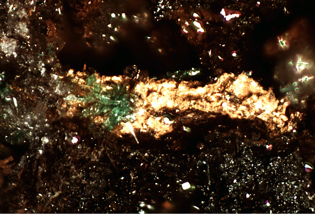


Gold Road Mine, Gold Road vein, Oatman, Oatman Mining District, Black Mountains, Mohave County, Arizona, USA