| Locality | Latitude | Longitude | Distance | Bearing |
|---|
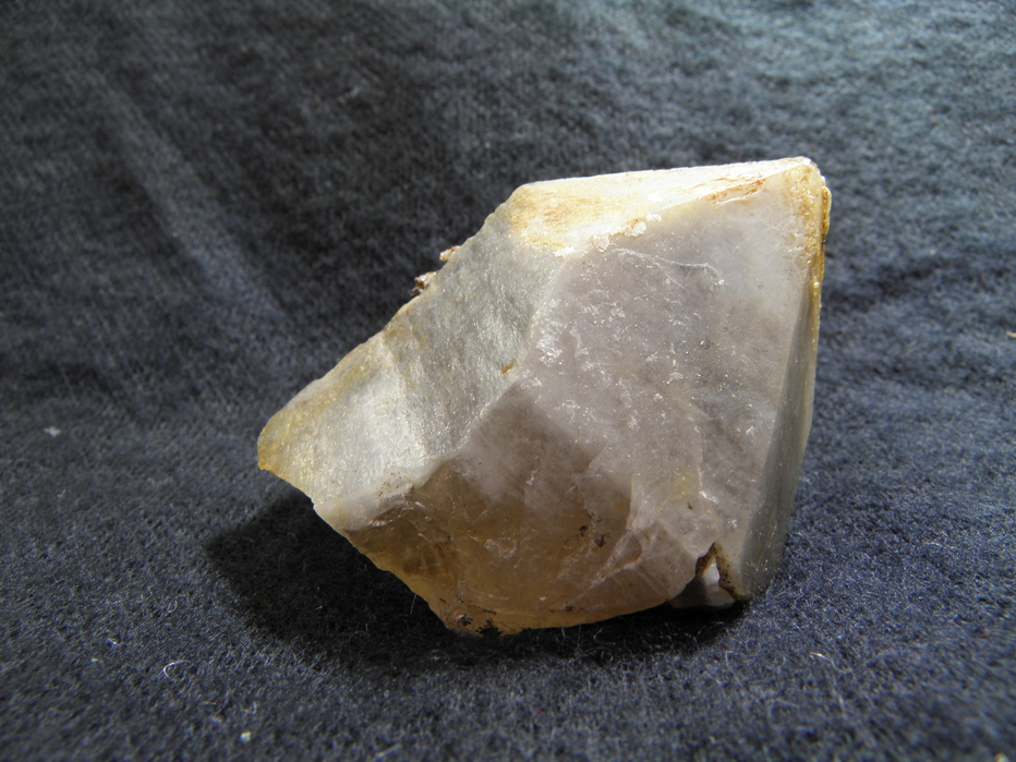
| Yellow Bird (Rainbow), Notch Peak Mining District, Millard County, Utah, USA | 39° 11' 22" N | 113° 22' 31" W | 0.0km (0.0 miles) | |
| Amasa Valley, House Range, Millard County, Utah, USA | 39° 11' 4" N | 113° 22' 54" W | 0.8km (0.5 miles) | |
| Queen of the Hills Tungsten occurrence, Amasa Valley, Millard County, Utah, USA | 39° 11' 19" N | 113° 23' 9" W | 0.9km (0.6 miles) | |
| Unnamed Au-W placer mines, Notch Peak Mining District, Millard County, Utah, USA | 39° 10' 54" N | 113° 23' 43" W | 1.9km (1.2 miles) | |
| Unknown Prospect (MRDS - 10010582), House Range, Millard County, Utah, USA | 39° 11' 43" N | 113° 24' 7" W | 2.4km (1.5 miles) | |
| Brown Queen, Notch Peak Mining District, Millard County, Utah, USA | 39° 12' 54" N | 113° 22' 40" W | 2.8km (1.8 miles) | |
| Klondike (New Klondike), Notch Peak Mining District, Millard County, Utah, USA | 39° 9' 49" N | 113° 22' 22" W | 2.9km (1.8 miles) | |
| Bell Base Lode, Notch Peak Mining District, Millard County, Utah, USA | 39° 13' 14" N | 113° 22' 31" W | 3.5km (2.1 miles) | |
| Baldy Peak Mine (Treasure Mountain Mining Company), Notch Peak Mining District, Millard County, Utah, USA | 39° 11' 16" N | 113° 25' 13" W | 3.9km (2.4 miles) | |
| Bonnie May Nos. 1-5 Occurrence, Notch Peak Mining District, Millard County, Utah, USA | 39° 13' 44" N | 113° 22' 32" W | 4.4km (2.7 miles) | |
| Notch Peak Occurrence, Notch Peak Mining District, Millard County, Utah, USA | 39° 10' 0" N | 113° 25' 0" W | 4.4km (2.7 miles) | |
| Painter Spring, House Range, Millard County, Utah, USA | 39° 11' 7" N | 113° 26' 28" W | 5.7km (3.6 miles) | |
| M&M Mine, Notch Peak Mining District, Millard County, Utah, USA | 39° 8' 56" N | 113° 25' 6" W | 5.9km (3.6 miles) | |
| Notch Peak, House Range, Millard County, Utah, USA | 39° 8' 37" N | 113° 24' 32" W | 5.9km (3.7 miles) | |
| Unknown Adit Occurrence (MRDS - 10010733), Notch Peak Mining District, Millard County, Utah, USA | 39° 9' 25" N | 113° 26' 35" W | 6.9km (4.3 miles) | |
| Lady Mae Adit, Notch Peak Mining District, Millard County, Utah, USA | 39° 8' 42" N | 113° 26' 18" W | 7.4km (4.6 miles) | |
| Scheelite Occurrence (MRDS - 10021089), Notch Peak Mining District, Millard County, Utah, USA | 39° 8' 25" N | 113° 18' 5" W | 8.4km (5.2 miles) | |
| Scheelite Queen Mine, Notch Peak Mining District, Millard County, Utah, USA | 39° 15' 0" N | 113° 27' 0" W | 9.3km (5.8 miles) | |
| Mineral Valley Gold, Notch Peak Mining District, Millard County, Utah, USA | 39° 18' 55" N | 113° 19' 11" W | 14.8km (9.2 miles) | |
| Spectrum Nos. 1 or 2 Stone Quarry, Notch Peak Mining District, Millard County, Utah, USA | 39° 19' 5" N | 113° 17' 7" W | 16.2km (10.1 miles) | |
| Harris Trilobite Quarries, Wheeler Amphitheater, Millard County, Utah, USA | 39° 21' 16" N | 113° 16' 39" W | 20.2km (12.5 miles) | |
| Wheeler Amphitheater, Millard County, Utah, USA | 39° 21' 29" N | 113° 16' 29" W | 20.6km (12.8 miles) | |
| Tule Valley, Millard County, Utah, USA | 38° 57' 30" N | 113° 22' 48" W | 25.7km (16.0 miles) | |
| Copper Wedge Claim, House Range, Millard County, Utah, USA | 39° 27' 46" N | 113° 15' 47" W | 31.9km (19.8 miles) | |
| Diatomaceous Earth (MRDS - 10010745), House Range, Millard County, Utah, USA | 39° 18' 32" N | 113° 0' 12" W | 34.6km (21.5 miles) | |
| South Wash No. 1; 2 Occurrence, House Range, Millard County, Utah, USA | 39° 21' 56" N | 112° 58' 48" W | 39.3km (24.4 miles) | |
| Jim No. 5 Occurrence (Mesa No. 1; Sorenson 1), House Range, Millard County, Utah, USA | 38° 49' 37" N | 113° 23' 58" W | 40.4km (25.1 miles) | |
| Sorenson No. 2 Claim, House Range, Millard County, Utah, USA | 38° 49' 33" N | 113° 27' 26" W | 41.1km (25.5 miles) | |
| Urbie and Moriah Occurrence, Saw Back Mining District, Millard County, Utah, USA | 39° 4' 59" N | 113° 52' 0" W | 44.0km (27.3 miles) | |
| Sevier Lake Sodium Deposits, Sevier Lake, Millard County, Utah, USA | 38° 48' 45" N | 113° 12' 3" W | 44.6km (27.7 miles) | |
Minerals recorded nearby (within 20 km)
Rock types recorded nearby (within 20 km)
Entries shown in red are rocks recorded for this region.


Painter Spring, House Range, Millard County, Utah, USA