| Locality | Latitude | Longitude | Distance | Bearing |
|---|
| Volgershall, Lüneburg, Lüneburg District, Lower Saxony, Germany | 53° 15' 0" N | 10° 23' 2" E | 4.3km (2.7 miles) | |
| Lüneburger Kalkberg, Lüneburg, Lüneburg District, Lower Saxony, Germany | 53° 14' 56" N | 10° 23' 47" E | 4.9km (3.1 miles) | |
| Schildstein, Lüneburg, Lüneburg District, Lower Saxony, Germany | 53° 14' 30" N | 10° 23' 24" E | 5.3km (3.3 miles) | |
| Oil field Börnsen, Herzogtum Lauenburg, Schleswig-Holstein, Germany | 53° 28' 37" N | 10° 16' 54" E | 22.0km (13.7 miles) | |
| Sudermühlen, Egestorf, Harburg, Lower Saxony, Germany | 53° 11' 32" N | 10° 1' 50" E | 23.5km (14.6 miles) | |
| Evendorf, Egestorf, Harburg, Lower Saxony, Germany | 53° 8' 59" N | 10° 4' 0" E | 24.0km (14.9 miles) | |
| Ohle & Lau gravel pit, Groß Pampau, Herzogtum Lauenburg, Schleswig-Holstein, Germany | 53° 31' 48" N | 10° 33' 52" E | 30.9km (19.2 miles) | |
| Else diatomite works, Munster, Heidekreis, Lower Saxony, Germany | 53° 0' 20" N | 10° 4' 45" E | 35.8km (22.2 miles) | |
| Karlstein, Rosengarten, Harburg, Hamburg, Germany | 53° 24' 26" N | 9° 49' 37" E | 37.4km (23.2 miles) | |
| Asbestos and diatomite works, Uelzen, Uelzen, Lower Saxony, Germany | 52° 58' 6" N | 10° 33' 13" E | 37.6km (23.3 miles) | |
| St Nikolai church, Hamburg-Mitte, Hamburg, Germany | 53° 32' 51" N | 9° 59' 26" E | 37.8km (23.5 miles) | |
| Hinschenfelde brickworks, Wandsbek, Hamburg, Germany | 53° 35' 30" N | 10° 6' 13" E | 38.0km (23.6 miles) | |
| Woltersdorf gravel pit, Woltersdorf, Herzogtum Lauenburg, Schleswig-Holstein, Germany | 53° 34' 30" N | 10° 39' 25" E | 38.3km (23.8 miles) | |
| Tin smelter, Tostedt, Harburg, Hamburg, Germany | 53° 16' 15" N | 9° 43' 54" E | 41.1km (25.6 miles) | |
| Segrahner Berg gravel pit, Gudow, Herzogtum Lauenburg, Schleswig-Holstein, Germany | 53° 32' 38" N | 10° 48' 44" E | 42.2km (26.2 miles) | |
| Anna lime-sandrock works, Tießau, Hitzacker, Lüchow-Dannenberg District, Lower Saxony, Germany | 53° 10' 51" N | 10° 59' 22" E | 44.1km (27.4 miles) | |
| Vellahn gravel pit, Vellahn, Ludwigslust-Parchim, Mecklenburg-West Pomerania, Germany | 53° 24' 9" N | 10° 59' 27" E | 44.6km (27.7 miles) | |
| Oberohe (Ober-Ohe), Faßberg, Celle District, Lower Saxony, Germany | 52° 52' 24" N | 10° 13' 30" E | 46.3km (28.8 miles) | |
| Niederohe (Nieder-Ohe), Faßberg, Celle District, Lower Saxony, Germany | 52° 51' 52" N | 10° 13' 17" E | 47.3km (29.4 miles) | |
| Diatomite pit, Unterlüß, Südheide, Celle District, Lower Saxony, Germany | 52° 51' 23" N | 10° 16' 15" E | 47.7km (29.7 miles) | |
| Loam pit, Bassel, Soltau, Heidekreis, Lower Saxony, Germany | 52° 57' 20" N | 9° 52' 9" E | 48.6km (30.2 miles) | |
| Friedrich-Franz potash mine, Lübtheen, Ludwigslust-Parchim, Mecklenburg-West Pomerania, Germany | 53° 18' 0" N | 11° 6' 0" E | 49.9km (31.0 miles) | |
| Jessenitz I potash mine, Lübtheen, Ludwigslust-Parchim, Mecklenburg-West Pomerania, Germany | 53° 16' 54" N | 11° 6' 29" E | 50.4km (31.3 miles) | |
| Schulau, Wedel, Pinneberg, Schleswig-Holstein, Germany | 53° 34' 42" N | 9° 42' 45" E | 53.5km (33.2 miles) | |
| Masel, Sprakensehl, Gifhorn, Lower Saxony, Germany | 52° 45' 6" N | 10° 30' 59" E | 60.1km (37.4 miles) | |
| Niendorf, Lübeck-Moisling, Lübeck, Schleswig-Holstein, Germany | 53° 49' 18" N | 10° 35' 49" E | 62.1km (38.6 miles) | |
| Teutonia potash mine, Wustrow, Lüchow-Dannenberg District, Lower Saxony, Germany | 52° 55' 56" N | 11° 4' 31" E | 62.2km (38.6 miles) | |
| Wendland potash mine, Luckau (Wendland), Lüchow-Dannenberg District, Lower Saxony, Germany | 52° 55' 0" N | 11° 4' 44" E | 63.5km (39.4 miles) | |
| Brickworks, Hamberge, Stormarn, Schleswig-Holstein, Germany | 53° 50' 16" N | 10° 34' 50" E | 63.5km (39.5 miles) | |
| Conow potash mine, Malliß, Ludwigslust-Parchim, Mecklenburg-West Pomerania, Germany | 53° 13' 28" N | 11° 18' 28" E | 64.1km (39.8 miles) | |


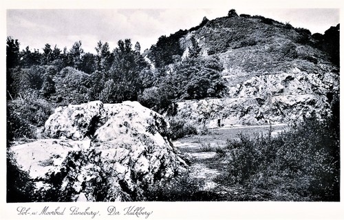


Lüneburger Kalkberg, Lüneburg, Lüneburg District, Lower Saxony, Germany