| Locality | Latitude | Longitude | Distance | Bearing |
|---|
| Harrodsburg, Monroe County, Indiana, USA | 39° 0' 48" N | 86° 32' 41" W | 0.0km (0.0 miles) | |
| Sphalerite Occurrence Z70, Monroe County, Indiana, USA | 39° 0' 45" N | 86° 32' 59" W | 0.4km (0.3 miles) | |
| Cleveland Stone Limestone Quarry, Monroe County, Indiana, USA | 39° 1' 50" N | 86° 32' 59" W | 2.0km (1.2 miles) | |
| Lake Monroe, Monroe County, Indiana, USA | 39° 0' 25" N | 86° 30' 10" W | 3.7km (2.3 miles) | |
| Guthrie Quarry, Lawrence County, Indiana, USA | 38° 58' 32" N | 86° 31' 54" W | 4.3km (2.7 miles) | |
| Victor Oolitic Stone Company, Monroe County, Indiana, USA | 39° 3' 24" N | 86° 34' 45" W | 5.7km (3.5 miles) | |
| Beck Quarry, Monroe County, Indiana, USA | 39° 4' 9" N | 86° 34' 32" W | 6.8km (4.2 miles) | |
| Sieboldt Quarry (Springville Quarry), Lawrence County, Indiana, USA | 38° 57' 48" N | 86° 35' 40" W | 7.0km (4.4 miles) | |
| Smithville, Monroe County, Indiana, USA | 39° 4' 15" N | 86° 30' 28" W | 7.2km (4.5 miles) | |
| Number 3 Needmore Quarry, Lawrence County, Indiana, USA | 38° 56' 54" N | 86° 31' 54" W | 7.3km (4.5 miles) | |
| 4-R Quarry, Monroe County, Indiana, USA | 39° 4' 54" N | 86° 33' 10" W | 7.7km (4.8 miles) | |
| Adams Quarry, Monroe County, Indiana, USA | 39° 4' 58" N | 86° 31' 41" W | 7.8km (4.9 miles) | |
| National Quarry, Monroe County, Indiana, USA | 39° 5' 2" N | 86° 31' 30" W | 8.0km (5.0 miles) | |
| University Quarry, Monroe County, Indiana, USA | 39° 5' 2" N | 86° 31' 30" W | 8.0km (5.0 miles) | |
| Unnamed Iron Prospect (MRDS - 10144418), Monroe County, Indiana, USA | 39° 2' 38" N | 86° 37' 51" W | 8.2km (5.1 miles) | |
| Monarch Quarry, Monroe County, Indiana, USA | 39° 5' 18" N | 86° 32' 59" W | 8.4km (5.2 miles) | |
| Unnamed Iron Prospect (MRDS - 10193314), Monroe County, Indiana, USA | 39° 3' 20" N | 86° 37' 45" W | 8.7km (5.4 miles) | |
| Shawnee Quarry, Monroe County, Indiana, USA | 39° 5' 4" N | 86° 35' 25" W | 8.8km (5.5 miles) | |
| Buffalo Quarry, Monroe County, Indiana, USA | 39° 5' 41" N | 86° 31' 41" W | 9.2km (5.7 miles) | |
| Acme Quarry, Monroe County, Indiana, USA | 39° 5' 48" N | 86° 31' 51" W | 9.4km (5.8 miles) | |
| Independent Limestone Company, Monroe County, Indiana, USA | 39° 5' 29" N | 86° 35' 17" W | 9.4km (5.9 miles) | |
| Unnamed Iron Prospect (MRDS - 10144768), Monroe County, Indiana, USA | 39° 1' 59" N | 86° 39' 34" W | 10.1km (6.3 miles) | |
| Peerless Quarry, Lawrence County, Indiana, USA | 38° 55' 36" N | 86° 29' 36" W | 10.6km (6.6 miles) | |
| Springville, Lawrence County, Indiana, USA | 38° 56' 10" N | 86° 37' 9" W | 10.7km (6.7 miles) | |
| Indiana Limestone quarry, Oolitic, Lawrence County, Indiana, USA | 38° 54' 38" N | 86° 31' 53" W | 11.5km (7.1 miles) | |
| P. M. and B. Quarry, Lawrence County, Indiana, USA | 38° 54' 35" N | 86° 31' 18" W | 11.7km (7.2 miles) | |
| Unnamed Iron Prospect (MRDS - 10169234), Monroe County, Indiana, USA | 39° 1' 1" N | 86° 40' 48" W | 11.7km (7.3 miles) | |
| Walsh Quarry, Lawrence County, Indiana, USA | 38° 54' 32" N | 86° 31' 50" W | 11.7km (7.3 miles) | |
| Diehl Hollow Quarry, Lawrence County, Indiana, USA | 38° 54' 28" N | 86° 32' 20" W | 11.8km (7.3 miles) | |
| Klondike Quarry, Lawrence County, Indiana, USA | 38° 54' 23" N | 86° 32' 9" W | 11.9km (7.4 miles) | |
Minerals recorded nearby (within 11.9 km)
Rock types recorded nearby (within 11.9 km)
Entries shown in red are rocks recorded for this region.
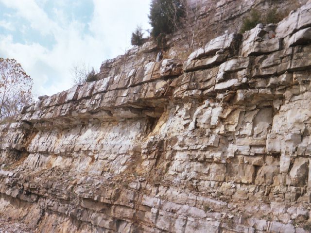


State Route 37 roadcut, Harrodsburg, Monroe County, Indiana, USA