| Locality | Latitude | Longitude | Distance | Bearing |
|---|
| Rotary Beach, Ketchikan Gateway Borough, Alaska, USA | 55° 18' 34" N | 131° 34' 46" W | 1.4km (0.9 miles) | |
| Gold Nugget Prospect and South Quarry Prospect, Ketchikan Gateway Borough, Alaska, USA | 55° 18' 32" N | 131° 34' 28" W | 1.7km (1.1 miles) | |
| Venitia; Black Swan; Laundromat; Jim's cut Prospect, Ketchikan Gateway Borough, Alaska, USA | 55° 19' 47" N | 131° 37' 10" W | 2.0km (1.2 miles) | |
| Birdseye Prospect, Ketchikan Gateway Borough, Alaska, USA | 55° 18' 20" N | 131° 33' 50" W | 2.5km (1.5 miles) | |
| Gold Flakes Prospect, Ketchikan Gateway Borough, Alaska, USA | 55° 17' 26" N | 131° 38' 20" W | 4.1km (2.5 miles) | |
| Ketchikan, Ketchikan Gateway Borough, Alaska, USA | 55° 20' 31" N | 131° 38' 45" W | 4.1km (2.6 miles) | |
| Shoenbar; Laskawanda; Schoenbar; Prospects, Ketchikan Gateway Borough, Alaska, USA | 55° 20' 57" N | 131° 38' 30" W | 4.5km (2.8 miles) | |
| Bear Mountain; Malaspina Prospect, Ketchikan Gateway Borough, Alaska, USA | 55° 21' 20" N | 131° 38' 12" W | 4.9km (3.1 miles) | |
| Sharon Prospect, Ketchikan Gateway Borough, Alaska, USA | 55° 19' 50" N | 131° 31' 4" W | 5.1km (3.2 miles) | |
| White Cliff Prospect, Ketchikan Gateway Borough, Alaska, USA | 55° 21' 2" N | 131° 39' 56" W | 5.7km (3.6 miles) | |
| Clairvoyance Prospect, Ketchikan Gateway Borough, Alaska, USA | 55° 18' 56" N | 131° 41' 26" W | 6.0km (3.7 miles) | |
| Wildcat Mine, Ketchikan Gateway Borough, Alaska, USA | 55° 21' 20" N | 131° 40' 8" W | 6.2km (3.9 miles) | |
| Ready Mix; Carlanna Creek; Hoadley Creek; Trapdoor; Little Sue Prospects, Ketchikan Gateway Borough, Alaska, USA | 55° 21' 35" N | 131° 40' 48" W | 7.1km (4.4 miles) | |
| Hoadley; Hoadley Brothers Prospect, Ketchikan Gateway Borough, Alaska, USA | 55° 21' 38" N | 131° 41' 2" W | 7.3km (4.5 miles) | |
| Unnamed Occurrences (ARDF - KC161), Red Mountain, Annette Island, Ketchikan Mining District, Prince of Wales-Hyder Census Area, Alaska, USA | 55° 15' 2" N | 131° 34' 4" W | 7.7km (4.8 miles) | |
| Blue Streak Prospect, Ketchikan Gateway Borough, Alaska, USA | 55° 21' 38" N | 131° 29' 2" W | 8.5km (5.3 miles) | |
| Peterson; Surprise Prospect, Ketchikan Gateway Borough, Alaska, USA | 55° 21' 54" N | 131° 28' 26" W | 9.3km (5.8 miles) | |
| Unnamed Occurrence (ARDF - KC133), Annette Bay, Annette Island, Ketchikan Mining District, Prince of Wales-Hyder Census Area, Alaska, USA | 55° 15' 0" N | 131° 30' 35" W | 9.3km (5.8 miles) | |
| Beach Prospect, Ketchikan Gateway Borough, Alaska, USA | 55° 22' 32" N | 131° 42' 46" W | 9.8km (6.1 miles) | |
| Unnamed Occurrences (ARDF - KC162), Annette Bay, Annette Island, Ketchikan Mining District, Prince of Wales-Hyder Census Area, Alaska, USA | 55° 14' 26" N | 131° 30' 56" W | 10.0km (6.2 miles) | |
| Unnamed Occurrences (ARDF - KC164), Bingo Mountain, Annette Island, Ketchikan Mining District, Prince of Wales-Hyder Census Area, Alaska, USA | 55° 13' 40" N | 131° 32' 34" W | 10.6km (6.6 miles) | |
| Unnamed Occurrence (ARDF - KC163), Bingo Mountain, Annette Island, Ketchikan Mining District, Prince of Wales-Hyder Census Area, Alaska, USA | 55° 13' 18" N | 131° 34' 8" W | 10.9km (6.7 miles) | |
| Alaska Lead and Silver; A.L.S. Mine, Ketchikan Gateway Borough, Alaska, USA | 55° 23' 12" N | 131° 28' 14" W | 11.0km (6.8 miles) | |
| Londevan; Lon-De-Van; Telegraph group Prospect, Ketchikan Gateway Borough, Alaska, USA | 55° 23' 56" N | 131° 28' 50" W | 11.5km (7.2 miles) | |
| Unnamed Occurrence (ARDF - KC165), Bush Mountain, Annette Island, Ketchikan Mining District, Prince of Wales-Hyder Census Area, Alaska, USA | 55° 13' 22" N | 131° 31' 4" W | 11.7km (7.3 miles) | |
| Black Ridge Prospect, Ketchikan Gateway Borough, Alaska, USA | 55° 16' 22" N | 131° 25' 44" W | 11.7km (7.3 miles) | |
| Unnamed Occurrences (ARDF - KC167), Bush Mountain, Annette Island, Ketchikan Mining District, Prince of Wales-Hyder Census Area, Alaska, USA | 55° 13' 0" N | 131° 31' 8" W | 12.3km (7.6 miles) | |
| Unnamed Occurrences (ARDF - KC135), Round Mountain, Annette Island, Ketchikan Mining District, Prince of Wales-Hyder Census Area, Alaska, USA | 55° 12' 42" N | 131° 32' 34" W | 12.3km (7.6 miles) | |
| Unnamed Occurrences (ARDF - KC166), Helen Todd Lake, Annette Island, Ketchikan Mining District, Prince of Wales-Hyder Census Area, Alaska, USA | 55° 13' 22" N | 131° 29' 48" W | 12.3km (7.7 miles) | |
| Ken Pond Prospect, Ketchikan Gateway Borough, Alaska, USA | 55° 24' 38" N | 131° 42' 24" W | 12.5km (7.7 miles) | |
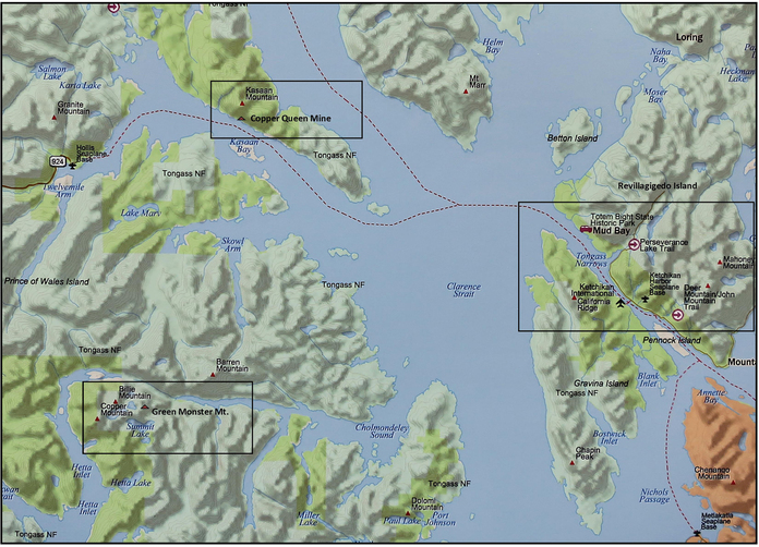


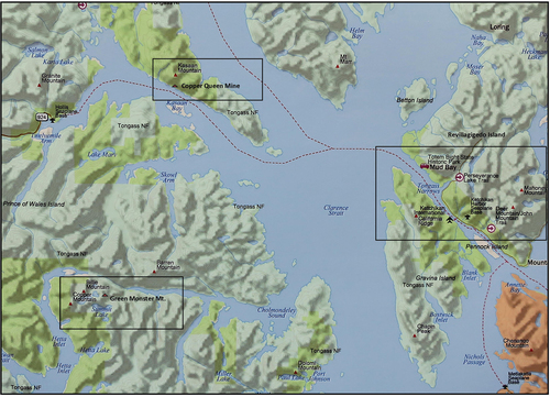
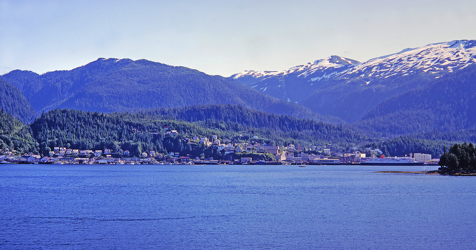


Ketchikan, Ketchikan Gateway Borough, Alaska, USA