| Locality | Latitude | Longitude | Distance | Bearing |
|---|
| Zwer's Scheelite Mine, Nundle, Parry Co., New South Wales, Australia | 31° 25' 35" S | 151° 10' 9" E | 0.0km (0.0 miles) | |
| Trevenna Mine, Hanging Rock, Nundle, Parry Co., New South Wales, Australia | 31° 26' 30" S | 151° 10' 48" E | 2.0km (1.2 miles) | |
| Square Top Intrusion, Parry Co., New South Wales, Australia | 31° 27' 52" S | 151° 11' 11" E | 4.5km (2.8 miles) | |
| Stannings Antimony Mine, Nundle, Parry Co., New South Wales, Australia | 31° 27' 33" S | 151° 8' 21" E | 4.6km (2.9 miles) | |
| Fogarty's Antimony Mine, Nundle, Parry Co., New South Wales, Australia | 31° 27' 30" S | 151° 8' 10" E | 4.8km (3.0 miles) | |
| Bowling Alley Point, Nundle, Parry Co., New South Wales, Australia | 31° 23' 26" S | 151° 8' 29" E | 4.8km (3.0 miles) | |
| Woodley's Antimony Mine, Nundle, Parry Co., New South Wales, Australia | 31° 28' 16" S | 151° 8' 46" E | 5.4km (3.4 miles) | |
| Prase Mine, Hanging Rock, Nundle, Parry Co., New South Wales, Australia | 31° 28' 48" S | 151° 11' 14" E | 6.2km (3.9 miles) | |
| Hanging Rock, Nundle, Parry Co., New South Wales, Australia | 31° 28' 59" S | 151° 11' 3" E | 6.5km (4.0 miles) | |
| Opossum Gully Prase Mine, Hanging Rock, Nundle, Parry Co., New South Wales, Australia | 31° 29' 40" S | 151° 10' 24" E | 7.6km (4.7 miles) | |
| Zircon Gully, Hanging Rock, Nundle, Parry Co., New South Wales, Australia | 31° 28' 15" S | 151° 14' 16" E | 8.2km (5.1 miles) | |
| Tamworth, Inglis Co., New South Wales, Australia | 31° 5' 33" S | 150° 55' 40" E | 43.6km (27.1 miles) | |
| Danglemah Mine (Dangelmare Mine), Danglemah, Inglis Co., New South Wales, Australia | 31° 1' 7" S | 151° 11' 58" E | 45.4km (28.2 miles) | |
| Mount Sally Mine, Danglemah, Inglis Co., New South Wales, Australia | 31° 0' 43" S | 151° 8' 4" E | 46.2km (28.7 miles) | |
| Danglemah, Inglis Co., New South Wales, Australia | 31° 0' 2" S | 151° 13' 32" E | 47.7km (29.6 miles) | |
| Turnbull and Gordons Mine, Bendemeer, Inglis Co., New South Wales, Australia | 30° 59' 21" S | 151° 11' 40" E | 48.7km (30.2 miles) | |
| Flaggy Mountain, Bendemeer, Inglis Co., New South Wales, Australia | 30° 59' 30" S | 151° 15' 3" E | 48.9km (30.4 miles) | |
| Murrurundi, Brisbane Co., New South Wales, Australia | 31° 45' 54" S | 150° 50' 3" E | 49.2km (30.6 miles) | |
| Nowlands Gap, Murrurundi, Brisbane Co., New South Wales, Australia | 31° 44' 35" S | 150° 48' 19" E | 49.3km (30.6 miles) | |
| Danglemah 1 (Black and White Mine), Bendemeer, Inglis Co., New South Wales, Australia | 30° 59' 10" S | 151° 14' 45" E | 49.5km (30.7 miles) | |
| Black and White Mine (Danglemah No 1 Mine; O'Neill's Danglemah deposit), Danglemah, Inglis Co., New South Wales, Australia | 30° 59' 5" S | 151° 14' 39" E | 49.6km (30.8 miles) | |
| Ardglen Rail Tunnel, Ardglen, Buckland Co., New South Wales, Australia | 31° 44' 21" S | 150° 47' 31" E | 49.9km (31.0 miles) | |
| Ardglen, Buckland Co., New South Wales, Australia | 31° 44' 7" S | 150° 47' 3" E | 50.1km (31.1 miles) | |
| Black Jack Mountain Manganese deposit, Bendemeer, Inglis Co., New South Wales, Australia | 30° 58' 22" S | 151° 7' 28" E | 50.6km (31.4 miles) | |
| Ardglen Quarry (State Rail Quarry), Ardglen, Buckland Co., New South Wales, Australia | 31° 44' 21" S | 150° 46' 49" E | 50.7km (31.5 miles) | |
| Werris Creek, Buckland Co., New South Wales, Australia | 31° 23' 35" S | 150° 38' 7" E | 50.8km (31.6 miles) | |
| Danglemah 2, Bendemeer, Inglis Co., New South Wales, Australia | 30° 58' 6" S | 151° 7' 44" E | 51.1km (31.7 miles) | |
| Borambil, Buckland Co., New South Wales, Australia | 31° 29' 22" S | 150° 38' 3" E | 51.2km (31.8 miles) | |
| Moonbi Molybdenite Deposit, Bendemeer, Inglis Co., New South Wales, Australia | 30° 58' 3" S | 151° 3' 39" E | 52.1km (32.3 miles) | |
| Potters Molybdenite Mine (Russ and Edwards claims), Bendemeer, Inglis Co., New South Wales, Australia | 30° 57' 57" S | 151° 4' 17" E | 52.1km (32.3 miles) | |

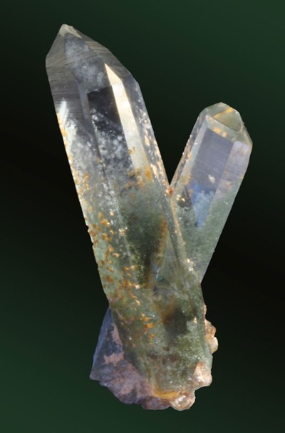


Hanging Rock, Nundle, Parry Co., New South Wales, Australia